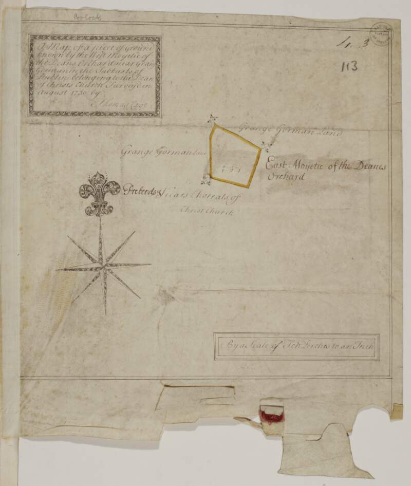
A map of a piece of Ground known by the West Moyetie of the Dean's Orchard near Grange Gorman in the subburbs of Dublin belonging to the Dean of Christs Church. Surveyed in August 1730 by Thomas Cave. Scale 10 Perches to an Inch
| Main Creator: | |
|---|---|
| Contributors: | |
| In collection: | Longfield Map Collection |
| Format: | Map |
| Language: | English |
| Published / Created: |
[August 1730]
|
| Subjects: | |
| Notes: | Physical description: 1 map Geographic Coverage: Barony of Coolock, County Dublin, Province of Leinster, Ireland. more |
As a digital copy of this item is available, the original will not be issued.
| Call Number | View In | Collection |
|---|---|---|
|
MS 21 F. 51 / (113) |
Manuscripts Reading Room |
Manuscripts |
Reproduction rights owned by National Library of Ireland


