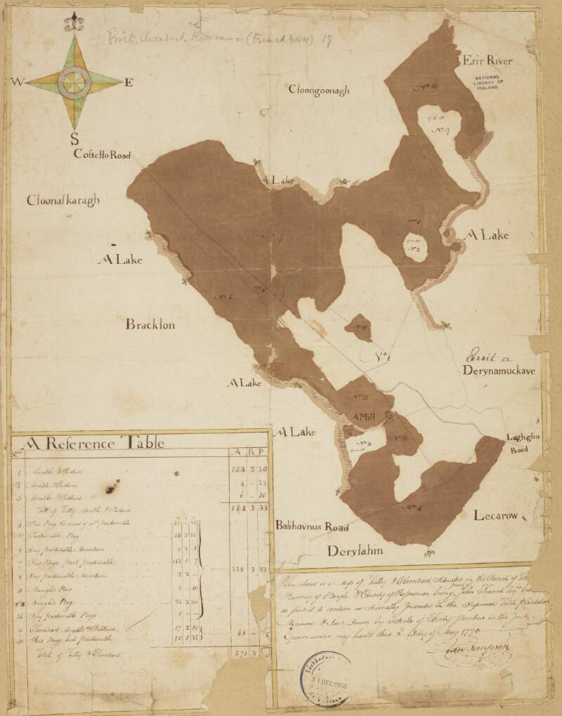
A map of Errit and Cloondart in the parish of Tibohine and barony of Frenchpark County Roscommon ... part of John French's estate ... By Edward Simpson 3rd May 1770. Table of reference showing acreage and condition of land. Scale of 40 perches to an inch.
| Main Creator: | |
|---|---|
| Contributors: | |
| In collection: | Longfield Map Collection |
| Format: | Map |
| Language: | English |
| Published / Created: |
[May 03 1770]
|
| Subjects: | |
| Notes: | Physical description: 1 map Geographic Coverage: Parish of Tibohine, Barony of Frenchpark, County Roscommon, Province of Connacht, Ireland. more |
As a digital copy of this item is available, the original will not be issued.
| Call Number | View In | Collection |
|---|---|---|
|
MS 21 F. 45 / (098) |
Manuscripts Reading Room |
Manuscripts |
Reproduction rights owned by National Library of Ireland


