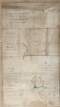
![A map of the demense of Ashfield in the barony of Portnahinch and Queens [Leix] County let by the Reverend Dean French to Capt. Archdall. Surveyed by J.L. March 1817. Scale 10 perches to an inch. Table of contents.](/IIIF/000310000/000302387/vtls000302387_001.jp2/full/800,/0/default.jpg)
A map of the demense of Ashfield in the barony of Portnahinch and Queens [Leix] County let by the Reverend Dean French to Capt. Archdall. Surveyed by J.L. March 1817. Scale 10 perches to an inch. Table of contents.
| Main Creator: | |
|---|---|
| Contributors: | |
| In collection: | Longfield Map Collection |
| Format: | Map |
| Language: | English |
| Published / Created: |
[March 1817]
|
| Subjects: | |
| Notes: | Physical description: 1 map Geographic Coverage: Barony of Portnahinch, County Laois, Province of Leinster, Ireland. more |
As a digital copy of this item is available, the original will not be issued.
| Call Number | View In | Collection |
|---|---|---|
|
MS 21 F. 42 / (016) |
Manuscripts Reading Room |
Manuscripts |
Reproduction rights owned by National Library of Ireland