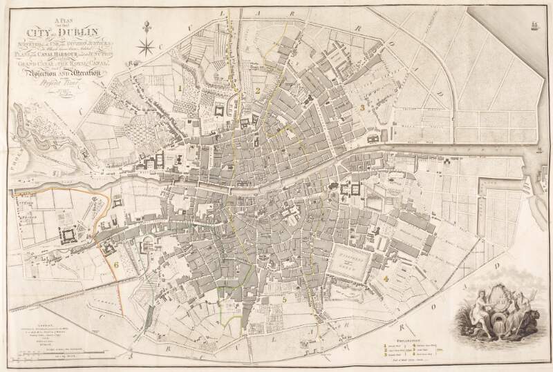
A plan of the city of Dublin as surveyed for the use of the divisionl: Justices: Plans of the canal harbour and its junction with the Grand Canal; The Royal Canal, and every projection & alteration to the present time 1797
Engraved by S.J. Neele, 352 Strand.
[graphic] /
| Main Creator: | |
|---|---|
| Summary: | Map of the city of Dublin and its outskirts. |
| Format: | Prints & Drawings |
| Language: | English |
| Published / Created: |
London :
W. Faden, Geographer to the King & to H.R.H. the Prince of Wales,
[between ca. 1803 and 1820].
|
| Subjects: | |
| Notes: | Title printed l.c.. Engraving l.r. in corner of map by J. Cottyer showing two figures holding a shell bearing the coats of arms of Dublin. Map placed in James Malton's album of Dublin views. Physical description: 1 print : etching ; image 50.3 x 75.6 cm., within plate mark 60.2 x 76.6 cm., on sheet 59.5 x 86.3 cm.. Reproduction Note: Col. Neg. No: 21494. more |
| Credits: | Attributed to Samuel John Neele, (d. 1824). |
As a digital copy of this item is available, the original will not be issued.
| Call Number | View In | Collection |
|---|---|---|
|
PD 3181 TX 11 |
Collection unavailable |
Prints & Drawings |
Reproduction rights owned by National Library of Ireland.


