Showing
1 - 20
results of
44
for search '
Brownrigg & Co., fl. 1801-1809, surveyors
'
Skip to content
Toggle navigation
NLI Website
- Catalogue -
English
Gaeilge
Home
Help
Advanced Search
Browse
Orders
Ask a Librarian
Language
English
Gaeilge
All Fields
Title
Author
Subject
Call Number
ISBN/ISSN
Publisher
Coordinates
Search digitised content only
FIND
Author
Brownrigg & Co., fl. 1801-1809, surveyors
Results
Showing
1 - 20
results of
44
for search '
Brownrigg & Co., fl. 1801-1809, surveyors
'
, query time: 0.07s
List
Grid
Sort
Relevance
Newest First
Oldest First
Call Number
Author
Title
1
2
3
Next
3
A map of a holding on the west side of Capel Street in the Lordship of St Marys Abbey and City of Dublin part of the estate of Wm. Flemying let to Hon. John Hay. Surveyed by Brownrigg & Co 1803. Scale 30 feet to an inch. Names of adjoining tenants shown
Map
Main Creator:
Brownrigg
&
Co
.,
fl
.
1801
-
1809
,
surveyors
Language:
English
Format:
Map
In collection:
Longfield Map Collection
Published / Created
[1803]
Notes
Physical description: 1 map Geographic Coverage: Dub...
Call Number:
Loading...
Located:
Loading...
A map of the estate of William Flemying situate in the Lordship of St. Marys Abbey and City of Dublin [Mary's lane - Capel Street area] Surveyed by Brownrigg & Co 1804. Names of tenants show on properties
Map
Main Creator:
Brownrigg
&
Co
.,
fl
.
1801
-
1809
,
surveyors
Language:
English
Format:
Map
In collection:
Longfield Map Collection
Published / Created
[1804]
Notes
Physical description: 1 map Geographic Coverage: Dub...
Call Number:
Loading...
Located:
Loading...
A map of a holding on the south east side of Fishamble Street in the City of Dublin belonging to the Prebendary of St. John, and let to the assignees of Thomas Holt. Surveyed by Brownrigg & Co 1803 Scale 10 feet to an inch. Names of adjoining tenants shown
Map
Main Creator:
Brownrigg
&
Co
.,
fl
.
1801
-
1809
,
surveyors
Language:
English
Format:
Map
In collection:
Longfield Map Collection
Published / Created
[1803]
Notes
Physical description: 1 map Geographic Coverage: Dub...
Call Number:
Loading...
Located:
Loading...
A map of a piece of ground called the east half of the Deans Orchard and also a piece of ground called the west moiety situate near Grange Gorman partly in the Liberties of the City of Dublin and partly in the County, the estate of the Dean of Christ Church Dublin. Surveyed by Brownrigg & Co 1803. Scale 80 feet to an inch. Names of adjoining tenants shown
Map
Main Creator:
Brownrigg
&
Co
.,
fl
.
1801
-
1809
,
surveyors
Language:
English
Format:
Map
In collection:
Longfield Map Collection
Published / Created
[1803]
Notes
Physical description: 1 map Geographic Coverage: Dub...
Call Number:
Loading...
Located:
Loading...
A map of a piece of ground adjoining Golden Bridge near Kilmainham in the County of Dublin let by [illegible] to [illegible]. Survey'd by Brownrigg & Co. 1803. Scale 8 Perches to an Inch
Map
Main Creator:
Brownrigg
&
Co
.,
fl
.
1801
-
1809
,
surveyors
Language:
English
Format:
Map
In collection:
Longfield Map Collection
Published / Created
[1803]
Notes
Physical description: 1 map Geographic Coverage: Bar...
Call Number:
Loading...
Located:
Loading...
A map of part of the Lands of Artane in the Barony of Coolock & Co of Dublin - part of the Estate of the Honble. Wm. Wesley Poole. Survey'd July 1802 by Brownrigg & Co. Scale 10 Perches to an Inch
Map
Main Creator:
Brownrigg
&
Co
.,
fl
.
1801
-
1809
,
surveyors
Language:
English
Format:
Map
In collection:
Longfield Map Collection
Published / Created
[July 1802]
Notes
Physical description: 1 map Geographic Coverage: Bar...
Call Number:
Loading...
Located:
Loading...
A map of part of the Estate of the Rt. Honble. Lord Visct. Palmerston in the manor of Grange Gorman & County of Dublin. Surveyed by Brownrigg & Company 1801. Scale 100 Feet to an Inch
Map
Main Creator:
Brownrigg
&
Co
.,
fl
.
1801
-
1809
,
surveyors
Language:
English
Format:
Map
In collection:
Longfield Map Collection
Published / Created
[1801]
Notes
Physical description: 1 map Geographic Coverage: Bar...
Call Number:
Loading...
Located:
Loading...
A map of a piece of ground at Booterstown in the County of Dublin. Surveyed for Counr. Caldbeck by Brownrigg & Co. 1801. Scale 40 Feet to an Inch.
Map
Main Creator:
Brownrigg
&
Co
.,
fl
.
1801
-
1809
,
surveyors
Language:
English
Format:
Map
In collection:
Longfield Map Collection
Published / Created
[1801]
Notes
Inset map: "A map of a holding on the East side of Pa...
Call Number:
Loading...
Located:
Loading...
A map of part of the Lands of Windy Harbour in the Parish Blanchards Town. Bary. of Castleknock & Co. Dublin, the property of Henry John Segrave Esq. a minor, Let to Timothy & John Leeson. Surveyed July 6th 1804 by Brownrigg & Co. Scale 10 Perches to an Inch
Map
Main Creator:
Brownrigg
&
Co
.,
fl
.
1801
-
1809
,
surveyors
Language:
English
Format:
Map
In collection:
Longfield Map Collection
Published / Created
[July 06 1804]
Notes
Physical description: 1 map Geographic Coverage: Par...
Call Number:
Loading...
Located:
Loading...
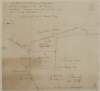
A map of the Great Commons [Derrymore & Cooltedery] adjoining the town of Portarlington in the Queens [Leix] County. Surveyed for Henry Parnell by Brownrigg & Co 1803. Scale 250 feet to an inch. Names of tenants & acreage of holdings shown.
Map
Main Creator:
Brownrigg
&
Co
.,
fl
.
1801
-
1809
,
surveyors
Language:
English
Format:
Map
In collection:
Longfield Map Collection
Published / Created
[1803]
Notes
Physical description: 1 map Geographic Coverage: Bar...
Call Number:
Loading...
Located:
Loading...
A map of the present course of that part of the River Dodder running between the demenses of A. Wilkinson and F. Synge near Rathfarnham in the County Dublin. By Brownrigg & Co 14 July 1802.
Map
Main Creator:
Brownrigg
&
Co
.,
fl
.
1801
-
1809
,
surveyors
Language:
English
Format:
Map
In collection:
Longfield Map Collection
Published / Created
[July 14 1802]
Notes
Physical description: 1 map Geographic Coverage: Cou...
Call Number:
Loading...
Located:
Loading...
A map of part of the Lands of Clontarf in the Barony of Coolock & Co. Dublin. Let by W. Punberton Esq. to Thos. Butler Esq. Surveyed by Brownrigg & Co. 1804. Scale 40 Feet to an Inch
Map
Main Creator:
Brownrigg
&
Co
.,
fl
.
1801
-
1809
,
surveyors
Language:
English
Format:
Map
In collection:
Longfield Map Collection
Published / Created
[1804]
Notes
Physical description: 1 map Geographic Coverage: Bar...
Call Number:
Loading...
Located:
Loading...
A map of the lands of Murphystown & Tipperstown in the Barony of [Rathdown] & County of Dublin, part of the Estate of the Dean of Christ Church and let to Nathl. Hone Esq. Surveyed by B & Co. 1802. Scale 40 Perches to an Inch.
Map
Main Creator:
Brownrigg
&
Co
.,
fl
.
1801
-
1809
,
surveyors
Language:
English
Format:
Map
In collection:
Longfield Map Collection
Published / Created
[1802]
Notes
Physical description: 1 map Geographic Coverage: Bar...
Call Number:
Loading...
Located:
Loading...
A map of part of the lands of Milestown, part of the lands of Rathleek and Walterstown in the barony of Dunboyne and County Meath let by Francis Synge. Copied by Brownrigg & Co. 1802. Scale 10 perches to an inch.
Map
Main Creator:
Brownrigg
&
Co
.,
fl
.
1801
-
1809
,
surveyors
Language:
English
Format:
Map
In collection:
Longfield Map Collection
Published / Created
[1802]
Notes
Physical description: 1 map Geographic Coverage: Bar...
Call Number:
Loading...
Located:
Loading...
A map of Belgard Estate in the Barony of Uppercross and County of Dublin the Property of John Hearn & Henry Trent Esq. Surveyed by Brownrigg & Co. 1802. Dublin. Scale 20 Perches to an Inch. Large sheet mounted on linen with separate page of references.
Map
Main Creator:
Brownrigg
&
Co
.,
fl
.
1801
-
1809
,
surveyors
Language:
English
Format:
Map
In collection:
Longfield Map Collection
Published / Created
[1802]
Notes
Physical description: 1 map Geographic Coverage: Bar...
Call Number:
Loading...
Located:
Loading...
A map of a holding on the south east side of Fishamble Street in the City of Dublin belonging to the Prebendary of St John's and let to the assignees of Thomas Holt. Surveyed by Brownrigg & Co. 1803. Names of adjoining tenants shown
Map
Main Creator:
Brownrigg
&
Co
.,
fl
.
1801
-
1809
,
surveyors
Language:
English
Format:
Map
In collection:
Longfield Map Collection
Published / Created
[1803]
Notes
Physical description: 1 map Geographic Coverage: Dub...
Call Number:
Loading...
Located:
Loading...
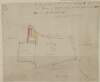
A map of Mount Tisdaile alias Bloomsbury [Bloomsberry], in the County Meath, the estate of Henry Brooke. Surveyed by B. & Co. 1802.
Map
Main Creator:
Brownrigg
&
Co
.,
fl
.
1801
-
1809
,
surveyors
Language:
English
Format:
Map
In collection:
Longfield Map Collection
Published / Created
[1802]
Notes
Physical description: 1 map Geographic Coverage: Bar...
Call Number:
Loading...
Located:
Loading...
A survey of part of the Lands of Grange, situate between the 11th & 12th Locks in the Grand Canal in the Co. Dublin, by J.B. & Co. Scale 10 Perches to an Inch
Map
Main Creator:
Brownrigg
&
Co
.,
fl
.
1801
-
1809
,
surveyors
Language:
English
Format:
Map
In collection:
Longfield Map Collection
Published / Created
[between 1801 and 1809]
Notes
Physical description: 1 map Geographic Coverage: Bar...
Call Number:
Loading...
Located:
Loading...
A map of a piece of ground on Sir John Rogerson's Quay or South Wall. Also a piece of ground behind the rere of Merrion Square and also a field on the Artichoke Road in the lands of Baggotrath. Ordered to be divided between Nichs. Le Favre and Edw. Kent. Copied by Brownrigg & Co 1800
Map
Main Creator:
Brownrigg
&
Co
.,
fl
.
1801
-
1809
,
surveyors
Language:
English
Format:
Map
In collection:
Longfield Map Collection
Published / Created
[1800]
Notes
Physical description: 1 map Geographic Coverage: Dub...
Call Number:
Loading...
Located:
Loading...
A map of part of the Lands of Finglas in the Barony of Nethercross & County of Dublin let by Mr. Thos. Smith to Mr. Petr. Story Survey'd by Brownrigg & Coy. 1804. Scale 10 Perches to an Inch.
Map
Main Creator:
Brownrigg
&
Co
.,
fl
.
1801
-
1809
,
surveyors
Language:
English
Format:
Map
In collection:
Longfield Map Collection
Published / Created
[1804]
Notes
Physical description: 1 map Geographic Coverage: Bar...
Call Number:
Loading...
Located:
Loading...
1
2
3
Next
3
Get RSS Feed
Email this Search
History
Narrow Search
Digitised
Format
43
Map
1
Manuscript
Online Availability
30
Not Digitised
14
Digitised
Published / Created
From:
To:
Subject
44
Land use surveys
43
Administration of estates
43
Boundaries (Estates)
43
Land tenure
2
History
1
Administration of Estates
more ...
1
Cartography
1
Estates
1
Maps
1
Maps and Surveys
1
Surveyors
see all ...
less ...
Author
42
Brownrigg & Co., fl. 1801-1809, surveyors
2
Longfield, John, ca. 1775-1833, surveyor
Collections
44
Longfield Map Collection
Language
44
English
Genre
43
Manuscript maps
43
Maps, Manuscript
2
Early works to 1800
Era
2
18th century
1
1780-1840
Region
44
Ireland
34
Dublin (County)
34
Dublin (Ireland : County)
18
Dublin
18
Dublin (Ireland)
4
Coolock (Barony)
more ...
4
Meath
4
Meath (Ireland)
4
Rathdown (Barony)
3
Dublin (Barony)
3
Nethercross (Barony)
3
Newcastle (Barony)
2
Kells Upper (Barony)
2
Uppercross (Barony)
2
Wicklow (County)
2
Wicklow (Ireland : County)
1
Ballymadun Parish
1
Ballymadun Parish (Ireland)
1
Balrothery (Barony)
1
Blanchards Town Parish
1
Blanchards Town Parish (Ireland)
1
Castleknock (Barony)
1
Dublin City
1
Dublin City (Barony)
1
Duleek (Barony)
1
Dunboyne (Barony)
1
Kildare (County)
1
Kildare (Ireland : County)
1
Laois
1
Laois (Ireland)
see all ...
less ...
Loading...
![A map of the Great Commons [Derrymore & Cooltedery] adjoining the town of Portarlington in the Queens [Leix] County. Surveyed for Henry Parnell by Brownrigg & Co 1803. Scale 250 feet to an inch. Names of tenants & acreage of holdings shown.](/IIIF/000310000/000302382/vtls000302382_001.jp2/full/100,/0/default.jpg)
![A map of Mount Tisdaile alias Bloomsbury [Bloomsberry], in the County Meath, the estate of Henry Brooke. Surveyed by B. & Co. 1802.](/IIIF/000310000/000301774/vtls000301774_001.jp2/full/100,/0/default.jpg)