Showing
141 - 160
results of
264
for search '
Will, John.
'
Skip to content
Toggle navigation
NLI Website
- Catalogue -
English
Gaeilge
Home
Help
Advanced Search
Browse
Orders
Ask a Librarian
Language
English
Gaeilge
All Fields
Title
Author
Subject
Call Number
ISBN/ISSN
Publisher
Coordinates
Search digitised content only
FIND
Author
Will, John.
Results
Showing
141 - 160
results of
264
for search '
Will, John.
'
, query time: 0.04s
List
Grid
Sort
Relevance
Newest First
Oldest First
Call Number
Author
Title
1
Previous
3
4
5
6
7
8
9
10
11
12
13
Next
14
A survey of the lands of Killabin [Killabban] in the barony of Ballyadams and Queens County the estate of Arthur French St. George done by John Longfield. 1808. Names of tenants & acreage of holdings shown.
Map
Main Creator:
Longfield,
John
, ca. 1775-1833, surveyor
Language:
English
Format:
Map
In collection:
Longfield Map Collection
Published / Created
[1808]
Notes
Physical description: 1 map Geographic Coverage: Bar...
Call Number:
Loading...
Located:
Loading...
A survey of part of the lands of Hybla [or Ballyreage] in the barony of Ophaly and County of Kildare belonging to Howard Moore. Surveyed by J.L. 1813. Scale 20 perches to an inch.
Map
Main Creator:
Longfield,
John
, ca. 1775-1833, surveyor
Language:
English
Format:
Map
In collection:
Longfield Map Collection
Published / Created
[1813]
Notes
Physical description: 1 map Geographic Coverage: Bar...
Call Number:
Loading...
Located:
Loading...
A survey of the lands of Mongfune in the barony of Owneybeg and County Limerick part of the estate of Lord Cloncurry. Surveyed by J.L. June, 1814. Table of reference showing tenants names and acreage.
Map
Main Creator:
Longfield,
John
, ca. 1775-1833, surveyor
Language:
English
Format:
Map
In collection:
Longfield Map Collection
Published / Created
[June 1814]
Notes
Physical description: 1 map Geographic Coverage: Bar...
Call Number:
Loading...
Located:
Loading...
A survey of the lands of Knavenstown [Knavinstown] the two Killawrences & Ballylogas in the barony of western Ophaly and County of Kildare the estate of the Dean and Chapter of Kildare let to Charles Fitzgerald. By J. Brownrigg, 1788. Scale 20 perches to an inch.
Map
Main Creator:
Brownrigg,
John
, ca. 1748-1838, surveyor
Language:
English
Format:
Map
In collection:
Longfield Map Collection
Published / Created
[1788]
Notes
Physical description: 1 map Geographic Coverage: Bar...
Call Number:
Loading...
Located:
Loading...
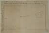
A map of Marsh field at Leixlip in the County Dublin [Kildare]. Surveyed by J.L. 1815. Scale 8 perches to an inch. Table of reference showing extent of property.
Map
Main Creator:
Longfield,
John
, ca. 1775-1833, surveyor
Language:
English
Format:
Map
In collection:
Longfield Map Collection
Published / Created
[1815]
Notes
Physical description: 1 map Geographic Coverage: Bar...
Call Number:
Loading...
Located:
Loading...
A map of part of the Lands of Lusk, in the County of Dublin the Estate of W. Parsons Esq. Surveyed by Laurence Magennis 1791. Copy.d. by J. Brownrigg 1792. Scale 20 Perches to an Inch.
Map
Main Creator:
Brownrigg,
John
, ca. 1748-1838, surveyor
Language:
English
Format:
Map
In collection:
Longfield Map Collection
Published / Created
[1792]
Notes
Physical description: 1 map Geographic Coverage: Bar...
Call Number:
Loading...
Located:
Loading...
A survey of the lands of Rathbeggan in the barony of Ratoath and County Meath the estate of John Standish. Surveyed April 1813 by J. Longfield. Table of reference showing tenants names and acreage of holdings.
Map
Main Creator:
Longfield,
John
, ca. 1775-1833, surveyor
Language:
English
Format:
Map
In collection:
Longfield Map Collection
Published / Created
[April 1813]
Notes
Physical description: 1 map Geographic Coverage: Bar...
Call Number:
Loading...
Located:
Loading...
A map of part of the Lands of Cabragh called Saltcock's Wood in the County of Dublin, the Estate of the Revd. Dean of Christ Church & Prebendaries & Vicars of same. J.L. 1820. Scale 10 Perches to an Inch
Map
Main Creator:
Longfield,
John
, ca. 1775-1833, surveyor
Language:
English
Format:
Map
In collection:
Longfield Map Collection
Published / Created
[1820]
Notes
Physical description: 1 map Geographic Coverage: Bar...
Call Number:
Loading...
Located:
Loading...
A map of part of the mill holding in the town of Clara and Kings [Offaly] County part of the estate of A. Cox traced from John Evans's map of 1767. By John Longfield December 3rd 1822. Scale 10 perches to an inch. Names of tenants shown.
Map
Main Creator:
Longfield,
John
, ca. 1775-1833, surveyor
Language:
English
Format:
Map
In collection:
Longfield Map Collection
Published / Created
[December 03 1822]
Notes
Physical description: 1 map Geographic Coverage: Bar...
Contributors:
“
...Evans,
John
, fl. 1767, surveyor...
”
Call Number:
Loading...
Located:
Loading...
A map of the town of Durmona the joint estate of Lady de Clifford and Sir J. Rowley. Surveyed by J. Longfield. Names of tenants 7 area of holdings shown on properties.
Map
Main Creator:
Longfield,
John
, ca. 1775-1833, surveyor
Language:
English
Format:
Map
In collection:
Longfield Map Collection
Published / Created
[between 1770 and 1840]
Notes
Inset maps: "A map of part of the lands of Lisduff le...
Call Number:
Loading...
Located:
Loading...
A survey of the Lands of Ballyglassin in the Barony of Emokilleagh [Imokilly] & County of Cork - the Estate of the Revd. Doct. Synge. March 1808. J.L.
Map
Main Creator:
Longfield,
John
, ca. 1775-1833, surveyor
Language:
English
Format:
Map
In collection:
Longfield Map Collection
Published / Created
[March 1808]
Notes
Physical description: 1 map Geographic Coverage: Bar...
Call Number:
Loading...
Located:
Loading...
A map of the lands of Knocksonna in the barony of Coshma and County of Limerick the estate of Grange Ormsby. By J. L. 1805. Scale 20 perches to an inch. Table of reference showing tenants names & acreage of holdings, similar references on map.
Map
Main Creator:
Longfield,
John
, ca. 1775-1833, surveyor
Language:
English
Format:
Map
In collection:
Longfield Map Collection
Published / Created
[1805]
Notes
Physical description: 1 map Geographic Coverage: Bar...
Call Number:
Loading...
Located:
Loading...
A survey of part of the Lands of Artain in the Barony of Coolock & County of Dublin the property of [illegible] Streich Esq. Oct 25. 1791. Survey'd by J.B. Scale 10 Perches to an Inch
Map
Main Creator:
Brownrigg,
John
, ca. 1748-1838, surveyor
Language:
English
Format:
Map
In collection:
Longfield Map Collection
Published / Created
[October 25 1791]
Notes
Physical description: 1 map Geographic Coverage: Bar...
Call Number:
Loading...
Located:
Loading...
A map of part of the Lands of Clonsagh in the Barony of Coolock and County of Dublin. Belonging to Messrs. Bias. by J.L. 1815
Map
Main Creator:
Longfield,
John
, ca. 1775-1833, surveyor
Language:
English
Format:
Map
In collection:
Longfield Map Collection
Published / Created
[1815]
Notes
Physical description: 1 map Geographic Coverage: Bar...
Call Number:
Loading...
Located:
Loading...
A survey of Carn in the barony of Fore and County of Westmeath part of the estate of the Rt. Hon. the Earl of Longford. By John Brownrigg 1799. Scale of 20 perches to an inch. Table of reference showing acreage and nature of land.
Map
Main Creator:
Brownrigg,
John
, ca. 1748-1838, surveyor
Language:
English
Format:
Map
In collection:
Longfield Map Collection
Published / Created
[1799]
Notes
Physical description: 1 map Geographic Coverage: Bar...
Call Number:
Loading...
Located:
Loading...
Part of chart of the river Shannon near Portumna. By John Longfield
Map
Main Creator:
Longfield,
John
, ca. 1775-1833, surveyor
Language:
English
Format:
Map
In collection:
Longfield Map Collection
Published / Created
[between 1795 and 1833]
Notes
Physical description: 1 map Geographic Coverage: Cou...
Call Number:
Loading...
Located:
Loading...
A map of the demense of Ashfield in the barony of Portnahinch and Queens [Leix] County let by the Reverend Dean French to Capt. Archdall. Surveyed by J.L. March 1817. Scale 10 perches to an inch. Table of contents.
Map
Main Creator:
Longfield,
John
, ca. 1775-1833, surveyor
Language:
English
Format:
Map
In collection:
Longfield Map Collection
Published / Created
[March 1817]
Notes
Physical description: 1 map Geographic Coverage: Bar...
Call Number:
Loading...
Located:
Loading...
A map of the King's Island at Limerick done for the Honble. William Cockayne, Constable of the Castle of Limerick. By J.B. February 1798. Scale 10 perches to an inch.
Map
Main Creator:
Brownrigg,
John
, ca. 1748-1838, surveyor
Language:
English
Format:
Map
In collection:
Longfield Map Collection
Published / Created
[February 1798]
Notes
Some staining around the edges of the map. Physical d...
Call Number:
Loading...
Located:
Loading...
A map of Carneystown [Kearneystown] in the barony of Salt South part of Lord Cloncurry's estate in County Kildare drawn for John Anderson [By] J.L. 1825.
Map
Main Creator:
Longfield,
John
, ca. 1775-1833, surveyor
Language:
English
Format:
Map
In collection:
Longfield Map Collection
Published / Created
[1825]
Notes
Physical description: 1 map Geographic Coverage: Bar...
Call Number:
Loading...
Located:
Loading...
A proposed Give and Take line between Ballyboggan and Park in the barony of Moyfenrath Upper and County Meath. Laid out by John Longfield. 1827. Scale 10 perches to an inch. On reverse autograph letter re map. 27. XI. 1827.
Map
Main Creator:
Longfield,
John
, ca. 1775-1833, surveyor
Language:
English
Format:
Map
In collection:
Longfield Map Collection
Published / Created
[November 27 1827]
Notes
Physical description: 1 map Geographic Coverage: Bar...
Call Number:
Loading...
Located:
Loading...
1
Previous
3
4
5
6
7
8
9
10
11
12
13
Next
14
Get RSS Feed
Email this Search
History
Narrow Search
Clear Filter
Digitised
Remove Filters
Clear Filter
Genre: Maps, Manuscript
Format
264
Map
Online Availability
Digitised
Published / Created
From:
To:
Subject
264
Boundaries (Estates)
264
Land tenure
264
Land use surveys
255
Administration of estates
53
History
18
Administration of Estates
Author
186
Longfield, John, ca. 1775-1833, surveyor
46
Brownrigg, John, ca. 1748-1838, surveyor
14
Brownrigg & Co., fl. 1801-1809, surveyors
4
Brownrigg, Longfield and Murray, fl. 1799-ca. 1805, surveyors
4
Scalé, Brownrigg & Sherrard, fl. 1774-1778, surveyors
1
Balfe, M., fl. 1821, surveyor
more ...
1
Bell, John (I and II), fl. 1721-1820
1
Browne, John, fl. 1788-ca. 1807, surveyor
1
Byrne, John, fl. 1789-1828, surveyor
1
Connolly, John, fl. 1826, surveyor
1
Logan, John, fl. 1827-1846, surveyor
1
Longfield, William, fl. 1825-ca. 1870, surveyor
1
Netterville, John, fl. 1747-1768, surveyor
1
O'Brien, John, fl. 1784-1820, surveyor
1
Roe, John, fl. 1793-1824, surveyor
see all ...
less ...
Collections
264
Longfield Map Collection
Language
264
English
Genre
264
Manuscript maps
Maps, Manuscript
53
Early works to 1800
Era
53
18th century
Region
260
Ireland
75
Dublin (Ireland : County)
74
Dublin (County)
57
Meath
57
Meath (Ireland)
46
Kildare (County)
more ...
46
Kildare (Ireland : County)
39
Coolock (Barony)
17
Offaly West (Barony)
16
Castleknock (Barony)
11
Balrothery (Barony)
11
Westmeath
11
Westmeath (Ireland)
11
Wicklow (County)
11
Wicklow (Ireland : County)
10
Roscommon (County)
10
Roscommon (Ireland : County)
9
Duleek Upper (Barony)
9
Laois
9
Laois (Ireland)
7
Moyfenrath Upper (Barony)
7
Ratoath (Barony)
6
Fore (Barony)
6
Kilkenny (County)
6
Kilkenny (Ireland : County)
6
Longford (County)
6
Longford (Ireland : County)
6
Offaly
6
Offaly (Ireland)
5
Dublin (Ireland)
see all ...
less ...
Loading...
![A survey of the lands of Killabin [Killabban] in the barony of Ballyadams and Queens County the estate of Arthur French St. George done by John Longfield. 1808. Names of tenants & acreage of holdings shown.](/IIIF/000310000/000302371/vtls000302371_001.jp2/full/100,/0/default.jpg)
![A survey of part of the lands of Hybla [or Ballyreage] in the barony of Ophaly and County of Kildare belonging to Howard Moore. Surveyed by J.L. 1813. Scale 20 perches to an inch.](/IIIF/000310000/000302221/vtls000302221_001.jp2/full/100,/0/default.jpg)

![A survey of the lands of Knavenstown [Knavinstown] the two Killawrences & Ballylogas in the barony of western Ophaly and County of Kildare the estate of the Dean and Chapter of Kildare let to Charles Fitzgerald. By J. Brownrigg, 1788. Scale 20 perches to an inch.](/IIIF/000310000/000302091/vtls000302091_001.jp2/full/100,/0/default.jpg)
![A map of Marsh field at Leixlip in the County Dublin [Kildare]. Surveyed by J.L. 1815. Scale 8 perches to an inch. Table of reference showing extent of property.](/IIIF/000310000/000302107/vtls000302107_001.jp2/full/100,/0/default.jpg)


![A map of part of the mill holding in the town of Clara and Kings [Offaly] County part of the estate of A. Cox traced from John Evans's map of 1767. By John Longfield December 3rd 1822. Scale 10 perches to an inch. Names of tenants shown.](/IIIF/000310000/000302167/vtls000302167_001.jp2/full/100,/0/default.jpg)

![A survey of the Lands of Ballyglassin in the Barony of Emokilleagh [Imokilly] & County of Cork - the Estate of the Revd. Doct. Synge. March 1808. J.L.](/IIIF/000310000/000301920/vtls000301920_001.jp2/full/100,/0/default.jpg)

![A survey of part of the Lands of Artain in the Barony of Coolock & County of Dublin the property of [illegible] Streich Esq. Oct 25. 1791. Survey'd by J.B. Scale 10 Perches to an Inch](/IIIF/000310000/000301120/vtls000301120_001.jp2/full/100,/0/default.jpg)


![A map of the demense of Ashfield in the barony of Portnahinch and Queens [Leix] County let by the Reverend Dean French to Capt. Archdall. Surveyed by J.L. March 1817. Scale 10 perches to an inch. Table of contents.](/IIIF/000310000/000302387/vtls000302387_001.jp2/full/100,/0/default.jpg)

![A map of Carneystown [Kearneystown] in the barony of Salt South part of Lord Cloncurry's estate in County Kildare drawn for John Anderson [By] J.L. 1825.](/IIIF/000310000/000302111/vtls000302111_001.jp2/full/100,/0/default.jpg)
