Showing
1 - 17
results of
17
for search '
Will, John.
'
Skip to content
Toggle navigation
NLI Website
- Catalogue -
English
Gaeilge
Home
Help
Advanced Search
Browse
Orders
Ask a Librarian
Language
English
Gaeilge
All Fields
Title
Author
Subject
Call Number
ISBN/ISSN
Publisher
Coordinates
Search digitised content only
FIND
Author
Will, John.
Results
Showing
1 - 17
results of
17
for search '
Will, John.
'
, query time: 0.18s
List
Grid
Sort
Relevance
Newest First
Oldest First
Call Number
Author
Title
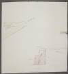
A map of part of Peafield in the Barony of Coolock & County of Dublin, the Estate of [illegible] Bever Esq. Survey'd by John Brownrigg 1795. Scale 20 Perches to an Inch
Map
Main Creator:
Brownrigg,
John
, ca. 1748-1838, surveyor
Language:
English
Format:
Map
In collection:
Longfield Map Collection
Published / Created
[1795]
Notes
Physical description: 1 map Geographic Coverage: Bar...
Call Number:
Loading...
Located:
Loading...
A map of Ballinealoe and Williamstown in the barony of Fore and County of Westmeath, the estate of Thomas Smyth. By J.B. March 1781.
Map
Main Creator:
Brownrigg,
John
, ca. 1748-1838, surveyor
Language:
English
Format:
Map
In collection:
Longfield Map Collection
Published / Created
[1781]
Notes
Inset map: "A map of several lots of ground lying bet...
Call Number:
Loading...
Located:
Loading...
A map of the Lands of Gracedien and its subdenominations in the Barony of Balrothery & County of Dublin, the Estate of John Venox Esq. by John Brownrigg. November 1794. Scale 20 Perches to an Inch
Map
Main Creator:
Brownrigg,
John
, ca. 1748-1838, surveyor
Language:
English
Format:
Map
In collection:
Longfield Map Collection
Published / Created
[November 1794]
Notes
Physical description: 1 map Geographic Coverage: Bar...
Call Number:
Loading...
Located:
Loading...
A map of the Line intended for the Royal Canal from Ashtown to Barberstown in the County of Dublin, as laid out by Richd. Evans Enginr. Surveyed by J. Brownrigg. 1791. Scale 500 Feet to an Inch
Map
Main Creator:
Brownrigg,
John
, ca. 1748-1838, surveyor
Language:
English
Format:
Map
In collection:
Longfield Map Collection
Published / Created
[1791]
Notes
Physical description: 1 map Geographic Coverage: Bar...
Call Number:
Loading...
Located:
Loading...
A map of Bay View & Mount Pleasant in the Barony of Coolock & County of Dublin belonging to Robt. Burton Esq. Surveyed by J. Brownrigg 1792. Scale 10 Perches to an Inch
Map
Main Creator:
Brownrigg,
John
, ca. 1748-1838, surveyor
Language:
English
Format:
Map
In collection:
Longfield Map Collection
Published / Created
[1792]
Notes
Physical description: 1 map Geographic Coverage: Bar...
Call Number:
Loading...
Located:
Loading...
A survey of a piece of ground called the Slip field near Clontarf in the Barony of Coolock and County of Dublin let by A. Savage Esq. To John Ash by J.B. 1792. Scale 10 Perches to an Inch
Map
Main Creator:
Brownrigg,
John
, ca. 1748-1838, surveyor
Language:
English
Format:
Map
In collection:
Longfield Map Collection
Published / Created
[1792]
Notes
Physical description: 1 map Geographic Coverage: Bar...
Call Number:
Loading...
Located:
Loading...
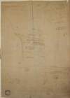
A survey of part of the Lands of Puckstown in the County of Dublin, let by Thos. Twig Esq. to [illegible] Hammell Esq. Surveyed by J.B. 18th May 1793. Scale 10 Perches to an Inch
Map
Main Creator:
Brownrigg,
John
, ca. 1748-1838, surveyor
Language:
English
Format:
Map
In collection:
Longfield Map Collection
Published / Created
[May 18 1793]
Notes
Physical description: 1 map Geographic Coverage: Bar...
Call Number:
Loading...
Located:
Loading...
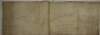
A map of Fyagh [Feagh] in the barony of Kells Lower and County of Meath, the estate of Thomas Bligh. Surveyed in September 1787 by J.B.
Map
Main Creator:
Brownrigg,
John
, ca. 1748-1838, surveyor
Language:
English
Format:
Map
In collection:
Longfield Map Collection
Published / Created
[1787-1788]
Notes
Inset map: "A map of a piece of ground on the west si...
Call Number:
Loading...
Located:
Loading...
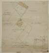
A survey of the Grange of Balscaddin in the Barony of Balrothery and County of Dublin belongg. to the Dean & Chapter of Christ Church by J.B. -[?]. March 7 1795
Map
Main Creator:
Brownrigg,
John
, ca. 1748-1838, surveyor
Language:
English
Format:
Map
In collection:
Longfield Map Collection
Published / Created
[March 07 1795]
Notes
Physical description: 1 map Geographic Coverage: Bar...
Call Number:
Loading...
Located:
Loading...
A survey of part of the Lands of Kinsaly called Sweets farm in the Barony of Coolock & County of Dublin, the Estate of Mrs. Sarah Tighe by John Brownrigg 1794. Scale 10 Perches to an Inch
Map
Main Creator:
Brownrigg,
John
, ca. 1748-1838, surveyor
Language:
English
Format:
Map
In collection:
Longfield Map Collection
Published / Created
[1794]
Notes
Physical description: 1 map Geographic Coverage: Bar...
Call Number:
Loading...
Located:
Loading...
A map of three Parcels of ground near the Black Rock in the County of Dublin belonging to John Allen Esq. Survey'd by John Brownrigg 1796. Scale 10 Perches to an Inch
Map
Main Creator:
Brownrigg,
John
, ca. 1748-1838, surveyor
Language:
English
Format:
Map
In collection:
Longfield Map Collection
Published / Created
[1796]
Notes
Physical description: 1 map Geographic Coverage: Bar...
Call Number:
Loading...
Located:
Loading...
A map of part of the Lands of Lusk, in the County of Dublin the Estate of W. Parsons Esq. Surveyed by Laurence Magennis 1791. Copy.d. by J. Brownrigg 1792. Scale 20 Perches to an Inch.
Map
Main Creator:
Brownrigg,
John
, ca. 1748-1838, surveyor
Language:
English
Format:
Map
In collection:
Longfield Map Collection
Published / Created
[1792]
Notes
Physical description: 1 map Geographic Coverage: Bar...
Call Number:
Loading...
Located:
Loading...
A map of a holding in Blackrock in the County of Dublin the Estate of Mrs. Mary Alcock, widow, let to Richd. Le Favre Esq. by J. Brownrigg 1793. Scale 40 Feet to an Inch
Map
Main Creator:
Brownrigg,
John
, ca. 1748-1838, surveyor
Language:
English
Format:
Map
In collection:
Longfield Map Collection
Published / Created
[1793]
Notes
Physical description: 1 map Geographic Coverage: Bar...
Call Number:
Loading...
Located:
Loading...
A survey of the House and part of the lands of the Grange of Baldoyle in the Barony of Coolock and County of Dublin, belonging to John Evans Esq. by John Brownrigg 2nd June 1792.
Map
Main Creator:
Brownrigg,
John
, ca. 1748-1838, surveyor
Language:
English
Format:
Map
In collection:
Longfield Map Collection
Published / Created
[June 02 1792]
Notes
Inset map: "A survey of Hannah-down Lodge and Farm -...
Call Number:
Loading...
Located:
Loading...
A survey of part of the Lands of Artain in the Barony of Coolock & County of Dublin the property of [illegible] Streich Esq. Oct 25. 1791. Survey'd by J.B. Scale 10 Perches to an Inch
Map
Main Creator:
Brownrigg,
John
, ca. 1748-1838, surveyor
Language:
English
Format:
Map
In collection:
Longfield Map Collection
Published / Created
[October 25 1791]
Notes
Physical description: 1 map Geographic Coverage: Bar...
Call Number:
Loading...
Located:
Loading...
A map of a piece of ground near Black Rock in the Co Dublin, pt. of the Estate of Wm. Ogilvie Esq. Surveyed by J.B.
Map
Main Creator:
Brownrigg,
John
, ca. 1748-1838, surveyor
Language:
English
Format:
Map
In collection:
Longfield Map Collection
Published / Created
[between 1768 and 1838]
Notes
Physical description: 1 map Geographic Coverage: Bar...
Call Number:
Loading...
Located:
Loading...
A survey of part of the Lands of Baskin in the Barony of Coolock & County of Dublin, the Estate of the Corporation of Taylors, done for the Revd. Jas. Baurin, by J. Brownrigg. 6th October 1795. Scale 5 Perches to an Inch
Map
Main Creator:
Brownrigg,
John
, ca. 1748-1838, surveyor
Language:
English
Format:
Map
In collection:
Longfield Map Collection
Published / Created
[October 06 1795]
Notes
Physical description: 1 map Geographic Coverage: Bar...
Call Number:
Loading...
Located:
Loading...
Get RSS Feed
Email this Search
History
Narrow Search
Clear Filter
Digitised
Remove Filters
Clear Filter
Author: Brownrigg, John, ca. 1748-1838, surveyor
Clear Filter
Region: Dublin (Ireland : County)
Format
17
Map
Online Availability
Digitised
Published / Created
From:
To:
Subject
17
Administration of estates
17
Boundaries (Estates)
17
Land tenure
17
Land use surveys
16
History
Author
Brownrigg, John, ca. 1748-1838, surveyor
Collections
17
Longfield Map Collection
Language
17
English
Genre
17
Manuscript maps
17
Maps, Manuscript
16
Early works to 1800
Era
16
18th century
Region
Dublin (Ireland : County)
17
Ireland
16
Dublin (County)
8
Coolock (Barony)
3
Balrothery (Barony)
3
Dublin (Barony)
more ...
2
Dublin (Ireland)
2
Dublin City (Barony)
2
Rathdown (Barony)
1
Castleknock (Barony)
1
Dublin
1
Dublin City (Barony))
1
Fore (Barony)
1
Kells Lower (Barony)
1
Meath
1
Meath (Ireland)
1
Westmeath
1
Westmeath (Ireland)
see all ...
less ...
Loading...
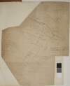
![A map of part of Peafield in the Barony of Coolock & County of Dublin, the Estate of [illegible] Bever Esq. Survey'd by John Brownrigg 1795. Scale 20 Perches to an Inch](/IIIF/000310000/000301182/vtls000301182_001.jp2/full/100,/0/default.jpg)


![A survey of part of the Lands of Puckstown in the County of Dublin, let by Thos. Twig Esq. to [illegible] Hammell Esq. Surveyed by J.B. 18th May 1793. Scale 10 Perches to an Inch](/IIIF/000310000/000301180/vtls000301180_001.jp2/full/100,/0/default.jpg)
![A map of Fyagh [Feagh] in the barony of Kells Lower and County of Meath, the estate of Thomas Bligh. Surveyed in September 1787 by J.B.](/IIIF/000310000/000301785/vtls000301785_001.jp2/full/100,/0/default.jpg)
![A survey of the Grange of Balscaddin in the Barony of Balrothery and County of Dublin belongg. to the Dean & Chapter of Christ Church by J.B. -[?]. March 7 1795](/IIIF/000310000/000302261/vtls000302261_001.jp2/full/100,/0/default.jpg)


![A survey of part of the Lands of Artain in the Barony of Coolock & County of Dublin the property of [illegible] Streich Esq. Oct 25. 1791. Survey'd by J.B. Scale 10 Perches to an Inch](/IIIF/000310000/000301120/vtls000301120_001.jp2/full/100,/0/default.jpg)