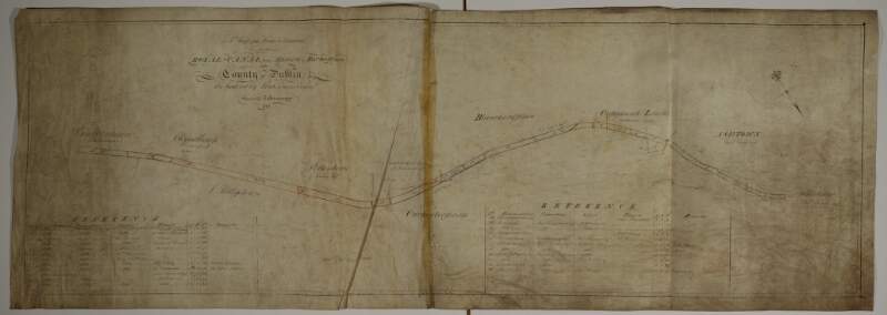
A map of the Line intended for the Royal Canal from Ashtown to Barberstown in the County of Dublin, as laid out by Richd. Evans Enginr. Surveyed by J. Brownrigg. 1791. Scale 500 Feet to an Inch
| Main Creator: | |
|---|---|
| Contributors: | |
| In collection: | Longfield Map Collection |
| Format: | Map |
| Language: | English |
| Published / Created: |
[1791]
|
| Subjects: | |
| Notes: | Physical description: 1 map Geographic Coverage: Barony of Castleknock, County Dublin, Province of Leinster, Ireland. more |
As a digital copy of this item is available, the original will not be issued.
| Call Number | View In | Collection |
|---|---|---|
|
MS 21 F. 51 / (067) |
Manuscripts Reading Room |
Manuscripts |
Reproduction rights owned by National Library of Ireland


