Showing
21 - 40
results of
44
for search '
Brownrigg & Co., fl. 1801-1809, surveyors
'
Skip to content
Toggle navigation
NLI Website
- Catalogue -
English
Gaeilge
Home
Help
Advanced Search
Browse
Orders
Ask a Librarian
Language
English
Gaeilge
All Fields
Title
Author
Subject
Call Number
ISBN/ISSN
Publisher
Coordinates
Search digitised content only
FIND
Author
Brownrigg & Co., fl. 1801-1809, surveyors
Results
Showing
21 - 40
results of
44
for search '
Brownrigg & Co., fl. 1801-1809, surveyors
'
, query time: 0.35s
List
Grid
Sort
Relevance
Newest First
Oldest First
Call Number
Author
Title
1
Previous
1
2
3
Next
3
A map of part of the Lands of Artane in the Barony of Coolock & Co of Dublin - part of the Estate of the Honble. Wm. Wesley Poole. Survey'd July 1802 by Brownrigg & Co. Scale 10 Perches to an Inch
Map
Main Creator:
Brownrigg
&
Co
.,
fl
.
1801
-
1809
,
surveyors
Language:
English
Format:
Map
In collection:
Longfield Map Collection
Published / Created
[July 1802]
Notes
Physical description: 1 map Geographic Coverage: Bar...
Call Number:
Loading...
Located:
Loading...
A map of a piece of ground adjoining Golden Bridge near Kilmainham in the County of Dublin let by [illegible] to [illegible]. Survey'd by Brownrigg & Co. 1803. Scale 8 Perches to an Inch
Map
Main Creator:
Brownrigg
&
Co
.,
fl
.
1801
-
1809
,
surveyors
Language:
English
Format:
Map
In collection:
Longfield Map Collection
Published / Created
[1803]
Notes
Physical description: 1 map Geographic Coverage: Bar...
Call Number:
Loading...
Located:
Loading...
A map of part of Lanesborough Lands in the Parish of Swords & County of Dublin let by the Coheiressess of the Late Jn.. Hatch Esq. to [illegible] Lawler. Surveyed by Brownrigg & Co. Scale 20 Perches to an Inch
Map
Main Creator:
Brownrigg
&
Co
.,
fl
.
1801
-
1809
,
surveyors
Language:
English
Format:
Map
In collection:
Longfield Map Collection
Published / Created
[between 1801 and 1809]
Notes
Physical description: 1 map Geographic Coverage: Bar...
Call Number:
Loading...
Located:
Loading...
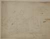
A map of Mount Tisdaile alias Bloomsbury [Bloomsberry], in the County Meath, the estate of Henry Brooke. Surveyed by B. & Co. 1802.
Map
Main Creator:
Brownrigg
&
Co
.,
fl
.
1801
-
1809
,
surveyors
Language:
English
Format:
Map
In collection:
Longfield Map Collection
Published / Created
[1802]
Notes
Physical description: 1 map Geographic Coverage: Bar...
Call Number:
Loading...
Located:
Loading...
A map of a holding in Little Mary Street situate in the Lordship of St. Mary's Abbey part of the estate of Wm. Flemying. Surveyed by Brownrigg & Co 1804.
Map
Main Creator:
Brownrigg
&
Co
.,
fl
.
1801
-
1809
,
surveyors
Language:
English
Format:
Map
In collection:
Longfield Map Collection
Published / Created
[1804]
Notes
Physical description: 1 map Geographic Coverage: Dub...
Call Number:
Loading...
Located:
Loading...
A map of part of the lands of Beaumont in the barony of Duleek and County of Meath. Surveyed by Brownrigg & Co. Scale 10 perches to an inch. Adjoining tenant shown.
Map
Main Creator:
Brownrigg
&
Co
.,
fl
.
1801
-
1809
,
surveyors
Language:
English
Format:
Map
In collection:
Longfield Map Collection
Published / Created
[between 1801 and 1809]
Notes
Physical description: 1 map Geographic Coverage: Bar...
Call Number:
Loading...
Located:
Loading...
A map of a piece of ground at Booterstown in the County of Dublin. Surveyed for Counr. Caldbeck by Brownrigg & Co. 1801. Scale 40 Feet to an Inch.
Map
Main Creator:
Brownrigg
&
Co
.,
fl
.
1801
-
1809
,
surveyors
Language:
English
Format:
Map
In collection:
Longfield Map Collection
Published / Created
[1801]
Notes
Inset map: "A map of a holding on the East side of Pa...
Call Number:
Loading...
Located:
Loading...
A map of a holding on the east side of Grafton Street in the City of Dublin belonging to Mr. William Duff. Surveyed by Brownrigg & Co 1804. Names of adjoining tenants shown
Map
Main Creator:
Brownrigg
&
Co
.,
fl
.
1801
-
1809
,
surveyors
Language:
English
Format:
Map
In collection:
Longfield Map Collection
Published / Created
[1804]
Notes
Physical description: 1 map Geographic Coverage: Dub...
Call Number:
Loading...
Located:
Loading...
A map of part of the Lands Glannacarrick [Glenageary] in the County of Dublin, let by Mr. Thos. Kelly to Jas. Williams Esq. Survey'd by Brownrigg & Co. 1802. Scale 100 Feet to an Inch.
Map
Main Creator:
Brownrigg
&
Co
.,
fl
.
1801
-
1809
,
surveyors
Language:
English
Format:
Map
In collection:
Longfield Map Collection
Published / Created
[1802]
Notes
Physical description: 1 map Geographic Coverage: Bar...
Call Number:
Loading...
Located:
Loading...
A map of Dervor [Derver] in the barony of Upper Kells and County Meath, the estate of General Taylor. Surveyed by Brownrigg & Co. 1802. Scale 20 perches to an inch. Names of tenants and acreage of holdings shown.
Map
Main Creator:
Brownrigg
&
Co
.,
fl
.
1801
-
1809
,
surveyors
Language:
English
Format:
Map
In collection:
Longfield Map Collection
Published / Created
[1802]
Notes
Physical description: 1 map Geographic Coverage: Bar...
Call Number:
Loading...
Located:
Loading...
A map of a parcel of ground lying between Smock Alley and Copper Alley on which is standing the old Musick Hall lately in the possession of Mr. Thos Magrath. Surveyed for [illegible] Watkin, Esq; By Brownrigg & Co 1804. Names of some tenants shown
Map
Main Creator:
Brownrigg
&
Co
.,
fl
.
1801
-
1809
,
surveyors
Language:
English
Format:
Map
In collection:
Longfield Map Collection
Published / Created
[1804]
Notes
Physical description: 1 map Geographic Coverage: Dub...
Call Number:
Loading...
Located:
Loading...
A map of a holding on the east side of Fishers Lane in the City of Dublin belonging to the Dean & Chapter of Christ Church. Surveyed by B & Co 1803. Bradogue river marked & adjoining properties shown.
Map
Main Creator:
Brownrigg
&
Co
.,
fl
.
1801
-
1809
,
surveyors
Language:
English
Format:
Map
In collection:
Longfield Map Collection
Published / Created
[1803]
Notes
Physical description: 1 map Geographic Coverage: Dub...
Call Number:
Loading...
Located:
Loading...
A survey of the lands of Coolnakilly in the barony of Newcastle and County of Wicklow the estate of Mrs. Sarah Tighe. Surveyed by Brownrigg & Co. 1804. Scale 20 perches to an inch. Table of reference showing tenants and acreage of holdings.
Map
Main Creator:
Brownrigg
&
Co
.,
fl
.
1801
-
1809
,
surveyors
Language:
English
Format:
Map
In collection:
Longfield Map Collection
Published / Created
[1804]
Notes
Physical description: 1 map Geographic Coverage: Bar...
Call Number:
Loading...
Located:
Loading...
A map of lands at Aghaderan, Abbeycartron & the Demense at Longford. [Pencilled title - A map of part of the lands of Longford the estate of the Rt. Honable. Thomas Earl of Longford. Surveyed by John Brownrigg 1796 and copied by Brownrigg & Co. 1804] Tenants & acreage shown.
Map
Main Creator:
Brownrigg
&
Co
.,
fl
.
1801
-
1809
,
surveyors
Language:
English
Format:
Map
In collection:
Longfield Map Collection
Published / Created
[1804]
Notes
Physical description: 1 map Geographic Coverage: Cou...
Call Number:
Loading...
Located:
Loading...
A survey of part of the Lands of Cottrellstown and Weystown partly in the Parish of Palmerstown and partly in the Parish of Ballymadun in the Barony of Balrothery & Co Dublin, belonging to the Vicars & prebends of Christ Church Dublin. Let to [illegible]. Surveyed by Brownrigg and Co. 1800
Map
Main Creator:
Brownrigg
&
Co
.,
fl
.
1801
-
1809
,
surveyors
Language:
English
Format:
Map
In collection:
Longfield Map Collection
Published / Created
[1800]
Notes
Physical description: 1 map Geographic Coverage: Par...
Call Number:
Loading...
Located:
Loading...
A map of part of the Lands of Kilternan in the County of Dublin let by [illegible] Anderson Esq to Rawdon Hautenville Esq. Surveyed by BG & Co. 29 Sept 1802. Scale 10 Perches to an Inch
Map
Main Creator:
Brownrigg
&
Co
.,
fl
.
1801
-
1809
,
surveyors
Language:
English
Format:
Map
In collection:
Longfield Map Collection
Published / Created
[September 29 1802]
Notes
Physical description: 1 map Geographic Coverage: Bar...
Call Number:
Loading...
Located:
Loading...
A map of a lot of ground on the Merchants Quay on which is a dwelling house, tenement warehouses and yards belonging to the Dean & Chapter of Christ Church, Dublin. Surveyed by B&Co 1803. Pat Connors holding shown
Map
Main Creator:
Brownrigg
&
Co
.,
fl
.
1801
-
1809
,
surveyors
Language:
English
Format:
Map
In collection:
Longfield Map Collection
Published / Created
[1803]
Notes
In mylar covering. Physical description: 1 map Geogr...
Call Number:
Loading...
Located:
Loading...
A map of several pieces of ground known by the name of Lanesborough Lands in the Parish of Swords and County of Dublin belonging to Francis Synge Esq let to [illegible]. Surveyed by Brownrigg & Co., 1802.
Map
Main Creator:
Brownrigg
&
Co
.,
fl
.
1801
-
1809
,
surveyors
Language:
English
Format:
Map
In collection:
Longfield Map Collection
Published / Created
[1802]
Notes
Physical description: 1 map Geographic Coverage: Bar...
Call Number:
Loading...
Located:
Loading...
A map of a lot of ground on the east side of Chancery Lane and also a lot of ground on the west side of Great Ship Street, part of the estate of the Dean of Christ Church Dublin and let to Lord Wicklow. Surveyed and traced by Brownrigg & Co 1803. Names of tenants shown on properties.
Map
Main Creator:
Brownrigg
&
Co
.,
fl
.
1801
-
1809
,
surveyors
Language:
English
Format:
Map
In collection:
Longfield Map Collection
Published / Created
[1803]
Notes
Physical description: 1 map Geographic Coverage: Dub...
Call Number:
Loading...
Located:
Loading...
A map of a holding on the east side of Grafton Street in the City of Dublin belonging to Mr. William Duff. Surveyed by Brownrigg & Co 1804. Names of adjoining tenants shown
Map
Main Creator:
Brownrigg
&
Co
.,
fl
.
1801
-
1809
,
surveyors
Language:
English
Format:
Map
In collection:
Longfield Map Collection
Published / Created
[1804]
Notes
Physical description: 1 map Geographic Coverage: Dub...
Call Number:
Loading...
Located:
Loading...
1
Previous
1
2
3
Next
3
Get RSS Feed
Email this Search
History
Narrow Search
Digitised
Format
43
Map
1
Manuscript
Online Availability
30
Not Digitised
14
Digitised
Published / Created
From:
To:
Subject
44
Land use surveys
43
Administration of estates
43
Boundaries (Estates)
43
Land tenure
2
History
1
Administration of Estates
more ...
1
Cartography
1
Estates
1
Maps
1
Maps and Surveys
1
Surveyors
see all ...
less ...
Author
42
Brownrigg & Co., fl. 1801-1809, surveyors
2
Longfield, John, ca. 1775-1833, surveyor
Collections
44
Longfield Map Collection
Language
44
English
Genre
43
Manuscript maps
43
Maps, Manuscript
2
Early works to 1800
Era
2
18th century
1
1780-1840
Region
44
Ireland
34
Dublin (County)
34
Dublin (Ireland : County)
18
Dublin
18
Dublin (Ireland)
4
Coolock (Barony)
more ...
4
Meath
4
Meath (Ireland)
4
Rathdown (Barony)
3
Dublin (Barony)
3
Nethercross (Barony)
3
Newcastle (Barony)
2
Kells Upper (Barony)
2
Uppercross (Barony)
2
Wicklow (County)
2
Wicklow (Ireland : County)
1
Ballymadun Parish
1
Ballymadun Parish (Ireland)
1
Balrothery (Barony)
1
Blanchards Town Parish
1
Blanchards Town Parish (Ireland)
1
Castleknock (Barony)
1
Dublin City
1
Dublin City (Barony)
1
Duleek (Barony)
1
Dunboyne (Barony)
1
Kildare (County)
1
Kildare (Ireland : County)
1
Laois
1
Laois (Ireland)
see all ...
less ...
Loading...
![A map of Mount Tisdaile alias Bloomsbury [Bloomsberry], in the County Meath, the estate of Henry Brooke. Surveyed by B. & Co. 1802.](/IIIF/000310000/000301774/vtls000301774_001.jp2/full/100,/0/default.jpg)

![A map of Dervor [Derver] in the barony of Upper Kells and County Meath, the estate of General Taylor. Surveyed by Brownrigg & Co. 1802. Scale 20 perches to an inch. Names of tenants and acreage of holdings shown.](/IIIF/000310000/000301772/vtls000301772_001.jp2/full/100,/0/default.jpg)

![A map of lands at Aghaderan, Abbeycartron & the Demense at Longford. [Pencilled title - A map of part of the lands of Longford the estate of the Rt. Honable. Thomas Earl of Longford. Surveyed by John Brownrigg 1796 and copied by Brownrigg & Co. 1804] Tenants & acreage shown.](/IIIF/000310000/000302312/vtls000302312_001.jp2/full/100,/0/default.jpg)
![A survey of part of the Lands of Cottrellstown and Weystown partly in the Parish of Palmerstown and partly in the Parish of Ballymadun in the Barony of Balrothery & Co Dublin, belonging to the Vicars & prebends of Christ Church Dublin. Let to [illegible]. Surveyed by Brownrigg and Co. 1800](/IIIF/000310000/000302264/vtls000302264_001.jp2/full/100,/0/default.jpg)