Showing
1 - 14
results of
14
for search '
Brownrigg, John, ca. 1748-1838, surveyor
'
Skip to content
Toggle navigation
NLI Website
- Catalogue -
English
Gaeilge
Home
Help
Advanced Search
Browse
Orders
Ask a Librarian
Language
English
Gaeilge
All Fields
Title
Author
Subject
Call Number
ISBN/ISSN
Publisher
Coordinates
Search digitised content only
FIND
Author
Brownrigg, John, ca. 1748-1838, surveyor
Results
Showing
1 - 14
results of
14
for search '
Brownrigg, John, ca. 1748-1838, surveyor
'
, query time: 0.17s
List
Grid
Sort
Relevance
Newest First
Oldest First
Call Number
Author
Title
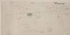
A survey of part of the lands of Clondoogan, Clonmahon, and [Drumlargan in the barony of Deece Upper] in the barony of Moyfenrath and County of Meath the estate of the Rt. Hon. Lord Langford. By John Brownrigg 1795. Names of tenants and acreage of holdings shown. Scale 20 perches to an inch.
Map
Main Creator:
Brownrigg
,
John
,
ca
.
1748
-
1838
,
surveyor
Language:
English
Format:
Map
In collection:
Longfield Map Collection
Published / Created
[1795]
Notes
Physical description: 1 map Geographic Coverage: Bar...
Call Number:
Loading...
Located:
Loading...
A map of the mill and part of the lands of Ardmulchon [Ardmulchan] intended to be taken for the use of the Boyne Navigation the estate of Lord Boyne. John Martin tenant. Surveyed by John Brownrigg 1791. Scale 250 feet to an inch. A note showing that the land purchased by the company was 1a. 1r. and not 2r. 20p.
Map
Main Creator:
Brownrigg
,
John
,
ca
.
1748
-
1838
,
surveyor
Language:
English
Format:
Map
In collection:
Longfield Map Collection
Published / Created
[1791]
Notes
Physical description: 1 map Geographic Coverage: Bar...
Call Number:
Loading...
Located:
Loading...
A map of Fyagh [Feagh] in the barony of Kells Lower and County of Meath, the estate of Thomas Bligh. Surveyed in September 1787 by J.B.
Map
Main Creator:
Brownrigg
,
John
,
ca
.
1748
-
1838
,
surveyor
Language:
English
Format:
Map
In collection:
Longfield Map Collection
Published / Created
[1787-1788]
Notes
Inset map: "A map of a piece of ground on the west si...
Call Number:
Loading...
Located:
Loading...
A survey of the demense of Killdalkey [Kildalkey] in the parish of Killdalkey [Kildalkey] barony of Lune and County of Meath [Surveyed by J.B.] May 7th 1772 for Robert Walle.
Map
Main Creator:
Brownrigg
,
John
,
ca
.
1748
-
1838
,
surveyor
Language:
English
Format:
Map
In collection:
Longfield Map Collection
Published / Created
[May 07 1772]
Notes
Physical description: 1 map Geographic Coverage: Par...
Call Number:
Loading...
Located:
Loading...
A survey of the lands of Johnstown in the barony of Duleek Upper and County of Meath. By J.B. August 31 [17]96. Scale 20 perches to an inch. Names of tenants & acreage of holdings shown.
Map
Main Creator:
Brownrigg
,
John
,
ca
.
1748
-
1838
,
surveyor
Language:
English
Format:
Map
In collection:
Longfield Map Collection
Published / Created
[August 31 1796]
Notes
Physical description: 1 map Geographic Coverage: Bar...
Call Number:
Loading...
Located:
Loading...
VI. Estate Maps. A Survey of the Manor of Moylough in the Barony of Monfenrath and County of Meath. The Estate of His Grace Robt. [Robert] Fowler, Archbishop of Dublin by Jon. Brownrigg,
1798.
Map
Main Creator:
Brownrigg
,
John
,
ca
.
1748
-
1838
,
surveyor
Language:
English
Format:
Map
In collection:
Fowler and Rawdon of Rathmoylon Papers, 1710-1897.
Published / Created
1798.
Notes
Physical description: 1 item (1 bound vol., 34 pp.).
Call Number:
Loading...
Located:
Loading...
View Context
A map of part of the lands of Clondoogan, Clonmahon and Drumlargan in the barony of Moyfenrath Lower, County of Meath the estate of Rt. Hon. Lord Langford. Surveyed by J. Brownrigg [Drumlargan in the barony of Deece Upper]. Names of tenants & acreage of holdings shown. Scale 20 perches to an inch.
Map
Main Creator:
Brownrigg
,
John
,
ca
.
1748
-
1838
,
surveyor
Language:
English
Format:
Map
In collection:
Longfield Map Collection
Published / Created
[between 1768 and 1838]
Notes
Physical description: 1 map Geographic Coverage: Bar...
Call Number:
Loading...
Located:
Loading...
A survey of part of the lands of Woodtown in the barony of Deece Upper and County of Meath, the estate of the late J. Wilson. By J. Brownrigg 1793. Scale 20 perches to an inch. Names of tenants & acreage of holdings shown.
Map
Main Creator:
Brownrigg
,
John
,
ca
.
1748
-
1838
,
surveyor
Language:
English
Format:
Map
In collection:
Longfield Map Collection
Published / Created
[1793]
Notes
Physical description: 1 map Geographic Coverage: Bar...
Call Number:
Loading...
Located:
Loading...
A map of part of the lands of Milestown, part of the lands of Rathleek and Walterstown in the barony of Dunboyne and County Meath let by Francis Synge. Copied by Brownrigg & Co. 1802. Scale 10 perches to an inch.
Map
Main Creator:
Brownrigg & Co., fl. 1801-1809, surveyors
Language:
English
Format:
Map
In collection:
Longfield Map Collection
Published / Created
[1802]
Notes
Physical description: 1 map Geographic Coverage: Bar...
Contributors:
“
...
Brownrigg
,
John
,
ca
.
1748
-
1838
,
surveyor
...
”
Call Number:
Loading...
Located:
Loading...
A map of Mount Tisdaile alias Bloomsbury [Bloomsberry], in the County Meath, the estate of Henry Brooke. Surveyed by B. & Co. 1802.
Map
Main Creator:
Brownrigg & Co., fl. 1801-1809, surveyors
Language:
English
Format:
Map
In collection:
Longfield Map Collection
Published / Created
[1802]
Notes
Physical description: 1 map Geographic Coverage: Bar...
Contributors:
“
...
Brownrigg
,
John
,
ca
.
1748
-
1838
,
surveyor
...
”
Call Number:
Loading...
Located:
Loading...
A map of part of the lands of Beaumont in the barony of Duleek and County of Meath. Surveyed by Brownrigg & Co. Scale 10 perches to an inch. Adjoining tenant shown.
Map
Main Creator:
Brownrigg & Co., fl. 1801-1809, surveyors
Language:
English
Format:
Map
In collection:
Longfield Map Collection
Published / Created
[between 1801 and 1809]
Notes
Physical description: 1 map Geographic Coverage: Bar...
Contributors:
“
...
Brownrigg
,
John
,
ca
.
1748
-
1838
,
surveyor
...
”
Call Number:
Loading...
Located:
Loading...
A map of Dervor [Derver] in the barony of Upper Kells and County Meath, the estate of General Taylor. Surveyed by Brownrigg & Co. 1802. Scale 20 perches to an inch. Names of tenants and acreage of holdings shown.
Map
Main Creator:
Brownrigg & Co., fl. 1801-1809, surveyors
Language:
English
Format:
Map
In collection:
Longfield Map Collection
Published / Created
[1802]
Notes
Physical description: 1 map Geographic Coverage: Bar...
Contributors:
“
...
Brownrigg
,
John
,
ca
.
1748
-
1838
,
surveyor
...
”
Call Number:
Loading...
Located:
Loading...
A survey of the estate of James Cheney in the barony of Skreen and County of Meath, June 1777. By Scale & Sherrard & Brownrigg. Some tenants' names shown.
Map
Main Creator:
Scalé, Brownrigg & Sherrard, fl. 1774-1778, surveyors
Language:
English
Format:
Map
In collection:
Longfield Map Collection
Published / Created
[June 1777]
Notes
Physical description: 1 map Geographic Coverage: Bar...
Contributors:
“
...
Brownrigg
,
John
,
ca
.
1748
-
1838
,
surveyor
...
”
Call Number:
Loading...
Located:
Loading...
A map of Dean Hill in the barony of Screen [Skreen] and County of Meath the estate of the Rt. Revd. Joseph Lord Bishop of Leighlin & Ferns Nov. 1774. By Scalé, Sherrard & Brownrigg. Names of tenants & acreage of holdings shown.
Map
Main Creator:
Scalé, Brownrigg & Sherrard, fl. 1774-1778, surveyors
Language:
English
Format:
Map
In collection:
Longfield Map Collection
Published / Created
[November 1774]
Notes
Physical description: 1 map Geographic Coverage: Bar...
Contributors:
“
...
Brownrigg
,
John
,
ca
.
1748
-
1838
,
surveyor
...
”
Call Number:
Loading...
Located:
Loading...
Get RSS Feed
Email this Search
History
Narrow Search
Digitised
Remove Filters
Clear Filter
Region: Meath (Ireland)
Format
14
Map
Online Availability
13
Digitised
1
Not Digitised
Published / Created
From:
To:
Subject
13
Administration of estates
13
Boundaries (Estates)
13
Land tenure
13
Land use surveys
9
History
1
Estate papers
more ...
1
Maps, Manuscript
see all ...
less ...
Author
8
Brownrigg, John, ca. 1748-1838, surveyor
4
Brownrigg & Co., fl. 1801-1809, surveyors
2
Scalé, Brownrigg & Sherrard, fl. 1774-1778, surveyors
Collections
13
Longfield Map Collection
1
Fowler and Rawdon of Rathmoylon Papers, 1710-1897.
Language
14
English
Genre
13
Manuscript maps
13
Maps, Manuscript
8
Early works to 1800
Era
9
18th century
Region
14
Ireland
Meath (Ireland)
13
Meath
3
Skreen (Barony)
2
Kells Upper (Barony)
2
Moyfenrath Lower (Barony)
more ...
1
Deece Upper (Barony)
1
Dublin (County)
1
Dublin (Ireland : County)
1
Dublin (Ireland)
1
Dublin City (Barony)
1
Dublin City (Barony))
1
Duleek (Barony)
1
Duleek Upper (Barony)
1
Dunboyne (Barony)
1
Kells Lower (Barony)
1
Kildalkey Parish
1
Kildalkey Parish (Ireland)
1
Lune (Barony)
1
Meath (County)
1
Rathmolyon (Meath, Ireland)
see all ...
less ...
Loading...
![A survey of part of the lands of Clondoogan, Clonmahon, and [Drumlargan in the barony of Deece Upper] in the barony of Moyfenrath and County of Meath the estate of the Rt. Hon. Lord Langford. By John Brownrigg 1795. Names of tenants and acreage of holdings shown. Scale 20 perches to an inch.](/IIIF/000310000/000301813/vtls000301813_001.jp2/full/100,/0/default.jpg)
![A map of the mill and part of the lands of Ardmulchon [Ardmulchan] intended to be taken for the use of the Boyne Navigation the estate of Lord Boyne. John Martin tenant. Surveyed by John Brownrigg 1791. Scale 250 feet to an inch. A note showing that the land purchased by the company was 1a. 1r. and not 2r. 20p.](/IIIF/000310000/000301863/vtls000301863_001.jp2/full/100,/0/default.jpg)
![A map of Fyagh [Feagh] in the barony of Kells Lower and County of Meath, the estate of Thomas Bligh. Surveyed in September 1787 by J.B.](/IIIF/000310000/000301785/vtls000301785_001.jp2/full/100,/0/default.jpg)
![A survey of the demense of Killdalkey [Kildalkey] in the parish of Killdalkey [Kildalkey] barony of Lune and County of Meath [Surveyed by J.B.] May 7th 1772 for Robert Walle.](/IIIF/000310000/000301788/vtls000301788_001.jp2/full/100,/0/default.jpg)
![A survey of the lands of Johnstown in the barony of Duleek Upper and County of Meath. By J.B. August 31 [17]96. Scale 20 perches to an inch. Names of tenants & acreage of holdings shown.](/IIIF/000310000/000301736/vtls000301736_001.jp2/full/100,/0/default.jpg)
![A map of part of the lands of Clondoogan, Clonmahon and Drumlargan in the barony of Moyfenrath Lower, County of Meath the estate of Rt. Hon. Lord Langford. Surveyed by J. Brownrigg [Drumlargan in the barony of Deece Upper]. Names of tenants & acreage of holdings shown. Scale 20 perches to an inch.](/IIIF/000310000/000301812/vtls000301812_001.jp2/full/100,/0/default.jpg)

![A map of Mount Tisdaile alias Bloomsbury [Bloomsberry], in the County Meath, the estate of Henry Brooke. Surveyed by B. & Co. 1802.](/IIIF/000310000/000301774/vtls000301774_001.jp2/full/100,/0/default.jpg)

![A map of Dervor [Derver] in the barony of Upper Kells and County Meath, the estate of General Taylor. Surveyed by Brownrigg & Co. 1802. Scale 20 perches to an inch. Names of tenants and acreage of holdings shown.](/IIIF/000310000/000301772/vtls000301772_001.jp2/full/100,/0/default.jpg)
![A map of Dean Hill in the barony of Screen [Skreen] and County of Meath the estate of the Rt. Revd. Joseph Lord Bishop of Leighlin & Ferns Nov. 1774. By Scalé, Sherrard & Brownrigg. Names of tenants & acreage of holdings shown.](/IIIF/000310000/000301864/vtls000301864_001.jp2/full/100,/0/default.jpg)