Showing
181 - 200
results of
1,581
for search '
Longfield, Robert Ormsby, 1844-1908, donor
'
Skip to content
Toggle navigation
NLI Website
- Catalogue -
English
Gaeilge
Home
Help
Advanced Search
Browse
Orders
Ask a Librarian
Language
English
Gaeilge
All Fields
Title
Author
Subject
Call Number
ISBN/ISSN
Publisher
Coordinates
Search digitised content only
FIND
Author
Longfield, Robert Ormsby, 1844-1908, donor
Results
Showing
181 - 200
results of
1,581
for search '
Longfield, Robert Ormsby, 1844-1908, donor
'
, query time: 0.05s
List
Grid
Sort
Relevance
Newest First
Oldest First
Call Number
Author
Title
1
Previous
5
6
7
8
9
10
11
12
13
14
15
Next
80
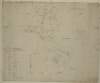
A survey of part of the lands of Bolagh in the barony of Arklow and County of Wicklow. Scale 16 perches to an inch. Table of reference showing tenants and acreage of holdings.
Map
Language:
English
Format:
Map
In collection:
Longfield Map Collection
Published / Created
[between 1770 and 1840]
Notes
Physical description: 1 map Geographic Coverage: Bar...
Contributors:
“
...
Longfield
,
Robert
Ormsby
,
1844
-
1908
,
donor
...
”
Call Number:
Loading...
Located:
Loading...
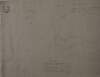
A map of the lands of his Grace the Archbishop of Dublin situate near Ballymore Eustace in the County of Kildare. Surveyed in June 1828 by John Byrne. Scale of 40 perches to an inch. Tenants names shown on holdings. Table of reference showing tenants names and area of holdings.
Map
Main Creator:
Byrne, John, fl. 1789-1828, surveyor
Language:
English
Format:
Map
In collection:
Longfield Map Collection
Published / Created
[June 1828]
Notes
Physical description: 1 map Geographic Coverage: Bar...
Contributors:
“
...
Longfield
,
Robert
Ormsby
,
1844
-
1908
,
donor
...
”
Call Number:
Loading...
Located:
Loading...
[A map of] Mr. Shaws Holding at St. Doolagh - Co. Dublin pt. of the Chantor of C[hrist] C[hurch] Estate
Map
Language:
English
Format:
Map
In collection:
Longfield Map Collection
Published / Created
[between 1770 and 1840]
Notes
Physical description: 1 map Geographic Coverage: Bar...
Contributors:
“
...
Longfield
,
Robert
Ormsby
,
1844
-
1908
,
donor
...
”
Call Number:
Loading...
Located:
Loading...
Map of Mount Ambrose in the Barony of Coolock [recte, Barony of Nethercross] & Co Dublin. Surveyed for J. Ambrose Esq. 1822
Map
Language:
English
Format:
Map
In collection:
Longfield Map Collection
Published / Created
[1822]
Notes
Inset map: "Map of part of Balheary called Little Jam...
Contributors:
“
...
Longfield
,
Robert
Ormsby
,
1844
-
1908
,
donor
...
”
Call Number:
Loading...
Located:
Loading...
A survey of part of the Rath of Creekstown [Crickstown] in the barony of Ratoath and County Meath part of the estate of the most noble the Marquis of Lansdowne. Surveyed by J.L. March 1823. Scale 16 perches to an inch.
Map
Main Creator:
Longfield, John, ca. 1775-1833, surveyor
Language:
English
Format:
Map
In collection:
Longfield Map Collection
Published / Created
[March 1823]
Notes
Inset map: "Dispensary ground at Ballyboggan in Count...
Contributors:
“
...
Longfield
,
Robert
Ormsby
,
1844
-
1908
,
donor
...
”
Call Number:
Loading...
Located:
Loading...
A map of Lisnolan and Prison in the barony of Carra and County of Mayo.
Map
Language:
English
Format:
Map
In collection:
Longfield Map Collection
Published / Created
[between 1770 and 1840]
Notes
Some tearing on map. Physical description: 1 map Geo...
Contributors:
“
...
Longfield
,
Robert
Ormsby
,
1844
-
1908
,
donor
...
”
Call Number:
Loading...
Located:
Loading...
Map of bog at Donore Raheens and Derreens in the barony of Clane and County of Kildare. Names of tenants showing on holdings with table of referenceshowing names & divisions of bogs
Map
Language:
English
Format:
Map
In collection:
Longfield Map Collection
Published / Created
[between 1770 and 1840]
Notes
Physical description: 1 map Geographic Coverage: Bar...
Contributors:
“
...
Longfield
,
Robert
Ormsby
,
1844
-
1908
,
donor
...
”
Call Number:
Loading...
Located:
Loading...
[A survey of the townlands of Duckery, Tullyear and Ballydown, in the Barony of Iveagh, Upper and County of Down]
Map
Language:
English
Format:
Map
In collection:
Longfield Map Collection
Published / Created
[between 1770 and 1840]
Notes
Physical description: 1 map Geographic Coverage: Bar...
Contributors:
“
...
Longfield
,
Robert
Ormsby
,
1844
-
1908
,
donor
...
”
Call Number:
Loading...
Located:
Loading...
[Map of] lands of Kill half barony of west Ophaly and County Kildare. Marquis of Drogheda 1819. Scale 20 perches to an inch. Names of tenants & acreage of holdings shown.
Map
Language:
English
Format:
Map
In collection:
Longfield Map Collection
Published / Created
[1819]
Notes
Physical description: 1 map Geographic Coverage: Bar...
Contributors:
“
...
Longfield
,
Robert
Ormsby
,
1844
-
1908
,
donor
...
”
Call Number:
Loading...
Located:
Loading...
[A map of Lomaunaghbawn Ballaghalode Claddagh, east and west, and other townlands in Barony of Ballymoe County Galway]. Scale 20 perches to an inch. Names of some tenants shown.
Map
Language:
English
Format:
Map
In collection:
Longfield Map Collection
Published / Created
[between 1770 and 1840]
Notes
Physical description: 1 map Geographic Coverage: Bar...
Contributors:
“
...
Longfield
,
Robert
Ormsby
,
1844
-
1908
,
donor
...
”
Call Number:
Loading...
Located:
Loading...
A map of Lusta [Lustia] and Larga in County Leitrim in the baronies of Leitrim and Drumahaire.
Map
Language:
English
Format:
Map
In collection:
Longfield Map Collection
Published / Created
[between 1770 and 1840]
Notes
Physical description: 1 map Geographic Coverage: Bar...
Contributors:
“
...
Longfield
,
Robert
Ormsby
,
1844
-
1908
,
donor
...
”
Call Number:
Loading...
Located:
Loading...
A survey of lands at Lisgarnly Kiltycarney [and Gort] in the barony and County of Leitrim. Names of some tenants & acreage of holdings shown.
Map
Language:
English
Format:
Map
In collection:
Longfield Map Collection
Published / Created
[between 1770 and 1840]
Notes
Physical description: 1 map Geographic Coverage: Bar...
Contributors:
“
...
Longfield
,
Robert
Ormsby
,
1844
-
1908
,
donor
...
”
Call Number:
Loading...
Located:
Loading...
A survey of part of the lands of Clondoogan, Clonmahon, and [Drumlargan in the barony of Deece Upper] in the barony of Moyfenrath and County of Meath the estate of the Rt. Hon. Lord Langford. By John Brownrigg 1795. Names of tenants and acreage of holdings shown. Scale 20 perches to an inch.
Map
Main Creator:
Brownrigg, John, ca. 1748-1838, surveyor
Language:
English
Format:
Map
In collection:
Longfield Map Collection
Published / Created
[1795]
Notes
Physical description: 1 map Geographic Coverage: Bar...
Contributors:
“
...
Longfield
,
Robert
Ormsby
,
1844
-
1908
,
donor
...
”
Call Number:
Loading...
Located:
Loading...
A map of part of the lands of Drummin [Drummond] in the barony of Moyfenrath and County of Meath part of the estate of Lady Jane Loftus. Surveyed by John Longfield. 1820. Scale 20 perches to an inch. Table of reference showing tenants names & acreage of holdings.
Map
Main Creator:
Longfield, John, ca. 1775-1833, surveyor
Language:
English
Format:
Map
In collection:
Longfield Map Collection
Published / Created
[1820]
Notes
Physical description: 1 map Geographic Coverage: Bar...
Contributors:
“
...
Longfield
,
Robert
Ormsby
,
1844
-
1908
,
donor
...
”
Call Number:
Loading...
Located:
Loading...
A map of a piece of ground at the rere of the holdings in Booterstown Lane in the County of Dublin let by Stephen Tully to [illegible] Butler. Surveyed Nov. 1809 J.L. Scale 40 feet to an inch. Names of adjoining tenants shown
Map
Main Creator:
Longfield, John, ca. 1775-1833, surveyor
Language:
English
Format:
Map
In collection:
Longfield Map Collection
Published / Created
[November 1809]
Notes
Physical description: 1 map Geographic Coverage: Bar...
Contributors:
“
...
Longfield
,
Robert
Ormsby
,
1844
-
1908
,
donor
...
”
Call Number:
Loading...
Located:
Loading...
A map of lands at Attateenoe, Clonygarra and Bauneen in the barony of Kells and County of Kilkenny. Scale 16 statute perches to an inch. Names of tenants acreage in type of agriculture shown. A note on map - "The corner at X [in Clonygarra] is the spot where the unfortunate man Devereac? was murdered in the year 1831."
Map
Language:
English
Format:
Map
In collection:
Longfield Map Collection
Published / Created
[between 1770 and 1840]
Notes
Physical description: 1 map Geographic Coverage: Bar...
Contributors:
“
...
Longfield
,
Robert
Ormsby
,
1844
-
1908
,
donor
...
”
Call Number:
Loading...
Located:
Loading...
A survey of the Rath of Creekstown [Crickstown] near Ashbourne in the County of Meath part of the estate of the most Honourable the Marquis of Lansdowne. By J.L. 1823. Scale 16 perches to an inch. Names of some tenants shown with acreage of holdings.
Map
Main Creator:
Longfield, John, ca. 1775-1833, surveyor
Language:
English
Format:
Map
In collection:
Longfield Map Collection
Published / Created
[1823]
Notes
Physical description: 1 map Geographic Coverage: Bar...
Contributors:
“
...
Longfield
,
Robert
Ormsby
,
1844
-
1908
,
donor
...
”
Call Number:
Loading...
Located:
Loading...
A map of lands at [Balriggan?] and a nearby townland in the County of Louth.
Map
Language:
English
Format:
Map
In collection:
Longfield Map Collection
Published / Created
[between 1770 and 1840]
Notes
Physical description: 1 map Geographic Coverage: Bar...
Contributors:
“
...
Longfield
,
Robert
Ormsby
,
1844
-
1908
,
donor
...
”
Call Number:
Loading...
Located:
Loading...
A map of lands at Tully ... and Figh in the barony of Frenchpark and County of Roscommon. Scale of 80 perches to an inch.
Map
Language:
English
Format:
Map
In collection:
Longfield Map Collection
Published / Created
[between 1770 and 1840]
Notes
Physical description: 1 map Geographic Coverage: Bar...
Contributors:
“
...
Longfield
,
Robert
Ormsby
,
1844
-
1908
,
donor
...
”
Call Number:
Loading...
Located:
Loading...
A map of the mill and part of the lands of Ardmulchon [Ardmulchan] intended to be taken for the use of the Boyne Navigation the estate of Lord Boyne. John Martin tenant. Surveyed by John Brownrigg 1791. Scale 250 feet to an inch. A note showing that the land purchased by the company was 1a. 1r. and not 2r. 20p.
Map
Main Creator:
Brownrigg, John, ca. 1748-1838, surveyor
Language:
English
Format:
Map
In collection:
Longfield Map Collection
Published / Created
[1791]
Notes
Physical description: 1 map Geographic Coverage: Bar...
Contributors:
“
...
Longfield
,
Robert
Ormsby
,
1844
-
1908
,
donor
...
”
Call Number:
Loading...
Located:
Loading...
1
Previous
5
6
7
8
9
10
11
12
13
14
15
Next
80
Get RSS Feed
Email this Search
History
Narrow Search
Digitised
Format
1,580
Map
1
Manuscript
Online Availability
956
Digitised
625
Not Digitised
Published / Created
From:
To:
Subject
1,579
Land use surveys
1,578
Boundaries (Estates)
1,578
Land tenure
1,565
Administration of estates
268
History
49
Administration of Estates
more ...
1
Cartography
1
Estates
1
Maps
1
Maps and Surveys
1
Surveyors
see all ...
less ...
Author
336
Longfield, John, ca. 1775-1833, surveyor
112
Brownrigg, John, ca. 1748-1838, surveyor
42
Brownrigg & Co., fl. 1801-1809, surveyors
38
Longfield, William, fl. 1825-ca. 1870, surveyor
8
Reading, Thomas, ca. 1704-1779, surveyor
7
Brownrigg, Longfield and Murray, fl. 1799-ca. 1805, surveyors
more ...
6
Gartland, William, fl. 1838-1851/68, surveyor
5
Byron, Samuel, fl. 1768-1795
4
Cave, Thomas, fl. ca. 1709-1749, surveyor
4
Scalé, Brownrigg & Sherrard, fl. 1774-1778, surveyors
3
Chaloner, Samuel, fl. 1812-1833, surveyor
3
Cuddehy, Michael, fl. 1791-1803, surveyor
3
Mathews, Thomas, fl. 1760-1784, surveyor
3
Roe, John, fl. 1793-1824, surveyor
3
Scully, Patrick, fl. 1777, surveyor
3
Sherrard, Thomas, ca. 1750-1837, surveyor
2
Brownrigg & Sherrard, fl. 1777-1778, surveyors
2
Byrne, John, fl. 1789-1828, surveyor
2
Donlevy, Bryan, fl. 1784-1792, surveyor
2
Frizell, Richard, fl. 1750-1797
2
Kirrilly, Bryan, fl. 1715-1716, surveyor
2
Lewis, Robert, fl. 1745-1785, surveyor
2
Lynch, Thomas, fl. 1804-1809, surveyor
2
Moynahan, John, fl. 1736-1764, surveyor
2
Mulvihill, Peter, ca. 1736-d. 1798, surveyor
2
Neville, Arthur Richards, fl. 1775-1828, surveyor
2
Sherrard & Brassington, fl. 1800-1822, surveyors
1
Balfe, M., fl. 1821, surveyor
1
Battersby, John, fl. 1778, surveyor
1
Bell, John (I and II), fl. 1721-1820
see all ...
less ...
Collections
1,581
Longfield Map Collection
Language
1,581
English
Genre
1,580
Manuscript maps
1,577
Maps, Manuscript
269
Early works to 1800
Era
268
18th century
1
1780-1840
1
19th century
Region
1,535
Ireland
711
Dublin (Ireland : County)
710
Dublin (County)
295
Dublin (Ireland)
294
Dublin
182
Kildare (County)
more ...
182
Kildare (Ireland : County)
155
Meath
155
Meath (Ireland)
118
Roscommon (County)
118
Roscommon (Ireland : County)
111
Rathdown (Barony)
85
Coolock (Barony)
76
Offaly West (Barony)
70
Uppercross (Barony)
47
Tipperary (County)
47
Tipperary (Ireland : County)
45
Northern Ireland
43
Newcastle (Barony)
40
Frenchpark (Barony)
40
Wicklow (County)
40
Wicklow (Ireland : County)
36
Castleknock (Barony)
35
Westmeath
35
Westmeath (Ireland)
34
Balrothery (Barony)
33
Laois
33
Laois (Ireland)
31
Dublin (Barony)
29
Nethercross (Barony)
see all ...
less ...
Loading...
![[A map of] Mr. Shaws Holding at St. Doolagh - Co. Dublin pt. of the Chantor of C[hrist] C[hurch] Estate](/IIIF/000310000/000301189/vtls000301189_001.jp2/full/100,/0/default.jpg)
![A survey of part of the Rath of Creekstown [Crickstown] in the barony of Ratoath and County Meath part of the estate of the most noble the Marquis of Lansdowne. Surveyed by J.L. March 1823. Scale 16 perches to an inch.](/IIIF/000310000/000301848/vtls000301848_001.jp2/full/100,/0/default.jpg)


![[A survey of the townlands of Duckery, Tullyear and Ballydown, in the Barony of Iveagh, Upper and County of Down]](/IIIF/000310000/000301931/vtls000301931_001.jp2/full/100,/0/default.jpg)
![[Map of] lands of Kill half barony of west Ophaly and County Kildare. Marquis of Drogheda 1819. Scale 20 perches to an inch. Names of tenants & acreage of holdings shown.](/IIIF/000310000/000302089/vtls000302089_001.jp2/full/100,/0/default.jpg)
![A map of Lusta [Lustia] and Larga in County Leitrim in the baronies of Leitrim and Drumahaire.](/IIIF/000310000/000302112/vtls000302112_001.jp2/full/100,/0/default.jpg)
![A survey of lands at Lisgarnly Kiltycarney [and Gort] in the barony and County of Leitrim. Names of some tenants & acreage of holdings shown.](/IIIF/000310000/000302430/vtls000302430_001.jp2/full/100,/0/default.jpg)
![A survey of part of the lands of Clondoogan, Clonmahon, and [Drumlargan in the barony of Deece Upper] in the barony of Moyfenrath and County of Meath the estate of the Rt. Hon. Lord Langford. By John Brownrigg 1795. Names of tenants and acreage of holdings shown. Scale 20 perches to an inch.](/IIIF/000310000/000301813/vtls000301813_001.jp2/full/100,/0/default.jpg)
![A map of part of the lands of Drummin [Drummond] in the barony of Moyfenrath and County of Meath part of the estate of Lady Jane Loftus. Surveyed by John Longfield. 1820. Scale 20 perches to an inch. Table of reference showing tenants names & acreage of holdings.](/IIIF/000310000/000301815/vtls000301815_001.jp2/full/100,/0/default.jpg)
![A map of lands at Attateenoe, Clonygarra and Bauneen in the barony of Kells and County of Kilkenny. Scale 16 statute perches to an inch. Names of tenants acreage in type of agriculture shown. A note on map - "The corner at X [in Clonygarra] is the spot where the unfortunate man Devereac? was murdered in the year 1831."](/IIIF/000310000/000302140/vtls000302140_001.jp2/full/100,/0/default.jpg)
![A survey of the Rath of Creekstown [Crickstown] near Ashbourne in the County of Meath part of the estate of the most Honourable the Marquis of Lansdowne. By J.L. 1823. Scale 16 perches to an inch. Names of some tenants shown with acreage of holdings.](/IIIF/000310000/000301843/vtls000301843_001.jp2/full/100,/0/default.jpg)
![A map of lands at [Balriggan?] and a nearby townland in the County of Louth.](/IIIF/000310000/000302318/vtls000302318_001.jp2/full/100,/0/default.jpg)

![A map of the mill and part of the lands of Ardmulchon [Ardmulchan] intended to be taken for the use of the Boyne Navigation the estate of Lord Boyne. John Martin tenant. Surveyed by John Brownrigg 1791. Scale 250 feet to an inch. A note showing that the land purchased by the company was 1a. 1r. and not 2r. 20p.](/IIIF/000310000/000301863/vtls000301863_001.jp2/full/100,/0/default.jpg)