Showing
1 - 20
results of
47
for search '
Longfield, Robert Ormsby, 1844-1908, donor
'
Skip to content
Toggle navigation
NLI Website
- Catalogue -
English
Gaeilge
Home
Help
Advanced Search
Browse
Orders
Ask a Librarian
Language
English
Gaeilge
All Fields
Title
Author
Subject
Call Number
ISBN/ISSN
Publisher
Coordinates
Search digitised content only
FIND
Author
Longfield, Robert Ormsby, 1844-1908, donor
Results
Showing
1 - 20
results of
47
for search '
Longfield, Robert Ormsby, 1844-1908, donor
'
, query time: 0.05s
List
Grid
Sort
Relevance
Newest First
Oldest First
Call Number
Author
Title
1
2
3
Next
3
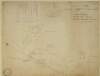
A map of Galbertstown and Newtown in the barony of Eliogarty as now held by the undertenants May 1775. Names of tenants & acreage of holdings shown.
Map
Language:
English
Format:
Map
In collection:
Longfield Map Collection
Published / Created
[May 1775]
Notes
Physical description: 1 map Geographic Coverage: Bar...
Contributors:
“
...
Longfield
,
Robert
Ormsby
,
1844
-
1908
,
donor
...
”
Call Number:
Loading...
Located:
Loading...
A survey of the lands of Knockulty and Fanningsbog in the barony of Slievardagh and County of Tipperary part of the estate of the Earl of Desart, October 1804. Names of tenants and acreage of holdings shown. Scale 20 perches to an inch.
Map
Language:
English
Format:
Map
In collection:
Longfield Map Collection
Published / Created
[October 1804]
Notes
Physical description: 1 map Geographic Coverage: Bar...
Contributors:
“
...
Longfield
,
Robert
Ormsby
,
1844
-
1908
,
donor
...
”
Call Number:
Loading...
Located:
Loading...
Map of part of the estate of George Putland and Sir Charles Hulse at both sides of Kilsheelan Street Clonmel. By Samuel Chaloner 1833. Scale 60 feet to one inch. Table of reference showing owners & area of allotments.
Map
Main Creator:
Chaloner, Samuel, fl. 1812-1833, surveyor
Language:
English
Format:
Map
In collection:
Longfield Map Collection
Published / Created
[1833]
Notes
Physical description: 1 map Geographic Coverage: Bar...
Contributors:
“
...
Longfield
,
Robert
Ormsby
,
1844
-
1908
,
donor
...
”
Call Number:
Loading...
Located:
Loading...
A map of lands at Stephenstown and Ballyduagh in the barony of Middlethird and County of Tipperary. Names of tenants and acreage of holdings shown.
Map
Language:
English
Format:
Map
In collection:
Longfield Map Collection
Published / Created
[between 1770 and 1840]
Notes
Physical description: 1 map Geographic Coverage: Bar...
Contributors:
“
...
Longfield
,
Robert
Ormsby
,
1844
-
1908
,
donor
...
”
Call Number:
Loading...
Located:
Loading...
A map of lands at Lyonstown part of Lord Derby's estate ... in the barony of Middlethird and County of Tipperary. By John Longfield, July 1824. Names of tenants and acreage of lands shown.
Map
Main Creator:
Longfield, John, ca. 1775-1833, surveyor
Language:
English
Format:
Map
In collection:
Longfield Map Collection
Published / Created
[July 1824]
Notes
Physical description: 1 map Geographic Coverage: Bar...
Contributors:
“
...
Longfield
,
Robert
Ormsby
,
1844
-
1908
,
donor
...
”
Call Number:
Loading...
Located:
Loading...
A map of the glebe lands of Killenaule in the barony of Slievardagh and County of Tipperary belonging to the Chancellor of Christ Church. Surveyed and traced by J.L. 1817. Names of tenants shown & table of reference with tenants names & area of holdings. With additional list 4 January 1833 laid out and possession taken by Sheriff.
Map
Main Creator:
Longfield, John, ca. 1775-1833, surveyor
Language:
English
Format:
Map
In collection:
Longfield Map Collection
Published / Created
[1817]
Notes
Physical description: 1 map Geographic Coverage: Bar...
Contributors:
“
...
Longfield
,
Robert
Ormsby
,
1844
-
1908
,
donor
...
”
Call Number:
Loading...
Located:
Loading...
A map of the lands of Galbertstown ... in the barony of Eliogarty and County of Tipperary. Surveyed 6 August 1764. By J. Moynahan.
Map
Main Creator:
Moynahan, John, fl. 1736-1764, surveyor
Language:
English
Format:
Map
In collection:
Longfield Map Collection
Published / Created
[August 06 1764]
Notes
Physical description: 1 map Geographic Coverage: Bar...
Contributors:
“
...
Longfield
,
Robert
Ormsby
,
1844
-
1908
,
donor
...
”
Call Number:
Loading...
Located:
Loading...
A map of lands at Glenbane Upper and Glenbane Lower in the barony of Middlethird and County of Tipperary. Names of tenants and acreage of holdings shown.
Map
Language:
English
Format:
Map
In collection:
Longfield Map Collection
Published / Created
[between 1770 and 1840]
Notes
Physical description: 1 map Geographic Coverage: Bar...
Contributors:
“
...
Longfield
,
Robert
Ormsby
,
1844
-
1908
,
donor
...
”
Call Number:
Loading...
Located:
Loading...
A map of Coolmore in the barony of Middlethird and County of Tipperary.
Map
Language:
English
Format:
Map
In collection:
Longfield Map Collection
Published / Created
[between 1770 and 1840]
Notes
Physical description: 1 map Geographic Coverage: Bar...
Contributors:
“
...
Longfield
,
Robert
Ormsby
,
1844
-
1908
,
donor
...
”
Call Number:
Loading...
Located:
Loading...
A map of Ballynahinch in the barony of Owney and Arra and County of Tipperary.
Map
Language:
English
Format:
Map
In collection:
Longfield Map Collection
Published / Created
[between 1770 and 1840]
Notes
Physical description: 1 map Geographic Coverage: Bar...
Contributors:
“
...
Longfield
,
Robert
Ormsby
,
1844
-
1908
,
donor
...
”
Call Number:
Loading...
Located:
Loading...
A survey of lands at Ballyphilip Ballygodoon Gotinstown Barronstown Ballykisteen and Acraboy in the barony of Clanwilliam and County of Tipperary. Names of tenants and acreage of holdings shown.
Map
Language:
English
Format:
Map
In collection:
Longfield Map Collection
Published / Created
[between 1770 and 1840]
Notes
Physical description: 1 map Geographic Coverage: Bar...
Contributors:
“
...
Longfield
,
Robert
Ormsby
,
1844
-
1908
,
donor
...
”
Call Number:
Loading...
Located:
Loading...
A survey of lands at Barnanalleen, Gortdrum, Cauteen, Rathneaveen [Ryan], Emly, and Farranassa in the barony of Clanwilliam and County of Tipperary. Names of tenants and acreage of holdings shown.
Map
Language:
English
Format:
Map
In collection:
Longfield Map Collection
Published / Created
[between 1770 and 1840]
Notes
Physical description: 1 map Geographic Coverage: Bar...
Contributors:
“
...
Longfield
,
Robert
Ormsby
,
1844
-
1908
,
donor
...
”
Call Number:
Loading...
Located:
Loading...
A map of Grallagh in the barony of Ormond Lower. Mr Smyth shown as tenant with acreage.
Map
Language:
English
Format:
Map
In collection:
Longfield Map Collection
Published / Created
[between 1770 and 1840]
Notes
Physical description: 1 map Geographic Coverage: Bar...
Contributors:
“
...
Longfield
,
Robert
Ormsby
,
1844
-
1908
,
donor
...
”
Call Number:
Loading...
Located:
Loading...
A map of Ballingeer in the barony of Owney and Arra in the County of Tipperary.
Map
Language:
English
Format:
Map
In collection:
Longfield Map Collection
Published / Created
[between 1770 and 1840]
Notes
Physical description: 1 map Geographic Coverage: Bar...
Contributors:
“
...
Longfield
,
Robert
Ormsby
,
1844
-
1908
,
donor
...
”
Call Number:
Loading...
Located:
Loading...
A map of Ronan and Carrownaglogh ... in the barony of Ormond Lower. Names of proprietors and acreage shown.
Map
Language:
English
Format:
Map
In collection:
Longfield Map Collection
Published / Created
[between 1770 and 1840]
Notes
Physical description: 1 map Geographic Coverage: Bar...
Contributors:
“
...
Longfield
,
Robert
Ormsby
,
1844
-
1908
,
donor
...
”
Call Number:
Loading...
Located:
Loading...
A map showing Lisnatubbrid ... In the barony of Iffa and Offa East in the County of Tipperary.
Map
Language:
English
Format:
Map
In collection:
Longfield Map Collection
Published / Created
[between 1770 and 1840]
Notes
Physical description: 1 map Geographic Coverage: Bar...
Contributors:
“
...
Longfield
,
Robert
Ormsby
,
1844
-
1908
,
donor
...
”
Call Number:
Loading...
Located:
Loading...
A map of the lands of Clondoty in the parish of Loughmoe West barony of Eliogarty and County of Tipperary part of the estate of the Rt. Hon. Visct. Jacelyn. Surveyed in March 1768 by Maurice Downer. A scale of 40 perches to an inch. [N.B. Mr James Reynolds attended the survey].
Map
Main Creator:
Downer, Maurice, fl. 1747-1778, surveyor
Language:
English
Format:
Map
In collection:
Longfield Map Collection
Published / Created
[March 1768]
Notes
Physical description: 1 map Geographic Coverage: Par...
Contributors:
“
...
Longfield
,
Robert
Ormsby
,
1844
-
1908
,
donor
...
”
Call Number:
Loading...
Located:
Loading...
A rough draft of Galbertstown in the barony of Eliogarty and County of Tipperary. By John Wright, April 1775. A scale of 40 perches to an inch.
Map
Main Creator:
Wright, John, fl. 1759-1775, surveyor
Language:
English
Format:
Map
In collection:
Longfield Map Collection
Published / Created
[April 1775]
Notes
Physical description: 1 map Geographic Coverage: Bar...
Contributors:
“
...
Longfield
,
Robert
Ormsby
,
1844
-
1908
,
donor
...
”
Call Number:
Loading...
Located:
Loading...
A survey of part of the townlands of Killenaulle done in order to ascertain the glebe, in the barony of Slievardagh and County of Tipperary. Table of reference showing tenants and acreage of holdings. Ms. Reference to Down Survey made in 1655 and variations in Sept. 1788. 1816.
Map
Language:
English
Format:
Map
In collection:
Longfield Map Collection
Published / Created
[1816]
Notes
Physical description: 1 map Geographic Coverage: Bar...
Contributors:
“
...
Longfield
,
Robert
Ormsby
,
1844
-
1908
,
donor
...
”
Call Number:
Loading...
Located:
Loading...
A map of lands at Boreen in the barony of Clanwilliam and County of Tipperary. Names of tenants and acreage of holdings shown.
Map
Language:
English
Format:
Map
In collection:
Longfield Map Collection
Published / Created
[between 1770 and 1840]
Notes
Physical description: 1 map Geographic Coverage: Bar...
Contributors:
“
...
Longfield
,
Robert
Ormsby
,
1844
-
1908
,
donor
...
”
Call Number:
Loading...
Located:
Loading...
1
2
3
Next
3
Get RSS Feed
Email this Search
History
Narrow Search
Digitised
Remove Filters
Clear Filter
Subject: Land tenure
Clear Filter
Region: Tipperary (County)
Format
47
Map
Online Availability
37
Not Digitised
10
Digitised
Published / Created
From:
To:
Subject
47
Administration of estates
47
Boundaries (Estates)
Land tenure
47
Land use surveys
8
History
Author
5
Longfield, John, ca. 1775-1833, surveyor
3
Chaloner, Samuel, fl. 1812-1833, surveyor
2
Moynahan, John, fl. 1736-1764, surveyor
1
Bridge, Timothy, fl. 1725-1732, surveyor
1
Downer, Maurice, fl. 1747-1778, surveyor
1
Longfield, William, fl. 1825-ca. 1870, surveyor
more ...
1
Steile, William Snr., fl. 1736-1760, surveyor
1
Wright, John, fl. 1759-1775, surveyor
see all ...
less ...
Collections
47
Longfield Map Collection
Language
47
English
Genre
47
Manuscript maps
47
Maps, Manuscript
8
Early works to 1800
Era
8
18th century
Region
47
Ireland
Tipperary (County)
47
Tipperary (Ireland : County)
10
Middlethird (Barony)
7
Clanwilliam (Barony)
7
Ormond Lower (Barony)
more ...
6
Owney and Arra (Barony)
5
Eliogarty (Barony)
5
Iffa and Offa East (Barony)
4
Slievardagh (Barony)
3
Ormond Upper (Barony)
1
Kilmore Parish
1
Kilmore Parish (Ireland)
1
Loughmoe West Parish
1
Loughmoe West Parish (Ireland)
1
Terryglass Parish
1
Terryglass Parish (Ireland)
see all ...
less ...
Loading...