Showing
1 - 20
results of
954
for search '
Longfield, Robert Ormsby, 1844-1908, donor
'
Skip to content
Toggle navigation
NLI Website
- Catalogue -
English
Gaeilge
Home
Help
Advanced Search
Browse
Orders
Ask a Librarian
Language
English
Gaeilge
All Fields
Title
Author
Subject
Call Number
ISBN/ISSN
Publisher
Coordinates
Search digitised content only
FIND
Author
Longfield, Robert Ormsby, 1844-1908, donor
Results
Showing
1 - 20
results of
954
for search '
Longfield, Robert Ormsby, 1844-1908, donor
'
, query time: 0.07s
List
Grid
Sort
Relevance
Newest First
Oldest First
Call Number
Author
Title
1
2
3
4
5
6
7
8
9
10
11
Next
48
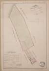
[A map of the lands of Grannagh Beg Baunoge and Knockault in the Barony of Loughrea and County of Galway]
Map
Language:
English
Format:
Map
In collection:
Longfield Map Collection
Published / Created
[between 1770 and 1840]
Notes
Physical description: 1 map Geographic Coverage: Bar...
Contributors:
“
...
Longfield
,
Robert
Ormsby
,
1844
-
1908
,
donor
...
”
Call Number:
Loading...
Located:
Loading...
A map of part of the Demense of Malahide, with parts of Streamstown Mayfield & Auburn, the whole formerly call'd Mabstown, in the B[arony] of Coolock & Co. Dublin - traced from the Down Survey. Order of the Rt. Revd. the Dean & Chapter of C.C. [Christ Church] Dublin. By J.L. 1816
Map
Main Creator:
Longfield, John, ca. 1775-1833, surveyor
Language:
English
Format:
Map
In collection:
Longfield Map Collection
Published / Created
[1816]
Notes
Physical description: 1 map Geographic Coverage: Bar...
Contributors:
“
...
Longfield
,
Robert
Ormsby
,
1844
-
1908
,
donor
...
”
Call Number:
Loading...
Located:
Loading...
A survey of Borreen [Barreen] in the barony of Ikeathy & Ooughterany and County of Kildare the estate of Judge Johnson let to Mr. Thomas Frayne 1817. Scale 20 perches to an inch. Table of reference showing acreage of fields.
Map
Language:
English
Format:
Map
In collection:
Longfield Map Collection
Published / Created
[1817]
Notes
Physical description: 1 map Geographic Coverage: Bar...
Contributors:
“
...
Longfield
,
Robert
Ormsby
,
1844
-
1908
,
donor
...
”
Call Number:
Loading...
Located:
Loading...
A map of lands at Errit in the barony of Frenchpark and County of Roscommon. Table of reference showing townland acreage & condition of land.
Map
Language:
English
Format:
Map
In collection:
Longfield Map Collection
Published / Created
[between 1770 and 1840]
Notes
Physical description: 1 map Geographic Coverage: Bar...
Contributors:
“
...
Longfield
,
Robert
Ormsby
,
1844
-
1908
,
donor
...
”
Call Number:
Loading...
Located:
Loading...
[A survey of a holding in Ballsbridge, Co Dublin] marking Mr. Le Favres ground. Scale 200 Feet to an Inch
Map
Language:
English
Format:
Map
In collection:
Longfield Map Collection
Published / Created
[between 1770 and 1840]
Notes
Physical description: 1 map Geographic Coverage: Bar...
Contributors:
“
...
Longfield
,
Robert
Ormsby
,
1844
-
1908
,
donor
...
”
Call Number:
Loading...
Located:
Loading...
A map of part of Tullog in the tenure of J. Langan in the barony of Duleek Upper and County of Meath. By a scale of 20 perches. 1808.
Map
Language:
English
Format:
Map
In collection:
Longfield Map Collection
Published / Created
[1808]
Notes
Physical description: 1 map Geographic Coverage: Bar...
Contributors:
“
...
Longfield
,
Robert
Ormsby
,
1844
-
1908
,
donor
...
”
Call Number:
Loading...
Located:
Loading...
A map of the lands of Carna [Carn] Barony of Offaly East and County of Kildare in the tenure of [Edward] Byrne. A survey of part of the lands of Carna [Carn] Barony of Offaly East Co Kildare in the tenure of Hugh Toole. Scale 16 perches to an inch. Table of reference tenants names & acreage of fields shown.
Map
Language:
English
Format:
Map
In collection:
Longfield Map Collection
Published / Created
[between 1770 and 1840]
Notes
Some staining around the edges with some old tape mar...
Contributors:
“
...
Longfield
,
Robert
Ormsby
,
1844
-
1908
,
donor
...
”
Call Number:
Loading...
Located:
Loading...
A map of the lands of Grangebeg in the Barony of Offaly West and County of Kildare. Names of tenants & acreage of holdings shown.
Map
Language:
English
Format:
Map
In collection:
Longfield Map Collection
Published / Created
[between 1770 and 1840]
Notes
Physical description: 1 map Geographic Coverage: Bar...
Contributors:
“
...
Longfield
,
Robert
Ormsby
,
1844
-
1908
,
donor
...
”
Call Number:
Loading...
Located:
Loading...
A survey of Bonnianstown [Bunnianstown] in the parish of Ardcath barony of Duleek Upper and County of Meath part of Lord Shelbournes estates. By John Longfield, May 1824. Table of reference showing fields & acreage.
Map
Main Creator:
Longfield, John, ca. 1775-1833, surveyor
Language:
English
Format:
Map
In collection:
Longfield Map Collection
Published / Created
[May 1824]
Notes
Physical description: 1 map Geographic Coverage: Par...
Contributors:
“
...
Longfield
,
Robert
Ormsby
,
1844
-
1908
,
donor
...
”
Call Number:
Loading...
Located:
Loading...
Portion of a plan of holdings adjoining Frenchman's Lane.
Map
Language:
English
Format:
Map
In collection:
Longfield Map Collection
Published / Created
[between 1770 and 1840]
Notes
Physical description: 1 map Geographic Coverage: Dub...
Contributors:
“
...
Longfield
,
Robert
Ormsby
,
1844
-
1908
,
donor
...
”
Call Number:
Loading...
Located:
Loading...
A map of several lots of ground in the town of Mountmellick part of the Marquis of Drogheda estate. Surveyed by John Longfield, 1819. Scale 4 perches to an inch. Table of reference showing tenants names & area of holdings.
Map
Main Creator:
Longfield, John, ca. 1775-1833, surveyor
Language:
English
Format:
Map
In collection:
Longfield Map Collection
Published / Created
[1819]
Notes
Physical description: 1 map Geographic Coverage: Bar...
Contributors:
“
...
Longfield
,
Robert
Ormsby
,
1844
-
1908
,
donor
...
”
Call Number:
Loading...
Located:
Loading...
Maps of pt. of Wm. White's Estate near Loughbrickland, 1804
Map
Language:
English
Format:
Map
In collection:
Longfield Map Collection
Published / Created
[1804]
Notes
Physical description: 1 map Geographic Coverage: Bar...
Contributors:
“
...
Longfield
,
Robert
Ormsby
,
1844
-
1908
,
donor
...
”
Call Number:
Loading...
Located:
Loading...
A map of part of the lands of Sterling [Stirling?] in the barony of Dunboyne and County Meath and part of the lands of Pheblestown [Phibblestown] in the barony of Castleknock and County Dublin. Surveyed for Mr. Bingham by J. Longfield 1806. Scale 10 perches to an inch.
Map
Main Creator:
Longfield, John, ca. 1775-1833, surveyor
Language:
English
Format:
Map
In collection:
Longfield Map Collection
Published / Created
[1806]
Notes
Physical description: 1 map Geographic Coverage: Bar...
Contributors:
“
...
Longfield
,
Robert
Ormsby
,
1844
-
1908
,
donor
...
”
Call Number:
Loading...
Located:
Loading...
A map of Cortown Milltown and Febog ... in the barony of Kells Upper and County Meath. Names of tenants & acreage of holdings shown.
Map
Language:
English
Format:
Map
In collection:
Longfield Map Collection
Published / Created
[between 1770 and 1840]
Notes
Physical description: 1 map Geographic Coverage: Bar...
Contributors:
“
...
Longfield
,
Robert
Ormsby
,
1844
-
1908
,
donor
...
”
Call Number:
Loading...
Located:
Loading...
A survey of Aughakine [Aghakine] in the parish of St. Cullom Kill [Columkille] barony of Granard & County of Longford the estate of Thomas Burrows. August 27 1790. Scale 20 perches to an inch. Names of tenants & acreage of holdings shown.
Map
Language:
English
Format:
Map
In collection:
Longfield Map Collection
Published / Created
[August 27 1790]
Notes
Physical description: 1 map Geographic Coverage: Par...
Contributors:
“
...
Longfield
,
Robert
Ormsby
,
1844
-
1908
,
donor
...
”
Call Number:
Loading...
Located:
Loading...
[A map of Gubh and other townlands in County Fermanagh]. Names of tenants acreage shown
Map
Language:
English
Format:
Map
In collection:
Longfield Map Collection
Published / Created
[between 1770 and 1840]
Notes
Physical description: 1 map Geographic Coverage: Cou...
Contributors:
“
...
Longfield
,
Robert
Ormsby
,
1844
-
1908
,
donor
...
”
Call Number:
Loading...
Located:
Loading...
Map of Coldrina [Cooldrinagh] in the barony of Newcastle and County of Dublin.
Map
Language:
English
Format:
Map
In collection:
Longfield Map Collection
Published / Created
[between 1770 and 1840]
Notes
Physical description: 1 map Geographic Coverage: Bar...
Contributors:
“
...
Longfield
,
Robert
Ormsby
,
1844
-
1908
,
donor
...
”
Call Number:
Loading...
Located:
Loading...
A map of lands at Cloonarragh in the barony of Ballintober South and County of Roscommon. Names of tenants and acreage of holdings shown.
Map
Language:
English
Format:
Map
In collection:
Longfield Map Collection
Published / Created
[between 1770 and 1840]
Notes
Physical description: 1 map Geographic Coverage: Bar...
Contributors:
“
...
Longfield
,
Robert
Ormsby
,
1844
-
1908
,
donor
...
”
Call Number:
Loading...
Located:
Loading...
A survey of the lands of Moortown in the barony of Duleek [Upper] and County of Meath. Done for Francis Synge by J.L. 1805. Names of tenants and acreage of holdings shown. Scale 10 perches to an inch.
Map
Main Creator:
Longfield, John, ca. 1775-1833, surveyor
Language:
English
Format:
Map
In collection:
Longfield Map Collection
Published / Created
[1805]
Notes
Physical description: 1 map Geographic Coverage: Bar...
Contributors:
“
...
Longfield
,
Robert
Ormsby
,
1844
-
1908
,
donor
...
”
Call Number:
Loading...
Located:
Loading...
[A map of Lands in the townlands of Derrenargan and Derreenasoo in the Barony of Boyle and County of Roscommon] Scale 20 Perches to an Inch
Map
Language:
English
Format:
Map
In collection:
Longfield Map Collection
Published / Created
[between 1770 and 1840]
Notes
Physical description: 1 map Geographic Coverage: Bar...
Contributors:
“
...
Longfield
,
Robert
Ormsby
,
1844
-
1908
,
donor
...
”
Call Number:
Loading...
Located:
Loading...
1
2
3
4
5
6
7
8
9
10
11
Next
48
Get RSS Feed
Email this Search
History
Narrow Search
Clear Filter
Digitised
Remove Filters
Clear Filter
Subject: Land tenure
Format
954
Map
Online Availability
Digitised
Published / Created
From:
To:
Subject
954
Boundaries (Estates)
Land tenure
954
Land use surveys
942
Administration of estates
142
History
47
Administration of Estates
Author
186
Longfield, John, ca. 1775-1833, surveyor
46
Brownrigg, John, ca. 1748-1838, surveyor
14
Brownrigg & Co., fl. 1801-1809, surveyors
14
Longfield, William, fl. 1825-ca. 1870, surveyor
6
Gartland, William, fl. 1838-1851/68, surveyor
5
Reading, Thomas, ca. 1704-1779, surveyor
more ...
4
Brownrigg, Longfield and Murray, fl. 1799-ca. 1805, surveyors
4
Scalé, Brownrigg & Sherrard, fl. 1774-1778, surveyors
3
Byron, Samuel, fl. 1768-1795
3
Cuddehy, Michael, fl. 1791-1803, surveyor
3
Scully, Patrick, fl. 1777, surveyor
2
Cave, Thomas, fl. ca. 1709-1749, surveyor
2
Donlevy, Bryan, fl. 1784-1792, surveyor
2
Lewis, Robert, fl. 1745-1785, surveyor
2
Lynch, Thomas, fl. 1804-1809, surveyor
2
Mulvihill, Peter, ca. 1736-d. 1798, surveyor
2
Sherrard, Thomas, ca. 1750-1837, surveyor
1
Balfe, M., fl. 1821, surveyor
1
Bell, John (I and II), fl. 1721-1820
1
Bourke, Theobald, fl. 1721-1746, surveyor
1
Boyd, Joseph, fl. 1780-1807, surveyor
1
Brassington & Gale, fl. 1832-1857, surveyors
1
Bridge, Timothy, fl. 1725-1732, surveyor
1
Browne, John, fl. 1788-ca. 1807, surveyor
1
Byrne, John, fl. 1789-1828, surveyor
1
Campbell, James, fl. 1773-1783, surveyor
1
Colbert, Thomas, fl. 1802, surveyor
1
Colbourne, Thomas, fl. 1810-1830
1
Connolly, John, fl. 1826, surveyor
1
Cooley, Garret, fl. 1787, surveyor
see all ...
less ...
Collections
954
Longfield Map Collection
Language
954
English
Genre
954
Manuscript maps
953
Maps, Manuscript
143
Early works to 1800
Era
142
18th century
1
19th century
Region
916
Ireland
182
Dublin (Ireland : County)
181
Dublin (County)
176
Kildare (County)
176
Kildare (Ireland : County)
147
Meath
more ...
147
Meath (Ireland)
111
Roscommon (County)
111
Roscommon (Ireland : County)
81
Coolock (Barony)
73
Offaly West (Barony)
39
Frenchpark (Barony)
39
Northern Ireland
34
Balrothery (Barony)
34
Castleknock (Barony)
34
Wicklow (County)
34
Wicklow (Ireland : County)
33
Westmeath
33
Westmeath (Ireland)
30
Laois
30
Laois (Ireland)
27
Kilkenny (County)
27
Kilkenny (Ireland : County)
23
Offaly
23
Offaly (Ireland)
22
Castlereagh (Barony)
21
Cavan (County)
21
Cavan (Ireland : County)
19
Mayo (County)
19
Mayo (Ireland : County)
see all ...
less ...
Loading...
![[A map of the lands of Grannagh Beg Baunoge and Knockault in the Barony of Loughrea and County of Galway]](/IIIF/000310000/000301965/vtls000301965_001.jp2/full/100,/0/default.jpg)
![A map of part of the Demense of Malahide, with parts of Streamstown Mayfield & Auburn, the whole formerly call'd Mabstown, in the B[arony] of Coolock & Co. Dublin - traced from the Down Survey. Order of the Rt. Revd. the Dean & Chapter of C.C. [Christ Church] Dublin. By J.L. 1816](/IIIF/000310000/000301174/vtls000301174_001.jp2/full/100,/0/default.jpg)
![A survey of Borreen [Barreen] in the barony of Ikeathy & Ooughterany and County of Kildare the estate of Judge Johnson let to Mr. Thomas Frayne 1817. Scale 20 perches to an inch. Table of reference showing acreage of fields.](/IIIF/000310000/000301998/vtls000301998_001.jp2/full/100,/0/default.jpg)

![[A survey of a holding in Ballsbridge, Co Dublin] marking Mr. Le Favres ground. Scale 200 Feet to an Inch](/IIIF/000310000/000301202/vtls000301202_001.jp2/full/100,/0/default.jpg)

![A map of the lands of Carna [Carn] Barony of Offaly East and County of Kildare in the tenure of [Edward] Byrne. A survey of part of the lands of Carna [Carn] Barony of Offaly East Co Kildare in the tenure of Hugh Toole. Scale 16 perches to an inch. Table of reference tenants names & acreage of fields shown.](/IIIF/000310000/000302057/vtls000302057_001.jp2/full/100,/0/default.jpg)

![A survey of Bonnianstown [Bunnianstown] in the parish of Ardcath barony of Duleek Upper and County of Meath part of Lord Shelbournes estates. By John Longfield, May 1824. Table of reference showing fields & acreage.](/IIIF/000310000/000301742/vtls000301742_001.jp2/full/100,/0/default.jpg)


![A map of part of the lands of Sterling [Stirling?] in the barony of Dunboyne and County Meath and part of the lands of Pheblestown [Phibblestown] in the barony of Castleknock and County Dublin. Surveyed for Mr. Bingham by J. Longfield 1806. Scale 10 perches to an inch.](/IIIF/000310000/000301758/vtls000301758_001.jp2/full/100,/0/default.jpg)

![A survey of Aughakine [Aghakine] in the parish of St. Cullom Kill [Columkille] barony of Granard & County of Longford the estate of Thomas Burrows. August 27 1790. Scale 20 perches to an inch. Names of tenants & acreage of holdings shown.](/IIIF/000310000/000302254/vtls000302254_001.jp2/full/100,/0/default.jpg)
![[A map of Gubh and other townlands in County Fermanagh]. Names of tenants acreage shown](/IIIF/000310000/000301944/vtls000301944_001.jp2/full/100,/0/default.jpg)
![Map of Coldrina [Cooldrinagh] in the barony of Newcastle and County of Dublin.](/IIIF/000310000/000302105/vtls000302105_001.jp2/full/100,/0/default.jpg)

![A survey of the lands of Moortown in the barony of Duleek [Upper] and County of Meath. Done for Francis Synge by J.L. 1805. Names of tenants and acreage of holdings shown. Scale 10 perches to an inch.](/IIIF/000310000/000301796/vtls000301796_001.jp2/full/100,/0/default.jpg)
![[A map of Lands in the townlands of Derrenargan and Derreenasoo in the Barony of Boyle and County of Roscommon] Scale 20 Perches to an Inch](/IIIF/000310000/000302282/vtls000302282_001.jp2/full/100,/0/default.jpg)