Showing
61 - 80
results of
1,578
for search '
Longfield, Robert Ormsby, 1844-1908, donor
'
Skip to content
Toggle navigation
NLI Website
- Catalogue -
English
Gaeilge
Home
Help
Advanced Search
Browse
Orders
Ask a Librarian
Language
English
Gaeilge
All Fields
Title
Author
Subject
Call Number
ISBN/ISSN
Publisher
Coordinates
Search digitised content only
FIND
Author
Longfield, Robert Ormsby, 1844-1908, donor
Results
Showing
61 - 80
results of
1,578
for search '
Longfield, Robert Ormsby, 1844-1908, donor
'
, query time: 0.06s
List
Grid
Sort
Relevance
Newest First
Oldest First
Call Number
Author
Title
1
Previous
1
2
3
4
5
6
7
8
9
10
11
Next
79
[A survey of holdings in Charlemont St. Dublin]. Scale 80 Feet to an Inch
Map
Language:
English
Format:
Map
In collection:
Longfield Map Collection
Published / Created
[between 1770 and 1840]
Notes
Physical description: 1 map Geographic Coverage: Dub...
Contributors:
“
...
Longfield
,
Robert
Ormsby
,
1844
-
1908
,
donor
...
”
Call Number:
Loading...
Located:
Loading...
A survey of part of the Lands of Blanchardstown in the County of Dublin - Parish & Barony of Castleknock, the Estate of Peter Locke Esq. by John Longfield 1830. Scale 10 Perches to an Inch
Map
Main Creator:
Longfield, John, ca. 1775-1833, surveyor
Language:
English
Format:
Map
In collection:
Longfield Map Collection
Published / Created
[1830]
Notes
Physical description: 1 map Geographic Coverage: Par...
Contributors:
“
...
Longfield
,
Robert
Ormsby
,
1844
-
1908
,
donor
...
”
Call Number:
Loading...
Located:
Loading...
A map of part of the Lands of Ashtown, near the 11th lock of the Royal Canal in the Co Dublin. Surveyed by J.L. Scale 100 Feet to an Inch
Map
Main Creator:
Longfield, John, ca. 1775-1833, surveyor
Language:
English
Format:
Map
In collection:
Longfield Map Collection
Published / Created
[between 1795 and 1833]
Notes
Physical description: 1 map Geographic Coverage: Bar...
Contributors:
“
...
Longfield
,
Robert
Ormsby
,
1844
-
1908
,
donor
...
”
Call Number:
Loading...
Located:
Loading...
A map of lands at Kilnew [and Garraun] in the barony of Ballaghkeen and County of Wexford. Tenants names and acreage of holdings shown.
Map
Language:
English
Format:
Map
In collection:
Longfield Map Collection
Published / Created
[between 1770 and 1840]
Notes
Physical description: 1 map Geographic Coverage: Bar...
Contributors:
“
...
Longfield
,
Robert
Ormsby
,
1844
-
1908
,
donor
...
”
Call Number:
Loading...
Located:
Loading...
Part of Westmanstown in the Barony of Castleknock & County of Dublin, the Estate of Captn. Vesey. 1786 [illegible]
Map
Language:
English
Format:
Map
In collection:
Longfield Map Collection
Published / Created
[1786-1796]
Notes
Inset maps: B - "A survey of part of Cooltrena in the...
Contributors:
“
...
Longfield
,
Robert
Ormsby
,
1844
-
1908
,
donor
...
”
Call Number:
Loading...
Located:
Loading...
A map of lands at Annacarney Carrigacarra and Togha in the baron of Talbotstown Lower and County of Wicklow. Names of tenants and acreage of holdings shown.
Map
Language:
English
Format:
Map
In collection:
Longfield Map Collection
Published / Created
[between 1770 and 1840]
Notes
Physical description: 1 map Geographic Coverage: Bar...
Contributors:
“
...
Longfield
,
Robert
Ormsby
,
1844
-
1908
,
donor
...
”
Call Number:
Loading...
Located:
Loading...
A survey of part of the River Dodder between Milltown and Clonskeagh - done for Jos. Thompson Esq by J.L. 1812 Nov.
Map
Main Creator:
Longfield, John, ca. 1775-1833, surveyor
Language:
English
Format:
Map
In collection:
Longfield Map Collection
Published / Created
[November 1812]
Notes
Physical description: 1 map Geographic Coverage: Bar...
Contributors:
“
...
Longfield
,
Robert
Ormsby
,
1844
-
1908
,
donor
...
”
Call Number:
Loading...
Located:
Loading...
Longitudinal and transverse sections of part of the lands of Mullaghard in the County of Meath subject to be flooded by the river Blackwater . Surveyed by John Long under the direction of William F. Mulvany C.E.
Map
Main Creator:
Longfield, John, ca. 1775-1833, surveyor
Language:
English
Format:
Map
In collection:
Longfield Map Collection
Published / Created
[between 1795 and 1833]
Notes
For other sections of the river Blackwater see MS 21...
Contributors:
“
...
Longfield
,
Robert
Ormsby
,
1844
-
1908
,
donor
...
”
Call Number:
Loading...
Located:
Loading...
A survey of Cloncrave in the barony of Farbill and County of Westmeath the estate of Thomas Darlington. By J.B. 1795. Scale 20 perches to an inch. Table of reference showing acreage and nature of land.
Map
Main Creator:
Brownrigg, John, ca. 1748-1838, surveyor
Language:
English
Format:
Map
In collection:
Longfield Map Collection
Published / Created
[1795]
Notes
Physical description: 1 map Geographic Coverage: Bar...
Contributors:
“
...
Longfield
,
Robert
Ormsby
,
1844
-
1908
,
donor
...
”
Call Number:
Loading...
Located:
Loading...
A map of lands at Carrowbehy, Caher, Derrylahan, Urrasaun... and Cloonmaul in the barony of Frenchpark and County of Roscommon. Names of tenants & acreage of holdings shown. Scale of 20 perches to an inch. Surveyed March 1830.
Map
Language:
English
Format:
Map
In collection:
Longfield Map Collection
Published / Created
[March 1830]
Notes
Physical description: 1 map Geographic Coverage: Bar...
Contributors:
“
...
Longfield
,
Robert
Ormsby
,
1844
-
1908
,
donor
...
”
Call Number:
Loading...
Located:
Loading...
A map of Derreens in the barony of Clane and County of Kildare the estate of Geo. Brien. Notes on turf banks, some names of tenants shown. Scale 20 perches to an inch. Darby Doogan's name on table of reference
Map
Language:
English
Format:
Map
In collection:
Longfield Map Collection
Published / Created
[between 1770 and 1840]
Notes
Physical description: 1 map Geographic Coverage: Bar...
Contributors:
“
...
Longfield
,
Robert
Ormsby
,
1844
-
1908
,
donor
...
”
Call Number:
Loading...
Located:
Loading...
A map of Rathcarstown with the turbary plot in Garristown let to Mr. Langan in the barony of Duleek Upper and County of Meath. A table of reference showing condition of land and acreage.
Map
Language:
English
Format:
Map
In collection:
Longfield Map Collection
Published / Created
[between 1770 and 1840]
Notes
Physical description: 1 map Geographic Coverage: Bar...
Contributors:
“
...
Longfield
,
Robert
Ormsby
,
1844
-
1908
,
donor
...
”
Call Number:
Loading...
Located:
Loading...
A map of the Lands of Balaspard in the Parish of Clonard, Barony of Upper Moyfenrath and County of Meath in the Demense of Mr. Thos. Cunningham. Surveyed 1810 by A. Read
Map
Main Creator:
Read, Andrew, fl. 1810, surveyor
Language:
English
Format:
Map
In collection:
Longfield Map Collection
Published / Created
[1810]
Notes
Physical description: 1 map Geographic Coverage: Bar...
Contributors:
“
...
Longfield
,
Robert
Ormsby
,
1844
-
1908
,
donor
...
”
Call Number:
Loading...
Located:
Loading...
A map of lands at Windgate in the barony of Rathdown and County of Wicklow. Surveyed in August 1809 for the Rev. Thomas Brownrigg. By Michael Currin. Scale 20 perches to an inch. Table of reference showing tenants and acreage of holdings.
Map
Main Creator:
Currin, Michael, fl. 1768-1809, surveyor
Language:
English
Format:
Map
In collection:
Longfield Map Collection
Published / Created
[August 1809]
Notes
Physical description: 1 map Geographic Coverage: Bar...
Contributors:
“
...
Longfield
,
Robert
Ormsby
,
1844
-
1908
,
donor
...
”
Call Number:
Loading...
Located:
Loading...
A map of Buckill in the barony of Frenchpark and County Roscommon. Table of reference showing townland acreage and quality of land.
Map
Language:
English
Format:
Map
In collection:
Longfield Map Collection
Published / Created
[between 1770 and 1840]
Notes
Physical description: 1 map Geographic Coverage: Bar...
Contributors:
“
...
Longfield
,
Robert
Ormsby
,
1844
-
1908
,
donor
...
”
Call Number:
Loading...
Located:
Loading...
A map of part of Lord Gormanston's Estate called [illegible] in the Barony of Balrothery and County of Dublin. Surveyed in March 1825
Map
Language:
English
Format:
Map
In collection:
Longfield Map Collection
Published / Created
[March 1825]
Notes
Physical description: 1 map Geographic Coverage: Bar...
Contributors:
“
...
Longfield
,
Robert
Ormsby
,
1844
-
1908
,
donor
...
”
Call Number:
Loading...
Located:
Loading...
A map of lands at Tully [and Loughcrew] in the barony of Fore and County of Meath. Tenants names & acreage of holdings shown.
Map
Language:
English
Format:
Map
In collection:
Longfield Map Collection
Published / Created
[between 1770 and 1840]
Notes
Physical description: 1 map Geographic Coverage: Bar...
Contributors:
“
...
Longfield
,
Robert
Ormsby
,
1844
-
1908
,
donor
...
”
Call Number:
Loading...
Located:
Loading...
A map of part of the Lands of Santry in the County of Dublin, part of the state - Poole Esq leased to Jn.. O'Hanlon. Surveyed in April 1805 for Jn.. Hanlin O'Hanlin. Scale 200 feet to an Inch
Map
Language:
English
Format:
Map
In collection:
Longfield Map Collection
Published / Created
[April 1805]
Notes
Physical description: 1 map Geographic Coverage: Bar...
Contributors:
“
...
Longfield
,
Robert
Ormsby
,
1844
-
1908
,
donor
...
”
Call Number:
Loading...
Located:
Loading...
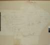
Map of lands & properties between Camden Street and Harcourt Street. Names of owners shown on plots.
Map
Language:
English
Format:
Map
In collection:
Longfield Map Collection
Published / Created
[between 1770 and 1840]
Notes
Physical description: 1 map Geographic Coverage: Dub...
Contributors:
“
...
Longfield
,
Robert
Ormsby
,
1844
-
1908
,
donor
...
”
Call Number:
Loading...
Located:
Loading...
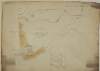
A map of three houses on the Bachelors Walk belonging to Mr Alder Armstrong June 26 1784
Map
Language:
English
Format:
Map
In collection:
Longfield Map Collection
Published / Created
[June 26 1784]
Notes
Physical description: 1 map Geographic Coverage: Dub...
Contributors:
“
...
Longfield
,
Robert
Ormsby
,
1844
-
1908
,
donor
...
”
Call Number:
Loading...
Located:
Loading...
1
Previous
1
2
3
4
5
6
7
8
9
10
11
Next
79
Get RSS Feed
Email this Search
History
Narrow Search
Digitised
Remove Filters
Clear Filter
Subject: Land tenure
Format
1,578
Map
Online Availability
954
Digitised
624
Not Digitised
Published / Created
From:
To:
Subject
1,578
Boundaries (Estates)
Land tenure
1,578
Land use surveys
1,565
Administration of estates
268
History
48
Administration of Estates
Author
335
Longfield, John, ca. 1775-1833, surveyor
112
Brownrigg, John, ca. 1748-1838, surveyor
42
Brownrigg & Co., fl. 1801-1809, surveyors
38
Longfield, William, fl. 1825-ca. 1870, surveyor
8
Reading, Thomas, ca. 1704-1779, surveyor
7
Brownrigg, Longfield and Murray, fl. 1799-ca. 1805, surveyors
more ...
6
Gartland, William, fl. 1838-1851/68, surveyor
5
Byron, Samuel, fl. 1768-1795
4
Cave, Thomas, fl. ca. 1709-1749, surveyor
4
Scalé, Brownrigg & Sherrard, fl. 1774-1778, surveyors
3
Chaloner, Samuel, fl. 1812-1833, surveyor
3
Cuddehy, Michael, fl. 1791-1803, surveyor
3
Mathews, Thomas, fl. 1760-1784, surveyor
3
Roe, John, fl. 1793-1824, surveyor
3
Scully, Patrick, fl. 1777, surveyor
3
Sherrard, Thomas, ca. 1750-1837, surveyor
2
Brownrigg & Sherrard, fl. 1777-1778, surveyors
2
Byrne, John, fl. 1789-1828, surveyor
2
Donlevy, Bryan, fl. 1784-1792, surveyor
2
Frizell, Richard, fl. 1750-1797
2
Kirrilly, Bryan, fl. 1715-1716, surveyor
2
Lewis, Robert, fl. 1745-1785, surveyor
2
Lynch, Thomas, fl. 1804-1809, surveyor
2
Moynahan, John, fl. 1736-1764, surveyor
2
Mulvihill, Peter, ca. 1736-d. 1798, surveyor
2
Neville, Arthur Richards, fl. 1775-1828, surveyor
2
Sherrard & Brassington, fl. 1800-1822, surveyors
1
Balfe, M., fl. 1821, surveyor
1
Battersby, John, fl. 1778, surveyor
1
Bell, John (I and II), fl. 1721-1820
see all ...
less ...
Collections
1,578
Longfield Map Collection
Language
1,578
English
Genre
1,578
Manuscript maps
1,577
Maps, Manuscript
269
Early works to 1800
Era
268
18th century
1
19th century
Region
1,534
Ireland
711
Dublin (Ireland : County)
710
Dublin (County)
295
Dublin (Ireland)
293
Dublin
182
Kildare (County)
more ...
182
Kildare (Ireland : County)
155
Meath
155
Meath (Ireland)
118
Roscommon (County)
118
Roscommon (Ireland : County)
111
Rathdown (Barony)
85
Coolock (Barony)
76
Offaly West (Barony)
70
Uppercross (Barony)
47
Tipperary (County)
47
Tipperary (Ireland : County)
45
Northern Ireland
43
Newcastle (Barony)
40
Frenchpark (Barony)
40
Wicklow (County)
40
Wicklow (Ireland : County)
36
Castleknock (Barony)
35
Westmeath
35
Westmeath (Ireland)
34
Balrothery (Barony)
33
Laois
33
Laois (Ireland)
31
Dublin (Barony)
29
Nethercross (Barony)
see all ...
less ...
Loading...


![A map of lands at Kilnew [and Garraun] in the barony of Ballaghkeen and County of Wexford. Tenants names and acreage of holdings shown.](/IIIF/000310000/000301019/vtls000301019_001.jp2/full/100,/0/default.jpg)
![Part of Westmanstown in the Barony of Castleknock & County of Dublin, the Estate of Captn. Vesey. 1786 [illegible]](/IIIF/000310000/000301112/vtls000301112_001.jp2/full/100,/0/default.jpg)


![A map of part of Lord Gormanston's Estate called [illegible] in the Barony of Balrothery and County of Dublin. Surveyed in March 1825](/IIIF/000310000/000301072/vtls000301072_001.jp2/full/100,/0/default.jpg)
![A map of lands at Tully [and Loughcrew] in the barony of Fore and County of Meath. Tenants names & acreage of holdings shown.](/IIIF/000310000/000301767/vtls000301767_001.jp2/full/100,/0/default.jpg)
