Showing
1 - 20
results of
76
for search '
Longfield, Robert Ormsby, 1844-1908, donor
'
Skip to content
Toggle navigation
NLI Website
- Catalogue -
English
Gaeilge
Home
Help
Advanced Search
Browse
Orders
Ask a Librarian
Language
English
Gaeilge
All Fields
Title
Author
Subject
Call Number
ISBN/ISSN
Publisher
Coordinates
Search digitised content only
FIND
Author
Longfield, Robert Ormsby, 1844-1908, donor
Results
Showing
1 - 20
results of
76
for search '
Longfield, Robert Ormsby, 1844-1908, donor
'
, query time: 0.09s
List
Grid
Sort
Relevance
Newest First
Oldest First
Call Number
Author
Title
1
2
3
4
Next
4
Loading...
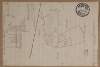
Numbered sheet showing Rathconnell Bog in the Barony of Offaly West and County of Kildare
Loading...
A map of the lands of Oghil in the Barony of Offaly West and County of Kildare. Names of some t...
Loading...
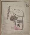
A plan of Monasterevin County Kildare. Names of tenants & area of holdings shown.
Loading...
A map of cabins and gardens in Monasterevin. Names of tenants & area of holdings shown.
Loading...
Plan of the Brewery premises in Monasterevin County Kildare. Scale 2 perches to an inch. Table...
Loading...
A map of lands at Mylerstown in the barony of [ Offaly west] and County of Kildare. Names of ten...
Loading...
A map of part of the lands of Kildangan called Salusky in the County of Kildare in the tenure of...
Loading...
Map of Red bog near Monasterevin. Scale 20 statute perches to an inch. Names & acreage of some...
Loading...
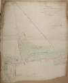
A survey of part of the lands of Ballagh ... Scale 10 perches to an inch.
Loading...
A survey of part of Grange Core [Grangecoor] in the County of Kildare part of the estate of the...
Loading...
A survey of the town of Monasterevin done with a view to shew the advantage & improvement of cha...
Loading...
Map of lands at Kilpatrick in the Barony of Offaly West and County of Kildare. Names of tenants...
Loading...
A map of lands at Kilebeg [Kilbeg] in the Barony of Offaly West and County of Kildare. Names of...
Loading...
A map of the lands of Grangebeg in the Barony of Offaly West and County of Kildare. Names of te...
Loading...
Map of Clooneygath [Clonegath] Bog in the Barony of Offaly West and County of Kildare. Scale 20...
Loading...
A map of the Pass-Lands of Monasterevin late in the possession of Mrs. Osborne 1817. Scale 20 p...
Loading...
Map of lands at Ballyvarney in the Barony of Offaly West and County of Kildare. Scale 20 statut...
Loading...
Map of lands at Cloneygath [Clonegath] in the Barony of Offaly West and County of Kildare. Name...
Loading...
A map of lands at Ardellis Lower in the Barony of Offaly West and County of Kildare. Scale 16 p...
Loading...
An outline map of Monasterevin County Kildare.
1
2
3
4
Next
4
Get RSS Feed
Email this Search
History
Narrow Search
Digitised
Remove Filters
Clear Filter
Collections: Longfield Map Collection
Clear Filter
Region: Offaly West (Barony)
Format
76
Map
Online Availability
73
Digitised
3
Not Digitised
Published / Created
From:
To:
Subject
76
Administration of estates
76
Boundaries (Estates)
76
Land tenure
76
Land use surveys
2
History
Author
16
Longfield, John, ca. 1775-1833, surveyor
2
Brownrigg, John, ca. 1748-1838, surveyor
1
Colbourne, Thomas, fl. 1810-1830
1
Longfield, William, fl. 1825-ca. 1870, surveyor
Collections
Longfield Map Collection
Language
76
English
Genre
76
Manuscript maps
76
Maps, Manuscript
2
Early works to 1800
Era
2
18th century
Region
76
Ireland
Offaly West (Barony)
75
Kildare (County)
75
Kildare (Ireland : County)
1
Kilcullen Parish
1
Kilcullen Parish (Ireland)
more ...
1
Monasterevin Parish
1
Monasterevin Parish (Ireland)
1
Offaly
1
Offaly (Ireland)
see all ...
less ...
Loading...


![A map of lands at Mylerstown in the barony of [ Offaly west] and County of Kildare. Names of tenants and acreage of holdings shown.](/IIIF/000310000/000302035/vtls000302035_001.jp2/full/100,/0/default.jpg)


![A survey of part of Grange Core [Grangecoor] in the County of Kildare part of the estate of the most noble Charles, Marquis of Drogheda let to [illegible] Dunne. Scale 10 perches to an inch.](/IIIF/000310000/000302080/vtls000302080_001.jp2/full/100,/0/default.jpg)

![A map of lands at Kilebeg [Kilbeg] in the Barony of Offaly West and County of Kildare. Names of tenants & acreage of holdings shown.](/IIIF/000310000/000302229/vtls000302229_001.jp2/full/100,/0/default.jpg)

![Map of Clooneygath [Clonegath] Bog in the Barony of Offaly West and County of Kildare. Scale 20 statute perches to an inch. Some tenants names shown.](/IIIF/000310000/000302228/vtls000302228_001.jp2/full/100,/0/default.jpg)


![Map of lands at Cloneygath [Clonegath] in the Barony of Offaly West and County of Kildare. Names of tenants and acreage of holdings shown.](/IIIF/000310000/000302205/vtls000302205_001.jp2/full/100,/0/default.jpg)

