Showing
1 - 20
results of
85
for search '
Longfield, Robert Ormsby, 1844-1908, donor
'
Skip to content
Toggle navigation
NLI Website
- Catalogue -
English
Gaeilge
Home
Help
Advanced Search
Browse
Orders
Ask a Librarian
Language
English
Gaeilge
All Fields
Title
Author
Subject
Call Number
ISBN/ISSN
Publisher
Coordinates
Search digitised content only
FIND
Author
Longfield, Robert Ormsby, 1844-1908, donor
Results
Showing
1 - 20
results of
85
for search '
Longfield, Robert Ormsby, 1844-1908, donor
'
, query time: 0.04s
List
Grid
Sort
Relevance
Newest First
Oldest First
Call Number
Author
Title
1
2
3
4
5
Next
5
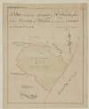
[A Survey of holdings in the townland of Artaine in the Barony of Coolock and County of Dublin.]
Map
Language:
English
Format:
Map
In collection:
Longfield Map Collection
Published / Created
[between 1770 and 1840]
Notes
Physical description: 1 map Geographic Coverage: Bar...
Contributors:
“
...
Longfield
,
Robert
Ormsby
,
1844
-
1908
,
donor
...
”
Call Number:
Loading...
Located:
Loading...
A survey of the Demense of Shrubs, situate in the Barony of Coolock and County of Dublin for John Croker Esq. Scale 10 Perches to an Inch
Map
Language:
English
Format:
Map
In collection:
Longfield Map Collection
Published / Created
[between 1770 and 1840]
Notes
Physical description: 1 map Geographic Coverage: Bar...
Contributors:
“
...
Longfield
,
Robert
Ormsby
,
1844
-
1908
,
donor
...
”
Call Number:
Loading...
Located:
Loading...
A map of part of the lands of Cadamstown in the barony of Ballybrit County Offaly part of the estate of Thomas Bernard let to Mr. Marinfold ... Surveyed by J.L. November 1805.
Map
Main Creator:
Longfield, John, ca. 1775-1833, surveyor
Language:
English
Format:
Map
In collection:
Longfield Map Collection
Published / Created
[1805-1808]
Notes
Inset map: "Pencil map - A plan of a line of grass ro...
Contributors:
“
...
Longfield
,
Robert
Ormsby
,
1844
-
1908
,
donor
...
”
Call Number:
Loading...
Located:
Loading...
A survey of part of the Lands of Dunbrow called Huntstown situate in the Barony of Coolock and County of Dublin, the Estate of Lord Viscount Clifden. Surveyed in March 1833. Scale 20 statute Perches to an Inch
Map
Language:
English
Format:
Map
In collection:
Longfield Map Collection
Published / Created
[March 1833]
Notes
Physical description: 1 map Geographic Coverage: Bar...
Contributors:
“
...
Longfield
,
Robert
Ormsby
,
1844
-
1908
,
donor
...
”
Call Number:
Loading...
Located:
Loading...
[Outline map of] Glasnevin for the Bishop of Kildare
Map
Language:
English
Format:
Map
In collection:
Longfield Map Collection
Published / Created
[between 1770 and 1840]
Notes
Physical description: 1 map Geographic Coverage: Bar...
Contributors:
“
...
Longfield
,
Robert
Ormsby
,
1844
-
1908
,
donor
...
”
Call Number:
Loading...
Located:
Loading...
[A map of the Botanic Gardens Glasnevin] Scale 100 Feet to an Inch
Map
Language:
English
Format:
Map
In collection:
Longfield Map Collection
Published / Created
[between 1770 and 1840]
Notes
Physical description: 1 map Geographic Coverage: Bar...
Contributors:
“
...
Longfield
,
Robert
Ormsby
,
1844
-
1908
,
donor
...
”
Call Number:
Loading...
Located:
Loading...
Map of part of the Grange of Baldoyle let by Mrs. Walshe to Mr. Smyth
Map
Language:
English
Format:
Map
In collection:
Longfield Map Collection
Published / Created
[between 1770 and 1840]
Notes
Physical description: 1 map Geographic Coverage: Bar...
Contributors:
“
...
Longfield
,
Robert
Ormsby
,
1844
-
1908
,
donor
...
”
Call Number:
Loading...
Located:
Loading...
A map of part of the Lands of Glasnevin in the County of Dublin, the Estate of the Rt. Revd. The Dean of Christ Church let to Isaac A. Eccles Esq. Surveyed by J. Longfield 1807. Scale 10 Perches to an Inch
Map
Main Creator:
Longfield, John, ca. 1775-1833, surveyor
Language:
English
Format:
Map
In collection:
Longfield Map Collection
Published / Created
[1807]
Notes
Inset attached to the map. Physical description: 1 m...
Contributors:
“
...
Longfield
,
Robert
Ormsby
,
1844
-
1908
,
donor
...
”
Call Number:
Loading...
Located:
Loading...
A map of part of the Lands of Glasnevin part of the Estate of the Dean of Christ Church held by John Bayly, copied from a survey made by Richard Francis in the year 1640, and traced out by Thomas Cave in the year 1730. By a scale of 20 Perches to an Inch
Map
Main Creator:
Cave, Thomas, fl. ca. 1709-1749, surveyor
Language:
English
Format:
Map
In collection:
Longfield Map Collection
Published / Created
[1730]
Notes
Physical description: 1 map Geographic Coverage: Bar...
Contributors:
“
...
Longfield
,
Robert
Ormsby
,
1844
-
1908
,
donor
...
”
Call Number:
Loading...
Located:
Loading...
[A survey of] Part of the Lands of Glasnevin let by the Dean and Chapter of Christ Church to the Honble. Wm. John Gore. [By John Longfield]. Scale 16 Perches to an Inch
Map
Main Creator:
Longfield, John, ca. 1775-1833, surveyor
Language:
English
Format:
Map
In collection:
Longfield Map Collection
Published / Created
[between 1795 and 1833]
Notes
Physical description: 1 map Geographic Coverage: Bar...
Contributors:
“
...
Longfield
,
Robert
Ormsby
,
1844
-
1908
,
donor
...
”
Call Number:
Loading...
Located:
Loading...
A survey of Venetian Park, in the Barony of Coolock and County of Dublin, the estate of [illegible] Vernon Esq. April 1831. Scale 10 Perches to an Inch
Map
Language:
English
Format:
Map
In collection:
Longfield Map Collection
Published / Created
[April 1831]
Notes
Physical description: 1 map Geographic Coverage: Bar...
Contributors:
“
...
Longfield
,
Robert
Ormsby
,
1844
-
1908
,
donor
...
”
Call Number:
Loading...
Located:
Loading...
A map of part of the Lands of St. Dowlaghs in the County of Dublin, the Estate of the Chantor of Christ Church. Surveyed by Jn. Longfield 1815. Scale 20 Perches to an Inch
Map
Main Creator:
Longfield, John, ca. 1775-1833, surveyor
Language:
English
Format:
Map
In collection:
Longfield Map Collection
Published / Created
[1815]
Notes
Physical description: 1 map Geographic Coverage: Bar...
Contributors:
“
...
Longfield
,
Robert
Ormsby
,
1844
-
1908
,
donor
...
”
Call Number:
Loading...
Located:
Loading...
A survey of part of the Demense of Clermont near Glasnevin in the County of Dublin let by Robt. Hayes Esq. By John Longfield 1819. Scale 10 Perches to an Inch
Map
Main Creator:
Longfield, John, ca. 1775-1833, surveyor
Language:
English
Format:
Map
In collection:
Longfield Map Collection
Published / Created
[1819]
Notes
Physical description: 1 map Geographic Coverage: Bar...
Contributors:
“
...
Longfield
,
Robert
Ormsby
,
1844
-
1908
,
donor
...
”
Call Number:
Loading...
Located:
Loading...
[A survey of Lands at Santry Co Dublin] Scale 16 Perches to an Inch
Map
Language:
English
Format:
Map
In collection:
Longfield Map Collection
Published / Created
[between 1770 and 1840]
Notes
Physical description: 1 map Geographic Coverage: Bar...
Contributors:
“
...
Longfield
,
Robert
Ormsby
,
1844
-
1908
,
donor
...
”
Call Number:
Loading...
Located:
Loading...
A survey of the Demense of Thorn Hill in the Parish of Clontarf & Co. of Dublin, belonging to Mrs. Bull, by J.L. 1816. Scale 10 Perches to an Inch
Map
Main Creator:
Longfield, John, ca. 1775-1833, surveyor
Language:
English
Format:
Map
In collection:
Longfield Map Collection
Published / Created
[1816]
Notes
Physical description: 1 map Geographic Coverage: Par...
Contributors:
“
...
Longfield
,
Robert
Ormsby
,
1844
-
1908
,
donor
...
”
Call Number:
Loading...
Located:
Loading...
[A map of] Mr. Shaws Holding at St. Doolagh - Co. Dublin pt. of the Chantor of C[hrist] C[hurch] Estate
Map
Language:
English
Format:
Map
In collection:
Longfield Map Collection
Published / Created
[between 1770 and 1840]
Notes
Physical description: 1 map Geographic Coverage: Bar...
Contributors:
“
...
Longfield
,
Robert
Ormsby
,
1844
-
1908
,
donor
...
”
Call Number:
Loading...
Located:
Loading...
A map of part of the Lands of Santry in the County of Dublin, part of the state - Poole Esq leased to Jn.. O'Hanlon. Surveyed in April 1805 for Jn.. Hanlin O'Hanlin. Scale 200 feet to an Inch
Map
Language:
English
Format:
Map
In collection:
Longfield Map Collection
Published / Created
[April 1805]
Notes
Physical description: 1 map Geographic Coverage: Bar...
Contributors:
“
...
Longfield
,
Robert
Ormsby
,
1844
-
1908
,
donor
...
”
Call Number:
Loading...
Located:
Loading...
A map of part of Peafield in the Barony of Coolock & County of Dublin, the Estate of [illegible] Bever Esq. Survey'd by John Brownrigg 1795. Scale 20 Perches to an Inch
Map
Main Creator:
Brownrigg, John, ca. 1748-1838, surveyor
Language:
English
Format:
Map
In collection:
Longfield Map Collection
Published / Created
[1795]
Notes
Physical description: 1 map Geographic Coverage: Bar...
Contributors:
“
...
Longfield
,
Robert
Ormsby
,
1844
-
1908
,
donor
...
”
Call Number:
Loading...
Located:
Loading...
A map of part of the Demense of Malahide, with parts of Streamstown Mayfield & Auburn, the whole formerly call'd Mabstown, in the B[arony] of Coolock & Co. Dublin - traced from the Down Survey. Order of the Rt. Revd. the Dean & Chapter of C.C. [Christ Church] Dublin. By J.L. 1816
Map
Main Creator:
Longfield, John, ca. 1775-1833, surveyor
Language:
English
Format:
Map
In collection:
Longfield Map Collection
Published / Created
[1816]
Notes
Physical description: 1 map Geographic Coverage: Bar...
Contributors:
“
...
Longfield
,
Robert
Ormsby
,
1844
-
1908
,
donor
...
”
Call Number:
Loading...
Located:
Loading...
[A map of ] Part of Belfield in the Barony of Coolock Co. Dublin for Aldn. Darragh. Partly in the Barony of Newcastle q.v.
Map
Language:
English
Format:
Map
In collection:
Longfield Map Collection
Published / Created
[between 1770 and 1840]
Notes
Physical description: 1 map Geographic Coverage: Bar...
Contributors:
“
...
Longfield
,
Robert
Ormsby
,
1844
-
1908
,
donor
...
”
Call Number:
Loading...
Located:
Loading...
1
2
3
4
5
Next
5
Get RSS Feed
Email this Search
History
Narrow Search
Digitised
Remove Filters
Clear Filter
Collections: Longfield Map Collection
Clear Filter
Region: Coolock (Barony)
Format
85
Map
Online Availability
81
Digitised
4
Not Digitised
Published / Created
From:
To:
Subject
85
Administration of estates
85
Boundaries (Estates)
85
Land tenure
85
Land use surveys
20
History
1
Administration of Estates
Author
26
Longfield, John, ca. 1775-1833, surveyor
8
Brownrigg, John, ca. 1748-1838, surveyor
4
Brownrigg & Co., fl. 1801-1809, surveyors
2
Cave, Thomas, fl. ca. 1709-1749, surveyor
2
Longfield, William, fl. 1825-ca. 1870, surveyor
2
Reading, Thomas, ca. 1704-1779, surveyor
more ...
1
Brownrigg, Longfield and Murray, fl. 1799-ca. 1805, surveyors
1
Colbert, Thomas, fl. 1802, surveyor
1
Logan, Thomas, fl. ca. 1777-1820, surveyor
1
Scalé, Brownrigg & Sherrard, fl. 1774-1778, surveyors
1
Sherrard, Thomas, ca. 1750-1837, surveyor
see all ...
less ...
Collections
Longfield Map Collection
Language
85
English
Genre
85
Manuscript maps
85
Maps, Manuscript
20
Early works to 1800
Era
20
18th century
Region
Coolock (Barony)
85
Dublin (County)
85
Dublin (Ireland : County)
85
Ireland
3
Glasnevin Parish
3
Glasnevin Parish (Ireland)
more ...
1
Ballybrit (Barony)
1
Clontarf Parish
1
Clontarf Parish (Ireland)
1
Clonturk Parish
1
Clonturk Parish (Ireland)
1
Kildare (County)
1
Kildare (Ireland : County)
1
Killossory Parish
1
Killossory Parish (Ireland)
1
Meath
1
Meath (Ireland)
1
Offaly
1
Offaly (Ireland)
1
Rathdown (Barony)
1
Salt North (Barony)
1
Skreen (Barony)
see all ...
less ...
Loading...
![[A Survey of holdings in the townland of Artaine in the Barony of Coolock and County of Dublin.]](/IIIF/000310000/000301125/vtls000301125_001.jp2/full/100,/0/default.jpg)


![[Outline map of] Glasnevin for the Bishop of Kildare](/IIIF/000310000/000301160/vtls000301160_001.jp2/full/100,/0/default.jpg)
![[A map of the Botanic Gardens Glasnevin] Scale 100 Feet to an Inch](/IIIF/000310000/000301145/vtls000301145_001.jp2/full/100,/0/default.jpg)


![[A survey of] Part of the Lands of Glasnevin let by the Dean and Chapter of Christ Church to the Honble. Wm. John Gore. [By John Longfield]. Scale 16 Perches to an Inch](/IIIF/000310000/000301161/vtls000301161_001.jp2/full/100,/0/default.jpg)
![A survey of Venetian Park, in the Barony of Coolock and County of Dublin, the estate of [illegible] Vernon Esq. April 1831. Scale 10 Perches to an Inch](/IIIF/000310000/000301198/vtls000301198_001.jp2/full/100,/0/default.jpg)

![[A survey of Lands at Santry Co Dublin] Scale 16 Perches to an Inch](/IIIF/000310000/000301193/vtls000301193_001.jp2/full/100,/0/default.jpg)

![[A map of] Mr. Shaws Holding at St. Doolagh - Co. Dublin pt. of the Chantor of C[hrist] C[hurch] Estate](/IIIF/000310000/000301189/vtls000301189_001.jp2/full/100,/0/default.jpg)

![A map of part of Peafield in the Barony of Coolock & County of Dublin, the Estate of [illegible] Bever Esq. Survey'd by John Brownrigg 1795. Scale 20 Perches to an Inch](/IIIF/000310000/000301182/vtls000301182_001.jp2/full/100,/0/default.jpg)
![A map of part of the Demense of Malahide, with parts of Streamstown Mayfield & Auburn, the whole formerly call'd Mabstown, in the B[arony] of Coolock & Co. Dublin - traced from the Down Survey. Order of the Rt. Revd. the Dean & Chapter of C.C. [Christ Church] Dublin. By J.L. 1816](/IIIF/000310000/000301174/vtls000301174_001.jp2/full/100,/0/default.jpg)
![[A map of ] Part of Belfield in the Barony of Coolock Co. Dublin for Aldn. Darragh. Partly in the Barony of Newcastle q.v.](/IIIF/000310000/000301132/vtls000301132_001.jp2/full/100,/0/default.jpg)