Showing
1 - 20
results of
268
for search '
Longfield, Robert Ormsby, 1844-1908, donor
'
Skip to content
Toggle navigation
NLI Website
- Catalogue -
English
Gaeilge
Home
Help
Advanced Search
Browse
Orders
Ask a Librarian
Language
English
Gaeilge
All Fields
Title
Author
Subject
Call Number
ISBN/ISSN
Publisher
Coordinates
Search digitised content only
FIND
Author
Longfield, Robert Ormsby, 1844-1908, donor
Results
Showing
1 - 20
results of
268
for search '
Longfield, Robert Ormsby, 1844-1908, donor
'
, query time: 0.04s
List
Grid
Sort
Relevance
Newest First
Oldest First
Call Number
Author
Title
1
2
3
4
5
6
7
8
9
10
11
Next
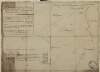
14
A map of a concern on Constitution Hill in the County of the City of Dublin. Surveyed for Mr. John Wilkinson by John Brownrigg 2nd Dec 1791. Scale 20 feet to an inch
Map
Main Creator:
Brownrigg, John, ca. 1748-1838, surveyor
Language:
English
Format:
Map
In collection:
Longfield Map Collection
Published / Created
[December 02 1791]
Notes
Physical description: 1 map Geographic Coverage: Dub...
Contributors:
“
...
Longfield
,
Robert
Ormsby
,
1844
-
1908
,
donor
...
”
Call Number:
Loading...
Located:
Loading...
A survey of part of Thomastown, 11th July 1791. Scale 10 Perches to an Inch
Map
Language:
English
Format:
Map
In collection:
Longfield Map Collection
Published / Created
[July 11 1791]
Notes
Physical description: 1 map Geographic Coverage: Bar...
Contributors:
“
...
Longfield
,
Robert
Ormsby
,
1844
-
1908
,
donor
...
”
Call Number:
Loading...
Located:
Loading...
A map of Ardmulchon [Ardmulchan] in the barony of Skreen and County of Meath the estate of Wm. Pole May 1776 showing Mr. Eatons part, and Mr. Floods part of Ardmulchan in the possession of Mr. Taaf.
Map
Language:
English
Format:
Map
In collection:
Longfield Map Collection
Published / Created
[May 1776]
Notes
Physical description: 1 map Geographic Coverage: Bar...
Contributors:
“
...
Longfield
,
Robert
Ormsby
,
1844
-
1908
,
donor
...
”
Call Number:
Loading...
Located:
Loading...
A map of part of the Farm of St. Sepulchres in the County of Dublin held under his Grace Robt. Lord Archbishop of Dublin by Wm. Thomas Esq. Survey'd by John Brownrigg 1795. Scale 80 Feet to an Inch
Map
Main Creator:
Brownrigg, John, ca. 1748-1838, surveyor
Language:
English
Format:
Map
In collection:
Longfield Map Collection
Published / Created
[1795]
Notes
Physical description: 1 map Geographic Coverage: Bar...
Contributors:
“
...
Longfield
,
Robert
Ormsby
,
1844
-
1908
,
donor
...
”
Call Number:
Loading...
Located:
Loading...
A map of Little Ardrums in the parish of Rathcore and County of Meath ... being part of the estate of Hers. L. Rowly. By Patrick Scully October 1776.
Map
Main Creator:
Scully, Patrick, fl. 1777, surveyor
Language:
English
Format:
Map
In collection:
Longfield Map Collection
Published / Created
[October 1776]
Notes
Physical description: 1 map Geographic Coverage: Par...
Contributors:
“
...
Longfield
,
Robert
Ormsby
,
1844
-
1908
,
donor
...
”
Call Number:
Loading...
Located:
Loading...
A map of Galbertstown and Newtown in the barony of Eliogarty as now held by the undertenants May 1775. Names of tenants & acreage of holdings shown.
Map
Language:
English
Format:
Map
In collection:
Longfield Map Collection
Published / Created
[May 1775]
Notes
Physical description: 1 map Geographic Coverage: Bar...
Contributors:
“
...
Longfield
,
Robert
Ormsby
,
1844
-
1908
,
donor
...
”
Call Number:
Loading...
Located:
Loading...
A map of Ballegny in the barony of Moyashel and Magheradermon and County of Westmeath part of the estate of Sir George Tuite, Bart and surveyed in January 1775 by James Campbell. Table of reference showing tenants and acreage of holdings.
Map
Main Creator:
Campbell, James, fl. 1773-1783, surveyor
Language:
English
Format:
Map
In collection:
Longfield Map Collection
Published / Created
[January 1775]
Notes
Physical description: 1 map Geographic Coverage: Bar...
Contributors:
“
...
Longfield
,
Robert
Ormsby
,
1844
-
1908
,
donor
...
”
Call Number:
Loading...
Located:
Loading...
A survey of Mylerstown in the Islans of Allen barony of Great Connell and County of Kildare the estate of Thomas Hutchinson Smyth By John Brown[r]igg. 1792. Scale 20 perches to an inch. Names of adjoining tenants shown
Map
Main Creator:
Brownrigg, John, ca. 1748-1838, surveyor
Language:
English
Format:
Map
In collection:
Longfield Map Collection
Published / Created
[1792]
Notes
Physical description: 1 map Geographic Coverage: Bar...
Contributors:
“
...
Longfield
,
Robert
Ormsby
,
1844
-
1908
,
donor
...
”
Call Number:
Loading...
Located:
Loading...
A map of Tullaghmore Ross Lurgy and Sherrigrin in the barony of Dungannon Middle and County Tyrone the estate of James Stewart 1798. Scale 20 perches to an inch. Names of tenants & acreage of holdings shown.
Map
Language:
English
Format:
Map
In collection:
Longfield Map Collection
Published / Created
[1798]
Notes
Physical description: 1 map Geographic Coverage: Bar...
Contributors:
“
...
Longfield
,
Robert
Ormsby
,
1844
-
1908
,
donor
...
”
Call Number:
Loading...
Located:
Loading...
A map of Killishee [Killashee] Soordlestown [Swordlestown] etc, in the barony of Naas and County of Kildare belonging to Robert Graydon. By John Brownrigg 1777. Names of tenants shown on some holdings.
Map
Main Creator:
Brownrigg, John, ca. 1748-1838, surveyor
Language:
English
Format:
Map
In collection:
Longfield Map Collection
Published / Created
[1777]
Notes
Physical description: 1 map Geographic Coverage: Bar...
Contributors:
“
...
Longfield
,
Robert
Ormsby
,
1844
-
1908
,
donor
...
”
Call Number:
Loading...
Located:
Loading...
A map of a Part of the Demense of Stillorgan in the Barony of Half Rathdown & County of Dublin the Estate of N. Lefavre Esq. let to Wm Cope Esq. by J. Brownrigg. 1793. Scale 200 Feet to an Inch
Map
Main Creator:
Brownrigg, John, ca. 1748-1838, surveyor
Language:
English
Format:
Map
In collection:
Longfield Map Collection
Published / Created
[1793]
Notes
Physical description: 1 map Geographic Coverage: Bar...
Contributors:
“
...
Longfield
,
Robert
Ormsby
,
1844
-
1908
,
donor
...
”
Call Number:
Loading...
Located:
Loading...
A survey of a piece of ground near Rathfarnham in the Co. of Dublin, done for Mr Perrier Feb 15 1798. Scale 10 Perches to an Inch
Map
Language:
English
Format:
Map
In collection:
Longfield Map Collection
Published / Created
[February 15 1798]
Notes
Physical description: 1 map Geographic Coverage: Bar...
Contributors:
“
...
Longfield
,
Robert
Ormsby
,
1844
-
1908
,
donor
...
”
Call Number:
Loading...
Located:
Loading...
A map of a lot of ground lying in the East side of Milltown Road, joining the new Road belonging to John Hatch Esq. Surveyed in October 1770 by Thos. Reading. Scale forty feet to an Inch
Map
Main Creator:
Reading, Thomas, ca. 1704-1779, surveyor
Language:
English
Format:
Map
In collection:
Longfield Map Collection
Published / Created
[October 1770]
Notes
Physical description: 1 map Geographic Coverage: Bar...
Contributors:
“
...
Longfield
,
Robert
Ormsby
,
1844
-
1908
,
donor
...
”
Call Number:
Loading...
Located:
Loading...
A map of several plots of ground with many buildings theron situate on Church Street, Greek St and Marys Lane Surveyed for John Chambers by J.B. 1794. Scale 20 feet to an inch. Names of tenants shown on properties
Map
Main Creator:
Brownrigg, John, ca. 1748-1838, surveyor
Language:
English
Format:
Map
In collection:
Longfield Map Collection
Published / Created
[1794]
Notes
Physical description: 1 map Geographic Coverage: Dub...
Contributors:
“
...
Longfield
,
Robert
Ormsby
,
1844
-
1908
,
donor
...
”
Call Number:
Loading...
Located:
Loading...
A map of part of the Lands of Glasnevin part of the Estate of the Dean of Christ Church held by John Bayly, copied from a survey made by Richard Francis in the year 1640, and traced out by Thomas Cave in the year 1730. By a scale of 20 Perches to an Inch
Map
Main Creator:
Cave, Thomas, fl. ca. 1709-1749, surveyor
Language:
English
Format:
Map
In collection:
Longfield Map Collection
Published / Created
[1730]
Notes
Physical description: 1 map Geographic Coverage: Bar...
Contributors:
“
...
Longfield
,
Robert
Ormsby
,
1844
-
1908
,
donor
...
”
Call Number:
Loading...
Located:
Loading...
A map of Ballinakillbeg [sic] in the Barony & County of Carlow the Estate of William Tighe Esq. May 1789.
Map
Language:
English
Format:
Map
In collection:
Longfield Map Collection
Published / Created
[May 1789]
Notes
Physical description: 1 map Geographic Coverage: Par...
Contributors:
“
...
Longfield
,
Robert
Ormsby
,
1844
-
1908
,
donor
...
”
Call Number:
Loading...
Located:
Loading...
A map of lands at Graigue and Moat in the barony of Cullenagh and Queens County [Leix] the estate of Gerald Fitzgerald. August 1797. Scale 20 perches to an inch. Adjoining proprietors shown.
Map
Language:
English
Format:
Map
In collection:
Longfield Map Collection
Published / Created
[August 1797]
Notes
Physical description: 1 map Geographic Coverage: Bar...
Contributors:
“
...
Longfield
,
Robert
Ormsby
,
1844
-
1908
,
donor
...
”
Call Number:
Loading...
Located:
Loading...
A map of the new Line of street called Hatch Street and also of the continuation of Harcourt Street to the Circular Road, belonging to Robt. Watson Wade & Edwd. Whitten Esq. Laid out for Building by Jn.. Brownrigg 1791. Scale 40 Feet to an Inch.
Map
Main Creator:
Brownrigg, John, ca. 1748-1838, surveyor
Language:
English
Format:
Map
In collection:
Longfield Map Collection
Published / Created
[1791]
Notes
Physical description: 1 map Geographic Coverage: Dub...
Contributors:
“
...
Longfield
,
Robert
Ormsby
,
1844
-
1908
,
donor
...
”
Call Number:
Loading...
Located:
Loading...
A map of a parcel of ground in St. Sepulchres in the County of Dublin let by John Hatch to Robert Watson Wade and Edward Whitton. Surveyed by John Brownrigg. June-Aug 1791. Scale 100 feet to an inch.
Map
Main Creator:
Brownrigg, John, ca. 1748-1838, surveyor
Language:
English
Format:
Map
In collection:
Longfield Map Collection
Published / Created
[June 1791]
Notes
In mylar covering. Physical description: 1 map Geogr...
Contributors:
“
...
Longfield
,
Robert
Ormsby
,
1844
-
1908
,
donor
...
”
Call Number:
Loading...
Located:
Loading...
A survey of part of the estate of the Rt. Hon. Lord Templetown. By John Brownrigg 1800, at Drumaoib ... and Liseenan in County Monaghan. Names of tenants & acreage of holdings shown.
Map
Main Creator:
Brownrigg, John, ca. 1748-1838, surveyor
Language:
English
Format:
Map
In collection:
Longfield Map Collection
Published / Created
[1800]
Notes
Physical description: 1 map Geographic Coverage: Bar...
Contributors:
“
...
Longfield
,
Robert
Ormsby
,
1844
-
1908
,
donor
...
”
Call Number:
Loading...
Located:
Loading...
1
2
3
4
5
6
7
8
9
10
11
Next
14
Get RSS Feed
Email this Search
History
Narrow Search
Digitised
Remove Filters
Clear Filter
Era: 18th century
Clear Filter
Subject: Land use surveys
Format
268
Map
Online Availability
142
Digitised
126
Not Digitised
Published / Created
From:
To:
Subject
268
Administration of estates
268
Boundaries (Estates)
268
History
268
Land tenure
Land use surveys
1
Administration of Estates
Author
108
Brownrigg, John, ca. 1748-1838, surveyor
7
Reading, Thomas, ca. 1704-1779, surveyor
5
Byron, Samuel, fl. 1768-1795
4
Cave, Thomas, fl. ca. 1709-1749, surveyor
4
Scalé, Brownrigg & Sherrard, fl. 1774-1778, surveyors
3
Mathews, Thomas, fl. 1760-1784, surveyor
more ...
3
Scully, Patrick, fl. 1777, surveyor
3
Sherrard, Thomas, ca. 1750-1837, surveyor
2
Brownrigg & Co., fl. 1801-1809, surveyors
2
Donlevy, Bryan, fl. 1784-1792, surveyor
2
Frizell, Richard, fl. 1750-1797
2
Kirrilly, Bryan, fl. 1715-1716, surveyor
2
Lewis, Robert, fl. 1745-1785, surveyor
2
Moynahan, John, fl. 1736-1764, surveyor
2
Mulvihill, Peter, ca. 1736-d. 1798, surveyor
1
Battersby, John, fl. 1778, surveyor
1
Bell, John (I and II), fl. 1721-1820
1
Bourke, Theobald, fl. 1721-1746, surveyor
1
Bridge, Timothy, fl. 1725-1732, surveyor
1
Browne, John, fl. 1788-ca. 1807, surveyor
1
Brownrigg & Sherrard, fl. 1777-1778, surveyors
1
Brownrigg, Longfield and Murray, fl. 1799-ca. 1805, surveyors
1
Byrne, John, fl. 1789-1828, surveyor
1
Campbell, James, fl. 1773-1783, surveyor
1
Cooley, Garret, fl. 1787, surveyor
1
Costello, James, fl. 1753-1787, surveyor
1
Cuddehy, Michael, fl. 1791-1803, surveyor
1
Cuttle, Thomas (I), fl. 1722-d. 1769
1
Downer, Maurice, fl. 1747-1778, surveyor
1
Evans, Richard, fl. 1789-1819, surveyor
see all ...
less ...
Collections
268
Longfield Map Collection
Language
268
English
Genre
268
Early works to 1800
268
Manuscript maps
268
Maps, Manuscript
Era
18th century
Region
264
Ireland
156
Dublin (Ireland : County)
155
Dublin (County)
64
Dublin (Ireland)
63
Dublin
25
Rathdown (Barony)
more ...
23
Meath
23
Meath (Ireland)
21
Kildare (County)
21
Kildare (Ireland : County)
20
Coolock (Barony)
18
Uppercross (Barony)
13
Dublin City (Barony)
11
Balrothery (Barony)
11
Westmeath
11
Westmeath (Ireland)
10
Roscommon (County)
10
Roscommon (Ireland : County)
9
Nethercross (Barony)
8
Dublin (Barony)
8
Longford (County)
8
Longford (Ireland : County)
8
Tipperary (County)
8
Tipperary (Ireland : County)
7
Frenchpark (Barony)
7
Skreen (Barony)
6
Connell (Barony)
6
Fore (Barony)
5
Deece Upper (Barony)
5
Eliogarty (Barony)
see all ...
less ...
Loading...
![A map of Ardmulchon [Ardmulchan] in the barony of Skreen and County of Meath the estate of Wm. Pole May 1776 showing Mr. Eatons part, and Mr. Floods part of Ardmulchan in the possession of Mr. Taaf.](/IIIF/000310000/000301861/vtls000301861_001.jp2/full/100,/0/default.jpg)

![A survey of Mylerstown in the Islans of Allen barony of Great Connell and County of Kildare the estate of Thomas Hutchinson Smyth By John Brown[r]igg. 1792. Scale 20 perches to an inch. Names of adjoining tenants shown](/IIIF/000310000/000301988/vtls000301988_001.jp2/full/100,/0/default.jpg)

![A map of Killishee [Killashee] Soordlestown [Swordlestown] etc, in the barony of Naas and County of Kildare belonging to Robert Graydon. By John Brownrigg 1777. Names of tenants shown on some holdings.](/IIIF/000310000/000302012/vtls000302012_001.jp2/full/100,/0/default.jpg)

![A map of Ballinakillbeg [sic] in the Barony & County of Carlow the Estate of William Tighe Esq. May 1789.](/IIIF/000310000/000301889/vtls000301889_001.jp2/full/100,/0/default.jpg)
![A map of lands at Graigue and Moat in the barony of Cullenagh and Queens County [Leix] the estate of Gerald Fitzgerald. August 1797. Scale 20 perches to an inch. Adjoining proprietors shown.](/IIIF/000310000/000302377/vtls000302377_001.jp2/full/100,/0/default.jpg)
