Showing
1 - 20
results of
108
for search '
Longfield, Robert Ormsby, 1844-1908, donor
'
Skip to content
Toggle navigation
NLI Website
- Catalogue -
English
Gaeilge
Home
Help
Advanced Search
Browse
Orders
Ask a Librarian
Language
English
Gaeilge
All Fields
Title
Author
Subject
Call Number
ISBN/ISSN
Publisher
Coordinates
Search digitised content only
FIND
Author
Longfield, Robert Ormsby, 1844-1908, donor
Results
Showing
1 - 20
results of
108
for search '
Longfield, Robert Ormsby, 1844-1908, donor
'
, query time: 0.18s
List
Grid
Sort
Relevance
Newest First
Oldest First
Call Number
Author
Title
1
2
3
4
5
6
Next
6
A survey of four holdings fronting Poolbeg Street Hawkins Street in the City of Dublin belonging to Wm. Frans. Read. By J. Brownrigg April 1790. Names of tenants shown on holdings
Map
Main Creator:
Brownrigg, John, ca. 1748-1838, surveyor
Language:
English
Format:
Map
In collection:
Longfield Map Collection
Published / Created
[April 1790]
Notes
Physical description: 1 map Geographic Coverage: Dub...
Contributors:
“
...
Longfield
,
Robert
Ormsby
,
1844
-
1908
,
donor
...
”
Call Number:
Loading...
Located:
Loading...
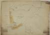
A survey of the Estate of Simon Davenport Esq. in the Barony of Tullygarvey and County of Cavan, by J. B[rownrigg] 1791.
Map
Main Creator:
Brownrigg, John, ca. 1748-1838, surveyor
Language:
English
Format:
Map
In collection:
Longfield Map Collection
Published / Created
[1791]
Notes
Physical description: 1 map Geographic Coverage: Par...
Contributors:
“
...
Longfield
,
Robert
Ormsby
,
1844
-
1908
,
donor
...
”
Call Number:
Loading...
Located:
Loading...
A map of a Lott of Building ground in the Lordship of Mary's Abbey and County of Dublin belonging to Mr. William Crosby. Survey'd by J. Brownrigg March 1789
Map
Main Creator:
Brownrigg, John, ca. 1748-1838, surveyor
Language:
English
Format:
Map
In collection:
Longfield Map Collection
Published / Created
[March 1789]
Notes
Physical description: 1 map Geographic Coverage: Dub...
Contributors:
“
...
Longfield
,
Robert
Ormsby
,
1844
-
1908
,
donor
...
”
Call Number:
Loading...
Located:
Loading...
A survey of Cloncrave in the barony of Farbill and County of Westmeath the estate of Thomas Darlington. By J.B. 1795. Scale 20 perches to an inch. Table of reference showing acreage and nature of land.
Map
Main Creator:
Brownrigg, John, ca. 1748-1838, surveyor
Language:
English
Format:
Map
In collection:
Longfield Map Collection
Published / Created
[1795]
Notes
Physical description: 1 map Geographic Coverage: Bar...
Contributors:
“
...
Longfield
,
Robert
Ormsby
,
1844
-
1908
,
donor
...
”
Call Number:
Loading...
Located:
Loading...
A plan of streets leading to Carlisle Bridge. Copied by J. Brownrigg 1799.
Map
Main Creator:
Brownrigg, John, ca. 1748-1838, surveyor
Language:
English
Format:
Map
In collection:
Longfield Map Collection
Published / Created
[1799]
Notes
Physical description: 1 map Geographic Coverage: Dub...
Contributors:
“
...
Longfield
,
Robert
Ormsby
,
1844
-
1908
,
donor
...
”
Call Number:
Loading...
Located:
Loading...
A survey of part of the Lands of Puckstown in the County of Dublin, let by Thos. Twig Esq. to [illegible] Hammell Esq. Surveyed by J.B. 18th May 1793. Scale 10 Perches to an Inch
Map
Main Creator:
Brownrigg, John, ca. 1748-1838, surveyor
Language:
English
Format:
Map
In collection:
Longfield Map Collection
Published / Created
[May 18 1793]
Notes
Physical description: 1 map Geographic Coverage: Bar...
Contributors:
“
...
Longfield
,
Robert
Ormsby
,
1844
-
1908
,
donor
...
”
Call Number:
Loading...
Located:
Loading...
A survey of Jordans Lands in several Divisions in the Town & Lands of Crumlin and County of Dublin done for Wm. Thomas Esq., Miss Sarah Cuthbert, Widow and the Reverend John Grave Clark. By John Brownrigg 1784. Scale Ten Perches to an Inch
Map
Main Creator:
Brownrigg, John, ca. 1748-1838, surveyor
Language:
English
Format:
Map
In collection:
Longfield Map Collection
Published / Created
[1784]
Notes
Physical description: 1 map Geographic Coverage: Bar...
Contributors:
“
...
Longfield
,
Robert
Ormsby
,
1844
-
1908
,
donor
...
”
Call Number:
Loading...
Located:
Loading...
Map of the Demense of Kinturk in the barony of Fore and County of Westmeath the seat of William Pollard. Surveyed in 1786 by J.B. Scale 10 perches to an inch.
Map
Main Creator:
Brownrigg, John, ca. 1748-1838, surveyor
Language:
English
Format:
Map
In collection:
Longfield Map Collection
Published / Created
[1786]
Notes
Physical description: 1 map Geographic Coverage: Bar...
Contributors:
“
...
Longfield
,
Robert
Ormsby
,
1844
-
1908
,
donor
...
”
Call Number:
Loading...
Located:
Loading...
A survey of the demense of Killdalkey [Kildalkey] in the parish of Killdalkey [Kildalkey] barony of Lune and County of Meath [Surveyed by J.B.] May 7th 1772 for Robert Walle.
Map
Main Creator:
Brownrigg, John, ca. 1748-1838, surveyor
Language:
English
Format:
Map
In collection:
Longfield Map Collection
Published / Created
[May 07 1772]
Notes
Physical description: 1 map Geographic Coverage: Par...
Contributors:
“
...
Longfield
,
Robert
Ormsby
,
1844
-
1908
,
donor
...
”
Call Number:
Loading...
Located:
Loading...
A survey of Cloonihane alias Dovegrove in the barony of Eglish and Kings [Offaly] County the estate of the Rt. Hon. Charles Earl of Drogheda. By J. Brownrigg. 1789.
Map
Main Creator:
Brownrigg, John, ca. 1748-1838, surveyor
Language:
English
Format:
Map
In collection:
Longfield Map Collection
Published / Created
[1789]
Notes
Physical description: 1 map Geographic Coverage: Bar...
Contributors:
“
...
Longfield
,
Robert
Ormsby
,
1844
-
1908
,
donor
...
”
Call Number:
Loading...
Located:
Loading...
A survey of Carn in the barony of Fore and County of Westmeath part of the estate of the Rt. Hon. the Earl of Longford. By J.B. December 1798. Scale 20 perches to an inch.
Map
Main Creator:
Brownrigg, John, ca. 1748-1838, surveyor
Language:
English
Format:
Map
In collection:
Longfield Map Collection
Published / Created
[December 1798]
Notes
Physical description: 1 map Geographic Coverage: Bar...
Contributors:
“
...
Longfield
,
Robert
Ormsby
,
1844
-
1908
,
donor
...
”
Call Number:
Loading...
Located:
Loading...
A map of the dwelling house offices & brewery in King St South let by David Sherlock to J. Connolly. Surveyed by John Brownrigg 1798. Names of tenants shown on holdings
Map
Main Creator:
Brownrigg, John, ca. 1748-1838, surveyor
Language:
English
Format:
Map
In collection:
Longfield Map Collection
Published / Created
[1798]
Notes
Physical description: 1 map Geographic Coverage: Dub...
Contributors:
“
...
Longfield
,
Robert
Ormsby
,
1844
-
1908
,
donor
...
”
Call Number:
Loading...
Located:
Loading...
A map of Massey's Farm part of the Lands of Templeogue the Estate of Chas. Domville Esq. On which to describe the course of the New Road as propos'd from Butterfield Lane & the Firhouse Road. By John Brownrigg 1788. Scale Ten perches to an Inch
Map
Main Creator:
Brownrigg, John, ca. 1748-1838, surveyor
Language:
English
Format:
Map
In collection:
Longfield Map Collection
Published / Created
[1788]
Notes
Physical description: 1 map Geographic Coverage: Bar...
Contributors:
“
...
Longfield
,
Robert
Ormsby
,
1844
-
1908
,
donor
...
”
Call Number:
Loading...
Located:
Loading...
A survey of part of the Lands of Artain in the Barony of Coolock & County of Dublin the property of [illegible] Streich Esq. Oct 25. 1791. Survey'd by J.B. Scale 10 Perches to an Inch
Map
Main Creator:
Brownrigg, John, ca. 1748-1838, surveyor
Language:
English
Format:
Map
In collection:
Longfield Map Collection
Published / Created
[October 25 1791]
Notes
Physical description: 1 map Geographic Coverage: Bar...
Contributors:
“
...
Longfield
,
Robert
Ormsby
,
1844
-
1908
,
donor
...
”
Call Number:
Loading...
Located:
Loading...
A map of part of the Lands of Springfield and part of Butterfield in the County of Dublin held by Mr. Middlewood. Surveyed by J. Brownrigg 1793. Scale 20 Perches to an Inch
Map
Main Creator:
Brownrigg, John, ca. 1748-1838, surveyor
Language:
English
Format:
Map
In collection:
Longfield Map Collection
Published / Created
[1793]
Notes
Physical description: 1 map Geographic Coverage: Bar...
Contributors:
“
...
Longfield
,
Robert
Ormsby
,
1844
-
1908
,
donor
...
”
Call Number:
Loading...
Located:
Loading...
A map of the late Mr. Nairac's house concerns on Aston's Quay in the City of Dublin. Surveyed by J. Brownrigg August 17 1796. Names of adjoining tenants shown on properties
Map
Main Creator:
Brownrigg, John, ca. 1748-1838, surveyor
Language:
English
Format:
Map
In collection:
Longfield Map Collection
Published / Created
[August 17 1796]
Notes
Physical description: 1 map Geographic Coverage: Dub...
Contributors:
“
...
Longfield
,
Robert
Ormsby
,
1844
-
1908
,
donor
...
”
Call Number:
Loading...
Located:
Loading...
A map of a lot of ground let by Wm. Cope to the Marqueesof Waterford for the purpose of opening a street. Surveyed by John Brownrigg 1794. Adjoining tenants names shown
Map
Main Creator:
Brownrigg, John, ca. 1748-1838, surveyor
Language:
English
Format:
Map
In collection:
Longfield Map Collection
Published / Created
[1794]
Notes
Physical description: 1 map Geographic Coverage: Dub...
Contributors:
“
...
Longfield
,
Robert
Ormsby
,
1844
-
1908
,
donor
...
”
Call Number:
Loading...
Located:
Loading...
A map of part of the estate of Wm. Sherlock on Dame Street in the City of Dublin. Surveyed by J. Brownrigg 1799. Scale 20 feet to an inch. References to tenants and leases
Map
Main Creator:
Brownrigg, John, ca. 1748-1838, surveyor
Language:
English
Format:
Map
In collection:
Longfield Map Collection
Published / Created
[1799]
Notes
Physical description: 1 map Geographic Coverage: Dub...
Contributors:
“
...
Longfield
,
Robert
Ormsby
,
1844
-
1908
,
donor
...
”
Call Number:
Loading...
Located:
Loading...
A map of the King's Island at Limerick done for the Honble. William Cockayne, Constable of the Castle of Limerick. By J.B. February 1798. Scale 10 perches to an inch.
Map
Main Creator:
Brownrigg, John, ca. 1748-1838, surveyor
Language:
English
Format:
Map
In collection:
Longfield Map Collection
Published / Created
[February 1798]
Notes
Some staining around the edges of the map. Physical d...
Contributors:
“
...
Longfield
,
Robert
Ormsby
,
1844
-
1908
,
donor
...
”
Call Number:
Loading...
Located:
Loading...
A survey of part of Johnstown and part of Parcellstown in the barony of Moygoish and County of Westmeath the estate of Ralph Smyth. By John Brownrigg 1783. Scale 20 perches to an inch. Names of tenants and acreage of holdings shown on Parellstown holdings.
Map
Main Creator:
Brownrigg, John, ca. 1748-1838, surveyor
Language:
English
Format:
Map
In collection:
Longfield Map Collection
Published / Created
[1783]
Notes
Physical description: 1 map Geographic Coverage: Bar...
Contributors:
“
...
Longfield
,
Robert
Ormsby
,
1844
-
1908
,
donor
...
”
Call Number:
Loading...
Located:
Loading...
1
2
3
4
5
6
Next
6
Get RSS Feed
Email this Search
History
Narrow Search
Digitised
Remove Filters
Clear Filter
Era: 18th century
Clear Filter
Author: Brownrigg, John, ca. 1748-1838, surveyor
Format
108
Map
Online Availability
64
Not Digitised
44
Digitised
Published / Created
From:
To:
Subject
108
Administration of estates
108
Boundaries (Estates)
108
History
108
Land tenure
108
Land use surveys
Author
Brownrigg, John, ca. 1748-1838, surveyor
Collections
108
Longfield Map Collection
Language
108
English
Genre
108
Early works to 1800
108
Manuscript maps
108
Maps, Manuscript
Era
18th century
Region
108
Ireland
79
Dublin (Ireland : County)
78
Dublin (County)
37
Dublin (Ireland)
35
Dublin
15
Rathdown (Barony)
more ...
10
Uppercross (Barony)
9
Dublin City (Barony)
8
Coolock (Barony)
8
Westmeath
8
Westmeath (Ireland)
7
Dublin (Barony)
6
Kildare (County)
6
Kildare (Ireland : County)
6
Meath
6
Meath (Ireland)
5
Fore (Barony)
4
Longford (County)
4
Longford (Ireland : County)
3
Balrothery (Barony)
3
Granard (Barony)
2
Connell (Barony)
2
Farbill (Barony)
2
Limerick (County)
2
Limerick (Ireland : County)
2
Offaly
2
Offaly (Ireland)
2
Offaly West (Barony)
1
Ballynacormick Parish
1
Ballynacormick Parish (Ireland)
see all ...
less ...
Loading...
![A survey of the Estate of Simon Davenport Esq. in the Barony of Tullygarvey and County of Cavan, by J. B[rownrigg] 1791.](/IIIF/000310000/000302209/vtls000302209_001.jp2/full/100,/0/default.jpg)
![A survey of part of the Lands of Puckstown in the County of Dublin, let by Thos. Twig Esq. to [illegible] Hammell Esq. Surveyed by J.B. 18th May 1793. Scale 10 Perches to an Inch](/IIIF/000310000/000301180/vtls000301180_001.jp2/full/100,/0/default.jpg)

![A survey of the demense of Killdalkey [Kildalkey] in the parish of Killdalkey [Kildalkey] barony of Lune and County of Meath [Surveyed by J.B.] May 7th 1772 for Robert Walle.](/IIIF/000310000/000301788/vtls000301788_001.jp2/full/100,/0/default.jpg)
![A survey of Cloonihane alias Dovegrove in the barony of Eglish and Kings [Offaly] County the estate of the Rt. Hon. Charles Earl of Drogheda. By J. Brownrigg. 1789.](/IIIF/000310000/000302163/vtls000302163_001.jp2/full/100,/0/default.jpg)

![A survey of part of the Lands of Artain in the Barony of Coolock & County of Dublin the property of [illegible] Streich Esq. Oct 25. 1791. Survey'd by J.B. Scale 10 Perches to an Inch](/IIIF/000310000/000301120/vtls000301120_001.jp2/full/100,/0/default.jpg)

