Showing
1 - 20
results of
39
for search '
Longfield, William, fl. 1825-ca. 1870, surveyor
'
Skip to content
Toggle navigation
NLI Website
- Catalogue -
English
Gaeilge
Home
Help
Advanced Search
Browse
Orders
Ask a Librarian
Language
English
Gaeilge
All Fields
Title
Author
Subject
Call Number
ISBN/ISSN
Publisher
Coordinates
Search digitised content only
FIND
Author
Longfield, William, fl. 1825-ca. 1870, surveyor
Results
Showing
1 - 20
results of
39
for search '
Longfield, William, fl. 1825-ca. 1870, surveyor
'
, query time: 0.09s
List
Grid
Sort
Relevance
Newest First
Oldest First
Call Number
Author
Title
1
2
Next
2
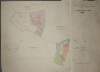
A map of Bishopscourt and part of Kilcarragh in the barony of Gaultiere and County of Waterford the estate of the Rt. Hon. & Rt. Revd. Richard Bourke Bishop of Waterford and Lismore. Surveyed November 1818 by Richard Walsh copied November 1833 by James Daly and recopied by William Longfield. January 1834. Table of reference showing tenants and acreage.
Map
Main Creator:
Longfield
,
William
,
fl
.
1825
-
ca
.
1870
,
surveyor
Language:
English
Format:
Map
In collection:
Longfield Map Collection
Published / Created
[January 1834]
Notes
Physical description: 1 map Geographic Coverage: Bar...
Call Number:
Loading...
Located:
Loading...
His Royal Highness The Duke of York his Lands in Rathcoole in the County of Dublin in Ireland. Surveyed in 1670 by Thomas Emerson and copied by William Longfield 1827. Laid down by a scale of 20 Perches to an Inch - Irish Plantation measure
Map
Main Creator:
Longfield
,
William
,
fl
.
1825
-
ca
.
1870
,
surveyor
Language:
English
Format:
Map
In collection:
Longfield Map Collection
Published / Created
[1827]
Notes
Physical description: 1 map Geographic Coverage: Bar...
Call Number:
Loading...
Located:
Loading...
A map of part of the lands of Cullenswood situate in Cullenswood Avenue the property of Mr. Darling. Surveyed by Wm. Longfield. 1845. Scale 40 feet to an inch
Map
Main Creator:
Longfield
,
William
,
fl
.
1825
-
ca
.
1870
,
surveyor
Language:
English
Format:
Map
In collection:
Longfield Map Collection
Published / Created
[1845]
Notes
Physical description: 1 map Geographic Coverage: Dub...
Call Number:
Loading...
Located:
Loading...
A map of part of Kilcorney townland in the parish of Rathcore, part of the estate of the Marquis of Lansdowne. By William Longfield. May 1835. Scale 16 perches to one inch.
Map
Main Creator:
Longfield
,
William
,
fl
.
1825
-
ca
.
1870
,
surveyor
Language:
English
Format:
Map
In collection:
Longfield Map Collection
Published / Created
[May 1835]
Notes
This map was digitised twice, once with the table of...
Call Number:
Loading...
Located:
Loading...
A map and survey of several parcels of land let by James Ormsby and situate in and about the Town of Rathcoole in the County of Dublin marking to this as in the underneath Reference 69.0.13 Surveyed in 1796 by John Byrne and copied by William Longfield 1827.
Map
Main Creator:
Longfield
,
William
,
fl
.
1825
-
ca
.
1870
,
surveyor
Language:
English
Format:
Map
In collection:
Longfield Map Collection
Published / Created
[1827]
Notes
Physical description: 1 map Geographic Coverage: Bar...
Call Number:
Loading...
Located:
Loading...
A map of part of the Lands of Rathcoole as was formerly held by Mathew Birmingham situate in the County of Dublin now held by James Ormsby Esq. Laid down by Richd. Frizell and copied by William Longfield 1827.
Map
Main Creator:
Longfield
,
William
,
fl
.
1825
-
ca
.
1870
,
surveyor
Language:
English
Format:
Map
In collection:
Longfield Map Collection
Published / Created
[1827]
Notes
Physical description: 1 map Geographic Coverage: Bar...
Call Number:
Loading...
Located:
Loading...
A map of sundry premises situate on the north side of Marys Abbey in the City of Dublin. Surveyed by Wm Longfield 1840. Names of tenants shown on properties
Map
Main Creator:
Longfield
,
William
,
fl
.
1825
-
ca
.
1870
,
surveyor
Language:
English
Format:
Map
In collection:
Longfield Map Collection
Published / Created
[1840]
Notes
Physical description: 1 map Geographic Coverage: Dub...
Call Number:
Loading...
Located:
Loading...
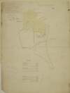
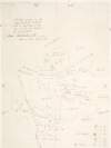
A map of part of the demense of Giltown [Gilltown] situate in the barony of Ophaly and counthy of Kildare the estate of the Revd. Joseph Burrowes. Surveyed in October 1834 By William Longfield. Scale 10 statute perches to an inch.
Map
Main Creator:
Longfield
,
William
,
fl
.
1825
-
ca
.
1870
,
surveyor
Language:
English
Format:
Map
In collection:
Longfield Map Collection
Published / Created
[October 1834]
Notes
Physical description: 1 map Geographic Coverage: Bar...
Call Number:
Loading...
Located:
Loading...
A survey of part of the townland of Camus in the barony of Middlethird and County of Tipperary being a part of the See lands of Cashel. Surveyed October 1833 by James Daly and copied by William Longfield. 1834. Scale 20 perches to an inch. Names of tenants and acreage of holdings shown.
Map
Main Creator:
Longfield
,
William
,
fl
.
1825
-
ca
.
1870
,
surveyor
Language:
English
Format:
Map
In collection:
Longfield Map Collection
Published / Created
[1834]
Notes
Physical description: 1 map Geographic Coverage: Bar...
Call Number:
Loading...
Located:
Loading...
A map of a holding on the south side of Thomas Street in the City of Dublin the property of the Vicar of St. Catherine's parish let to Mrs. Anne Thorpe. Surveyed by W. Longfield 1834. Mr. P. Larkins's holding shown
Map
Main Creator:
Longfield
,
William
,
fl
.
1825
-
ca
.
1870
,
surveyor
Language:
English
Format:
Map
In collection:
Longfield Map Collection
Published / Created
[1834]
Notes
Physical description: 1 map Geographic Coverage: Par...
Call Number:
Loading...
Located:
Loading...
A map of several pieces of ground lying contiguous to the Town of Ballymore Eustace part of the Estate of the Archbishop of Dublin, situate in the Barony of Uppercross and County of Dublin in the tenure of Lord Mountcashel. Surveyed by William Longfield in Sept 1838. Scale 20 Plantation Perches to an Inch
Map
Main Creator:
Longfield
,
William
,
fl
.
1825
-
ca
.
1870
,
surveyor
Language:
English
Format:
Map
In collection:
Longfield Map Collection
Published / Created
[September 1838]
Notes
Physical description: 1 map Geographic Coverage: Bar...
Call Number:
Loading...
Located:
Loading...
A map of part of the Lands of Hollybrook in the County of Dublin. Surveyed by Wm Longfield 28 June 1832. Scale 8 Plantation Perches to an Inch
Map
Main Creator:
Longfield
,
William
,
fl
.
1825
-
ca
.
1870
,
surveyor
Language:
English
Format:
Map
In collection:
Longfield Map Collection
Published / Created
[June 28 1832]
Notes
Physical description: 1 map Geographic Coverage: Bar...
Call Number:
Loading...
Located:
Loading...
A map of the estate of the St. Paul, St. Michan & St. George in the City of Dublin partly surveyed, and partly copied by Wm. Longfield 1837. Names of tenants shown on properties
Map
Main Creator:
Longfield
,
William
,
fl
.
1825
-
ca
.
1870
,
surveyor
Language:
English
Format:
Map
In collection:
Longfield Map Collection
Published / Created
[1837]
Notes
Physical description: 1 map Geographic Coverage: Dub...
Call Number:
Loading...
Located:
Loading...
Plan of Proby Square, Carysfort Avenue Black Rock County of Dublin, the Property of Robt. Jas. Graves Esq. M.D. Laid out for Building by Wm. Longfield. Scale 50 Feet to an Inch
Map
Main Creator:
Longfield
,
William
,
fl
.
1825
-
ca
.
1870
,
surveyor
Language:
English
Format:
Map
In collection:
Longfield Map Collection
Published / Created
[between 1825 and 1870]
Notes
Physical description: 1 map Geographic Coverage: Bar...
Call Number:
Loading...
Located:
Loading...
A map of part of the College Lands of Rathcoole held by Messrs Clynch & Hart from Mr Cradock situate in the County Dublin. Scale 40 perches to an inch. Surveyed by J.B. Copied by William Longfield, 1827. Tenants names & acreage shown.
Map
Main Creator:
Longfield
,
William
,
fl
.
1825
-
ca
.
1870
,
surveyor
Language:
English
Format:
Map
In collection:
Longfield Map Collection
Published / Created
[1827]
Notes
Physical description: 1 map Geographic Coverage: Bar...
Call Number:
Loading...
Located:
Loading...
A map of part of Ballyboggan [situate near Kinnegad] in the County of Meath part of the estate of the Marquis of Lansdowne. By William Longfield May 1835. Scale 16 perches to an inch.
Map
Main Creator:
Longfield
,
William
,
fl
.
1825
-
ca
.
1870
,
surveyor
Language:
English
Format:
Map
In collection:
Longfield Map Collection
Published / Created
[May 1835]
Notes
Physical description: 1 map Geographic Coverage: Bar...
Call Number:
Loading...
Located:
Loading...
A map of Rolagh part of the estate of Lord Gormanstown situate in the lower barony of Morgallion and County of Meath. Surveyed in January 1835 By W. Longfield. Scale 16 perches to an inch. Names of tenants & acreage of holdings shown.
Map
Main Creator:
Longfield
,
William
,
fl
.
1825
-
ca
.
1870
,
surveyor
Language:
English
Format:
Map
In collection:
Longfield Map Collection
Published / Created
[January 1835]
Notes
Physical description: 1 map Geographic Coverage: Bar...
Call Number:
Loading...
Located:
Loading...
A map of part of the lands at Gormanston in the barony of Duleek Upper and County of Meath. By W.L. 1844.
Map
Main Creator:
Longfield
,
William
,
fl
.
1825
-
ca
.
1870
,
surveyor
Language:
English
Format:
Map
In collection:
Longfield Map Collection
Published / Created
[1844]
Notes
Physical description: 1 map Geographic Coverage: Bar...
Call Number:
Loading...
Located:
Loading...
A map of several pieces of Ground situate at Ballymore Eustace in the Barony of Upper Cross & Co. Dublin the Estate of Thomas Spring Rice Esq. Surveyed by William Longfield January 1834. Scale 5 Plantation perches to an Inch
Map
Main Creator:
Longfield
,
William
,
fl
.
1825
-
ca
.
1870
,
surveyor
Language:
English
Format:
Map
In collection:
Longfield Map Collection
Published / Created
[January 1834]
Notes
Physical description: 1 map Geographic Coverage: Bar...
Call Number:
Loading...
Located:
Loading...
A map of part of Oristown in the barony of Kells Upper and County of Meath. Surveyed by William Longfield December 1835. Scale 16 perches to an inch. Table of reference showing tenants names & acreage of holdings. Autographed as court exhibit, 21st December 1835.
Map
Main Creator:
Longfield
,
William
,
fl
.
1825
-
ca
.
1870
,
surveyor
Language:
English
Format:
Map
In collection:
Longfield Map Collection
Published / Created
[December 1835]
Notes
Physical description: 1 map Geographic Coverage: Bar...
Call Number:
Loading...
Located:
Loading...
1
2
Next
2
Get RSS Feed
Email this Search
History
Narrow Search
Digitised
Format
39
Map
Online Availability
24
Not Digitised
15
Digitised
Published / Created
From:
To:
Subject
39
Administration of estates
39
Boundaries (Estates)
39
Land tenure
39
Land use surveys
1
Administration of Estates
Author
38
Longfield, William, fl. 1825-ca. 1870, surveyor
1
Longfield, John, ca. 1775-1833, surveyor
Collections
39
Longfield Map Collection
Language
39
English
Genre
39
Manuscript maps
38
Maps, Manuscript
Era
1
19th century
Region
39
Ireland
27
Dublin (County)
27
Dublin (Ireland : County)
8
Dublin
8
Dublin (Ireland)
7
Newcastle (Barony)
more ...
5
Meath
5
Meath (Ireland)
5
Rathdown (Barony)
4
Uppercross (Barony)
3
Coolock (Barony)
2
Kildare (County)
2
Kildare (Ireland : County)
1
Ballymoe (Barony)
1
Donegal (County)
1
Donegal (Ireland : County)
1
Dulee Upper (Barony)
1
Gaultiere (Barony)
1
Kells Upper (Barony)
1
Middlethird (Barony)
1
Morgallion (Barony)
1
Moyfenrath Upper (Barony)
1
Naas South (Barony)
1
Offaly West (Barony)
1
Raphoe North (Barony)
1
Rathcoole Parish
1
Rathcoole Parish (Ireland)
1
Ratoath (Barony)
1
Roscommon (County)
1
Roscommon (Ireland : County)
see all ...
less ...
Loading...
![A map of part of the demense of Giltown [Gilltown] situate in the barony of Ophaly and counthy of Kildare the estate of the Revd. Joseph Burrowes. Surveyed in October 1834 By William Longfield. Scale 10 statute perches to an inch.](/IIIF/000310000/000302214/vtls000302214_001.jp2/full/100,/0/default.jpg)
![A map of part of Ballyboggan [situate near Kinnegad] in the County of Meath part of the estate of the Marquis of Lansdowne. By William Longfield May 1835. Scale 16 perches to an inch.](/IIIF/000310000/000301806/vtls000301806_001.jp2/full/100,/0/default.jpg)