Showing
81 - 100
results of
1,581
for search '
Longfield, Robert Ormsby, 1844-1908, donor
'
Skip to content
Toggle navigation
NLI Website
- Catalogue -
English
Gaeilge
Home
Help
Advanced Search
Browse
Orders
Ask a Librarian
Language
English
Gaeilge
All Fields
Title
Author
Subject
Call Number
ISBN/ISSN
Publisher
Coordinates
Search digitised content only
FIND
Author
Longfield, Robert Ormsby, 1844-1908, donor
Results
Showing
81 - 100
results of
1,581
for search '
Longfield, Robert Ormsby, 1844-1908, donor
'
, query time: 0.12s
List
Grid
Sort
Relevance
Newest First
Oldest First
Call Number
Author
Title
1
Previous
1
2
3
4
5
6
7
8
9
10
11
Next
80
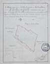
[A map of part of Damaskstown in the Barony of Balrothery and County of Dublin]
Map
Language:
English
Format:
Map
In collection:
Longfield Map Collection
Published / Created
[between 1770 and 1840]
Notes
Physical description: 1 map Geographic Coverage: Bar...
Contributors:
“
...
Longfield
,
Robert
Ormsby
,
1844
-
1908
,
donor
...
”
Call Number:
Loading...
Located:
Loading...
Map of concerns between Harcourt Street and Camden Street. Scale 80 feet to an inch. Adjoining tenants shown
Map
Language:
English
Format:
Map
In collection:
Longfield Map Collection
Published / Created
[between 1770 and 1840]
Notes
Physical description: 1 map Geographic Coverage: Dub...
Contributors:
“
...
Longfield
,
Robert
Ormsby
,
1844
-
1908
,
donor
...
”
Call Number:
Loading...
Located:
Loading...
Survey of concerns between Kevin's Port and Montague Street. Names of tenants shown on properties.
Map
Language:
English
Format:
Map
In collection:
Longfield Map Collection
Published / Created
[between 1770 and 1840]
Notes
Physical description: 1 map Geographic Coverage: Dub...
Contributors:
“
...
Longfield
,
Robert
Ormsby
,
1844
-
1908
,
donor
...
”
Call Number:
Loading...
Located:
Loading...
A map of part of the Glebe lands of Kilcullen in the County of Kildare, granted by the Rev. Thomas Brownrigg Chancellor of the cathedral church of the Holy and Undivided Trinity Dublin to the Rev. J. Hardy and his successors as an additional Glebe to the parish of Killcullen. Surveyed by John Longfield 1822. Scale 20 perches to an inch. Table of reference showing tenants names & area of holdings.
Map
Main Creator:
Longfield, John, ca. 1775-1833, surveyor
Language:
English
Format:
Map
In collection:
Longfield Map Collection
Published / Created
[1822]
Notes
Physical description: 1 map Geographic Coverage: Par...
Contributors:
“
...
Longfield
,
Robert
Ormsby
,
1844
-
1908
,
donor
...
”
Call Number:
Loading...
Located:
Loading...
Plan of north east Dublin City. Streets not named
Map
Language:
English
Format:
Map
In collection:
Longfield Map Collection
Published / Created
[between 1770 and 1840]
Notes
Physical description: 1 map Geographic Coverage: Dub...
Contributors:
“
...
Longfield
,
Robert
Ormsby
,
1844
-
1908
,
donor
...
”
Call Number:
Loading...
Located:
Loading...
A map of lands at Mylerstown in the barony of [ Offaly west] and County of Kildare. Names of tenants and acreage of holdings shown.
Map
Language:
English
Format:
Map
In collection:
Longfield Map Collection
Published / Created
[between 1770 and 1840]
Notes
Physical description: 1 map Geographic Coverage: Bar...
Contributors:
“
...
Longfield
,
Robert
Ormsby
,
1844
-
1908
,
donor
...
”
Call Number:
Loading...
Located:
Loading...
A map of the lands of Lismore, the estate of William Carden, and adjoining townlands in the parish of Aghaboe and barony of Clandonagh surveyed to ascertain the bounds of lands between the Duchens of Chandos and William Carden by John Longfield 1809.
Map
Main Creator:
Longfield, John, ca. 1775-1833, surveyor
Language:
English
Format:
Map
In collection:
Longfield Map Collection
Published / Created
[1809].
Notes
Physical description: 1 map Geographic Coverage: Par...
Contributors:
“
...
Longfield
,
Robert
Ormsby
,
1844
-
1908
,
donor
...
”
Call Number:
Loading...
Located:
Loading...
A map of the precincts of Christ Church showing the part about to be purchased by the Commissioners of Wide Streets. Surveyed by J.L. 1817. Names of tenants on Skinner Row. Shown on properties
Map
Main Creator:
Longfield, John, ca. 1775-1833, surveyor
Language:
English
Format:
Map
In collection:
Longfield Map Collection
Published / Created
[1817]
Notes
Physical description: 1 map Geographic Coverage: Dub...
Contributors:
“
...
Longfield
,
Robert
Ormsby
,
1844
-
1908
,
donor
...
”
Call Number:
Loading...
Located:
Loading...
Map of properties at Upper Bride Street showing City Basin
Map
Language:
English
Format:
Map
In collection:
Longfield Map Collection
Published / Created
[between 1770 and 1840]
Notes
Physical description: 1 map Geographic Coverage: Dub...
Contributors:
“
...
Longfield
,
Robert
Ormsby
,
1844
-
1908
,
donor
...
”
Call Number:
Loading...
Located:
Loading...
Plan showing Kenedy's Lane - St. Nicholas Street, Dublin City. Scale 20 feet to an inch
Map
Language:
English
Format:
Map
In collection:
Longfield Map Collection
Published / Created
[between 1770 and 1840]
Notes
Physical description: 1 map Geographic Coverage: Dub...
Contributors:
“
...
Longfield
,
Robert
Ormsby
,
1844
-
1908
,
donor
...
”
Call Number:
Loading...
Located:
Loading...
A plan showing sheets and properties in the town of Mountmellick in Queens [Leix] County. Names of tenants & acreage of holdings shown.
Map
Language:
English
Format:
Map
In collection:
Longfield Map Collection
Published / Created
[between 1770 and 1840]
Notes
In poor condition with stained, frayed edges and a la...
Contributors:
“
...
Longfield
,
Robert
Ormsby
,
1844
-
1908
,
donor
...
”
Call Number:
Loading...
Located:
Loading...
A map of part of the estate of James Stewart situate in the barony of Dungannon and parish of Arboe County Tyrone. Surveyed in 1803 included are the the townlands of Anneeter Beg, Anneeter More, Ardean, Cluntoe [Richardson], Lurgyroe, Kinrush ... and Killycanavan. Names of tenants and area of holdings shown.
Map
Language:
English
Format:
Map
In collection:
Longfield Map Collection
Published / Created
[1803]
Notes
Physical description: 1 map Geographic Coverage: Par...
Contributors:
“
...
Longfield
,
Robert
Ormsby
,
1844
-
1908
,
donor
...
”
Call Number:
Loading...
Located:
Loading...
A map of part of Ballyboggan [situate near Kinnegad] in the County of Meath part of the estate of the Marquis of Lansdowne. By William Longfield May 1835. Scale 16 perches to an inch.
Map
Main Creator:
Longfield, William, fl. 1825-ca. 1870, surveyor
Language:
English
Format:
Map
In collection:
Longfield Map Collection
Published / Created
[May 1835]
Notes
Physical description: 1 map Geographic Coverage: Bar...
Contributors:
“
...
Longfield
,
Robert
Ormsby
,
1844
-
1908
,
donor
...
”
Call Number:
Loading...
Located:
Loading...
A map of a parcel of ground in St. Sepulchres in the County of Dublin let by John Hatch to Robert Watson Wade and Edward Whitton. Surveyed by John Brownrigg. June-Aug 1791. Scale 100 feet to an inch.
Map
Main Creator:
Brownrigg, John, ca. 1748-1838, surveyor
Language:
English
Format:
Map
In collection:
Longfield Map Collection
Published / Created
[June 1791]
Notes
In mylar covering. Physical description: 1 map Geogr...
Contributors:
“
...
Longfield
,
Robert
Ormsby
,
1844
-
1908
,
donor
...
”
Call Number:
Loading...
Located:
Loading...
[A plan of Land excavated at Simmons Court in the Barony of Rathdown] Scale 5 Perches, Plantation measure to an Inch
Map
Language:
English
Format:
Map
In collection:
Longfield Map Collection
Published / Created
[between 1770 and 1840]
Notes
Physical description: 1 map Geographic Coverage: Bar...
Contributors:
“
...
Longfield
,
Robert
Ormsby
,
1844
-
1908
,
donor
...
”
Call Number:
Loading...
Located:
Loading...
A map of cabins and gardens in Monasterevin. Names of tenants & area of holdings shown.
Map
Language:
English
Format:
Map
In collection:
Longfield Map Collection
Published / Created
[between 1770 and 1840]
Notes
Inset map: "A map of part of Clogheen in the Barony o...
Contributors:
“
...
Longfield
,
Robert
Ormsby
,
1844
-
1908
,
donor
...
”
Call Number:
Loading...
Located:
Loading...
A plan of Monasterevin County Kildare. Names of tenants & area of holdings shown.
Map
Language:
English
Format:
Map
In collection:
Longfield Map Collection
Published / Created
[between 1770 and 1840]
Notes
Physical description: 1 map Geographic Coverage: Bar...
Contributors:
“
...
Longfield
,
Robert
Ormsby
,
1844
-
1908
,
donor
...
”
Call Number:
Loading...
Located:
Loading...
A survey of part of the Lands of Dunbrow called Huntstown situate in the Barony of Coolock and County of Dublin, the Estate of Lord Viscount Clifden. Surveyed in March 1833. Scale 20 statute Perches to an Inch
Map
Language:
English
Format:
Map
In collection:
Longfield Map Collection
Published / Created
[March 1833]
Notes
Physical description: 1 map Geographic Coverage: Bar...
Contributors:
“
...
Longfield
,
Robert
Ormsby
,
1844
-
1908
,
donor
...
”
Call Number:
Loading...
Located:
Loading...
[A Survey of holdings in the townland of Artaine in the Barony of Coolock and County of Dublin.]
Map
Language:
English
Format:
Map
In collection:
Longfield Map Collection
Published / Created
[between 1770 and 1840]
Notes
Physical description: 1 map Geographic Coverage: Bar...
Contributors:
“
...
Longfield
,
Robert
Ormsby
,
1844
-
1908
,
donor
...
”
Call Number:
Loading...
Located:
Loading...
A map of lands at Ballinree, Streamstown and Rathgibbon in the barony of Eglish and Kings [Offaly] County. Names of tenants and acreage of holdings shown.
Map
Language:
English
Format:
Map
In collection:
Longfield Map Collection
Published / Created
[between 1770 and 1840]
Notes
Physical description: 1 map Geographic Coverage: Bar...
Contributors:
“
...
Longfield
,
Robert
Ormsby
,
1844
-
1908
,
donor
...
”
Call Number:
Loading...
Located:
Loading...
1
Previous
1
2
3
4
5
6
7
8
9
10
11
Next
80
Get RSS Feed
Email this Search
History
Narrow Search
Digitised
Format
1,580
Map
1
Manuscript
Online Availability
956
Digitised
625
Not Digitised
Published / Created
From:
To:
Subject
1,579
Land use surveys
1,578
Boundaries (Estates)
1,578
Land tenure
1,565
Administration of estates
268
History
49
Administration of Estates
more ...
1
Cartography
1
Estates
1
Maps
1
Maps and Surveys
1
Surveyors
see all ...
less ...
Author
336
Longfield, John, ca. 1775-1833, surveyor
112
Brownrigg, John, ca. 1748-1838, surveyor
42
Brownrigg & Co., fl. 1801-1809, surveyors
38
Longfield, William, fl. 1825-ca. 1870, surveyor
8
Reading, Thomas, ca. 1704-1779, surveyor
7
Brownrigg, Longfield and Murray, fl. 1799-ca. 1805, surveyors
more ...
6
Gartland, William, fl. 1838-1851/68, surveyor
5
Byron, Samuel, fl. 1768-1795
4
Cave, Thomas, fl. ca. 1709-1749, surveyor
4
Scalé, Brownrigg & Sherrard, fl. 1774-1778, surveyors
3
Chaloner, Samuel, fl. 1812-1833, surveyor
3
Cuddehy, Michael, fl. 1791-1803, surveyor
3
Mathews, Thomas, fl. 1760-1784, surveyor
3
Roe, John, fl. 1793-1824, surveyor
3
Scully, Patrick, fl. 1777, surveyor
3
Sherrard, Thomas, ca. 1750-1837, surveyor
2
Brownrigg & Sherrard, fl. 1777-1778, surveyors
2
Byrne, John, fl. 1789-1828, surveyor
2
Donlevy, Bryan, fl. 1784-1792, surveyor
2
Frizell, Richard, fl. 1750-1797
2
Kirrilly, Bryan, fl. 1715-1716, surveyor
2
Lewis, Robert, fl. 1745-1785, surveyor
2
Lynch, Thomas, fl. 1804-1809, surveyor
2
Moynahan, John, fl. 1736-1764, surveyor
2
Mulvihill, Peter, ca. 1736-d. 1798, surveyor
2
Neville, Arthur Richards, fl. 1775-1828, surveyor
2
Sherrard & Brassington, fl. 1800-1822, surveyors
1
Balfe, M., fl. 1821, surveyor
1
Battersby, John, fl. 1778, surveyor
1
Bell, John (I and II), fl. 1721-1820
see all ...
less ...
Collections
1,581
Longfield Map Collection
Language
1,581
English
Genre
1,580
Manuscript maps
1,577
Maps, Manuscript
269
Early works to 1800
Era
268
18th century
1
1780-1840
1
19th century
Region
1,535
Ireland
711
Dublin (Ireland : County)
710
Dublin (County)
295
Dublin (Ireland)
294
Dublin
182
Kildare (County)
more ...
182
Kildare (Ireland : County)
155
Meath
155
Meath (Ireland)
118
Roscommon (County)
118
Roscommon (Ireland : County)
111
Rathdown (Barony)
85
Coolock (Barony)
76
Offaly West (Barony)
70
Uppercross (Barony)
47
Tipperary (County)
47
Tipperary (Ireland : County)
45
Northern Ireland
43
Newcastle (Barony)
40
Frenchpark (Barony)
40
Wicklow (County)
40
Wicklow (Ireland : County)
36
Castleknock (Barony)
35
Westmeath
35
Westmeath (Ireland)
34
Balrothery (Barony)
33
Laois
33
Laois (Ireland)
31
Dublin (Barony)
29
Nethercross (Barony)
see all ...
less ...
Loading...
![[A map of part of Damaskstown in the Barony of Balrothery and County of Dublin]](/IIIF/000310000/000301078/vtls000301078_001.jp2/full/100,/0/default.jpg)
![A map of lands at Mylerstown in the barony of [ Offaly west] and County of Kildare. Names of tenants and acreage of holdings shown.](/IIIF/000310000/000302035/vtls000302035_001.jp2/full/100,/0/default.jpg)


![A plan showing sheets and properties in the town of Mountmellick in Queens [Leix] County. Names of tenants & acreage of holdings shown.](/IIIF/000310000/000302384/vtls000302384_001.jp2/full/100,/0/default.jpg)
![A map of part of the estate of James Stewart situate in the barony of Dungannon and parish of Arboe County Tyrone. Surveyed in 1803 included are the the townlands of Anneeter Beg, Anneeter More, Ardean, Cluntoe [Richardson], Lurgyroe, Kinrush ... and Killycanavan. Names of tenants and area of holdings shown.](/IIIF/000310000/000302573/vtls000302573_001.jp2/full/100,/0/default.jpg)
![A map of part of Ballyboggan [situate near Kinnegad] in the County of Meath part of the estate of the Marquis of Lansdowne. By William Longfield May 1835. Scale 16 perches to an inch.](/IIIF/000310000/000301806/vtls000301806_001.jp2/full/100,/0/default.jpg)


![[A Survey of holdings in the townland of Artaine in the Barony of Coolock and County of Dublin.]](/IIIF/000310000/000301125/vtls000301125_001.jp2/full/100,/0/default.jpg)
![A map of lands at Ballinree, Streamstown and Rathgibbon in the barony of Eglish and Kings [Offaly] County. Names of tenants and acreage of holdings shown.](/IIIF/000310000/000302164/vtls000302164_001.jp2/full/100,/0/default.jpg)