Showing
181 - 200
results of
1,581
for search '
Longfield, Robert Ormsby, 1844-1908, donor
'
Skip to content
Toggle navigation
NLI Website
- Catalogue -
English
Gaeilge
Home
Help
Advanced Search
Browse
Orders
Ask a Librarian
Language
English
Gaeilge
All Fields
Title
Author
Subject
Call Number
ISBN/ISSN
Publisher
Coordinates
Search digitised content only
FIND
Author
Longfield, Robert Ormsby, 1844-1908, donor
Results
Showing
181 - 200
results of
1,581
for search '
Longfield, Robert Ormsby, 1844-1908, donor
'
, query time: 0.08s
List
Grid
Sort
Relevance
Newest First
Oldest First
Call Number
Author
Title
1
Previous
5
6
7
8
9
10
11
12
13
14
15
Next
80
A survey of the lands of Castlekeely in the barony of Clane and County Kildare the estate of John Mansfield. Surveyed by J.L. 1816. Names of tenants shown on some holdings
Map
Main Creator:
Longfield, John, ca. 1775-1833, surveyor
Language:
English
Format:
Map
In collection:
Longfield Map Collection
Published / Created
[1816]
Notes
Some staining around the sides of the map. Physical d...
Contributors:
“
...
Longfield
,
Robert
Ormsby
,
1844
-
1908
,
donor
...
”
Call Number:
Loading...
Located:
Loading...
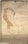
A map of the bog of Cloonegad [Clonegath] in the County of Kildare shewing the situation and extent of the several turf banks occupied by sundry tenants of the most noble Charles Marquis of Drogheda. By J.L. 1811.
Map
Main Creator:
Longfield, John, ca. 1775-1833, surveyor
Language:
English
Format:
Map
In collection:
Longfield Map Collection
Published / Created
[1811]
Notes
Physical description: 1 map Geographic Coverage: Bar...
Contributors:
“
...
Longfield
,
Robert
Ormsby
,
1844
-
1908
,
donor
...
”
Call Number:
Loading...
Located:
Loading...
A survey of the lands & bogs of Cloncarlon [Cloncarlin] near Monasterevin in the County of Kildare occupied by John Cassidy. By J.L. 1815. Scale 16 perches to an inch. Table of reference showing area of profitable and cutaway bog.
Map
Main Creator:
Longfield, John, ca. 1775-1833, surveyor
Language:
English
Format:
Map
In collection:
Longfield Map Collection
Published / Created
[1815]
Notes
Physical description: 1 map Geographic Coverage: Bar...
Contributors:
“
...
Longfield
,
Robert
Ormsby
,
1844
-
1908
,
donor
...
”
Call Number:
Loading...
Located:
Loading...
A survey of part of the lands of Harristown in the Barony of Offaly West and County of Kildare. Names of tenants, acreage and crop pattern shown.
Map
Language:
English
Format:
Map
In collection:
Longfield Map Collection
Published / Created
[between 1770 and 1840]
Notes
Physical description: 1 map Geographic Coverage: Bar...
Contributors:
“
...
Longfield
,
Robert
Ormsby
,
1844
-
1908
,
donor
...
”
Call Number:
Loading...
Located:
Loading...
A survey of the Lands of Doonane and Drummaghmartin, in the Barony of Tulla & Co. Clare, let to Henry Molony Esq., the Estate of Tottenham Esq. by J.L. 1815
Map
Main Creator:
Longfield, John, ca. 1775-1833, surveyor
Language:
English
Format:
Map
In collection:
Longfield Map Collection
Published / Created
[1815]
Notes
Physical description: 1 map Geographic Coverage: Bar...
Contributors:
“
...
Longfield
,
Robert
Ormsby
,
1844
-
1908
,
donor
...
”
Call Number:
Loading...
Located:
Loading...
A ground plan of Mrs. Hunters premises in Glovers Alley. Adjoining tenants names shown.
Map
Language:
English
Format:
Map
In collection:
Longfield Map Collection
Published / Created
[between 1770 and 1840]
Notes
Physical description: 1 map Geographic Coverage: Dub...
Contributors:
“
...
Longfield
,
Robert
Ormsby
,
1844
-
1908
,
donor
...
”
Call Number:
Loading...
Located:
Loading...
Numbered sheet showing Rathconnell Bog in the Barony of Offaly West and County of Kildare
Map
Language:
English
Format:
Map
In collection:
Longfield Map Collection
Published / Created
[between 1770 and 1840]
Notes
Physical description: 1 map Geographic Coverage: Bar...
Contributors:
“
...
Longfield
,
Robert
Ormsby
,
1844
-
1908
,
donor
...
”
Call Number:
Loading...
Located:
Loading...
A survey of part of the lands of Moyvannan in the barony of Athlone and County of Roscommon the estate of Col. F. W. French M.P. Surveyed by J.L. 1825. Scale 16 perches to an inch. Owen Ward's allotment shown.
Map
Main Creator:
Longfield, John, ca. 1775-1833, surveyor
Language:
English
Format:
Map
In collection:
Longfield Map Collection
Published / Created
[1825]
Notes
Physical description: 1 map Geographic Coverage: Bar...
Contributors:
“
...
Longfield
,
Robert
Ormsby
,
1844
-
1908
,
donor
...
”
Call Number:
Loading...
Located:
Loading...
A survey of the lands of Knockulty and Fanningsbog in the barony of Slievardagh and County of Tipperary part of the estate of the Earl of Desart, October 1804. Names of tenants and acreage of holdings shown. Scale 20 perches to an inch.
Map
Language:
English
Format:
Map
In collection:
Longfield Map Collection
Published / Created
[October 1804]
Notes
Physical description: 1 map Geographic Coverage: Bar...
Contributors:
“
...
Longfield
,
Robert
Ormsby
,
1844
-
1908
,
donor
...
”
Call Number:
Loading...
Located:
Loading...
A map of part of the Lands of Swords call'd the Bullock Parks - let by the Revd. Sir James B Hutchinson to Mr. Pat Cuffe. Survey'd by J.L. 1814
Map
Main Creator:
Longfield, John, ca. 1775-1833, surveyor
Language:
English
Format:
Map
In collection:
Longfield Map Collection
Published / Created
[1814]
Notes
Physical description: 1 map Geographic Coverage: Bar...
Contributors:
“
...
Longfield
,
Robert
Ormsby
,
1844
-
1908
,
donor
...
”
Call Number:
Loading...
Located:
Loading...
[A plan of a holding on the Stillorgan Demense]
Map
Language:
English
Format:
Map
In collection:
Longfield Map Collection
Published / Created
[between 1770 and 1840]
Notes
Physical description: 1 map Geographic Coverage: Bar...
Contributors:
“
...
Longfield
,
Robert
Ormsby
,
1844
-
1908
,
donor
...
”
Call Number:
Loading...
Located:
Loading...
A survey of Burgage More in the barony of Talbotstown Lower and County of Wicklow the estate of the Chanters of St. Patrick, Dublin. 1780.
Map
Language:
English
Format:
Map
In collection:
Longfield Map Collection
Published / Created
[1780]
Notes
Physical description: 1 map Geographic Coverage: Bar...
Contributors:
“
...
Longfield
,
Robert
Ormsby
,
1844
-
1908
,
donor
...
”
Call Number:
Loading...
Located:
Loading...
Map of lands at Kilpatrick in the Barony of Offaly West and County of Kildare. Names of tenants & acreage of holdings shown.
Map
Language:
English
Format:
Map
In collection:
Longfield Map Collection
Published / Created
[between 1770 and 1840]
Notes
Physical description: 1 map Geographic Coverage: Bar...
Contributors:
“
...
Longfield
,
Robert
Ormsby
,
1844
-
1908
,
donor
...
”
Call Number:
Loading...
Located:
Loading...
A survey of a piece of ground near Rathfarnham in the Co. of Dublin, done for Mr Perrier Feb 15 1798. Scale 10 Perches to an Inch
Map
Language:
English
Format:
Map
In collection:
Longfield Map Collection
Published / Created
[February 15 1798]
Notes
Physical description: 1 map Geographic Coverage: Bar...
Contributors:
“
...
Longfield
,
Robert
Ormsby
,
1844
-
1908
,
donor
...
”
Call Number:
Loading...
Located:
Loading...
Levels round part of the commons of Lyons belonging to John Longfield 1816. Scale 20 perches to an inch in length. 20 feet to an inch in height.
Map
Language:
English
Format:
Map
In collection:
Longfield Map Collection
Published / Created
[1816]
Notes
Physical description: 1 map Geographic Coverage: Bar...
Contributors:
“
...
Longfield
,
Robert
Ormsby
,
1844
-
1908
,
donor
...
”
Call Number:
Loading...
Located:
Loading...
A plan of several holdings lying between Barrack St & Ellis's Quay in the City of Dublin. Surveyed for Francis Prendergast, by J.L. 1813. Names of tenants shown on properties
Map
Main Creator:
Longfield, John, ca. 1775-1833, surveyor
Language:
English
Format:
Map
In collection:
Longfield Map Collection
Published / Created
[1813]
Notes
Physical description: 1 map Geographic Coverage: Dub...
Contributors:
“
...
Longfield
,
Robert
Ormsby
,
1844
-
1908
,
donor
...
”
Call Number:
Loading...
Located:
Loading...
[A survey of holdings in the town and townland of Clondalkin in the Barony of Uppercross and County of Dublin]
Map
Language:
English
Format:
Map
In collection:
Longfield Map Collection
Published / Created
[between 1770 and 1840]
Notes
Physical description: 1 map Geographic Coverage: Bar...
Contributors:
“
...
Longfield
,
Robert
Ormsby
,
1844
-
1908
,
donor
...
”
Call Number:
Loading...
Located:
Loading...
Section of the line of Hatch Street from Harcourt Street to Leeson Street By John Longfield 1828.
Map
Main Creator:
Longfield, John, ca. 1775-1833, surveyor
Language:
English
Format:
Map
In collection:
Longfield Map Collection
Published / Created
[1828]
Notes
Physical description: 1 map Geographic Coverage: Dub...
Contributors:
“
...
Longfield
,
Robert
Ormsby
,
1844
-
1908
,
donor
...
”
Call Number:
Loading...
Located:
Loading...
Map of lands at Mylerstown in the barony of Connell and County of Kildare. Scale 20 perches to an inch. Names of tenants and acreage of holdings shown.
Map
Language:
English
Format:
Map
In collection:
Longfield Map Collection
Published / Created
[between 1770 and 1840]
Notes
Physical description: 1 map Geographic Coverage: Bar...
Contributors:
“
...
Longfield
,
Robert
Ormsby
,
1844
-
1908
,
donor
...
”
Call Number:
Loading...
Located:
Loading...
A map [chart] of part of the river Slaney from Enniscorthy to Polldarrig in County Wexford.
Map
Language:
English
Format:
Map
In collection:
Longfield Map Collection
Published / Created
[between 1770 and 1840]
Notes
Physical description: 1 map Geographic Coverage: Bar...
Contributors:
“
...
Longfield
,
Robert
Ormsby
,
1844
-
1908
,
donor
...
”
Call Number:
Loading...
Located:
Loading...
1
Previous
5
6
7
8
9
10
11
12
13
14
15
Next
80
Get RSS Feed
Email this Search
History
Narrow Search
Digitised
Format
1,580
Map
1
Manuscript
Online Availability
956
Digitised
625
Not Digitised
Published / Created
From:
To:
Subject
1,579
Land use surveys
1,578
Boundaries (Estates)
1,578
Land tenure
1,565
Administration of estates
268
History
49
Administration of Estates
more ...
1
Cartography
1
Estates
1
Maps
1
Maps and Surveys
1
Surveyors
see all ...
less ...
Author
336
Longfield, John, ca. 1775-1833, surveyor
112
Brownrigg, John, ca. 1748-1838, surveyor
42
Brownrigg & Co., fl. 1801-1809, surveyors
38
Longfield, William, fl. 1825-ca. 1870, surveyor
8
Reading, Thomas, ca. 1704-1779, surveyor
7
Brownrigg, Longfield and Murray, fl. 1799-ca. 1805, surveyors
more ...
6
Gartland, William, fl. 1838-1851/68, surveyor
5
Byron, Samuel, fl. 1768-1795
4
Cave, Thomas, fl. ca. 1709-1749, surveyor
4
Scalé, Brownrigg & Sherrard, fl. 1774-1778, surveyors
3
Chaloner, Samuel, fl. 1812-1833, surveyor
3
Cuddehy, Michael, fl. 1791-1803, surveyor
3
Mathews, Thomas, fl. 1760-1784, surveyor
3
Roe, John, fl. 1793-1824, surveyor
3
Scully, Patrick, fl. 1777, surveyor
3
Sherrard, Thomas, ca. 1750-1837, surveyor
2
Brownrigg & Sherrard, fl. 1777-1778, surveyors
2
Byrne, John, fl. 1789-1828, surveyor
2
Donlevy, Bryan, fl. 1784-1792, surveyor
2
Frizell, Richard, fl. 1750-1797
2
Kirrilly, Bryan, fl. 1715-1716, surveyor
2
Lewis, Robert, fl. 1745-1785, surveyor
2
Lynch, Thomas, fl. 1804-1809, surveyor
2
Moynahan, John, fl. 1736-1764, surveyor
2
Mulvihill, Peter, ca. 1736-d. 1798, surveyor
2
Neville, Arthur Richards, fl. 1775-1828, surveyor
2
Sherrard & Brassington, fl. 1800-1822, surveyors
1
Balfe, M., fl. 1821, surveyor
1
Battersby, John, fl. 1778, surveyor
1
Bell, John (I and II), fl. 1721-1820
see all ...
less ...
Collections
1,581
Longfield Map Collection
Language
1,581
English
Genre
1,580
Manuscript maps
1,577
Maps, Manuscript
269
Early works to 1800
Era
268
18th century
1
1780-1840
1
19th century
Region
1,535
Ireland
711
Dublin (Ireland : County)
710
Dublin (County)
295
Dublin (Ireland)
294
Dublin
182
Kildare (County)
more ...
182
Kildare (Ireland : County)
155
Meath
155
Meath (Ireland)
118
Roscommon (County)
118
Roscommon (Ireland : County)
111
Rathdown (Barony)
85
Coolock (Barony)
76
Offaly West (Barony)
70
Uppercross (Barony)
47
Tipperary (County)
47
Tipperary (Ireland : County)
45
Northern Ireland
43
Newcastle (Barony)
40
Frenchpark (Barony)
40
Wicklow (County)
40
Wicklow (Ireland : County)
36
Castleknock (Barony)
35
Westmeath
35
Westmeath (Ireland)
34
Balrothery (Barony)
33
Laois
33
Laois (Ireland)
31
Dublin (Barony)
29
Nethercross (Barony)
see all ...
less ...
Loading...

![A map of the bog of Cloonegad [Clonegath] in the County of Kildare shewing the situation and extent of the several turf banks occupied by sundry tenants of the most noble Charles Marquis of Drogheda. By J.L. 1811.](/IIIF/000310000/000302206/vtls000302206_001.jp2/full/100,/0/default.jpg)
![A survey of the lands & bogs of Cloncarlon [Cloncarlin] near Monasterevin in the County of Kildare occupied by John Cassidy. By J.L. 1815. Scale 16 perches to an inch. Table of reference showing area of profitable and cutaway bog.](/IIIF/000310000/000302062/vtls000302062_001.jp2/full/100,/0/default.jpg)


![[A survey of holdings in the town and townland of Clondalkin in the Barony of Uppercross and County of Dublin]](/IIIF/000310000/000301127/vtls000301127_001.jp2/full/100,/0/default.jpg)

![A map [chart] of part of the river Slaney from Enniscorthy to Polldarrig in County Wexford.](/IIIF/000310000/000301018/vtls000301018_001.jp2/full/100,/0/default.jpg)