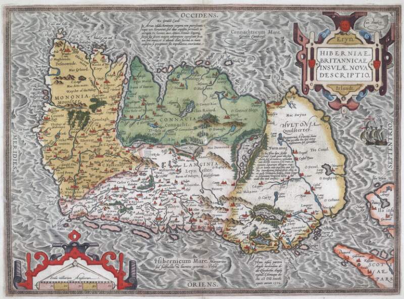
Hiberniae, Britannicae Insulae, nova descriptio.
| Main Creator: | |
|---|---|
| Contributors: | |
| Summary: | Map of Ireland indicating the territories of the major lords and chieftains, and includes towns, ecclesiastical sites and castles. |
| In collection: | Theatrum orbis terrarum. |
| Format: | Manuscript |
| Published / Created: |
[Antverpiae,
1592].
|
| Subjects: | |
| Notes: | From the author's atlas 'Theatrum orbis terrarum', 1592 ed. Relief shown pictorially. Text on verso under title 'Hibernia', with page number '14' printed lower right. Based on a large wall map of England, Scotland, Wales and Ireland published by Gerard Mercator at Duisburg, Germany, in 1564. Physical description: 1 hand col. map, 45 x 57 cm, originally folded to 45 x 28.5 cm. more |
| Arrangement: | Item |
Loading...

Hiberniae, Britannicae Insulae, nova descriptio.
| In Collection: | Theatrum orbis terrarum. |
|---|---|
| Description: | Map of Ireland indicating the territories of the major lords and chieftains, and includes towns, ecclesiastical sites and castles. |
| Main Creator: | |
| Created: |
[Antverpiae,
1592].
|
| Extent: | 1 hand col. map, 45 x 57 cm, originally folded to 45 x 28.5 cm. |
| Format: | Manuscript |
| Call Number: |
MS 48,518/91
(Manuscripts Reading Room) |