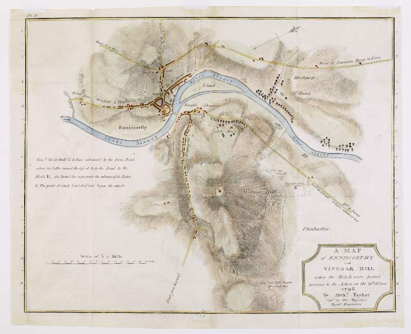
A map of Enniscorthy and Vinegar Hill, where the rebels were posted previous to the action on the 21st of June 1798, by Alexander Taylor, Captain in His Majesties Royal Engineers,
[1798?]
| Main Creator: | |
|---|---|
| Summary: | The map marks the routes by which the government forces and the rebels advanced, and the spot where Lieutenant General Lake began the attack. |
| Format: | Map |
| Language: | English |
| Subjects: | |
| Notes: | Above the scale bar is written 'Scale of 1/2 a mile' and at the end 'Perches'. 40 perches to an inch. Physical description: 1 map : printed and hand coloured ; 37 x 29 cm. Geographic Coverage: Enniscorthy and Vinegar Hill, County Wexford, Ireland, more |
| Arrangement: | Item |

