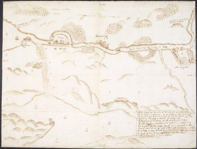
A plott of Logh Foyle brought over by Cap. Covert,
1600.
| Summary: | An alphabetic key corresponds to the various landmarks. Shows the Lyfford, the Derry, Dornalog and Kilmors. |
|---|---|
| In collection: | Maps, drawings and plans by Richard Bartlett (Barthelet) and others, 1587-1625. |
| Format: | Manuscript |
| Language: | English |
| Published / Created: |
1600.
|
| Subjects: | |
| Notes: | No scale is provided on this map. Physical description: 1 sheet. more |
| Access: | Original withdrawn. Digitised images are available online. |