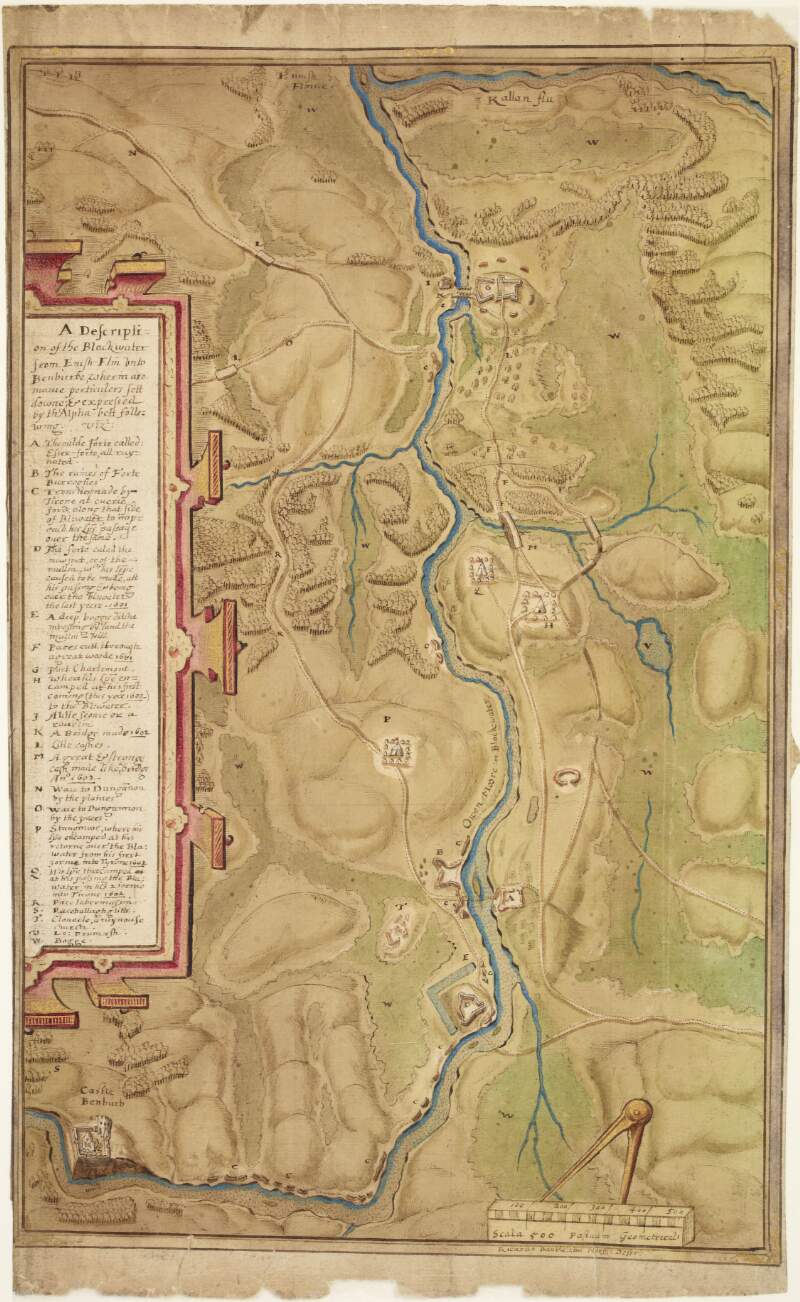
Map and description of Blackwater Valley, showing fortified positions of Irish and English in the O'Neill wars,
circa 1602.
| Main Creator: | |
|---|---|
| Summary: | The map reads "A description of the Blackwater from Enish Flm onto Benburbe where are manie perticulers sett down; & expressed by the Alphabet following [sic]". |
| In collection: | Maps, drawings and plans by Richard Bartlett (Barthelet) and others, 1587-1625. |
| Format: | Manuscript |
| Language: | English |
| Published / Created: |
circa 1602.
|
| Subjects: | |
| Notes: | Scale is marked "scala 500 passuum geometrical". Physical description: 1 sheet : 26 x 43 cm. more |
| Access: | Original withdrawn. Digitised images are available online. |
Loading...

Map and description of Blackwater Valley, showing fortified positions of Irish and English in the O'Neill wars,
circa 1602.
| In Collection: | Maps, drawings and plans by Richard Bartlett (Barthelet) and others, 1587-1625. |
|---|---|
| Description: | The map reads "A description of the Blackwater from Enish Flm onto Benburbe where are manie perticulers sett down; & expressed by the Alphabet following [sic]". |
| Main Creator: | |
| Created: |
circa 1602.
|
| Language: | English |
| Extent: | 1 sheet : 26 x 43 cm. |
| Format: | Manuscript |
| Call Number: |
MS 2656 (8)
(Manuscripts Reading Room) |
| Access Conditions: | Original withdrawn. Digitised images are available online. |
| Rights: | Reproduction rights owned by National Library of Ireland. |