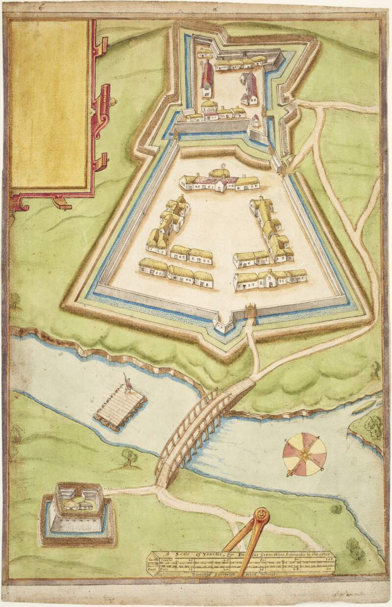
Plan of Charlemont Fort and bridge over the Blackwater river,
circa 1602.
| Main Creator: | |
|---|---|
| In collection: | Maps, drawings and plans by Richard Bartlett (Barthelet) and others, 1587-1625. |
| Format: | Manuscript |
| Language: | English |
| Published / Created: |
circa 1602.
|
| Subjects: | |
| Notes: | Scale is marked as "yeardes and paces geom; th'one answerable to the other". Physical description: 1 sheet : 27.6 x 43 cm. more |
| Access: | Original withdrawn. Digitised images are available online. |
Loading...

Plan of Charlemont Fort and bridge over the Blackwater river,
circa 1602.
| In Collection: | Maps, drawings and plans by Richard Bartlett (Barthelet) and others, 1587-1625. |
|---|---|
| Main Creator: | |
| Created: |
circa 1602.
|
| Language: | English |
| Extent: | 1 sheet : 27.6 x 43 cm. |
| Format: | Manuscript |
| Call Number: |
MS 2656 (4)
(Manuscripts Reading Room) |
| Access Conditions: | Original withdrawn. Digitised images are available online. |
| Rights: | Reproduction rights owned by National Library of Ireland. |