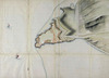
The above Plott is the Survey taken of all the Strand from the Parkegate to the Wall by the Lord Lowthes Garden near Dublin Bridge and other plotts of Ground formerly leased to the persons above mentioned being Surveyed and Admeasured pursuant to an order from the Lord Mayor Sherriffs Comens and Cittizens of the City of Dublin /
John Groor,
1682
| Main Creator: | |
|---|---|
| Format: | Map |
| Language: | English |
| Subjects: | |
| Notes: | Roads, gates, streets, houses, river, bridge, island, wall, land plots. Orientation: compass arrow, north above left. A number of landowners' names are inscribed directly on the map. These include Sir John Temple, the Duke of Ormond, Sir Theo: Jones, Henry Orsen, Sir William Usher, Sir Gerard Lowther, John Greene, and Mr. Tighe. Scale: A scale of 120 feete to an Inch [RF: 1:1440]. Includes scale bar. Physical description: 1 manuscript map; pen and ink (hand-tinted); 33 x 86 cm. Geographic Coverage: Inscribed on map: Christchurch meadow, Usher's Island, Pallace Garden, the Bowling Green, Bridewell, Dublin Bridge. Dublin City. County Dublin. Province of Leinster. Ireland. more |