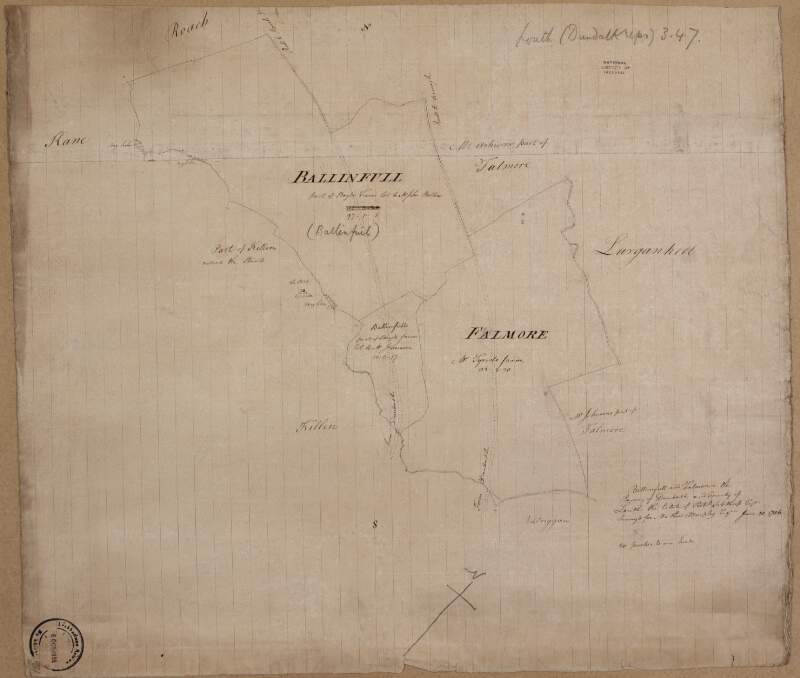
A map of lands at Ballinfail and Falmore in the barony of Dundalk Upper & County of Louth the estate of Robert Sibthorp. Surveyed for Matthew Murphy January 30, 1786. Scale 20 perches to an inch. Names of tenants & acreage of holdings shown.
| Contributors: | |
|---|---|
| In collection: | Longfield Map Collection |
| Format: | Map |
| Language: | English |
| Published / Created: |
[January 30 1786]
|
| Subjects: | |
| Notes: | Physical description: 1 map Geographic Coverage: Barony of Dundalk upper, County Louth, Province of Leinster, Ireland. more |
As a digital copy of this item is available, the original will not be issued.
| Call Number | View In | Collection |
|---|---|---|
|
MS 21 F. 40 / (031) |
Manuscripts Reading Room |
Manuscripts |
Reproduction rights owned by National Library of Ireland


