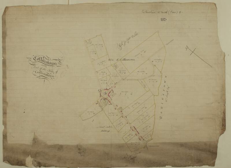
A map of Collinstown with part of the Hills of Collinstown in the barony of Fore and County of Westmeath. Names of tenants and acreage of holdings shown.
| Contributors: | |
|---|---|
| In collection: | Longfield Map Collection |
| Format: | Map |
| Language: | English |
| Published / Created: |
[between 1770 and 1840]
|
| Subjects: | |
| Notes: | Physical description: 1 map Geographic Coverage: Barony of Fore, County Westmeath, Province of Leinster, Ireland. more |
As a digital copy of this item is available, the original will not be issued.
| Call Number | View In | Collection |
|---|---|---|
|
MS 21 F. 48 / (010) |
Manuscripts Reading Room |
Manuscripts |
Reproduction rights owned by National Library of Ireland


