Sketchbook of drawings of the waterways of Dublin and Kildare
[graphic].
| Contributors: | |
|---|---|
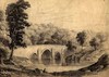
| Summary: | Sketches of waterways around Dublin and Kildare, including Dublin Docks, North Wall, South Wall, North Strand, Ballybough Bridge, Miltown Bridge, Drumcondra Bridge, Glasnevin Bridge, the Liffey Valley and Salmon Leap at Leixlip. Album also contains drawings of Connemara including Garbally, Ballinasloe, Killary Bay and Harbour, Delphi, Doolough, Renvyle, Oughterard and Clifden. Other sketches include coastlines showing Amsterdam Island (French Southern and Antarctic Territories), Table Mountain, the Island of Tristan da Cunha, and Cape Rachado (now known as Tanjung Tuan) in the Malacca Straits. |
| Format: | Prints & Drawings |
| Language: | English |
| Published / Created: |
1821-1831.
|
| Subjects: | |
| Notes: | Inscribed in pencil on verso of flyleaf: Power le Poer Trench / Custom House. Physical description: 1 sketchbook (50 drawings on 48 pages) pencil, 21.5 x 29 cm. more |
| Call Number | View In | Collection |
|---|---|---|
|
PD 4247 TX |
Collection unavailable |
Prints & Drawings |
Reproduction rights owned by National Library of Ireland