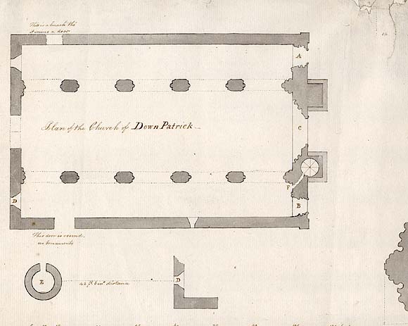
Plan of the Church of DownPatrick
G.B. ; A.C. 30th Oct. 1799
[graphic] /
| Main Creator: | |
|---|---|
| Contributors: | |
| Summary: | Plan of St. Patrick's Cathedral, Downpatrick, County Down, Northern Ireland, with an indication of the location of the Round Tower outside the Cathedral. There is also a plan of the column on top of the capitals, and a ground plan of the columns. |
| Format: | Prints & Drawings |
| Language: | English |
| Published / Created: |
30th October 1799.
|
| Subjects: | |
| Notes: | Inscribed in ink l.c. on sheet: The Tower E is 42 feet in circumference & 67 feet high, the door is placed as in the plan but in the View or Elevation it is turned towards the Spectator to show it - it is even with the ground F Aperture leading to the stair case, it has no form of door, the stair case is 46 feet high & the whole height of the Church 72 feet 4 in.s - all of Freestone. Title inscribed in ink m.l. within image. Watermark is a crowned shield with fleurs-de-lys above the letters "ADRIAAN ROGGE". Physical description: 1 drawing : pen & wash ; image 22.8 x 35.9 cm., on sheet 28 x 43.1 cm. Citations/References: Archaelogical Survey of County Down. - Belfast 1966 p. 266-272 more |
| Credits: | Attributed to Austin Cooper (1759-1830), the original owner of this collection, after an original drawing by Gabriel Beranger (1729-1817). |
