Showing
1 - 16
results of
16
for search '
Will, John.
'
Skip to content
Toggle navigation
NLI Website
- Catalogue -
English
Gaeilge
Home
Help
Advanced Search
Browse
Orders
Ask a Librarian
Language
English
Gaeilge
All Fields
Title
Author
Subject
Call Number
ISBN/ISSN
Publisher
Coordinates
Search digitised content only
FIND
Author
Will, John.
Results
Showing
1 - 16
results of
16
for search '
Will, John.
'
, query time: 0.04s
List
Grid
Sort
Relevance
Newest First
Oldest First
Call Number
Author
Title
Loading...
A map of part of the Farm of St. Sepulchres in the County of Dublin held under his Grace Robt. L...
Loading...
A map of Ballinealoe and Williamstown in the barony of Fore and County of Westmeath, the estate...
Loading...
A survey of a holding in Mary's Abbey belonging [to] Mrs. Mazier. April 1798. By J.B.
Loading...
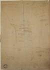
A map of Fyagh [Feagh] in the barony of Kells Lower and County of Meath, the estate of Thomas Bl...
Loading...
A map of the new Line of street called Hatch Street and also of the continuation of Harcourt Str...
Loading...
A map of a Lott of Building ground in the Lordship of Mary's Abbey and County of Dublin belongin...
Loading...
A survey of George Paul Monk Esq holding at St Stephen's Green done for [illegible] Mitchell Esq...
Loading...
A map of a lot of ground on the north side of Sheriff Street in the City of Dublin done for Jame...
Loading...
A survey of part of the lands of Baggots Rath for Francis Thomas Russell. By John Longfield May...
Loading...
A map of a Holding [No.17] on the North side of Cook St in the City of Dublin, let by [illegible...
Loading...
A survey of a holding at St. Stephen's Green held by Mr. Thomas Glynn under Peter Digges Latouch...
Loading...
A map of Eight Lots of Building ground in Frederick Street and in the County of the City of Dubl...
Loading...
[A plan of holdings at] Johnmills in the Barony of Uppercross Co Dublin belonging to John Gilmor...
Loading...
A map of a holding on the East side of Aungier St. In the City of Dublin, known by the name Ram...
Loading...
A map of a piece of ground at Booterstown in the County of Dublin. Surveyed for Counr. Caldbeck...
Loading...
A map of part of the Precincts of St John without Newgate Dublin, the Estate of Thomas & Ralph S...
Get RSS Feed
Email this Search
History
Narrow Search
Digitised
Remove Filters
Clear Filter
Subject: Administration of estates
Clear Filter
Region: Dublin City (Barony)
Format
16
Map
Online Availability
12
Not Digitised
4
Digitised
Published / Created
From:
To:
Subject
Administration of estates
16
Boundaries (Estates)
16
Land tenure
16
Land use surveys
11
History
Author
9
Brownrigg, John, ca. 1748-1838, surveyor
4
Longfield, John, ca. 1775-1833, surveyor
1
Brownrigg & Co., fl. 1801-1809, surveyors
1
Brownrigg & Sherrard, fl. 1777-1778, surveyors
1
Brownrigg, Longfield and Murray, fl. 1799-ca. 1805, surveyors
Collections
16
Longfield Map Collection
Language
16
English
Genre
16
Manuscript maps
16
Maps, Manuscript
11
Early works to 1800
Era
11
18th century
Region
16
Dublin (Ireland : County)
Dublin City (Barony)
16
Ireland
15
Dublin (County)
15
Dublin (Ireland)
12
Dublin
more ...
1
Dublin (Barony)
1
Dublin City
1
Dublin City (Barony))
1
Fore (Barony)
1
Kells Lower (Barony)
1
Meath
1
Meath (Ireland)
1
Rathdown (Barony)
1
Uppercross (Barony)
1
Westmeath
1
Westmeath (Ireland)
see all ...
less ...
Loading...
![A map of Fyagh [Feagh] in the barony of Kells Lower and County of Meath, the estate of Thomas Bligh. Surveyed in September 1787 by J.B.](/IIIF/000310000/000301785/vtls000301785_001.jp2/full/100,/0/default.jpg)

