Showing
1 - 20
results of
49
for search '
Will, John.
'
Skip to content
Toggle navigation
NLI Website
- Catalogue -
English
Gaeilge
Home
Help
Advanced Search
Browse
Orders
Ask a Librarian
Language
English
Gaeilge
All Fields
Title
Author
Subject
Call Number
ISBN/ISSN
Publisher
Coordinates
Search digitised content only
FIND
Author
Will, John.
Results
Showing
1 - 20
results of
49
for search '
Will, John.
'
, query time: 0.04s
List
Grid
Sort
Relevance
Newest First
Oldest First
Call Number
Author
Title
1
2
3
Next
3
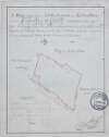
A survey of a holding in Fontstown Marquis of Drogheda estate by J.L. 1826. Tenants names & acreages shown.
Map
Main Creator:
Longfield,
John
, ca. 1775-1833, surveyor
Language:
English
Format:
Map
In collection:
Longfield Map Collection
Published / Created
[1826]
Notes
To view the inset see MS 21 F. 36 / (125). Physical d...
Call Number:
Loading...
Located:
Loading...
A map of Mylarstown [Mylerstown] & Killiagh [Killeagh] in the Island of Allen and County of Kildare the estate of Thomas Smyth held by William Wyly, Joseph & Aaron Mickle. Surveyed February 1765 by John Nettervile. Scale 40 perches to an inch. Table of reference showing tenants & acreage of holdings.
Map
Main Creator:
Netterville,
John
, fl. 1747-1768, surveyor
Language:
English
Format:
Map
In collection:
Longfield Map Collection
Published / Created
[February 1765]
Notes
Physical description: 1 map Geographic Coverage: Bar...
Call Number:
Loading...
Located:
Loading...
A plan of Naas gaol and the adjoining concerns. By J.L. 1824. Scale 20 feet to an inch.
Map
Main Creator:
Longfield,
John
, ca. 1775-1833, surveyor
Language:
English
Format:
Map
In collection:
Longfield Map Collection
Published / Created
[1824]
Notes
Physical description: 1 map Geographic Coverage: Bar...
Call Number:
Loading...
Located:
Loading...
A map of part of the bog of Monasterevin in the County of Kildare the estate of the most noble Charles, Marqis of Drogheda. By J.L. 1811. Names of tenants & acreage of turbary shown.
Map
Main Creator:
Longfield,
John
, ca. 1775-1833, surveyor
Language:
English
Format:
Map
In collection:
Longfield Map Collection
Published / Created
[1811]
Notes
Physical description: 1 map Geographic Coverage: Bar...
Call Number:
Loading...
Located:
Loading...
A survey of part of Corballis in the barony [of Kilkea and Moone] and County of Kildare belonging to Thomas Graydon. By J. Brownrigg 1779. Names of tenants & area of holdings shown.
Map
Main Creator:
Brownrigg,
John
, ca. 1748-1838, surveyor
Language:
English
Format:
Map
In collection:
Longfield Map Collection
Published / Created
[1779]
Notes
Physical description: 1 map Geographic Coverage: Bar...
Call Number:
Loading...
Located:
Loading...
A survey of part of the lands of Ovidstown in the barony of Salt North and County of Kildare the property of Mrs. Smyth. Surveyed by J.L. 1827. Names of tenants & acreage of holdings shown.
Map
Main Creator:
Longfield,
John
, ca. 1775-1833, surveyor
Language:
English
Format:
Map
In collection:
Longfield Map Collection
Published / Created
[1827]
Notes
Physical description: 1 map Geographic Coverage: Bar...
Call Number:
Loading...
Located:
Loading...
A survey of Mylarstown [Mylerstown] in the Islands of Allen barony of Great Connell County of Kildare the estate of Thomas Hutchinson Smyth. By John Brownrigg 1794. Scale 20 perches to an inch. Table of reference, numbered allotments & descriptive details of land with acreage of land tenants names shown.
Map
Main Creator:
Brownrigg,
John
, ca. 1748-1838, surveyor
Language:
English
Format:
Map
In collection:
Longfield Map Collection
Published / Created
[1794]
Notes
Physical description: 1 map Geographic Coverage: Bar...
Call Number:
Loading...
Located:
Loading...
Plan of a piece of ground proposed as a site for a new gaol at Naas. Surveyed by J. Longfield 1825. Scale 50 feet to an inch. Names of tenants shown on properties.
Map
Main Creator:
Longfield,
John
, ca. 1775-1833, surveyor
Language:
English
Format:
Map
In collection:
Longfield Map Collection
Published / Created
[1825]
Notes
Physical description: 1 map Geographic Coverage: Bar...
Call Number:
Loading...
Located:
Loading...
A map of part of the lands of Drummin [Drummond] in the barony of [Upper] Moyfenrath and County of Meath part of the estate of Lady Jane Loftus. Surveyed by J Longfield 1820. Names of tenants shown on holdings. Table of reference with tenants names acreage of holdings
Map
Main Creator:
Longfield,
John
, ca. 1775-1833, surveyor
Language:
English
Format:
Map
In collection:
Longfield Map Collection
Published / Created
[1820]
Notes
Significant staining on the map. A large sticker from...
Call Number:
Loading...
Located:
Loading...
A map of several parcels of ground call'd the Bell lands of Kilcullen, in the County of Kildare part of the estate of the Prebendaries & Vicars of Christ Church Dublin let to [illegible]. Survey'd by J.L. 1809. Table of reference showing tenants names & area of holdings.
Map
Main Creator:
Longfield,
John
, ca. 1775-1833, surveyor
Language:
English
Format:
Map
In collection:
Longfield Map Collection
Published / Created
[1809]
Notes
Physical description: 1 map Geographic Coverage: Bar...
Call Number:
Loading...
Located:
Loading...
A survey of the lands of Ballinlig and Cornamucklagh [near Clonard] in the barony of Carbury and County of Kildare part of the estate of Lady Jane Loftus. By J. Longfield. June 1819. Some tenants names shown on holdings
Map
Main Creator:
Longfield,
John
, ca. 1775-1833, surveyor
Language:
English
Format:
Map
In collection:
Longfield Map Collection
Published / Created
[June 1819]
Notes
Damaged, with some tears and creases. Some staining i...
Call Number:
Loading...
Located:
Loading...
A survey of the lands of Castlekeely in the barony of Clane and County Kildare the estate of John Mansfield. Surveyed by J.L. 1816. Names of tenants shown on some holdings
Map
Main Creator:
Longfield,
John
, ca. 1775-1833, surveyor
Language:
English
Format:
Map
In collection:
Longfield Map Collection
Published / Created
[1816]
Notes
Some staining around the sides of the map. Physical d...
Call Number:
Loading...
Located:
Loading...
A map of the bog of Cloonegad [Clonegath] in the County of Kildare shewing the situation and extent of the several turf banks occupied by sundry tenants of the most noble Charles Marquis of Drogheda. By J.L. 1811.
Map
Main Creator:
Longfield,
John
, ca. 1775-1833, surveyor
Language:
English
Format:
Map
In collection:
Longfield Map Collection
Published / Created
[1811]
Notes
Physical description: 1 map Geographic Coverage: Bar...
Call Number:
Loading...
Located:
Loading...
A survey of the lands & bogs of Cloncarlon [Cloncarlin] near Monasterevin in the County of Kildare occupied by John Cassidy. By J.L. 1815. Scale 16 perches to an inch. Table of reference showing area of profitable and cutaway bog.
Map
Main Creator:
Longfield,
John
, ca. 1775-1833, surveyor
Language:
English
Format:
Map
In collection:
Longfield Map Collection
Published / Created
[1815]
Notes
Physical description: 1 map Geographic Coverage: Bar...
Call Number:
Loading...
Located:
Loading...
A map of the lands of Oughill [Oghil] in the barony of Ophaley [Offaly] west and County of Kildare the estate of the most noble Charles Marquis of Drogheda. Surveyed by John Longfield 1816. Names of tenants and acreage of holdings shown.
Map
Main Creator:
Longfield,
John
, ca. 1775-1833, surveyor
Language:
English
Format:
Map
In collection:
Longfield Map Collection
Published / Created
[1816]
Notes
Physical description: 1 map Geographic Coverage: Bar...
Call Number:
Loading...
Located:
Loading...
A map of a piece of ground [now a plantation] adjoining the concerns of John Cassidy in Monasterevin, the estate of Charles Marquis of Drogheda. Surveyed September 1806. By J.L. Scale 42 feet to an inch.
Map
Main Creator:
Longfield,
John
, ca. 1775-1833, surveyor
Language:
English
Format:
Map
In collection:
Longfield Map Collection
Published / Created
[1806]
Notes
Physical description: 1 map Geographic Coverage: Bar...
Call Number:
Loading...
Located:
Loading...
A survey of part of Carah [Carragh] and part of Raheen in the barony of Clane and County Kildare part of the estate of John Mansfield. By J.L. 1813. Table of reference showing tenants names acreage of holdings
Map
Main Creator:
Longfield,
John
, ca. 1775-1833, surveyor
Language:
English
Format:
Map
In collection:
Longfield Map Collection
Published / Created
[1813]
Notes
Some staining at the top of the map. Physical descrip...
Call Number:
Loading...
Located:
Loading...
A map of Killishee [Killashee] Soordlestown [Swordlestown] etc, in the barony of Naas and County of Kildare belonging to Robert Graydon. By John Brownrigg 1777. Names of tenants shown on some holdings.
Map
Main Creator:
Brownrigg,
John
, ca. 1748-1838, surveyor
Language:
English
Format:
Map
In collection:
Longfield Map Collection
Published / Created
[1777]
Notes
Physical description: 1 map Geographic Coverage: Bar...
Call Number:
Loading...
Located:
Loading...
A map of the lands of his Grace the Archbishop of Dublin situate near Ballymore Eustace in the County of Kildare. Surveyed in June 1828 by John Byrne. Scale of 40 perches to an inch. Tenants names shown on holdings. Table of reference showing tenants names and area of holdings.
Map
Main Creator:
Byrne,
John
, fl. 1789-1828, surveyor
Language:
English
Format:
Map
In collection:
Longfield Map Collection
Published / Created
[June 1828]
Notes
Physical description: 1 map Geographic Coverage: Bar...
Call Number:
Loading...
Located:
Loading...
A map of part of the Glebe lands of Kilcullen in the County of Kildare, granted by the Rev. Thomas Brownrigg Chancellor of the cathedral church of the Holy and Undivided Trinity Dublin to the Rev. J. Hardy and his successors as an additional Glebe to the parish of Killcullen. Surveyed by John Longfield 1822. Scale 20 perches to an inch. Table of reference showing tenants names & area of holdings.
Map
Main Creator:
Longfield,
John
, ca. 1775-1833, surveyor
Language:
English
Format:
Map
In collection:
Longfield Map Collection
Published / Created
[1822]
Notes
Physical description: 1 map Geographic Coverage: Par...
Call Number:
Loading...
Located:
Loading...
1
2
3
Next
3
Get RSS Feed
Email this Search
History
Narrow Search
Digitised
Remove Filters
Clear Filter
Subject: Land use surveys
Clear Filter
Region: Kildare (County)
Format
49
Map
Online Availability
46
Digitised
3
Not Digitised
Published / Created
From:
To:
Subject
49
Administration of estates
49
Boundaries (Estates)
49
Land tenure
Land use surveys
7
History
Author
39
Longfield, John, ca. 1775-1833, surveyor
6
Brownrigg, John, ca. 1748-1838, surveyor
1
Brownrigg & Co., fl. 1801-1809, surveyors
1
Byrne, John, fl. 1789-1828, surveyor
1
Logan, John, fl. 1827-1846, surveyor
1
Netterville, John, fl. 1747-1768, surveyor
Collections
49
Longfield Map Collection
Language
49
English
Genre
49
Manuscript maps
49
Maps, Manuscript
7
Early works to 1800
Era
7
18th century
Region
49
Ireland
Kildare (County)
49
Kildare (Ireland : County)
18
Offaly West (Barony)
5
Kilcullen (Barony)
5
Naas South (Barony)
more ...
4
Connell (Barony)
4
Salt North (Barony)
4
Salt South (Barony)
3
Clane (Barony)
3
Naas North (Barony)
2
Ballymore Eustace Parish
2
Ballymore Eustace Parish (Ireland)
1
Carbury (Barony)
1
Kilcullen Parish
1
Kilcullen Parish (Ireland)
1
Kilkea and Moone (Barony)
1
Killcullen Parish
1
Killcullen Parish (Ireland)
1
Monasterevin Parish
1
Monasterevin Parish (Ireland)
1
Narragh and Reban East (Barony)
1
Upper Moyfemath (Barony)
see all ...
less ...
Loading...
![A map of Mylarstown [Mylerstown] & Killiagh [Killeagh] in the Island of Allen and County of Kildare the estate of Thomas Smyth held by William Wyly, Joseph & Aaron Mickle. Surveyed February 1765 by John Nettervile. Scale 40 perches to an inch. Table of reference showing tenants & acreage of holdings.](/IIIF/000310000/000302034/vtls000302034_001.jp2/full/100,/0/default.jpg)


![A survey of part of Corballis in the barony [of Kilkea and Moone] and County of Kildare belonging to Thomas Graydon. By J. Brownrigg 1779. Names of tenants & area of holdings shown.](/IIIF/000310000/000302010/vtls000302010_001.jp2/full/100,/0/default.jpg)

![A survey of Mylarstown [Mylerstown] in the Islands of Allen barony of Great Connell County of Kildare the estate of Thomas Hutchinson Smyth. By John Brownrigg 1794. Scale 20 perches to an inch. Table of reference, numbered allotments & descriptive details of land with acreage of land tenants names shown.](/IIIF/000310000/000301989/vtls000301989_001.jp2/full/100,/0/default.jpg)

![A map of part of the lands of Drummin [Drummond] in the barony of [Upper] Moyfenrath and County of Meath part of the estate of Lady Jane Loftus. Surveyed by J Longfield 1820. Names of tenants shown on holdings. Table of reference with tenants names acreage of holdings](/IIIF/000310000/000301970/vtls000301970_001.jp2/full/100,/0/default.jpg)
![A map of several parcels of ground call'd the Bell lands of Kilcullen, in the County of Kildare part of the estate of the Prebendaries & Vicars of Christ Church Dublin let to [illegible]. Survey'd by J.L. 1809. Table of reference showing tenants names & area of holdings.](/IIIF/000310000/000302001/vtls000302001_001.jp2/full/100,/0/default.jpg)
![A survey of the lands of Ballinlig and Cornamucklagh [near Clonard] in the barony of Carbury and County of Kildare part of the estate of Lady Jane Loftus. By J. Longfield. June 1819. Some tenants names shown on holdings](/IIIF/000310000/000301969/vtls000301969_001.jp2/full/100,/0/default.jpg)

![A map of the bog of Cloonegad [Clonegath] in the County of Kildare shewing the situation and extent of the several turf banks occupied by sundry tenants of the most noble Charles Marquis of Drogheda. By J.L. 1811.](/IIIF/000310000/000302206/vtls000302206_001.jp2/full/100,/0/default.jpg)
![A survey of the lands & bogs of Cloncarlon [Cloncarlin] near Monasterevin in the County of Kildare occupied by John Cassidy. By J.L. 1815. Scale 16 perches to an inch. Table of reference showing area of profitable and cutaway bog.](/IIIF/000310000/000302062/vtls000302062_001.jp2/full/100,/0/default.jpg)
![A map of the lands of Oughill [Oghil] in the barony of Ophaley [Offaly] west and County of Kildare the estate of the most noble Charles Marquis of Drogheda. Surveyed by John Longfield 1816. Names of tenants and acreage of holdings shown.](/IIIF/000310000/000302067/vtls000302067_001.jp2/full/100,/0/default.jpg)
![A map of a piece of ground [now a plantation] adjoining the concerns of John Cassidy in Monasterevin, the estate of Charles Marquis of Drogheda. Surveyed September 1806. By J.L. Scale 42 feet to an inch.](/IIIF/000310000/000302176/vtls000302176_001.jp2/full/100,/0/default.jpg)
![A survey of part of Carah [Carragh] and part of Raheen in the barony of Clane and County Kildare part of the estate of John Mansfield. By J.L. 1813. Table of reference showing tenants names acreage of holdings](/IIIF/000310000/000301977/vtls000301977_001.jp2/full/100,/0/default.jpg)
![A map of Killishee [Killashee] Soordlestown [Swordlestown] etc, in the barony of Naas and County of Kildare belonging to Robert Graydon. By John Brownrigg 1777. Names of tenants shown on some holdings.](/IIIF/000310000/000302012/vtls000302012_001.jp2/full/100,/0/default.jpg)