Showing
1 - 20
results of
130
for search '
Will, John.
'
Skip to content
Toggle navigation
NLI Website
- Catalogue -
English
Gaeilge
Home
Help
Advanced Search
Browse
Orders
Ask a Librarian
Language
English
Gaeilge
All Fields
Title
Author
Subject
Call Number
ISBN/ISSN
Publisher
Coordinates
Search digitised content only
FIND
Author
Will, John.
Results
Showing
1 - 20
results of
130
for search '
Will, John.
'
, query time: 0.06s
List
Grid
Sort
Relevance
Newest First
Oldest First
Call Number
Author
Title
1
2
3
4
5
6
7
Next
7
Loading...
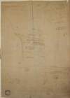
A map of a piece of ground on the west side of Church St in the City of Dublin being part of the...
Loading...
A map of a piece of ground situate on the north side of Henry St in the City of Dublin, the prop...
Loading...
A map of several plots of ground with many buildings theron situate on Church Street, Greek St a...
Loading...
A map of the precincts of Christ Church showing the part about to be purchased by the Commission...
Loading...
A map of a parcel of ground in St. Sepulchres in the County of Dublin let by John Hatch to Rober...
Loading...
A survey of part of the farm of St. Sepulchre's in the County of Dublin let by His Grace Robert...
Loading...
A map of that part of the Royal Canal intended to pass through the County of Dublin from Summer...
Loading...
A map of a lot of ground between Boyne Street and Denzile Street the property of Thomas Hamilton...
Loading...
A map of a concern on Constitution Hill in the County of the City of Dublin. Surveyed for Mr. J...
Loading...
A map of a holding in Blessington St in the City of Dublin let to Charles Hunt. Surveyed by J....
Loading...
A map of a piece of ground situate on the west side of New Bride St and in the County of the Cit...
Loading...
A map of part of the farm of St. Sepulchres in County of Dublin held under His Grace Robt. Lord...
Loading...
A survey of a holding on the east side of Meath Street, Dublin, the property of the poor of the...
Loading...
A map of a lot of ground lying on the north side of Merrion Row formerly belonging to Susanna La...
Loading...
A map of Ballinealoe and Williamstown in the barony of Fore and County of Westmeath, the estate...
Loading...
A map of a concern in Brides St and Cannon St part of the Treasurer's garden belonging to the De...
Loading...
A map of part of Lloyd's Rope walk and sundry other premises lying on the north side of Lower Ab...
Loading...
A survey of six holdings situated in Brown Street done by order of Henry Rooke. By John Longfie...
Loading...
A survey of three houses in Queen Street part of the estate of the Marquis of Lansdowne. Survey...
Loading...
A map of two holdings on the north side of St Stephens Green in the City of Dublin. Surveyed by...
1
2
3
4
5
6
7
Next
7
Get RSS Feed
Email this Search
History
Narrow Search
Digitised
Remove Filters
Clear Filter
Subject: Land use surveys
Clear Filter
Region: Dublin (Ireland)
Clear Filter
Format: Map
Format
Map
Online Availability
125
Not Digitised
5
Digitised
Published / Created
From:
To:
Subject
130
Administration of estates
130
Boundaries (Estates)
130
Land tenure
Land use surveys
41
History
Author
70
Longfield, John, ca. 1775-1833, surveyor
38
Brownrigg, John, ca. 1748-1838, surveyor
17
Brownrigg & Co., fl. 1801-1809, surveyors
3
Brownrigg, Longfield and Murray, fl. 1799-ca. 1805, surveyors
1
Brownrigg & Sherrard, fl. 1777-1778, surveyors
1
Roe, John, fl. 1793-1824, surveyor
Collections
130
Longfield Map Collection
Language
130
English
Genre
130
Manuscript maps
130
Maps, Manuscript
41
Early works to 1800
Era
41
18th century
Region
130
Dublin (Ireland : County)
Dublin (Ireland)
130
Ireland
129
Dublin (County)
127
Dublin
15
Dublin City (Barony)
more ...
3
Dublin (Barony)
1
Dublin City
1
Dublin City (Barony))
1
Fore (Barony)
1
Kells Lower (Barony)
1
Meath
1
Meath (Ireland)
1
Rathdown (Barony)
1
St. John Parish
1
St. John Parish (Ireland)
1
St. Michan's Parish
1
St. Michan's Parish (Ireland)
1
Uppercross (Barony)
1
Westmeath
1
Westmeath (Ireland)
see all ...
less ...
Loading...