Showing
141 - 160
results of
631
for search '
Will, John.
'
Skip to content
Toggle navigation
NLI Website
- Catalogue -
English
Gaeilge
Home
Help
Advanced Search
Browse
Orders
Ask a Librarian
Language
English
Gaeilge
All Fields
Title
Author
Subject
Call Number
ISBN/ISSN
Publisher
Coordinates
Search digitised content only
FIND
Author
Will, John.
Results
Showing
141 - 160
results of
631
for search '
Will, John.
'
, query time: 0.05s
List
Grid
Sort
Relevance
Newest First
Oldest First
Call Number
Author
Title
1
Previous
3
4
5
6
7
8
9
10
11
12
13
Next
32
A map of the lands of Harristown in the barony of Moyfenrath Upper and County of Meath part of the estate of the Marquis of Landsdowne. Surveyed by John Longfield. Scale 20 perches to an inch. Names of some tenants, acreage of holdings shown.
Map
Main Creator:
Longfield,
John
, ca. 1775-1833, surveyor
Language:
English
Format:
Map
In collection:
Longfield Map Collection
Published / Created
[between 1795 and 1833]
Notes
Physical description: 1 map Geographic Coverage: Bar...
Call Number:
Loading...
Located:
Loading...
The whole contains exclusive of the road on Morristown Ridge 14 acres 0 roods and 37 perches Irish or 23 acres, 0 roods and 8 perches British... /
1832.
Map
Main Creator:
Byrne,
John
, fl. 1789-1828, surveyor
Language:
English
Format:
Map
In collection:
Mansfield papers, 1565-1954
Published / Created
1832.
Notes
Map shows holdings at Morristown County Kildare, Prov...
Call Number:
Loading...
Located:
Loading...
View Context
A map of a holding at Hollybrook Park near Clontarf in the County of Dublin let by [illegible] Armstrong Esq. To [illegible] Surveyed by J.L. 1812. Scale 100 Feet to an Inch.
Map
Main Creator:
Longfield,
John
, ca. 1775-1833, surveyor
Language:
English
Format:
Map
In collection:
Longfield Map Collection
Published / Created
[1812]
Notes
Physical description: 1 map Geographic Coverage: Bar...
Call Number:
Loading...
Located:
Loading...
A survey of part of the Lands of Roganstown in the Barony of Nethercross and County of Dublin let to Wm. Disney Esq. Survey'd by J.L. March 1815
Map
Main Creator:
Longfield,
John
, ca. 1775-1833, surveyor
Language:
English
Format:
Map
In collection:
Longfield Map Collection
Published / Created
[March 1815]
Notes
Physical description: 1 map Geographic Coverage: Bar...
Call Number:
Loading...
Located:
Loading...
A map of Bay View & Mount Pleasant in the Barony of Coolock & County of Dublin belonging to Robt. Burton Esq. Surveyed by J. Brownrigg 1792. Scale 10 Perches to an Inch
Map
Main Creator:
Brownrigg,
John
, ca. 1748-1838, surveyor
Language:
English
Format:
Map
In collection:
Longfield Map Collection
Published / Created
[1792]
Notes
Physical description: 1 map Geographic Coverage: Bar...
Call Number:
Loading...
Located:
Loading...
A map of Part of the Lands of Churchtown in the Co Dublin, the property of Mr. Leasam. Survey'd by J. Longfield 1819. Scale 10 Perches to an Inch.
Map
Main Creator:
Longfield,
John
, ca. 1775-1833, surveyor
Language:
English
Format:
Map
In collection:
Longfield Map Collection
Published / Created
[1819]
Notes
Physical description: 1 map Geographic Coverage: Bar...
Call Number:
Loading...
Located:
Loading...
A survey of Mylarstown [Mylerstown] in the Islands of Allen barony of Great Connell County of Kildare the estate of Thomas Hutchinson Smyth. By John Brownrigg 1794. Scale 20 perches to an inch. Table of reference, numbered allotments & descriptive details of land with acreage of land tenants names shown.
Map
Main Creator:
Brownrigg,
John
, ca. 1748-1838, surveyor
Language:
English
Format:
Map
In collection:
Longfield Map Collection
Published / Created
[1794]
Notes
Physical description: 1 map Geographic Coverage: Bar...
Call Number:
Loading...
Located:
Loading...
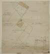
A map of part of the Demense of Malahide, with parts of Streamstown Mayfield & Auburn, the whole formerly call'd Mabstown, in the B[arony] of Coolock & Co. Dublin - traced from the Down Survey. Order of the Rt. Revd. the Dean & Chapter of C.C. [Christ Church] Dublin. By J.L. 1816
Map
Main Creator:
Longfield,
John
, ca. 1775-1833, surveyor
Language:
English
Format:
Map
In collection:
Longfield Map Collection
Published / Created
[1816]
Notes
Physical description: 1 map Geographic Coverage: Bar...
Call Number:
Loading...
Located:
Loading...
A map of a holding in Skippers Alley in the City of Dublin. The estate of [illegible] Ball, Esq Surveyed by J.L. 1814. Names of tenants shown on property.
Map
Main Creator:
Longfield,
John
, ca. 1775-1833, surveyor
Language:
English
Format:
Map
In collection:
Longfield Map Collection
Published / Created
[1814]
Notes
Physical description: 1 map Geographic Coverage: Dub...
Call Number:
Loading...
Located:
Loading...
A survey of a Lott of ground in Whites Avenue [Merrion] in the Parish of Donnybrook and Co of Dublin, done Frans. Lowe Esq by J.L. 1819. Scale 10 Perches to an Inch
Map
Main Creator:
Longfield,
John
, ca. 1775-1833, surveyor
Language:
English
Format:
Map
In collection:
Longfield Map Collection
Published / Created
[1819]
Notes
Physical description: 1 map Geographic Coverage: Bar...
Call Number:
Loading...
Located:
Loading...
A survey of Bonnianstown [Bunnianstown] in the parish of Ardcath barony of Duleek Upper and County of Meath part of Lord Shelbournes estates. By John Longfield, May 1824. Table of reference showing fields & acreage.
Map
Main Creator:
Longfield,
John
, ca. 1775-1833, surveyor
Language:
English
Format:
Map
In collection:
Longfield Map Collection
Published / Created
[May 1824]
Notes
Physical description: 1 map Geographic Coverage: Par...
Call Number:
Loading...
Located:
Loading...
Plan of a piece of ground proposed as a site for a new gaol at Naas. Surveyed by J. Longfield 1825. Scale 50 feet to an inch. Names of tenants shown on properties.
Map
Main Creator:
Longfield,
John
, ca. 1775-1833, surveyor
Language:
English
Format:
Map
In collection:
Longfield Map Collection
Published / Created
[1825]
Notes
Physical description: 1 map Geographic Coverage: Bar...
Call Number:
Loading...
Located:
Loading...
[A map of] Part of Rathcoole. Surveyed by J. Longfield 1827. Scale 16 Perches to an Inch.
Map
Main Creator:
Longfield,
John
, ca. 1775-1833, surveyor
Language:
English
Format:
Map
In collection:
Longfield Map Collection
Published / Created
[1827]
Notes
Physical description: 1 map Geographic Coverage: Bar...
Call Number:
Loading...
Located:
Loading...
A map of ground on the east side of Constitution Hill in the County of Dublin called Plover Park part of the estate of the Prebendaries and Vicars of Christ Church let to Richard Wilson. Surveyed by John Longfield 1816. Scale 40 feet to an inch
Map
Main Creator:
Longfield,
John
, ca. 1775-1833, surveyor
Language:
English
Format:
Map
In collection:
Longfield Map Collection
Published / Created
[1816]
Notes
Physical description: 1 map Geographic Coverage: Dub...
Call Number:
Loading...
Located:
Loading...
A map of several holdings on the north side of Brunswick St in the County of the City of Dublin part of the estate of the Prebendaries & Vicars of Christ Church. Surveyed by J. Longfield 1817. Scale 40 feet to an Inch. Tenants names show on properties
Map
Main Creator:
Longfield,
John
, ca. 1775-1833, surveyor
Language:
English
Format:
Map
In collection:
Longfield Map Collection
Published / Created
[1817]
Notes
Physical description: 1 map Geographic Coverage: Dub...
Call Number:
Loading...
Located:
Loading...
A map of part of the Lands of St. Dowlaghs call'd Ballymacarte in the County of Dublin, the estate of the Chantor of Christ Church. Survey'd by Jn.. Longfield 1814. Scale 20 Perches to an Inch
Map
Main Creator:
Longfield,
John
, ca. 1775-1833, surveyor
Language:
English
Format:
Map
In collection:
Longfield Map Collection
Published / Created
[1814]
Notes
Physical description: 1 map Geographic Coverage: Bar...
Call Number:
Loading...
Located:
Loading...
An accurate survey of part of the Honble. Colonel Wentworth Harman's estate in the County of Longford barony of Moydow and parish of Ballynacormick ... taken by William Nevill in 1722 and copied by John Brownrigg in 1784. Scale of 40 perches to an inch. Table of reference showing denominations, tenants & acreage.
Map
Main Creator:
Brownrigg,
John
, ca. 1748-1838, surveyor
Language:
English
Format:
Map
In collection:
Longfield Map Collection
Published / Created
[1784]
Notes
Physical description: 1 map Geographic Coverage: Par...
Call Number:
Loading...
Located:
Loading...
A survey of a holding on the west side of Usher's Court in the City of Dublin the estate of the Dean & Chapter of Christ Church let to [illegible] McEvoy. By J.L. April 1831. Names of adjoining tenants shown.
Map
Main Creator:
Longfield,
John
, ca. 1775-1833, surveyor
Language:
English
Format:
Map
In collection:
Longfield Map Collection
Published / Created
[April 1831]
Notes
Physical description: 1 map Geographic Coverage: Dub...
Call Number:
Loading...
Located:
Loading...
A map of a proposed line of new Road to shorten the carriage way from Balls Bridge to the new Church and Bridge of Donnybrook in the Co. of Dublin. Survey'd & Laid out by John Longfield in April 1825 [?]. Scale 10 Perches to an Inch
Map
Main Creator:
Longfield,
John
, ca. 1775-1833, surveyor
Language:
English
Format:
Map
In collection:
Longfield Map Collection
Published / Created
[April 1825]
Notes
Physical description: 1 map Geographic Coverage: Bar...
Call Number:
Loading...
Located:
Loading...
A survey of part of Mr. Bunbury's estate near the Naul in the barony of Duleek Upper and County of Meath. Surveyed in June 1825. By J. Longfield. Scale 10 perches to an inch. Names of tenants & acreage of holdings shown.
Map
Main Creator:
Longfield,
John
, ca. 1775-1833, surveyor
Language:
English
Format:
Map
In collection:
Longfield Map Collection
Published / Created
[June 1825]
Notes
Two significant creases on map. Physical description:...
Call Number:
Loading...
Located:
Loading...
1
Previous
3
4
5
6
7
8
9
10
11
12
13
Next
32
Get RSS Feed
Email this Search
History
Narrow Search
Digitised
Remove Filters
Clear Filter
Subject: Land use surveys
Format
630
Map
1
Manuscript
Online Availability
367
Not Digitised
264
Digitised
Published / Created
From:
To:
Subject
Land use surveys
530
Land tenure
526
Boundaries (Estates)
524
Administration of estates
126
History
116
Administration of Estates
more ...
105
Estates
101
Cartography
101
Maps and Surveys
101
Surveyors
97
Maps
4
Eviction
4
Farm rents
4
Landlord and tenant
4
Tenant farmers
see all ...
less ...
Author
338
Longfield, John, ca. 1775-1833, surveyor
113
Brownrigg, John, ca. 1748-1838, surveyor
42
Brownrigg & Co., fl. 1801-1809, surveyors
28
Tully, John, fl. 1781
21
Dolan, John, fl. 1799-1828
11
Hill, John
more ...
7
Brownrigg, Longfield and Murray, fl. 1799-ca. 1805, surveyors
6
Longfield, William, fl. 1825-ca. 1870, surveyor
5
Byrne, John, fl. 1789-1828, surveyor
4
Netterville, John, fl. 1747-1768, surveyor
4
Scalé, Brownrigg & Sherrard, fl. 1774-1778, surveyors
3
Brooks, John
3
Evans, John, fl. 1771-1803
3
Roe, John, fl. 1793-1824, surveyor
2
Altamont, Earls of
2
Brownrigg & Sherrard, fl. 1777-1778, surveyors
2
Moynahan, John, fl. 1736-1764, surveyor
2
O'Brien, William, 1881-1968
1
Balfe, M., fl. 1821, surveyor
1
Battersby, John, fl. 1778, surveyor
1
Bell, John (I and II), fl. 1721-1820
1
Berne, John, fl. 1757
1
Browne, John, fl. 1788-ca. 1807, surveyor
1
Bruster, John
1
Connolly, John, fl. 1826, surveyor
1
Connors, John
1
Daly, Timothy
1
Dawson, John fl. 1811 Surveyor
1
Frain, James 1788-1832 Surveyor
1
Gorman, John
see all ...
less ...
Collections
527
Longfield Map Collection
38
Bellew of Mount Bellew Papers
37
Leitrim Papers, 1749-1952.
6
Mansfield papers, 1565-1954
4
vtls000364409
3
Doneraile Papers, 1607-1961.
more ...
3
Westport Estate papers, 1540-1993.
2
Clonbrock papers, 1624-1965
2
Gardiner Papers, ca. 1667-1898.
1
Bellingham Papers, 1681-1912
1
Bruen of Oak Park Papers
1
Considine Papers, 1764-1912
1
D'Arcy of Hyde Park Papers, 1720-2001.
1
Doyne Family and Estate Papers, c.1660-1939
1
Killadoon Papers (Clements Papers), 1588-1931.
1
vtls000260613
1
vtls000364523
see all ...
less ...
Language
631
English
Genre
626
Manuscript maps
526
Maps, Manuscript
126
Early works to 1800
Era
126
18th century
1
1780-1840
Region
627
Ireland
321
Dublin (Ireland : County)
320
Dublin (County)
130
Dublin (Ireland)
128
Dublin
58
Meath
more ...
58
Meath (Ireland)
57
Rathdown (Barony)
49
Kildare (County)
49
Kildare (Ireland : County)
46
Roscommon (County)
43
Galway (County)
41
Limerick (County)
40
Coolock (Barony)
27
Uppercross (Barony)
21
Newcastle (Barony)
18
Offaly West (Barony)
17
Dublin (Barony)
16
Castleknock (Barony)
16
Dublin City (Barony)
16
Nethercross (Barony)
13
Wicklow (County)
13
Wicklow (Ireland : County)
12
Westmeath
12
Westmeath (Ireland)
11
Balrothery (Barony)
10
Roscommon (Ireland : County)
9
Duleek Upper (Barony)
9
Laois
9
Laois (Ireland)
see all ...
less ...
Loading...

![A map of a holding at Hollybrook Park near Clontarf in the County of Dublin let by [illegible] Armstrong Esq. To [illegible] Surveyed by J.L. 1812. Scale 100 Feet to an Inch.](/IIIF/000310000/000301170/vtls000301170_001.jp2/full/100,/0/default.jpg)
![A survey of Mylarstown [Mylerstown] in the Islands of Allen barony of Great Connell County of Kildare the estate of Thomas Hutchinson Smyth. By John Brownrigg 1794. Scale 20 perches to an inch. Table of reference, numbered allotments & descriptive details of land with acreage of land tenants names shown.](/IIIF/000310000/000301989/vtls000301989_001.jp2/full/100,/0/default.jpg)
![A map of part of the Demense of Malahide, with parts of Streamstown Mayfield & Auburn, the whole formerly call'd Mabstown, in the B[arony] of Coolock & Co. Dublin - traced from the Down Survey. Order of the Rt. Revd. the Dean & Chapter of C.C. [Christ Church] Dublin. By J.L. 1816](/IIIF/000310000/000301174/vtls000301174_001.jp2/full/100,/0/default.jpg)
![A survey of Bonnianstown [Bunnianstown] in the parish of Ardcath barony of Duleek Upper and County of Meath part of Lord Shelbournes estates. By John Longfield, May 1824. Table of reference showing fields & acreage.](/IIIF/000310000/000301742/vtls000301742_001.jp2/full/100,/0/default.jpg)


