Showing
1 - 20
results of
58
for search '
Will, John.
'
Skip to content
Toggle navigation
NLI Website
- Catalogue -
English
Gaeilge
Home
Help
Advanced Search
Browse
Orders
Ask a Librarian
Language
English
Gaeilge
All Fields
Title
Author
Subject
Call Number
ISBN/ISSN
Publisher
Coordinates
Search digitised content only
FIND
Author
Will, John.
Results
Showing
1 - 20
results of
58
for search '
Will, John.
'
, query time: 0.04s
List
Grid
Sort
Relevance
Newest First
Oldest First
Call Number
Author
Title
1
2
3
Next
3
Longitudinal and transverse sections of that part of the river Blackwater adjoining the lands of Mullaghard Rathaldron and Liscartan in the County of Meath. Surveyed by John Long under the direction of William F. Mulvany C.E.
Map
Main Creator:
Longfield,
John
, ca. 1775-1833, surveyor
Language:
English
Format:
Map
In collection:
Longfield Map Collection
Published / Created
[between 1795 and 1833]
Notes
For other sections of the river Blackwater see: MS 21...
Call Number:
Loading...
Located:
Loading...
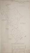
A survey of the lands of Johnstown in the barony of Duleek Upper and County of Meath. By J.B. August 31 [17]96. Scale 20 perches to an inch. Names of tenants & acreage of holdings shown.
Map
Main Creator:
Brownrigg,
John
, ca. 1748-1838, surveyor
Language:
English
Format:
Map
In collection:
Longfield Map Collection
Published / Created
[August 31 1796]
Notes
Physical description: 1 map Geographic Coverage: Bar...
Call Number:
Loading...
Located:
Loading...
A map of the lands of Harristown in the barony of Moyfenrath Upper and County of Meath part of the estate of the Marquis of Landsdowne. Surveyed by John Longfield. Scale 20 perches to an inch. Names of some tenants, acreage of holdings shown.
Map
Main Creator:
Longfield,
John
, ca. 1775-1833, surveyor
Language:
English
Format:
Map
In collection:
Longfield Map Collection
Published / Created
[between 1795 and 1833]
Notes
Physical description: 1 map Geographic Coverage: Bar...
Call Number:
Loading...
Located:
Loading...
A map of the demense and lands of Williamstown in the barony of Kells Upper and County of Meath. Surveyed in May 1824 by John Roe. Scale 20 perches to an inch. On reverse - a letter from John Longfield, 18 January 1825, On the condition of the house & lands & their probable value.
Map
Main Creator:
Roe,
John
, fl. 1793-1824, surveyor
Language:
English
Format:
Map
In collection:
Longfield Map Collection
Published / Created
[May 1824]
Notes
Physical description: 1 map Geographic Coverage: Bar...
Call Number:
Loading...
Located:
Loading...
Longitudinal and transverse sections of that part of the river Blackwater adjoining the lands of Mullaghard Rathaldron and Liscartan in the County of Meath. Surveyed by John Long under the direction of William F. Mulvany C.E.
Map
Main Creator:
Longfield,
John
, ca. 1775-1833, surveyor
Language:
English
Format:
Map
In collection:
Longfield Map Collection
Published / Created
[between 1795 and 1833]
Notes
For other sections of the river Blackwater see: MS 2...
Call Number:
Loading...
Located:
Loading...
A survey of the lands of Bedlowstown [Bellewstown] in the lower barony of Navan and County of Meath part of the estate of Nathanill Preston. Surveyed April 1813. By John Longfield. Names of tenants and acreage of holdings shown.
Map
Main Creator:
Longfield,
John
, ca. 1775-1833, surveyor
Language:
English
Format:
Map
In collection:
Longfield Map Collection
Published / Created
[April 1813]
Notes
Physical description: 1 map Geographic Coverage: Bar...
Call Number:
Loading...
Located:
Loading...
Section of that part of the river Blackwater between Ratholdron weir and the Dhuoag stream at Mullahard in the County of Meath. Surveyed by John Long under the direction of William F. Mulvany C.E.
Map
Main Creator:
Longfield,
John
, ca. 1775-1833, surveyor
Language:
English
Format:
Map
In collection:
Longfield Map Collection
Published / Created
[between 1795 and 1833]
Notes
For other sections of the river Blackwater see MS 21...
Call Number:
Loading...
Located:
Loading...
A survey of the lands of Mullanevally [Mullaghavally] in the barony of Lower Kells and County of Meath the estate of Thomas S. Whyte. By J. L. 1822. Scale 20 perches to an inch. Tenants names & acreage of holdings shown.
Map
Main Creator:
Longfield,
John
, ca. 1775-1833, surveyor
Language:
English
Format:
Map
In collection:
Longfield Map Collection
Published / Created
[1822]
Notes
Physical description: 1 map Geographic Coverage: Bar...
Call Number:
Loading...
Located:
Loading...
A survey of Cloughan [Cloghan] in the barony of Upper Duleek County of Dublin the estate of General Hawkshaw. Surveyed by John Longfield. 1816. Scale 20 perches to an inch. Names of tenants shown on holdings and in table of reference with acreage of holdings.
Map
Main Creator:
Longfield,
John
, ca. 1775-1833, surveyor
Language:
English
Format:
Map
In collection:
Longfield Map Collection
Published / Created
[1816]
Notes
There is a large crease running through the map. Phys...
Call Number:
Loading...
Located:
Loading...
Section line of the bounds ditch & stream between Killiskilling [Killaskillen] & Anne Mount, near Kinnegad part of the estate of the most noble the Marquis of Lansdowne. By John Longfield. June 1822. Estimate shown. Scale 10 perches to an inch in length. 10 feet to an inch in height.
Map
Main Creator:
Longfield,
John
, ca. 1775-1833, surveyor
Language:
English
Format:
Map
In collection:
Longfield Map Collection
Published / Created
[June 1822]
Notes
Physical description: 1 map Geographic Coverage: Bar...
Call Number:
Loading...
Located:
Loading...
A survey of part of the lands of Woodtown in the barony of Deece Upper and County of Meath, the estate of the late J. Wilson. By J. Brownrigg 1793. Scale 20 perches to an inch. Names of tenants & acreage of holdings shown.
Map
Main Creator:
Brownrigg,
John
, ca. 1748-1838, surveyor
Language:
English
Format:
Map
In collection:
Longfield Map Collection
Published / Created
[1793]
Notes
Physical description: 1 map Geographic Coverage: Bar...
Call Number:
Loading...
Located:
Loading...
A map of part of the estate of the Revd. Archdeacon Synge situate in the barony of Duleek and County of Meath. Surveyed by John Longfield 1808.
Map
Main Creator:
Longfield,
John
, ca. 1775-1833, surveyor
Language:
English
Format:
Map
In collection:
Longfield Map Collection
Published / Created
[1808]
Notes
Inset map: "A map of a holding at the village of Morn...
Call Number:
Loading...
Located:
Loading...
Section of that part of the river Blackwater between Ratholdron weir and the Dhuoag stream at Mullahard in the County of Meath. Surveyed by John Long under the direction of William F. Mulvany C.E.
Map
Main Creator:
Longfield,
John
, ca. 1775-1833, surveyor
Language:
English
Format:
Map
In collection:
Longfield Map Collection
Published / Created
[between 1795 and 1833]
Notes
For other sections of the river Blackwater see MS 21...
Call Number:
Loading...
Located:
Loading...
A map of Caulstown in the parish and barony of Dunboyne and County of Meath. Surveyed in April 1830 by J.L. Scale 16 plantation perches to an inch. Table of reference showing tenants & acreage of holdings.
Map
Main Creator:
Longfield,
John
, ca. 1775-1833, surveyor
Language:
English
Format:
Map
In collection:
Longfield Map Collection
Published / Created
[April 1830]
Notes
Physical description: 1 map Geographic Coverage: Par...
Call Number:
Loading...
Located:
Loading...
A map of that part of the river Boyne from [Slaney forde?] to the [Killy river?] in the County of Meath. Surveyed by J. L. 1829.
Map
Main Creator:
Longfield,
John
, ca. 1775-1833, surveyor
Language:
English
Format:
Map
In collection:
Longfield Map Collection
Published / Created
[between 1795 and 1833]
Notes
For adjoining sections of the river Blackwater see MS...
Call Number:
Loading...
Located:
Loading...
A map of the tillage ground of Loughlanstown [Loughlinstown] in the barony of Ratoath and County of Meath. Surveyed for Wm. Fletcher by J.L. March 17, 1809. Scale 16 perches to an inch. Nams of adjoining owners shown.
Map
Main Creator:
Longfield,
John
, ca. 1775-1833, surveyor
Language:
English
Format:
Map
In collection:
Longfield Map Collection
Published / Created
[March 17 1809]
Notes
Physical description: 1 map Geographic Coverage: Bar...
Call Number:
Loading...
Located:
Loading...
A map of part of Great Pace [Pace] for the Marquis of Lansdowne. By J.L. March, 1826. Scale 10 perches to an inch. Table of reference showing tenants & acreage of holdings.
Map
Main Creator:
Longfield,
John
, ca. 1775-1833, surveyor
Language:
English
Format:
Map
In collection:
Longfield Map Collection
Published / Created
[March 1826]
Notes
Physical description: 1 map Geographic Coverage: Bar...
Call Number:
Loading...
Located:
Loading...
A map of Cornahova [Cornahoova] in the barony of Morgallion and County of Meath. The estate of Lord Viscount Gormanstown. Surveyed by John Longfield, 1816. Scale 20 perches to an inch. Names of tenants & acreage of holdings shown.
Map
Main Creator:
Longfield,
John
, ca. 1775-1833, surveyor
Language:
English
Format:
Map
In collection:
Longfield Map Collection
Published / Created
[1816]
Notes
Physical description: 1 map Geographic Coverage: Bar...
Call Number:
Loading...
Located:
Loading...
A survey of the lands of Rathbeggan in the barony of Ratoath and County Meath the estate of John Standish. Surveyed April 1813 by J. Longfield. Table of reference showing tenants names and acreage of holdings.
Map
Main Creator:
Longfield,
John
, ca. 1775-1833, surveyor
Language:
English
Format:
Map
In collection:
Longfield Map Collection
Published / Created
[April 1813]
Notes
Physical description: 1 map Geographic Coverage: Bar...
Call Number:
Loading...
Located:
Loading...
A map of part of the lands of Clondoogan, Clonmahon and Drumlargan in the barony of Moyfenrath Lower, County of Meath the estate of Rt. Hon. Lord Langford. Surveyed by J. Brownrigg [Drumlargan in the barony of Deece Upper]. Names of tenants & acreage of holdings shown. Scale 20 perches to an inch.
Map
Main Creator:
Brownrigg,
John
, ca. 1748-1838, surveyor
Language:
English
Format:
Map
In collection:
Longfield Map Collection
Published / Created
[between 1768 and 1838]
Notes
Physical description: 1 map Geographic Coverage: Bar...
Call Number:
Loading...
Located:
Loading...
1
2
3
Next
3
Get RSS Feed
Email this Search
History
Narrow Search
Digitised
Remove Filters
Clear Filter
Subject: Boundaries (Estates)
Clear Filter
Region: Meath
Format
58
Map
Online Availability
57
Digitised
1
Not Digitised
Published / Created
From:
To:
Subject
Boundaries (Estates)
58
Land tenure
58
Land use surveys
48
Administration of estates
16
Administration of Estates
9
History
Author
43
Longfield, John, ca. 1775-1833, surveyor
7
Brownrigg, John, ca. 1748-1838, surveyor
4
Brownrigg & Co., fl. 1801-1809, surveyors
2
Scalé, Brownrigg & Sherrard, fl. 1774-1778, surveyors
1
Browne, John, fl. 1788-ca. 1807, surveyor
1
Roe, John, fl. 1793-1824, surveyor
Collections
58
Longfield Map Collection
Language
58
English
Genre
58
Manuscript maps
58
Maps, Manuscript
9
Early works to 1800
Era
9
18th century
Region
58
Ireland
Meath
58
Meath (Ireland)
9
Duleek Upper (Barony)
7
Moyfenrath Upper (Barony)
7
Ratoath (Barony)
more ...
5
Skreen (Barony)
4
Dunboyne (Barony)
3
Kells Lower (Barony)
3
Kells Upper (Barony)
3
Morgallion (Barony)
2
Dublin (County)
2
Dublin (Ireland : County)
2
Moyfenrath Lower (Barony)
1
Ardcath Parish
1
Ardcath Parish (Ireland)
1
Boyne River (Ireland)
1
Castleknock (Barony)
1
Deece Upper (Barony)
1
Dublin (Ireland)
1
Dublin City (Barony)
1
Dublin City (Barony))
1
Duleek (Barony)
1
Duleek Lower (Barony)
1
Dunboyne Parish
1
Dunboyne Parish (Ireland)
1
Fore (Barony)
1
Kildalkey Parish
1
Kildalkey Parish (Ireland)
1
Kildare
see all ...
less ...
Loading...

![A survey of the lands of Johnstown in the barony of Duleek Upper and County of Meath. By J.B. August 31 [17]96. Scale 20 perches to an inch. Names of tenants & acreage of holdings shown.](/IIIF/000310000/000301736/vtls000301736_001.jp2/full/100,/0/default.jpg)


![A survey of the lands of Bedlowstown [Bellewstown] in the lower barony of Navan and County of Meath part of the estate of Nathanill Preston. Surveyed April 1813. By John Longfield. Names of tenants and acreage of holdings shown.](/IIIF/000310000/000301841/vtls000301841_001.jp2/full/100,/0/default.jpg)

![A survey of the lands of Mullanevally [Mullaghavally] in the barony of Lower Kells and County of Meath the estate of Thomas S. Whyte. By J. L. 1822. Scale 20 perches to an inch. Tenants names & acreage of holdings shown.](/IIIF/000310000/000301770/vtls000301770_001.jp2/full/100,/0/default.jpg)
![A survey of Cloughan [Cloghan] in the barony of Upper Duleek County of Dublin the estate of General Hawkshaw. Surveyed by John Longfield. 1816. Scale 20 perches to an inch. Names of tenants shown on holdings and in table of reference with acreage of holdings.](/IIIF/000310000/000301748/vtls000301748_001.jp2/full/100,/0/default.jpg)
![Section line of the bounds ditch & stream between Killiskilling [Killaskillen] & Anne Mount, near Kinnegad part of the estate of the most noble the Marquis of Lansdowne. By John Longfield. June 1822. Estimate shown. Scale 10 perches to an inch in length. 10 feet to an inch in height.](/IIIF/000310000/000301834/vtls000301834_001.jp2/full/100,/0/default.jpg)


![A map of that part of the river Boyne from [Slaney forde?] to the [Killy river?] in the County of Meath. Surveyed by J. L. 1829.](/IIIF/000310000/000308882/vtls000308882_001.jp2/full/100,/0/default.jpg)
![A map of the tillage ground of Loughlanstown [Loughlinstown] in the barony of Ratoath and County of Meath. Surveyed for Wm. Fletcher by J.L. March 17, 1809. Scale 16 perches to an inch. Nams of adjoining owners shown.](/IIIF/000310000/000301852/vtls000301852_001.jp2/full/100,/0/default.jpg)
![A map of part of Great Pace [Pace] for the Marquis of Lansdowne. By J.L. March, 1826. Scale 10 perches to an inch. Table of reference showing tenants & acreage of holdings.](/IIIF/000310000/000301760/vtls000301760_001.jp2/full/100,/0/default.jpg)
![A map of Cornahova [Cornahoova] in the barony of Morgallion and County of Meath. The estate of Lord Viscount Gormanstown. Surveyed by John Longfield, 1816. Scale 20 perches to an inch. Names of tenants & acreage of holdings shown.](/IIIF/000310000/000301792/vtls000301792_001.jp2/full/100,/0/default.jpg)

![A map of part of the lands of Clondoogan, Clonmahon and Drumlargan in the barony of Moyfenrath Lower, County of Meath the estate of Rt. Hon. Lord Langford. Surveyed by J. Brownrigg [Drumlargan in the barony of Deece Upper]. Names of tenants & acreage of holdings shown. Scale 20 perches to an inch.](/IIIF/000310000/000301812/vtls000301812_001.jp2/full/100,/0/default.jpg)