Showing
1 - 20
results of
320
for search '
Will, John.
'
Skip to content
Toggle navigation
NLI Website
- Catalogue -
English
Gaeilge
Home
Help
Advanced Search
Browse
Orders
Ask a Librarian
Language
English
Gaeilge
All Fields
Title
Author
Subject
Call Number
ISBN/ISSN
Publisher
Coordinates
Search digitised content only
FIND
Author
Will, John.
Results
Showing
1 - 20
results of
320
for search '
Will, John.
'
, query time: 0.07s
List
Grid
Sort
Relevance
Newest First
Oldest First
Call Number
Author
Title
1
2
3
4
5
6
7
8
9
10
11
Next
16
[A plan of holdings in the neighbourhood of Dolphins Barn] by John Battersby 1778
Map
Main Creator:
Battersby,
John
, fl. 1778, surveyor
Language:
English
Format:
Map
In collection:
Longfield Map Collection
Published / Created
[1778]
Notes
Physical description: 1 map Geographic Coverage: Bar...
Call Number:
Loading...
Located:
Loading...
A map of a concern in Brides St and Cannon St part of the Treasurer's garden belonging to the Dean & Chapter of St Patricks Dublin. By John Brownrigg 1782. Names of tenants shown on holdings
Map
Main Creator:
Brownrigg,
John
, ca. 1748-1838, surveyor
Language:
English
Format:
Map
In collection:
Longfield Map Collection
Published / Created
[1782]
Notes
Physical description: 1 map Geographic Coverage: Dub...
Call Number:
Loading...
Located:
Loading...
A map of the Lands of Ring in the Barony of Balrothery and County of Dublin, part of the Estate of Jenico Visct. Gormanston. Surveyed in October 1819 by J.L.
Map
Main Creator:
Longfield,
John
, ca. 1775-1833, surveyor
Language:
English
Format:
Map
In collection:
Longfield Map Collection
Published / Created
[October 1819]
Notes
Physical description: 1 map Geographic Coverage: Bar...
Call Number:
Loading...
Located:
Loading...
A survey of part of the River Dodder between Milltown and Clonskeagh - done for Jos. Thompson Esq by J.L. 1812 Nov.
Map
Main Creator:
Longfield,
John
, ca. 1775-1833, surveyor
Language:
English
Format:
Map
In collection:
Longfield Map Collection
Published / Created
[November 1812]
Notes
Physical description: 1 map Geographic Coverage: Bar...
Call Number:
Loading...
Located:
Loading...
A map of a piece of ground at the rere of the holdings in Booterstown Lane in the County of Dublin let by Stephen Tully to [illegible] Butler. Surveyed Nov. 1809 J.L. Scale 40 feet to an inch. Names of adjoining tenants shown
Map
Main Creator:
Longfield,
John
, ca. 1775-1833, surveyor
Language:
English
Format:
Map
In collection:
Longfield Map Collection
Published / Created
[November 1809]
Notes
Physical description: 1 map Geographic Coverage: Bar...
Call Number:
Loading...
Located:
Loading...
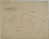
A map of part of Peafield in the Barony of Coolock & County of Dublin, the Estate of [illegible] Bever Esq. Survey'd by John Brownrigg 1795. Scale 20 Perches to an Inch
Map
Main Creator:
Brownrigg,
John
, ca. 1748-1838, surveyor
Language:
English
Format:
Map
In collection:
Longfield Map Collection
Published / Created
[1795]
Notes
Physical description: 1 map Geographic Coverage: Bar...
Call Number:
Loading...
Located:
Loading...
A map of part of the Lands of Swords call'd the Bullock Parks - let by the Revd. Sir James B Hutchinson to Mr. Pat Cuffe. Survey'd by J.L. 1814
Map
Main Creator:
Longfield,
John
, ca. 1775-1833, surveyor
Language:
English
Format:
Map
In collection:
Longfield Map Collection
Published / Created
[1814]
Notes
Physical description: 1 map Geographic Coverage: Bar...
Call Number:
Loading...
Located:
Loading...
A survey of the Demense of Thorn Hill in the Parish of Clontarf & Co. of Dublin, belonging to Mrs. Bull, by J.L. 1816. Scale 10 Perches to an Inch
Map
Main Creator:
Longfield,
John
, ca. 1775-1833, surveyor
Language:
English
Format:
Map
In collection:
Longfield Map Collection
Published / Created
[1816]
Notes
Physical description: 1 map Geographic Coverage: Par...
Call Number:
Loading...
Located:
Loading...
A survey of a lot of ground on the west side of Bridge St in the parish of St. Audeon City of Dublin belonging to the Dean & Chapter of Christ Church. Surveyed by John Longfield. Scale 20 feet to an inch. Names of tenants shown on properties
Map
Main Creator:
Longfield,
John
, ca. 1775-1833, surveyor
Language:
English
Format:
Map
In collection:
Longfield Map Collection
Published / Created
[between 1795 and 1833]
Notes
Physical description: 1 map Geographic Coverage: Dub...
Call Number:
Loading...
Located:
Loading...
A survey of a holding in Mary's Abbey belonging [to] Mrs. Mazier. April 1798. By J.B.
Map
Main Creator:
Brownrigg,
John
, ca. 1748-1838, surveyor
Language:
English
Format:
Map
In collection:
Longfield Map Collection
Published / Created
[April 1798]
Notes
Physical description: 1 map Geographic Coverage: Dub...
Call Number:
Loading...
Located:
Loading...
Part of the Lands of Brennan's Town survey'd by J. Longfield 1821. Scale 20 Perches to an Inch. Together with Valuation of the Land by John Longfield 1827.
Map
Main Creator:
Longfield,
John
, ca. 1775-1833, surveyor
Language:
English
Format:
Map
In collection:
Longfield Map Collection
Published / Created
[1827]
Notes
Physical description: 1 map Geographic Coverage: Bar...
Call Number:
Loading...
Located:
Loading...
[A survey of] Part of the Lands of Glasnevin let by the Dean and Chapter of Christ Church to the Honble. Wm. John Gore. [By John Longfield]. Scale 16 Perches to an Inch
Map
Main Creator:
Longfield,
John
, ca. 1775-1833, surveyor
Language:
English
Format:
Map
In collection:
Longfield Map Collection
Published / Created
[between 1795 and 1833]
Notes
Physical description: 1 map Geographic Coverage: Bar...
Call Number:
Loading...
Located:
Loading...
A map of the precincts of Christ Church showing the parts about to be purchased by the Commissioners of Wide Streets Surveyed by J.L. 1817.
Map
Main Creator:
Longfield,
John
, ca. 1775-1833, surveyor
Language:
English
Format:
Map
In collection:
Longfield Map Collection
Published / Created
[1817]
Notes
Physical description: 1 map Geographic Coverage: Dub...
Call Number:
Loading...
Located:
Loading...
A survey of part of the Lands of Springfield and part of Butterfield in the County of Dublin the property of W Middlewood by John Brownrigg, 1795. Scale 20 Perches to an Inch
Map
Main Creator:
Brownrigg,
John
, ca. 1748-1838, surveyor
Language:
English
Format:
Map
In collection:
Longfield Map Collection
Published / Created
[1795]
Notes
Physical description: 1 map Geographic Coverage: Bar...
Call Number:
Loading...
Located:
Loading...
A map of the Lands of Ballinclay and part of the Lands of Dalkey in the County of Dublin the Estate of the Rt. Honble. the Earl of Clonmell. By J. Brownrigg May 12 1794. Scale 10 Perches to an Inch
Map
Main Creator:
Brownrigg,
John
, ca. 1748-1838, surveyor
Language:
English
Format:
Map
In collection:
Longfield Map Collection
Published / Created
[May 12 1794]
Notes
Physical description: 1 map Geographic Coverage: Bar...
Call Number:
Loading...
Located:
Loading...
A map of two holdings on the north side of St Stephens Green in the City of Dublin. Surveyed by John Longfield 1833. Names of tenants shown on properties and adjoining tenants shown.
Map
Main Creator:
Longfield,
John
, ca. 1775-1833, surveyor
Language:
English
Format:
Map
In collection:
Longfield Map Collection
Published / Created
[1833]
Notes
Physical description: 1 map Geographic Coverage: Dub...
Call Number:
Loading...
Located:
Loading...
A survey of Three lots of ground in the Town of Saggart in the County of Dublin, partly traced from Thomas Reading's Survey made in the year 1751 by John Longfield 1817
Map
Main Creator:
Longfield,
John
, ca. 1775-1833, surveyor
Language:
English
Format:
Map
In collection:
Longfield Map Collection
Published / Created
[1817]
Notes
Physical description: 1 map Geographic Coverage: Bar...
Call Number:
Loading...
Located:
Loading...
A survey of six holdings situated in Brown Street done by order of Henry Rooke. By John Longfield 1833. Mr Faleys woollen factory & Mr Greene's holding shown
Map
Main Creator:
Longfield,
John
, ca. 1775-1833, surveyor
Language:
English
Format:
Map
In collection:
Longfield Map Collection
Published / Created
[1833]
Notes
Physical description: 1 map Geographic Coverage: Dub...
Call Number:
Loading...
Located:
Loading...
A survey of part of the Lands of Gibberalter. Near the Commons of Kilmainham Surveyed 26 Sept 1793 by J.B. Scale two hundred feet to an Inch
Map
Main Creator:
Brownrigg,
John
, ca. 1748-1838, surveyor
Language:
English
Format:
Map
In collection:
Longfield Map Collection
Published / Created
[September 26 1793]
Notes
Physical description: 1 map Geographic Coverage: Bar...
Call Number:
Loading...
Located:
Loading...
A survey of part of Kilrusk belonging to Dr. Ambrose by J.L. 1806. Scale 10 Perches to an Inch.
Map
Main Creator:
Longfield,
John
, ca. 1775-1833, surveyor
Language:
English
Format:
Map
In collection:
Longfield Map Collection
Published / Created
[1806]
Notes
Physical description: 1 map Geographic Coverage: Bar...
Call Number:
Loading...
Located:
Loading...
1
2
3
4
5
6
7
8
9
10
11
Next
16
Get RSS Feed
Email this Search
History
Narrow Search
Digitised
Remove Filters
Clear Filter
Region: Dublin (County)
Clear Filter
Format: Map
Format
Map
Online Availability
246
Not Digitised
74
Digitised
Published / Created
From:
To:
Subject
320
Administration of estates
320
Boundaries (Estates)
320
Land tenure
320
Land use surveys
87
History
Author
186
Longfield, John, ca. 1775-1833, surveyor
81
Brownrigg, John, ca. 1748-1838, surveyor
33
Brownrigg & Co., fl. 1801-1809, surveyors
6
Longfield, William, fl. 1825-ca. 1870, surveyor
4
Brownrigg, Longfield and Murray, fl. 1799-ca. 1805, surveyors
2
Brownrigg & Sherrard, fl. 1777-1778, surveyors
more ...
2
Roe, John, fl. 1793-1824, surveyor
2
Scalé, Brownrigg & Sherrard, fl. 1774-1778, surveyors
1
Battersby, John, fl. 1778, surveyor
1
Byrne, John, fl. 1789-1828, surveyor
1
Kelly, John, fl. 1820-1852, surveyor
1
Molloy, John, fl. 1809-1839, surveyor
see all ...
less ...
Collections
320
Longfield Map Collection
Language
320
English
Genre
320
Manuscript maps
320
Maps, Manuscript
87
Early works to 1800
Era
87
18th century
Region
Dublin (County)
320
Dublin (Ireland : County)
320
Ireland
129
Dublin (Ireland)
126
Dublin
56
Rathdown (Barony)
more ...
40
Coolock (Barony)
27
Uppercross (Barony)
17
Dublin (Barony)
16
Castleknock (Barony)
16
Nethercross (Barony)
15
Dublin City (Barony)
15
Newcastle (Barony)
11
Balrothery (Barony)
3
Finglas Parish
3
Finglas Parish (Ireland)
2
Meath
2
Meath (Ireland)
1
Ballybrit (Barony)
1
Ballymadun Parish
1
Ballymadun Parish (Ireland)
1
Blanchards Town Parish
1
Blanchards Town Parish (Ireland)
1
Castleknock Parish
1
Castleknock Parish (Ireland)
1
Clontarf Parish
1
Clontarf Parish (Ireland)
1
Dalkey Parish
1
Dalkey Parish (Ireland)
1
Dublin City
see all ...
less ...
Loading...
![A map of part of Peafield in the Barony of Coolock & County of Dublin, the Estate of [illegible] Bever Esq. Survey'd by John Brownrigg 1795. Scale 20 Perches to an Inch](/IIIF/000310000/000301182/vtls000301182_001.jp2/full/100,/0/default.jpg)

![[A survey of] Part of the Lands of Glasnevin let by the Dean and Chapter of Christ Church to the Honble. Wm. John Gore. [By John Longfield]. Scale 16 Perches to an Inch](/IIIF/000310000/000301161/vtls000301161_001.jp2/full/100,/0/default.jpg)