Showing
1 - 20
results of
57
for search '
S. M.
'
Skip to content
Toggle navigation
NLI Website
- Catalogue -
English
Gaeilge
Home
Help
Advanced Search
Browse
Orders
Ask a Librarian
Language
English
Gaeilge
All Fields
Title
Author
Subject
Call Number
ISBN/ISSN
Publisher
Coordinates
Search digitised content only
FIND
Author
S. M.
Results
Showing
1 - 20
results of
57
for search '
S. M.
'
, query time: 0.05s
List
Grid
Sort
Relevance
Newest First
Oldest First
Call Number
Author
Title
1
2
3
Next
3
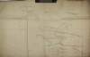
A rough draft of lands at Ardass Rathleg Rathbarna ... and Carrawgarve in the barony of Castlereagh and County of Roscommon copied from a survey made of the above lands by John Kelly in the year 1699 and copied by M. Balfe in March 1821.
Map
Main Creator:
Balfe,
M
., fl. 1821, surveyor
Language:
English
Format:
Map
In collection:
Longfield Map Collection
Published / Created
[March 1821]
Notes
Physical description: 1 map Geographic Coverage: Bar...
Call Number:
Loading...
Located:
Loading...
Map of the Pakenham Mahon estate in the County Roscommon,
1840-1877.
Map
Language:
English
Format:
Map
In collection:
Pakenham-Mahon Additional Papers, 1654-1895.
Published / Created
1840-1877.
Notes
Physical description: 1 item (1 bound map volume, 25...
Call Number:
Loading...
Located:
Loading...
View Context
Map of the Pakenham Mahon estate in the County Roscommon,
1734-1895.
Map
Language:
English
Format:
Map
In collection:
Pakenham-Mahon Additional Papers, 1654-1895.
Published / Created
1734-1895.
Notes
Physical description: 1 item (1 bound map volume, 32...
Call Number:
Loading...
Located:
Loading...
View Context
Map of the Pakenham Mahon estate in the County Roscommon,
1745-1837.
Map
Language:
English
Format:
Map
In collection:
Pakenham-Mahon Additional Papers, 1654-1895.
Published / Created
1745-1837.
Notes
Physical description: 1 item (1 bound map volume, 45...
Call Number:
Loading...
Located:
Loading...
View Context
Maps of the Pakenham Mahon estate in the County Roscommon by Henry Doogan, Patt Mc Loughlin, John McCann, John Fitzsimons [and others],
1734-1895.
Map
Main Creator:
Dougan, Henry, fl. 1717-1738
Language:
English
Format:
Map
In collection:
Pakenham-Mahon Additional Papers, 1654-1895.
Published / Created
1734-1895.
Notes
Physical description: 3 items (3 volumes, 101 manuscr...
Call Number:
Loading...
Located:
Loading...
View Context
A map of a concern on the east side of Beresford Street done for Barton. Measure by Brownrigg Longfield & Murray 1802. Scale 20 feet to an Inch
Map
Main Creator:
Brownrigg, Longfield and Murray, fl. 1799-ca. 1805, surveyors
Language:
English
Format:
Map
In collection:
Longfield Map Collection
Published / Created
[1802]
Notes
Physical description: 1 map Geographic Coverage: Dub...
Call Number:
Loading...
Located:
Loading...
A map of the proposed line of Road from Hilltown to Kilkeel in the County of Down. Survey by Brownrigg, Longfield & Murray. 1801
Map
Main Creator:
Brownrigg, Longfield and Murray, fl. 1799-ca. 1805, surveyors
Language:
English
Format:
Map
In collection:
Longfield Map Collection
Published / Created
[1801]
Notes
Physical description: 1 map Geographic Coverage: Bar...
Call Number:
Loading...
Located:
Loading...
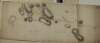
A map of the demense of Bellegrove and Rathronshin Queens [Leix] County. Surveyed by Brownrigg Longfield & Murray. Scale 20 perches to an inch. Table of reference showing contents & acreage & R. Allen's farm.
Map
Main Creator:
Brownrigg, Longfield and Murray, fl. 1799-ca. 1805, surveyors
Language:
English
Format:
Map
In collection:
Longfield Map Collection
Published / Created
[between 1799 and 1805]
Notes
Physical description: 1 map Geographic Coverage: Bar...
Call Number:
Loading...
Located:
Loading...
A map of a holding in Daly Square the estate of Dean Allett. Surveyed by Brownrigg Murray & Longfield 1801. Names of adjoining tenants shown
Map
Main Creator:
Brownrigg, Longfield and Murray, fl. 1799-ca. 1805, surveyors
Language:
English
Format:
Map
In collection:
Longfield Map Collection
Published / Created
[1801]
Notes
Physical description: 1 map Geographic Coverage: Dub...
Call Number:
Loading...
Located:
Loading...
A map of the several estates of John Hearn and Henry Trant at Carrowreagh ... and Lissalway situate in the County of Roscommon and barony of Castlereagh. Surveyed by Brownrigg Longfield and Murray. 1802. Scale 20 perches to an inch. Names of tenants and acreage of holdings shown.
Map
Main Creator:
Brownrigg, Longfield and Murray, fl. 1799-ca. 1805, surveyors
Language:
English
Format:
Map
In collection:
Longfield Map Collection
Published / Created
[1802]
Notes
Physical description: 1 map Geographic Coverage: Bar...
Call Number:
Loading...
Located:
Loading...
A map of a holding on the East side of Aungier St. In the City of Dublin, known by the name Ram Inn belonging to Mr. Philip Martin. Surveyed by Brownrigg, Longfield & Murray 1800.
Map
Main Creator:
Brownrigg, Longfield and Murray, fl. 1799-ca. 1805, surveyors
Language:
English
Format:
Map
In collection:
Longfield Map Collection
Published / Created
[1800]
Notes
Physical description: 1 map Geographic Coverage: Dub...
Call Number:
Loading...
Located:
Loading...
A map of an intended line of new Road between the Towns of Mallahide & Swords in the County of Dublin. Survey'd by Brownrigg Longfield & Murray. Scale 20 Perches to an Inch
Map
Main Creator:
Brownrigg, Longfield and Murray, fl. 1799-ca. 1805, surveyors
Language:
English
Format:
Map
In collection:
Longfield Map Collection
Published / Created
[between 1799 and 1805]
Notes
Physical description: 1 map Geographic Coverage: Bar...
Call Number:
Loading...
Located:
Loading...
Rough Map of Finlogh Laghta for Calculation of Rent as Surveyed per Order of Charles O'Hara Esquire /
1799.
Map
Main Creator:
Mackey, Thomas
Language:
English
Format:
Map
In collection:
O'Hara of Annaghmore Papers, 1585-1967
Published / Created
1799.
Notes
Map content: land plots, road, bog Inscription / Ann...
Call Number:
Loading...
Located:
Loading...
View Context
Map of the Kilahaly's Division of Finlaugh /
1800.
Map
Main Creator:
Mackey, Thomas
Language:
English
Format:
Map
In collection:
O'Hara of Annaghmore Papers, 1585-1967
Published / Created
1800.
Notes
Map content: land plots, bog, common Inscription / A...
Call Number:
Loading...
Located:
Loading...
View Context
Map of that part of Ardcree in the actual possession of Mr. Joseph Stokes by Order of Charles O'Hara esquire /
1794.
Map
Main Creator:
Mackey, Thomas
Language:
English
Format:
Map
In collection:
O'Hara of Annaghmore Papers, 1585-1967
Published / Created
1794.
Notes
Map content: land plots, roads, mill, river Borders...
Call Number:
Loading...
Located:
Loading...
View Context
Map of Ranaghan by order of Charles O'Hara esquire /
1793.
Map
Main Creator:
Mackey, Thomas
Language:
English
Format:
Map
In collection:
O'Hara of Annaghmore Papers, 1585-1967
Published / Created
1793.
Notes
Map content: land plots, road, river Borders / Embel...
Call Number:
Loading...
Located:
Loading...
View Context
Map of Nympshfield Bog per order of Charles O'Hara Esquire /
1800.
Map
Main Creator:
Mackey, Thomas
Language:
English
Format:
Map
In collection:
O'Hara of Annaghmore Papers, 1585-1967
Published / Created
1800.
Notes
Map content: land plots, house, road, bog, field Bor...
Call Number:
Loading...
Located:
Loading...
View Context
Map of part of Killoran by the Order of Charles O'Hara Esquire /
1796.
Map
Main Creator:
Mackey, Thomas
Language:
English
Format:
Map
In collection:
O'Hara of Annaghmore Papers, 1585-1967
Published / Created
1796.
Notes
Map content: land plots, road Borders / Embellishmen...
Call Number:
Loading...
Located:
Loading...
View Context
Map of Mullinigrogane part of Killorran per order of Charles O'Hara Esquire /
1802.
Map
Main Creator:
Mackey, Thomas
Language:
English
Format:
Map
In collection:
O'Hara of Annaghmore Papers, 1585-1967
Published / Created
1802.
Notes
Map content: land plots, mountains, roads Borders /...
Call Number:
Loading...
Located:
Loading...
View Context
Map of Robert Barbers Holding in Rathosey /
1798.
Map
Main Creator:
Mackey, Thomas
Language:
English
Format:
Map
In collection:
O'Hara of Annaghmore Papers, 1585-1967
Published / Created
1798.
Notes
Map content: land plots, houses Inscription / Annota...
Call Number:
Loading...
Located:
Loading...
View Context
1
2
3
Next
3
Get RSS Feed
Email this Search
History
Narrow Search
Digitised
Remove Filters
Clear Filter
Format: Map
Clear Filter
Subject: Administration of estates
Format
Map
Online Availability
52
Not Digitised
5
Digitised
Published / Created
From:
To:
Subject
Administration of estates
38
Land use surveys
35
Maps and Surveys
25
Estates
20
Cartography
20
Surveyors
more ...
18
Land tenure
10
Eviction
10
Farm rents
10
Landlord and tenant
10
Tenant farmers
8
Boundaries (Estates)
1
History
1
Maps, Manuscript
see all ...
less ...
Author
17
Moran, Nicholas, fl. 1746-1769
10
Mackey, Thomas
7
Brownrigg, Longfield and Murray, fl. 1799-ca. 1805, surveyors
6
Monck of Ballytrammon, Viscounts
4
Monteagle Family
4
Murphy, Columbus
more ...
1
Balfe, M., fl. 1821, surveyor
1
Byron, Samuel, fl. 1768-1795
1
Currin, Michael, fl. 1768-1809, surveyor
1
Dougan, Henry, fl. 1717-1738
1
Ordnance Survey of Ireland
see all ...
less ...
Collections
17
vtls000364409
15
O'Hara of Annaghmore Papers, 1585-1967
9
Monck Estate and Family Papers, 1668-1947.
8
Longfield Map Collection
4
Monteagle Papers, 1790-1923.
4
Pakenham-Mahon Additional Papers, 1654-1895.
Language
57
English
Genre
28
Manuscript maps
8
Maps, Manuscript
2
Early works to 1800
Era
2
18th century
1
19th century
Region
56
Ireland
15
Sligo (County)
6
Roscommon (County)
5
Dublin
4
Dublin (County)
4
Dublin (Ireland : County)
more ...
4
Strokestown (Ireland)
3
Dublin (Ireland)
2
Castlereagh (Barony)
2
Roscommon (Ireland : County)
1
Coolock (Barony)
1
Down (County)
1
Down (Northern Ireland : County)
1
Dublin City (Barony)
1
Iveagh (Barony)
1
Laois
1
Laois (Ireland)
1
Northern Ireland
1
Portnahinch (Barony)
1
Wicklow
1
Wicklow (County)
see all ...
less ...
Loading...

![A map of the demense of Bellegrove and Rathronshin Queens [Leix] County. Surveyed by Brownrigg Longfield & Murray. Scale 20 perches to an inch. Table of reference showing contents & acreage & R. Allen's farm.](/IIIF/000310000/000302386/vtls000302386_001.jp2/full/100,/0/default.jpg)