Showing
201 - 220
results of
338
for search '
Will, John.
'
Skip to content
Toggle navigation
NLI Website
- Catalogue -
English
Gaeilge
Home
Help
Advanced Search
Browse
Orders
Ask a Librarian
Language
English
Gaeilge
All Fields
Title
Author
Subject
Call Number
ISBN/ISSN
Publisher
Coordinates
Search digitised content only
FIND
Author
Will, John.
Results
Showing
201 - 220
results of
338
for search '
Will, John.
'
, query time: 0.05s
List
Grid
Sort
Relevance
Newest First
Oldest First
Call Number
Author
Title
1
Previous
6
7
8
9
10
11
12
13
14
15
16
Next
17
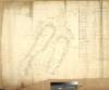
A map of part of the Lands of Palmerstown in the County of Dublin let by the Revd Sir B. Synge Hutchinson Bt. to [illegible]. Surveyed by J.L. 1816
Map
Main Creator:
Longfield,
John
, ca. 1775-1833, surveyor
Language:
English
Format:
Map
In collection:
Longfield Map Collection
Published / Created
[1816]
Notes
Physical description: 1 map Geographic Coverage: Bar...
Call Number:
Loading...
Located:
Loading...
A map of the Glebe of Stillorgan alia Acrenakill, situate in the half Barony of Rathdown & County of Dublin, the Estate of the Dean of Christ Church, let to the representatives of the late Alderman Waver. Surveyed by J.L. June 1820. Scale 10 Perches to an Inch
Map
Main Creator:
Longfield,
John
, ca. 1775-1833, surveyor
Language:
English
Format:
Map
In collection:
Longfield Map Collection
Published / Created
[June 1820]
Notes
Physical description: 1 map Geographic Coverage: Bar...
Call Number:
Loading...
Located:
Loading...
A survey of Lands of Mount Stuart in the Parish of Killossory, Barony of Coolock & County of Dublin, the Estate of Heny. Ellis Esq. by J.L. 1808. Scale 16 Perches to an Inch
Map
Main Creator:
Longfield,
John
, ca. 1775-1833, surveyor
Language:
English
Format:
Map
In collection:
Longfield Map Collection
Published / Created
[1808]
Notes
Physical description: 1 map Geographic Coverage: Par...
Call Number:
Loading...
Located:
Loading...
A map of the holding No.17 Bridge Street in the City of Dublin, let by Mr. Michael Gernon to Mr John Anderson, Junr. Surveyed by John Longfield 1805. Names of adjoining tenants shown
Map
Main Creator:
Longfield,
John
, ca. 1775-1833, surveyor
Language:
English
Format:
Map
In collection:
Longfield Map Collection
Published / Created
[1805]
Notes
Physical description: 1 map Geographic Coverage: Dub...
Call Number:
Loading...
Located:
Loading...
A map of part of the Lands of Simothscourt, the Estate of the Revd. The Dean and Chapter of Christ Church, showing the ground proposed to be purchased for the use of the Dublin and Kingstown Railway. By John Longfield March 1833. Scale 5 Plantation Perches to an Inch.
Map
Main Creator:
Longfield,
John
, ca. 1775-1833, surveyor
Language:
English
Format:
Map
In collection:
Longfield Map Collection
Published / Created
[March 1833]
Notes
Physical description: 1 map Geographic Coverage: Bar...
Call Number:
Loading...
Located:
Loading...
A map of Fearmoor [Fearmore] in the Barony of Offaly West and County of Kildare the estate of the Marquis of Drogheda. By John Longfield 1815. Scale 20 perches to an inch. Names of tenants and acreage of holdings shown.
Map
Main Creator:
Longfield,
John
, ca. 1775-1833, surveyor
Language:
English
Format:
Map
In collection:
Longfield Map Collection
Published / Created
[1815]
Notes
Inset map: "A map of the lands of Grangecoor in the B...
Call Number:
Loading...
Located:
Loading...
A map of Part of the Lands of Glasnevin in the County of Dublin let by the Honble. Wm. Jn.. Gore to [illegible]. Surveyed by Jn. Longfield 1807. Scale 16 Perches to an Inch
Map
Main Creator:
Longfield,
John
, ca. 1775-1833, surveyor
Language:
English
Format:
Map
In collection:
Longfield Map Collection
Published / Created
[1807]
Notes
Physical description: 1 map Geographic Coverage: Bar...
Call Number:
Loading...
Located:
Loading...
Section of that part of the river Blackwater between Ratholdron weir and the Dhuoag stream at Mullahard in the County of Meath. Surveyed by John Long under the direction of William F. Mulvany C.E.
Map
Main Creator:
Longfield,
John
, ca. 1775-1833, surveyor
Language:
English
Format:
Map
In collection:
Longfield Map Collection
Published / Created
[between 1795 and 1833]
Notes
For other sections of the river Blackwater see MS 21...
Call Number:
Loading...
Located:
Loading...
A survey of part of Kilrusk belonging to Dr. Ambrose by J.L. 1806. Scale 10 Perches to an Inch.
Map
Main Creator:
Longfield,
John
, ca. 1775-1833, surveyor
Language:
English
Format:
Map
In collection:
Longfield Map Collection
Published / Created
[1806]
Notes
Physical description: 1 map Geographic Coverage: Bar...
Call Number:
Loading...
Located:
Loading...
A map of Marsh field at Leixlip in the County Dublin [Kildare]. Surveyed by J.L. 1815. Scale 8 perches to an inch. Table of reference showing extent of property.
Map
Main Creator:
Longfield,
John
, ca. 1775-1833, surveyor
Language:
English
Format:
Map
In collection:
Longfield Map Collection
Published / Created
[1815]
Notes
Physical description: 1 map Geographic Coverage: Bar...
Call Number:
Loading...
Located:
Loading...
A map of Cornahova [Cornahoova] in the barony of Morgallion and County of Meath. The estate of Lord Viscount Gormanstown. Surveyed by John Longfield, 1816. Scale 20 perches to an inch. Names of tenants & acreage of holdings shown.
Map
Main Creator:
Longfield,
John
, ca. 1775-1833, surveyor
Language:
English
Format:
Map
In collection:
Longfield Map Collection
Published / Created
[1816]
Notes
Physical description: 1 map Geographic Coverage: Bar...
Call Number:
Loading...
Located:
Loading...
[A map of] Part of Simmonscourt, Survey'd 17th Oct 1832 by John Longfield. Scale 5 Perches Plant. Meas. to an Inch
Map
Main Creator:
Longfield,
John
, ca. 1775-1833, surveyor
Language:
English
Format:
Map
In collection:
Longfield Map Collection
Published / Created
[October 17 1832]
Notes
Physical description: 1 map Geographic Coverage: Bar...
Call Number:
Loading...
Located:
Loading...
A map of holding on Stephen Street and Great Ship Street the estate of the Dean & Chapter of Christ Church let to the Reps of the late Geo. Hepanstall. By John Longfield 1812. Names of adjoining tenants shown
Map
Main Creator:
Longfield,
John
, ca. 1775-1833, surveyor
Language:
English
Format:
Map
In collection:
Longfield Map Collection
Published / Created
[1812]
Notes
Physical description: 1 map Geographic Coverage: Dub...
Call Number:
Loading...
Located:
Loading...
A survey of the lands of Rathbeggan in the barony of Ratoath and County Meath the estate of John Standish. Surveyed April 1813 by J. Longfield. Table of reference showing tenants names and acreage of holdings.
Map
Main Creator:
Longfield,
John
, ca. 1775-1833, surveyor
Language:
English
Format:
Map
In collection:
Longfield Map Collection
Published / Created
[April 1813]
Notes
Physical description: 1 map Geographic Coverage: Bar...
Call Number:
Loading...
Located:
Loading...
A survey of the town of Monasterevin done with a view to shew the advantage & improvement of changing the bridge from its present site so as to range with the main entrance from Dublin. By John Longfield, 1807. Scale 100 feet to an inch.
Map
Main Creator:
Longfield,
John
, ca. 1775-1833, surveyor
Language:
English
Format:
Map
In collection:
Longfield Map Collection
Published / Created
[1807]
Notes
Physical description: 1 map Geographic Coverage: Bar...
Call Number:
Loading...
Located:
Loading...
A survey of part of the lands of Baggots Rath for Francis Thomas Russell. By John Longfield May 1824. Scale 10 perches to an inch. Mr Haig's holding shown.
Map
Main Creator:
Longfield,
John
, ca. 1775-1833, surveyor
Language:
English
Format:
Map
In collection:
Longfield Map Collection
Published / Created
[May 1824]
Notes
Physical description: 1 map Geographic Coverage: Dub...
Call Number:
Loading...
Located:
Loading...
A survey of Doonen in the parish of Kilcolagh and barony of Frenchpark and County of Roscommon the estate of Daniel Farrell. By J Longfield March 1828. Table of reference showing tenants and acreage of holdings.
Map
Main Creator:
Longfield,
John
, ca. 1775-1833, surveyor
Language:
English
Format:
Map
In collection:
Longfield Map Collection
Published / Created
[March 1828]
Notes
Physical description: 1 map Geographic Coverage: Par...
Call Number:
Loading...
Located:
Loading...
A map of the Bottoms Meadows near Swords in the County of Dublin part of the Estate of the Revd. Sir. S. Hutchinson Esq let to [illegible]. Surveyed by J.L. 1814
Map
Main Creator:
Longfield,
John
, ca. 1775-1833, surveyor
Language:
English
Format:
Map
In collection:
Longfield Map Collection
Published / Created
[1814]
Notes
Physical description: 1 map Geographic Coverage: Bar...
Call Number:
Loading...
Located:
Loading...
A Survey of the lands of Drumellison [Drumellis] and a moiety of Drumcroe in the Barony of Lower Loughtee and Co. Cavan. Surveyed by J. Longfield. June 1816
Map
Main Creator:
Longfield,
John
, ca. 1775-1833, surveyor
Language:
English
Format:
Map
In collection:
Longfield Map Collection
Published / Created
[June 1816]
Notes
Physical description: 1 map Geographic Coverage: Par...
Call Number:
Loading...
Located:
Loading...
A survey of part of the lands of Newtown in the barony of Salt South and County Kildare belonging to Mr. Graham. By J.L. October, 1816. Scale 20 perches to an inch. Names of tenant and acreage of holdings shown.
Map
Main Creator:
Longfield,
John
, ca. 1775-1833, surveyor
Language:
English
Format:
Map
In collection:
Longfield Map Collection
Published / Created
[October 1816]
Notes
Physical description: 1 map Geographic Coverage: Bar...
Call Number:
Loading...
Located:
Loading...
1
Previous
6
7
8
9
10
11
12
13
14
15
16
Next
17
Get RSS Feed
Email this Search
History
Narrow Search
Digitised
Remove Filters
Clear Filter
Author: Longfield, John, ca. 1775-1833, surveyor
Format
337
Map
1
Manuscript
Online Availability
186
Digitised
152
Not Digitised
Published / Created
From:
To:
Subject
338
Land use surveys
335
Boundaries (Estates)
335
Land tenure
327
Administration of estates
20
Administration of Estates
3
Cartography
more ...
3
Estates
3
Maps and Surveys
3
Surveyors
1
History
1
Maps
see all ...
less ...
Author
Longfield, John, ca. 1775-1833, surveyor
Collections
336
Longfield Map Collection
2
vtls000364409
Language
338
English
Genre
337
Manuscript maps
335
Maps, Manuscript
1
Early works to 1800
Era
1
1780-1840
1
18th century
Region
335
Ireland
186
Dublin (County)
186
Dublin (Ireland : County)
71
Dublin
70
Dublin (Ireland)
43
Meath
more ...
43
Meath (Ireland)
39
Kildare (County)
39
Kildare (Ireland : County)
32
Rathdown (Barony)
26
Coolock (Barony)
16
Offaly West (Barony)
14
Castleknock (Barony)
14
Uppercross (Barony)
13
Newcastle (Barony)
12
Nethercross (Barony)
11
Wicklow (County)
11
Wicklow (Ireland : County)
8
Duleek Upper (Barony)
7
Laois
7
Laois (Ireland)
7
Moyfenrath Upper (Barony)
7
Ratoath (Barony)
7
Roscommon (County)
7
Roscommon (Ireland : County)
6
Balrothery (Barony)
5
Kilcullen (Barony)
5
Kilkenny (County)
5
Kilkenny (Ireland : County)
5
Mayo (County)
see all ...
less ...
Loading...
![A map of part of the Lands of Palmerstown in the County of Dublin let by the Revd Sir B. Synge Hutchinson Bt. to [illegible]. Surveyed by J.L. 1816](/IIIF/000310000/000302272/vtls000302272_001.jp2/full/100,/0/default.jpg)

![A map of Fearmoor [Fearmore] in the Barony of Offaly West and County of Kildare the estate of the Marquis of Drogheda. By John Longfield 1815. Scale 20 perches to an inch. Names of tenants and acreage of holdings shown.](/IIIF/000310000/000302218/vtls000302218_001.jp2/full/100,/0/default.jpg)
![A map of Part of the Lands of Glasnevin in the County of Dublin let by the Honble. Wm. Jn.. Gore to [illegible]. Surveyed by Jn. Longfield 1807. Scale 16 Perches to an Inch](/IIIF/000310000/000301143/vtls000301143_001.jp2/full/100,/0/default.jpg)

![A map of Marsh field at Leixlip in the County Dublin [Kildare]. Surveyed by J.L. 1815. Scale 8 perches to an inch. Table of reference showing extent of property.](/IIIF/000310000/000302107/vtls000302107_001.jp2/full/100,/0/default.jpg)
![A map of Cornahova [Cornahoova] in the barony of Morgallion and County of Meath. The estate of Lord Viscount Gormanstown. Surveyed by John Longfield, 1816. Scale 20 perches to an inch. Names of tenants & acreage of holdings shown.](/IIIF/000310000/000301792/vtls000301792_001.jp2/full/100,/0/default.jpg)


![A Survey of the lands of Drumellison [Drumellis] and a moiety of Drumcroe in the Barony of Lower Loughtee and Co. Cavan. Surveyed by J. Longfield. June 1816](/IIIF/000310000/000301907/vtls000301907_001.jp2/full/100,/0/default.jpg)
