Showing
1 - 20
results of
1,581
for search '
Longfield, Robert Ormsby, 1844-1908, donor
'
Skip to content
Toggle navigation
NLI Website
- Catalogue -
English
Gaeilge
Home
Help
Advanced Search
Browse
Orders
Ask a Librarian
Language
English
Gaeilge
All Fields
Title
Author
Subject
Call Number
ISBN/ISSN
Publisher
Coordinates
Search digitised content only
FIND
Author
Longfield, Robert Ormsby, 1844-1908, donor
Results
Showing
1 - 20
results of
1,581
for search '
Longfield, Robert Ormsby, 1844-1908, donor
'
, query time: 0.04s
List
Grid
Sort
Relevance
Newest First
Oldest First
Call Number
Author
Title
1
2
3
4
5
6
7
8
9
10
11
Next
80
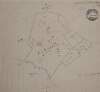
Map of area in Kildare Street
Map
Language:
English
Format:
Map
In collection:
Longfield Map Collection
Published / Created
[between 1770 and 1840]
Notes
Physical description: 1 map Geographic Coverage: Dub...
Contributors:
“
...
Longfield
,
Robert
Ormsby
,
1844
-
1908
,
donor
...
”
Call Number:
Loading...
Located:
Loading...
A survey of part of the estate of the Rt. Hon. Lord Templetown. By John Brownrigg 1800, at Drumaoib ... and Liseenan in County Monaghan. Names of tenants & acreage of holdings shown.
Map
Main Creator:
Brownrigg, John, ca. 1748-1838, surveyor
Language:
English
Format:
Map
In collection:
Longfield Map Collection
Published / Created
[1800]
Notes
Physical description: 1 map Geographic Coverage: Bar...
Contributors:
“
...
Longfield
,
Robert
Ormsby
,
1844
-
1908
,
donor
...
”
Call Number:
Loading...
Located:
Loading...
A map of part of Killeen in the Barony of Narragh & Reban East and County of Kildare. Names of tenants & area of holdings shown.
Map
Language:
English
Format:
Map
In collection:
Longfield Map Collection
Published / Created
[between 1770 and 1840]
Notes
Physical description: 1 map Geographic Coverage: Bar...
Contributors:
“
...
Longfield
,
Robert
Ormsby
,
1844
-
1908
,
donor
...
”
Call Number:
Loading...
Located:
Loading...
A map of part of the Lands of Crumlin in the County of Dublin, the Estate of the Dean & Chapter of Christ Church let to [illegible]. Survey'd by Jn.. Longfield 1805. Scale 20 Perches to an Inch
Map
Main Creator:
Longfield, John, ca. 1775-1833, surveyor
Language:
English
Format:
Map
In collection:
Longfield Map Collection
Published / Created
[1805]
Notes
Physical description: 1 map Geographic Coverage: Bar...
Contributors:
“
...
Longfield
,
Robert
Ormsby
,
1844
-
1908
,
donor
...
”
Call Number:
Loading...
Located:
Loading...
A survey of Mooney's holding, part of Graigues, barony of Clane County Kildare estate of Nicholas Browne. Nov. 12. 1784. Names of tenants shown on holdings
Map
Language:
English
Format:
Map
In collection:
Longfield Map Collection
Published / Created
[November 12 1784]
Notes
Physical description: 1 map Geographic Coverage: Bar...
Contributors:
“
...
Longfield
,
Robert
Ormsby
,
1844
-
1908
,
donor
...
”
Call Number:
Loading...
Located:
Loading...
[A map of part of Damaskstown in the Barony of Balrothery and County of Dublin]
Map
Language:
English
Format:
Map
In collection:
Longfield Map Collection
Published / Created
[between 1770 and 1840]
Notes
Physical description: 1 map Geographic Coverage: Bar...
Contributors:
“
...
Longfield
,
Robert
Ormsby
,
1844
-
1908
,
donor
...
”
Call Number:
Loading...
Located:
Loading...
Map of concerns between Harcourt Street and Camden Street. Scale 80 feet to an inch. Adjoining tenants shown
Map
Language:
English
Format:
Map
In collection:
Longfield Map Collection
Published / Created
[between 1770 and 1840]
Notes
Physical description: 1 map Geographic Coverage: Dub...
Contributors:
“
...
Longfield
,
Robert
Ormsby
,
1844
-
1908
,
donor
...
”
Call Number:
Loading...
Located:
Loading...
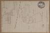
[A map of Raphoe Demense in the Barony of Raphoe N & County of Donegal]
Map
Language:
English
Format:
Map
In collection:
Longfield Map Collection
Published / Created
[between 1770 and 1840]
Notes
Physical description: 1 map Geographic Coverage: Bar...
Contributors:
“
...
Longfield
,
Robert
Ormsby
,
1844
-
1908
,
donor
...
”
Call Number:
Loading...
Located:
Loading...
A survey of Aghagad and Buckfield situate in the County of Roscommon part of the estate of St. George Caulfield. By Michael Cuddehy March 1803. Scale of 20 perches to an inch. Table of reference showing allotments and names of tenants.
Map
Main Creator:
Cuddehy, Michael, fl. 1791-1803, surveyor
Language:
English
Format:
Map
In collection:
Longfield Map Collection
Published / Created
[March 1803]
Notes
Physical description: 1 map Geographic Coverage: Bar...
Contributors:
“
...
Longfield
,
Robert
Ormsby
,
1844
-
1908
,
donor
...
”
Call Number:
Loading...
Located:
Loading...
A map of a piece of ground on the west side of Church St in the City of Dublin being part of the foundry concern formerly belonging to Mr. Henry Jackson. The estate of the Dean and Chapter of Christ Church. Surveyed by J.L. 1812. Scale 15 feet to an inch
Map
Main Creator:
Longfield, John, ca. 1775-1833, surveyor
Language:
English
Format:
Map
In collection:
Longfield Map Collection
Published / Created
[1812]
Notes
Physical description: 1 map Geographic Coverage: Dub...
Contributors:
“
...
Longfield
,
Robert
Ormsby
,
1844
-
1908
,
donor
...
”
Call Number:
Loading...
Located:
Loading...
A map of Part of Castleknock. Surveyed by J. Longfield
Map
Main Creator:
Longfield, John, ca. 1775-1833, surveyor
Language:
English
Format:
Map
In collection:
Longfield Map Collection
Published / Created
[between 1795 and 1833]
Notes
Physical description: 1 map Geographic Coverage: Bar...
Contributors:
“
...
Longfield
,
Robert
Ormsby
,
1844
-
1908
,
donor
...
”
Call Number:
Loading...
Located:
Loading...
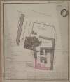
A plan of Monasterevin County Kildare. Names of tenants & area of holdings shown.
Map
Language:
English
Format:
Map
In collection:
Longfield Map Collection
Published / Created
[between 1770 and 1840]
Notes
Physical description: 1 map Geographic Coverage: Bar...
Contributors:
“
...
Longfield
,
Robert
Ormsby
,
1844
-
1908
,
donor
...
”
Call Number:
Loading...
Located:
Loading...
A survey of part of the Lands of Dunbrow called Huntstown situate in the Barony of Coolock and County of Dublin, the Estate of Lord Viscount Clifden. Surveyed in March 1833. Scale 20 statute Perches to an Inch
Map
Language:
English
Format:
Map
In collection:
Longfield Map Collection
Published / Created
[March 1833]
Notes
Physical description: 1 map Geographic Coverage: Bar...
Contributors:
“
...
Longfield
,
Robert
Ormsby
,
1844
-
1908
,
donor
...
”
Call Number:
Loading...
Located:
Loading...
A map of sundry premises on the north side of Thomas Street in the City of Dublin in the tenure of Thomas Browne. Surveyed 1814. Names of some tenants shown
Map
Language:
English
Format:
Map
In collection:
Longfield Map Collection
Published / Created
[1814]
Notes
Physical description: 1 map Geographic Coverage: Dub...
Contributors:
“
...
Longfield
,
Robert
Ormsby
,
1844
-
1908
,
donor
...
”
Call Number:
Loading...
Located:
Loading...
A map of cabins and gardens in Monasterevin. Names of tenants & area of holdings shown.
Map
Language:
English
Format:
Map
In collection:
Longfield Map Collection
Published / Created
[between 1770 and 1840]
Notes
Inset map: "A map of part of Clogheen in the Barony o...
Contributors:
“
...
Longfield
,
Robert
Ormsby
,
1844
-
1908
,
donor
...
”
Call Number:
Loading...
Located:
Loading...
Plan of the Brewery premises in Monasterevin County Kildare. Scale 2 perches to an inch. Table of reference & notes on buildings.
Map
Language:
English
Format:
Map
In collection:
Longfield Map Collection
Published / Created
[between 1770 and 1840]
Notes
Physical description: 1 map Geographic Coverage: Bar...
Contributors:
“
...
Longfield
,
Robert
Ormsby
,
1844
-
1908
,
donor
...
”
Call Number:
Loading...
Located:
Loading...
A map of part of the lands at Kelshamore in the barony of Talbotstown Upper and County of Wicklow the estate of the Rev Sir S.S. Hutchinson, Bart let to Edward Flynn, Senior. Surveyed by John Longfield 1813. Scale 20 perches to an inch.
Map
Main Creator:
Longfield, John, ca. 1775-1833, surveyor
Language:
English
Format:
Map
In collection:
Longfield Map Collection
Published / Created
[1813]
Notes
Physical description: 1 map Geographic Coverage: Bar...
Contributors:
“
...
Longfield
,
Robert
Ormsby
,
1844
-
1908
,
donor
...
”
Call Number:
Loading...
Located:
Loading...
A map of lands at Stephenstown and Ballyduagh in the barony of Middlethird and County of Tipperary. Names of tenants and acreage of holdings shown.
Map
Language:
English
Format:
Map
In collection:
Longfield Map Collection
Published / Created
[between 1770 and 1840]
Notes
Physical description: 1 map Geographic Coverage: Bar...
Contributors:
“
...
Longfield
,
Robert
Ormsby
,
1844
-
1908
,
donor
...
”
Call Number:
Loading...
Located:
Loading...
A map of lands at Mylerstown in the barony of [ Offaly west] and County of Kildare. Names of tenants and acreage of holdings shown.
Map
Language:
English
Format:
Map
In collection:
Longfield Map Collection
Published / Created
[between 1770 and 1840]
Notes
Physical description: 1 map Geographic Coverage: Bar...
Contributors:
“
...
Longfield
,
Robert
Ormsby
,
1844
-
1908
,
donor
...
”
Call Number:
Loading...
Located:
Loading...
A map of the precincts of Christ Church showing the part about to be purchased by the Commissioners of Wide Streets. Surveyed by J.L. 1817. Names of tenants on Skinner Row. Shown on properties
Map
Main Creator:
Longfield, John, ca. 1775-1833, surveyor
Language:
English
Format:
Map
In collection:
Longfield Map Collection
Published / Created
[1817]
Notes
Physical description: 1 map Geographic Coverage: Dub...
Contributors:
“
...
Longfield
,
Robert
Ormsby
,
1844
-
1908
,
donor
...
”
Call Number:
Loading...
Located:
Loading...
1
2
3
4
5
6
7
8
9
10
11
Next
80
Get RSS Feed
Email this Search
History
Narrow Search
Digitised
Format
1,580
Map
1
Manuscript
Online Availability
956
Digitised
625
Not Digitised
Published / Created
From:
To:
Subject
1,579
Land use surveys
1,578
Boundaries (Estates)
1,578
Land tenure
1,565
Administration of estates
268
History
49
Administration of Estates
more ...
1
Cartography
1
Estates
1
Maps
1
Maps and Surveys
1
Surveyors
see all ...
less ...
Author
336
Longfield, John, ca. 1775-1833, surveyor
112
Brownrigg, John, ca. 1748-1838, surveyor
42
Brownrigg & Co., fl. 1801-1809, surveyors
38
Longfield, William, fl. 1825-ca. 1870, surveyor
8
Reading, Thomas, ca. 1704-1779, surveyor
7
Brownrigg, Longfield and Murray, fl. 1799-ca. 1805, surveyors
more ...
6
Gartland, William, fl. 1838-1851/68, surveyor
5
Byron, Samuel, fl. 1768-1795
4
Cave, Thomas, fl. ca. 1709-1749, surveyor
4
Scalé, Brownrigg & Sherrard, fl. 1774-1778, surveyors
3
Chaloner, Samuel, fl. 1812-1833, surveyor
3
Cuddehy, Michael, fl. 1791-1803, surveyor
3
Mathews, Thomas, fl. 1760-1784, surveyor
3
Roe, John, fl. 1793-1824, surveyor
3
Scully, Patrick, fl. 1777, surveyor
3
Sherrard, Thomas, ca. 1750-1837, surveyor
2
Brownrigg & Sherrard, fl. 1777-1778, surveyors
2
Byrne, John, fl. 1789-1828, surveyor
2
Donlevy, Bryan, fl. 1784-1792, surveyor
2
Frizell, Richard, fl. 1750-1797
2
Kirrilly, Bryan, fl. 1715-1716, surveyor
2
Lewis, Robert, fl. 1745-1785, surveyor
2
Lynch, Thomas, fl. 1804-1809, surveyor
2
Moynahan, John, fl. 1736-1764, surveyor
2
Mulvihill, Peter, ca. 1736-d. 1798, surveyor
2
Neville, Arthur Richards, fl. 1775-1828, surveyor
2
Sherrard & Brassington, fl. 1800-1822, surveyors
1
Balfe, M., fl. 1821, surveyor
1
Battersby, John, fl. 1778, surveyor
1
Bell, John (I and II), fl. 1721-1820
see all ...
less ...
Collections
1,581
Longfield Map Collection
Language
1,581
English
Genre
1,580
Manuscript maps
1,577
Maps, Manuscript
269
Early works to 1800
Era
268
18th century
1
1780-1840
1
19th century
Region
1,535
Ireland
711
Dublin (Ireland : County)
710
Dublin (County)
295
Dublin (Ireland)
294
Dublin
182
Kildare (County)
more ...
182
Kildare (Ireland : County)
155
Meath
155
Meath (Ireland)
118
Roscommon (County)
118
Roscommon (Ireland : County)
111
Rathdown (Barony)
85
Coolock (Barony)
76
Offaly West (Barony)
70
Uppercross (Barony)
47
Tipperary (County)
47
Tipperary (Ireland : County)
45
Northern Ireland
43
Newcastle (Barony)
40
Frenchpark (Barony)
40
Wicklow (County)
40
Wicklow (Ireland : County)
36
Castleknock (Barony)
35
Westmeath
35
Westmeath (Ireland)
34
Balrothery (Barony)
33
Laois
33
Laois (Ireland)
31
Dublin (Barony)
29
Nethercross (Barony)
see all ...
less ...
Loading...


![[A map of part of Damaskstown in the Barony of Balrothery and County of Dublin]](/IIIF/000310000/000301078/vtls000301078_001.jp2/full/100,/0/default.jpg)
![[A map of Raphoe Demense in the Barony of Raphoe N & County of Donegal]](/IIIF/000310000/000301921/vtls000301921_001.jp2/full/100,/0/default.jpg)


![A map of lands at Mylerstown in the barony of [ Offaly west] and County of Kildare. Names of tenants and acreage of holdings shown.](/IIIF/000310000/000302035/vtls000302035_001.jp2/full/100,/0/default.jpg)