Showing
1 - 20
results of
175
for search '
Brownrigg, John, ca. 1748-1838, surveyor
'
Skip to content
Toggle navigation
NLI Website
- Catalogue -
English
Gaeilge
Home
Help
Advanced Search
Browse
Orders
Ask a Librarian
Language
English
Gaeilge
All Fields
Title
Author
Subject
Call Number
ISBN/ISSN
Publisher
Coordinates
Search digitised content only
FIND
Author
Brownrigg, John, ca. 1748-1838, surveyor
Results
Showing
1 - 20
results of
175
for search '
Brownrigg, John, ca. 1748-1838, surveyor
'
, query time: 0.06s
List
Grid
Sort
Relevance
Newest First
Oldest First
Call Number
Author
Title
1
2
3
4
5
6
7
8
9
Next
9
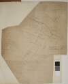
A survey of George Paul Monk Esq holding at St Stephen's Green done for [illegible] Mitchell Esq. by John Brownrigg Aug 11 1787
Map
Main Creator:
Brownrigg
,
John
,
ca
.
1748
-
1838
,
surveyor
Language:
English
Format:
Map
In collection:
Longfield Map Collection
Published / Created
[August 11 1787]
Notes
Physical description: 1 map Geographic Coverage: Dub...
Call Number:
Loading...
Located:
Loading...
[A map of ] Part of Ballybowden in the County of Dublin belonging to Count. O'Callahan Esq. by John Brownrigg 1779
Map
Main Creator:
Brownrigg
,
John
,
ca
.
1748
-
1838
,
surveyor
Language:
English
Format:
Map
In collection:
Longfield Map Collection
Published / Created
[1779]
Notes
Physical description: 1 map Geographic Coverage: Bar...
Call Number:
Loading...
Located:
Loading...
[Map showing] Levels of Messrs. Wade or Whittens Ground at the Black rock by John Brownrigg 1791
Map
Main Creator:
Brownrigg
,
John
,
ca
.
1748
-
1838
,
surveyor
Language:
English
Format:
Map
In collection:
Longfield Map Collection
Published / Created
[1791]
Notes
Physical description: 1 map Geographic Coverage: Bar...
Call Number:
Loading...
Located:
Loading...
A survey of part of the Lands of Kinsaly called Sweets farm in the Barony of Coolock & County of Dublin, the Estate of Mrs. Sarah Tighe by John Brownrigg 1794. Scale 10 Perches to an Inch
Map
Main Creator:
Brownrigg
,
John
,
ca
.
1748
-
1838
,
surveyor
Language:
English
Format:
Map
In collection:
Longfield Map Collection
Published / Created
[1794]
Notes
Physical description: 1 map Geographic Coverage: Bar...
Call Number:
Loading...
Located:
Loading...
A map of two Holdings in the street of Tallaght in the County of Dublin belonging to Mr. Anthy. Cleval by J. Brownrigg 1797. Scale Eight Perches to an Inch
Map
Main Creator:
Brownrigg
,
John
,
ca
.
1748
-
1838
,
surveyor
Language:
English
Format:
Map
In collection:
Longfield Map Collection
Published / Created
[1797]
Notes
Physical description: 1 map Geographic Coverage: Bar...
Call Number:
Loading...
Located:
Loading...
A map of a holding on the north side of Summer Hill in the City of Dublin the propety of Mr. Wood. Surveyed by J.B. 1792. Names of adjoining tenants shown
Map
Main Creator:
Brownrigg
,
John
,
ca
.
1748
-
1838
,
surveyor
Language:
English
Format:
Map
In collection:
Longfield Map Collection
Published / Created
[1792]
Notes
Physical description: 1 map Geographic Coverage: Dub...
Call Number:
Loading...
Located:
Loading...
A survey of the Lands of Furry Hill, a subdenomination of Balally in the County of Dublin done in 1777 by John Connor and copied 1782 by John Brownrigg. Scale 10 Perches to an Inch
Map
Main Creator:
Brownrigg
,
John
,
ca
.
1748
-
1838
,
surveyor
Language:
English
Format:
Map
In collection:
Longfield Map Collection
Published / Created
[1782]
Notes
Physical description: 1 map Geographic Coverage: Bar...
Call Number:
Loading...
Located:
Loading...
A map of a holding on the east side of Charlemont Street belonging to Mr. Peter. Surveyed by J. Brownrigg 1795. Names of tenants shown on properties
Map
Main Creator:
Brownrigg
,
John
,
ca
.
1748
-
1838
,
surveyor
Language:
English
Format:
Map
In collection:
Longfield Map Collection
Published / Created
[1795]
Notes
Physical description: 1 map Geographic Coverage: Dub...
Call Number:
Loading...
Located:
Loading...
Map of the Demense of Kinturk in the barony of Fore and County of Westmeath the seat of William Pollard. Surveyed in 1786 by J.B. Scale 10 perches to an inch.
Map
Main Creator:
Brownrigg
,
John
,
ca
.
1748
-
1838
,
surveyor
Language:
English
Format:
Map
In collection:
Longfield Map Collection
Published / Created
[1786]
Notes
Physical description: 1 map Geographic Coverage: Bar...
Call Number:
Loading...
Located:
Loading...
A survey of Carn in the barony of Fore and County of Westmeath part of the estate of the Rt. Hon. the Earl of Longford. By J.B. December 1798. Scale 20 perches to an inch.
Map
Main Creator:
Brownrigg
,
John
,
ca
.
1748
-
1838
,
surveyor
Language:
English
Format:
Map
In collection:
Longfield Map Collection
Published / Created
[December 1798]
Notes
Physical description: 1 map Geographic Coverage: Bar...
Call Number:
Loading...
Located:
Loading...
[A map showing part of Bushy Park and the Lands of Butterfield & Synge Esq in the County Dublin] a dotted line indicates the bed of the river in 1782 according to a survey made by Mr. Brownrigg. Scale 10 Perches to an Inch
Map
Main Creator:
Brownrigg
,
John
,
ca
.
1748
-
1838
,
surveyor
Language:
English
Format:
Map
In collection:
Longfield Map Collection
Published / Created
[1782]
Notes
Physical description: 1 map Geographic Coverage: Bar...
Call Number:
Loading...
Located:
Loading...
[A map of Mr. Oglevie's Demense at Booterstown in the County of Dublin, by J.B.]. Scale 4 Perches to an Inch
Map
Main Creator:
Brownrigg
,
John
,
ca
.
1748
-
1838
,
surveyor
Language:
English
Format:
Map
In collection:
Longfield Map Collection
Published / Created
[between 1768 and 1838]
Notes
Physical description: 1 map Geographic Coverage: Bar...
Call Number:
Loading...
Located:
Loading...
A map of a proposed line to be laid out as an equal give and take straight boundary between Hodgestown the estate of the Rt. Hon. the Earl of Longford, and Higginstown the estate of George Nugent. Surveyed by John Brownrigg. 1796. Scale 20 perches to an inch.
Map
Main Creator:
Brownrigg
,
John
,
ca
.
1748
-
1838
,
surveyor
Language:
English
Format:
Map
In collection:
Longfield Map Collection
Published / Created
[1796]
Notes
Physical description: 1 map Geographic Coverage: Bar...
Call Number:
Loading...
Located:
Loading...
A map of the Lands of Ballinclay and part of the Lands of Dalkey in the County of Dublin the Estate of the Rt. Honble. the Earl of Clonmell. By J. Brownrigg May 12 1794. Scale 10 Perches to an Inch
Map
Main Creator:
Brownrigg
,
John
,
ca
.
1748
-
1838
,
surveyor
Language:
English
Format:
Map
In collection:
Longfield Map Collection
Published / Created
[May 12 1794]
Notes
Physical description: 1 map Geographic Coverage: Bar...
Call Number:
Loading...
Located:
Loading...
A survey of part of the Lands of Gibberalter. Near the Commons of Kilmainham Surveyed 26 Sept 1793 by J.B. Scale two hundred feet to an Inch
Map
Main Creator:
Brownrigg
,
John
,
ca
.
1748
-
1838
,
surveyor
Language:
English
Format:
Map
In collection:
Longfield Map Collection
Published / Created
[September 26 1793]
Notes
Physical description: 1 map Geographic Coverage: Bar...
Call Number:
Loading...
Located:
Loading...
A map of the Line intended for the Royal Canal from Ashtown to Barberstown in the County of Dublin, as laid out by Richd. Evans Enginr. Surveyed by J. Brownrigg. 1791. Scale 500 Feet to an Inch
Map
Main Creator:
Brownrigg
,
John
,
ca
.
1748
-
1838
,
surveyor
Language:
English
Format:
Map
In collection:
Longfield Map Collection
Published / Created
[1791]
Notes
Physical description: 1 map Geographic Coverage: Bar...
Call Number:
Loading...
Located:
Loading...
A survey of a holding at St. Stephen's Green held by Mr. Thomas Glynn under Peter Digges Latouche Esq. Done by John Brownrigg Nov 23 1787. Scale 20 Feet to an Inch
Map
Main Creator:
Brownrigg
,
John
,
ca
.
1748
-
1838
,
surveyor
Language:
English
Format:
Map
In collection:
Longfield Map Collection
Published / Created
[November 23 1787]
Notes
Physical description: 1 map Geographic Coverage: Dub...
Call Number:
Loading...
Located:
Loading...
A map of the Lands of Gracedien and its subdenominations in the Barony of Balrothery & County of Dublin, the Estate of John Venox Esq. by John Brownrigg. November 1794. Scale 20 Perches to an Inch
Map
Main Creator:
Brownrigg
,
John
,
ca
.
1748
-
1838
,
surveyor
Language:
English
Format:
Map
In collection:
Longfield Map Collection
Published / Created
[November 1794]
Notes
Physical description: 1 map Geographic Coverage: Bar...
Call Number:
Loading...
Located:
Loading...
A map of Part of the Lands of Stillorgan the Property of N. Lefavre Esq. Laid out in Lots for Building, by J. Brownrigg 1792. Scale 100 Feet to an Inch
Map
Main Creator:
Brownrigg
,
John
,
ca
.
1748
-
1838
,
surveyor
Language:
English
Format:
Map
In collection:
Longfield Map Collection
Published / Created
[1792]
Notes
Physical description: 1 map Geographic Coverage: Bar...
Call Number:
Loading...
Located:
Loading...
A survey of part of the Lands of Springfield and part of Butterfield in the County of Dublin the property of W Middlewood by John Brownrigg, 1795. Scale 20 Perches to an Inch
Map
Main Creator:
Brownrigg
,
John
,
ca
.
1748
-
1838
,
surveyor
Language:
English
Format:
Map
In collection:
Longfield Map Collection
Published / Created
[1795]
Notes
Physical description: 1 map Geographic Coverage: Bar...
Call Number:
Loading...
Located:
Loading...
1
2
3
4
5
6
7
8
9
Next
9
Get RSS Feed
Email this Search
History
Narrow Search
Digitised
Format
172
Map
2
Prints & Drawings
1
Manuscript
Online Availability
104
Not Digitised
71
Digitised
Published / Created
From:
To:
Subject
172
Land use surveys
170
Administration of estates
170
Boundaries (Estates)
170
Land tenure
117
History
2
Administration of Estates
more ...
2
Antiquities
2
Cartography
2
Dolmens
2
Estates
2
Irish
2
Maps
2
Maps and Surveys
2
Surveyors
1
Estate papers
1
Maps, Manuscript
see all ...
less ...
Author
114
Brownrigg, John, ca. 1748-1838, surveyor
42
Brownrigg & Co., fl. 1801-1809, surveyors
7
Brownrigg, Longfield and Murray, fl. 1799-ca. 1805, surveyors
4
Scalé, Brownrigg & Sherrard, fl. 1774-1778, surveyors
3
Longfield, John, ca. 1775-1833, surveyor
2
Brownrigg & Sherrard, fl. 1777-1778, surveyors
more ...
2
Frazer, William, d. 1905, artist
1
Longfield, William, fl. 1825-ca. 1870, surveyor
see all ...
less ...
Collections
171
Longfield Map Collection
2
Sketch books of Irish antiquities
1
Fowler and Rawdon of Rathmoylon Papers, 1710-1897.
1
Gardiner Papers, ca. 1667-1898.
Language
175
English
Genre
171
Manuscript maps
170
Maps, Manuscript
116
Early works to 1800
2
Ink drawings
2
Pen works
2
Wash drawings
Era
117
18th century
2
1880-1900
1
1780-1840
Region
174
Ireland
125
Dublin (Ireland : County)
124
Dublin (County)
60
Dublin (Ireland)
58
Dublin
20
Rathdown (Barony)
more ...
14
Coolock (Barony)
14
Meath (Ireland)
13
Dublin (Barony)
13
Meath
12
Dublin City (Barony)
12
Uppercross (Barony)
8
Kildare (County)
8
Kildare (Ireland : County)
8
Westmeath
8
Westmeath (Ireland)
7
Longford (Ireland : County)
5
Balrothery (Barony)
5
Fore (Barony)
5
Longford (County)
4
Nethercross (Barony)
4
Newcastle (Barony)
3
Granard (Barony)
3
Skreen (Barony)
2
Castleknock (Barony)
2
Connell (Barony)
2
Farbill (Barony)
2
Kells Upper (Barony)
2
Laois
2
Laois (Ireland)
see all ...
less ...
Loading...