Showing
1 - 20
results of
321
for search '
Will, John.
'
Skip to content
Toggle navigation
NLI Website
- Catalogue -
English
Gaeilge
Home
Help
Advanced Search
Browse
Orders
Ask a Librarian
Language
English
Gaeilge
All Fields
Title
Author
Subject
Call Number
ISBN/ISSN
Publisher
Coordinates
Search digitised content only
FIND
Author
Will, John.
Results
Showing
1 - 20
results of
321
for search '
Will, John.
'
, query time: 0.04s
List
Grid
Sort
Relevance
Newest First
Oldest First
Call Number
Author
Title
1
2
3
4
5
6
7
8
9
10
11
Next
17
[A plan of holdings in the neighbourhood of Dolphins Barn] by John Battersby 1778
Map
Main Creator:
Battersby,
John
, fl. 1778, surveyor
Language:
English
Format:
Map
In collection:
Longfield Map Collection
Published / Created
[1778]
Notes
Physical description: 1 map Geographic Coverage: Bar...
Call Number:
Loading...
Located:
Loading...
A map of part of the Lands of Crumlin in the County of Dublin, the Estate of the Dean & Chapter of Christ Church let to [illegible]. Survey'd by Jn.. Longfield 1805. Scale 20 Perches to an Inch
Map
Main Creator:
Longfield,
John
, ca. 1775-1833, surveyor
Language:
English
Format:
Map
In collection:
Longfield Map Collection
Published / Created
[1805]
Notes
Physical description: 1 map Geographic Coverage: Bar...
Call Number:
Loading...
Located:
Loading...
A map of a piece of ground on the west side of Church St in the City of Dublin being part of the foundry concern formerly belonging to Mr. Henry Jackson. The estate of the Dean and Chapter of Christ Church. Surveyed by J.L. 1812. Scale 15 feet to an inch
Map
Main Creator:
Longfield,
John
, ca. 1775-1833, surveyor
Language:
English
Format:
Map
In collection:
Longfield Map Collection
Published / Created
[1812]
Notes
Physical description: 1 map Geographic Coverage: Dub...
Call Number:
Loading...
Located:
Loading...
A map of Part of Castleknock. Surveyed by J. Longfield
Map
Main Creator:
Longfield,
John
, ca. 1775-1833, surveyor
Language:
English
Format:
Map
In collection:
Longfield Map Collection
Published / Created
[between 1795 and 1833]
Notes
Physical description: 1 map Geographic Coverage: Bar...
Call Number:
Loading...
Located:
Loading...
A map of Ballinealoe and Williamstown in the barony of Fore and County of Westmeath, the estate of Thomas Smyth. By J.B. March 1781.
Map
Main Creator:
Brownrigg,
John
, ca. 1748-1838, surveyor
Language:
English
Format:
Map
In collection:
Longfield Map Collection
Published / Created
[1781]
Notes
Inset map: "A map of several lots of ground lying bet...
Call Number:
Loading...
Located:
Loading...
A map of a parcel of ground in St. Sepulchres in the County of Dublin let by John Hatch to Robert Watson Wade and Edward Whitton. Surveyed by John Brownrigg. June-Aug 1791. Scale 100 feet to an inch.
Map
Main Creator:
Brownrigg,
John
, ca. 1748-1838, surveyor
Language:
English
Format:
Map
In collection:
Longfield Map Collection
Published / Created
[June 1791]
Notes
In mylar covering. Physical description: 1 map Geogr...
Call Number:
Loading...
Located:
Loading...
A map of part of the Lands of Rathcoole in the County of Dublin belonging to Laurence Clynch Esq. Surveyed and traced by John Longfield 1827. Scale 10 Perches to an Inch.
Map
Main Creator:
Longfield,
John
, ca. 1775-1833, surveyor
Language:
English
Format:
Map
In collection:
Longfield Map Collection
Published / Created
[1827]
Notes
Physical description: 1 map Geographic Coverage: Bar...
Call Number:
Loading...
Located:
Loading...
A map of a concern on Constitution Hill in the County of the City of Dublin. Surveyed for Mr. John Wilkinson by John Brownrigg 2nd Dec 1791. Scale 20 feet to an inch
Map
Main Creator:
Brownrigg,
John
, ca. 1748-1838, surveyor
Language:
English
Format:
Map
In collection:
Longfield Map Collection
Published / Created
[December 02 1791]
Notes
Physical description: 1 map Geographic Coverage: Dub...
Call Number:
Loading...
Located:
Loading...
A survey of Redesdale [Part of the Lands of Kilmacud] in the Parish of Stillorgan, Barony of Rathdown & County of Dublin for Walter Bourne Esq. June 1833 by Jn. Longfield. Scale 10 statute Perches to an Inch
Map
Main Creator:
Longfield,
John
, ca. 1775-1833, surveyor
Language:
English
Format:
Map
In collection:
Longfield Map Collection
Published / Created
[June 1833]
Notes
Physical description: 1 map Geographic Coverage: Par...
Call Number:
Loading...
Located:
Loading...
A map of a holding in Blessington St in the City of Dublin let to Charles Hunt. Surveyed by J. Longfield 1824. Scale 20 feet to an Inch
Map
Main Creator:
Longfield,
John
, ca. 1775-1833, surveyor
Language:
English
Format:
Map
In collection:
Longfield Map Collection
Published / Created
[1824]
Notes
Physical description: 1 map Geographic Coverage: Dub...
Call Number:
Loading...
Located:
Loading...
A map of part of the Lands of Dunleary in the Barony of Rathdown and County of Dublin let by Edwd. Bonham Esq. to Mrs. Maria Burbury Isaac. Survey'd by J.L. 1809. Scale 10 Perches to an Inch
Map
Main Creator:
Longfield,
John
, ca. 1775-1833, surveyor
Language:
English
Format:
Map
In collection:
Longfield Map Collection
Published / Created
[1809]
Notes
Physical description: 1 map Geographic Coverage: Bar...
Call Number:
Loading...
Located:
Loading...
A map of part of Lloyd's Rope walk and sundry other premises lying on the north side of Lower Abbey St. Taken from Saml. Byron's survey made in 1791 on which is described the ground purchased by the Commissrs. of Wide Streets as by Deed dated 2nd & 4th of Dec 1797 may appear; & also the ground which they now claim in addition to said Purchase done by John Longfield 1807. Scale 30 Feet to an Inch
Map
Main Creator:
Longfield,
John
, ca. 1775-1833, surveyor
Language:
English
Format:
Map
In collection:
Longfield Map Collection
Published / Created
[1807]
Notes
Physical description: 1 map Geographic Coverage: Dub...
Call Number:
Loading...
Located:
Loading...
A map of a Part of the Demense of Stillorgan in the Barony of Half Rathdown & County of Dublin the Estate of N. Lefavre Esq. let to Wm Cope Esq. by J. Brownrigg. 1793. Scale 200 Feet to an Inch
Map
Main Creator:
Brownrigg,
John
, ca. 1748-1838, surveyor
Language:
English
Format:
Map
In collection:
Longfield Map Collection
Published / Created
[1793]
Notes
Physical description: 1 map Geographic Coverage: Bar...
Call Number:
Loading...
Located:
Loading...
A map of part of the farm of St. Sepulchres in County of Dublin held under His Grace Robt. Lord Archbishop of Dublin by Wm. Thomas. Surveyed by John Brownrigg 1795. Scale 80 feet to an inch. Names of adjoining tenants shown
Map
Main Creator:
Brownrigg,
John
, ca. 1748-1838, surveyor
Language:
English
Format:
Map
In collection:
Longfield Map Collection
Published / Created
[1795]
Notes
Physical description: 1 map Geographic Coverage: Dub...
Call Number:
Loading...
Located:
Loading...
A map of several pieces of Land lying in and about the Town of Finglas, in the Parish of Finglas, Barony of Nethercross and County of Dublin belonging to the Dean & Chapter of Christ Church Dublin, let to John Bayly Esq. Surveyed by John Longfield 1812. Scale 20 Perches to an Inch.
Map
Main Creator:
Longfield,
John
, ca. 1775-1833, surveyor
Language:
English
Format:
Map
In collection:
Longfield Map Collection
Published / Created
[1812]
Notes
Physical description: 1 map Geographic Coverage: Par...
Call Number:
Loading...
Located:
Loading...
A map of several holdings on Mercer St & Glover's Alley in the City of Dublin part of the estate of the Dean of Christ Church. Surveyed by John Longfield, 1800. Names of some tenants shown on properties
Map
Main Creator:
Longfield,
John
, ca. 1775-1833, surveyor
Language:
English
Format:
Map
In collection:
Longfield Map Collection
Published / Created
[1800]
Notes
Physical description: 1 map Geographic Coverage: Dub...
Call Number:
Loading...
Located:
Loading...
Section of the line of Hatch Street from Harcourt Street to Leeson Street By John Longfield 1828.
Map
Main Creator:
Longfield,
John
, ca. 1775-1833, surveyor
Language:
English
Format:
Map
In collection:
Longfield Map Collection
Published / Created
[1828]
Notes
Physical description: 1 map Geographic Coverage: Dub...
Call Number:
Loading...
Located:
Loading...
A survey of part of the farm of St. Sepulchre's in the County of Dublin let by His Grace Robert Lord Archbishop of Dublin to Mr. Francis Usher. By John Brownrigg 1782. Scale 400 feet to an inch
Map
Main Creator:
Brownrigg,
John
, ca. 1748-1838, surveyor
Language:
English
Format:
Map
In collection:
Longfield Map Collection
Published / Created
[1782]
Notes
Physical description: 1 map Geographic Coverage: Dub...
Call Number:
Loading...
Located:
Loading...
A survey of two fields on Rathmines Road part of the Estate of the Right Honble. the Earl of Meath, by John Brownrigg. Oct. 1791
Map
Main Creator:
Brownrigg,
John
, ca. 1748-1838, surveyor
Language:
English
Format:
Map
In collection:
Longfield Map Collection
Published / Created
[October 1791]
Notes
Physical description: 1 map Geographic Coverage: Bar...
Call Number:
Loading...
Located:
Loading...
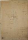
A map of part of the lands of Sterling [Stirling?] in the barony of Dunboyne and County Meath and part of the lands of Pheblestown [Phibblestown] in the barony of Castleknock and County Dublin. Surveyed for Mr. Bingham by J. Longfield 1806. Scale 10 perches to an inch.
Map
Main Creator:
Longfield,
John
, ca. 1775-1833, surveyor
Language:
English
Format:
Map
In collection:
Longfield Map Collection
Published / Created
[1806]
Notes
Physical description: 1 map Geographic Coverage: Bar...
Call Number:
Loading...
Located:
Loading...
1
2
3
4
5
6
7
8
9
10
11
Next
17
Get RSS Feed
Email this Search
History
Narrow Search
Digitised
Remove Filters
Clear Filter
Region: Dublin (Ireland : County)
Clear Filter
Subject: Administration of estates
Format
321
Map
Online Availability
246
Not Digitised
75
Digitised
Published / Created
From:
To:
Subject
Administration of estates
321
Boundaries (Estates)
321
Land tenure
321
Land use surveys
88
History
Author
186
Longfield, John, ca. 1775-1833, surveyor
82
Brownrigg, John, ca. 1748-1838, surveyor
33
Brownrigg & Co., fl. 1801-1809, surveyors
6
Longfield, William, fl. 1825-ca. 1870, surveyor
4
Brownrigg, Longfield and Murray, fl. 1799-ca. 1805, surveyors
2
Brownrigg & Sherrard, fl. 1777-1778, surveyors
more ...
2
Roe, John, fl. 1793-1824, surveyor
2
Scalé, Brownrigg & Sherrard, fl. 1774-1778, surveyors
1
Battersby, John, fl. 1778, surveyor
1
Byrne, John, fl. 1789-1828, surveyor
1
Kelly, John, fl. 1820-1852, surveyor
1
Molloy, John, fl. 1809-1839, surveyor
see all ...
less ...
Collections
321
Longfield Map Collection
Language
321
English
Genre
321
Manuscript maps
321
Maps, Manuscript
88
Early works to 1800
Era
88
18th century
Region
Dublin (Ireland : County)
321
Ireland
320
Dublin (County)
130
Dublin (Ireland)
127
Dublin
56
Rathdown (Barony)
more ...
40
Coolock (Barony)
27
Uppercross (Barony)
17
Dublin (Barony)
16
Castleknock (Barony)
16
Dublin City (Barony)
16
Nethercross (Barony)
15
Newcastle (Barony)
11
Balrothery (Barony)
3
Finglas Parish
3
Finglas Parish (Ireland)
2
Meath
2
Meath (Ireland)
1
Ballybrit (Barony)
1
Ballymadun Parish
1
Ballymadun Parish (Ireland)
1
Blanchards Town Parish
1
Blanchards Town Parish (Ireland)
1
Castleknock Parish
1
Castleknock Parish (Ireland)
1
Clontarf Parish
1
Clontarf Parish (Ireland)
1
Dalkey Parish
1
Dalkey Parish (Ireland)
1
Dublin City
see all ...
less ...
Loading...

![A map of part of the lands of Sterling [Stirling?] in the barony of Dunboyne and County Meath and part of the lands of Pheblestown [Phibblestown] in the barony of Castleknock and County Dublin. Surveyed for Mr. Bingham by J. Longfield 1806. Scale 10 perches to an inch.](/IIIF/000310000/000301758/vtls000301758_001.jp2/full/100,/0/default.jpg)