Showing
81 - 100
results of
526
for search '
Will, John.
'
Skip to content
Toggle navigation
NLI Website
- Catalogue -
English
Gaeilge
Home
Help
Advanced Search
Browse
Orders
Ask a Librarian
Language
English
Gaeilge
All Fields
Title
Author
Subject
Call Number
ISBN/ISSN
Publisher
Coordinates
Search digitised content only
FIND
Author
Will, John.
Results
Showing
81 - 100
results of
526
for search '
Will, John.
'
, query time: 0.04s
List
Grid
Sort
Relevance
Newest First
Oldest First
Call Number
Author
Title
1
Previous
1
2
3
4
5
6
7
8
9
10
11
Next
27
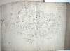
A survey of Mylarstown [Mylerstown] in the Islands of Allen barony of Great Connell County of Kildare the estate of Thomas Hutchinson Smyth. By John Brownrigg 1794. Scale 20 perches to an inch. Table of reference, numbered allotments & descriptive details of land with acreage of land tenants names shown.
Map
Main Creator:
Brownrigg,
John
, ca. 1748-1838, surveyor
Language:
English
Format:
Map
In collection:
Longfield Map Collection
Published / Created
[1794]
Notes
Physical description: 1 map Geographic Coverage: Bar...
Call Number:
Loading...
Located:
Loading...
A survey of a piece of ground called the Slip field near Clontarf in the Barony of Coolock and County of Dublin let by A. Savage Esq. To John Ash by J.B. 1792. Scale 10 Perches to an Inch
Map
Main Creator:
Brownrigg,
John
, ca. 1748-1838, surveyor
Language:
English
Format:
Map
In collection:
Longfield Map Collection
Published / Created
[1792]
Notes
Physical description: 1 map Geographic Coverage: Bar...
Call Number:
Loading...
Located:
Loading...
A map of part of the Lands of Palmerstown in the County of Dublin let by the Revd Sir B. Synge Hutchinson Bt. to [illegible]. Surveyed by J.L. 1816
Map
Main Creator:
Longfield,
John
, ca. 1775-1833, surveyor
Language:
English
Format:
Map
In collection:
Longfield Map Collection
Published / Created
[1816]
Notes
Physical description: 1 map Geographic Coverage: Bar...
Call Number:
Loading...
Located:
Loading...
A map of the Glebe of Stillorgan alia Acrenakill, situate in the half Barony of Rathdown & County of Dublin, the Estate of the Dean of Christ Church, let to the representatives of the late Alderman Waver. Surveyed by J.L. June 1820. Scale 10 Perches to an Inch
Map
Main Creator:
Longfield,
John
, ca. 1775-1833, surveyor
Language:
English
Format:
Map
In collection:
Longfield Map Collection
Published / Created
[June 1820]
Notes
Physical description: 1 map Geographic Coverage: Bar...
Call Number:
Loading...
Located:
Loading...
A survey of Lands of Mount Stuart in the Parish of Killossory, Barony of Coolock & County of Dublin, the Estate of Heny. Ellis Esq. by J.L. 1808. Scale 16 Perches to an Inch
Map
Main Creator:
Longfield,
John
, ca. 1775-1833, surveyor
Language:
English
Format:
Map
In collection:
Longfield Map Collection
Published / Created
[1808]
Notes
Physical description: 1 map Geographic Coverage: Par...
Call Number:
Loading...
Located:
Loading...
A map of part of Simmons Court in the County of the City of Dublin belonging to John Maher Esq. by J. Brownrigg 1788. Scale 10 Perches to an Inch
Map
Main Creator:
Brownrigg,
John
, ca. 1748-1838, surveyor
Language:
English
Format:
Map
In collection:
Longfield Map Collection
Published / Created
[1788]
Notes
Physical description: 1 map Geographic Coverage: Bar...
Call Number:
Loading...
Located:
Loading...
A survey of a holding in Back Lane in the City of Dublin belonging to the Prebendaries and Vicars of Christ Church Dublin let to Sir John Parnell. By J.B. 17th May 1796. Scale 20 feet to an inch. Names of tenants and adjoining tenants shown
Map
Main Creator:
Brownrigg,
John
, ca. 1748-1838, surveyor
Language:
English
Format:
Map
In collection:
Longfield Map Collection
Published / Created
[May 17 1796]
Notes
Physical description: 1 map Geographic Coverage: Dub...
Call Number:
Loading...
Located:
Loading...
A map of the holding No.17 Bridge Street in the City of Dublin, let by Mr. Michael Gernon to Mr John Anderson, Junr. Surveyed by John Longfield 1805. Names of adjoining tenants shown
Map
Main Creator:
Longfield,
John
, ca. 1775-1833, surveyor
Language:
English
Format:
Map
In collection:
Longfield Map Collection
Published / Created
[1805]
Notes
Physical description: 1 map Geographic Coverage: Dub...
Call Number:
Loading...
Located:
Loading...
A map of the Lands of Drumnagally & Ballykiel near Banbridge in the County of Down the Estate of Nichs. Chl. White Esq. Surveyed by J.L. 1819.
Map
Main Creator:
Longfield,
John
, ca. 1775-1833, surveyor
Language:
English
Format:
Map
In collection:
Longfield Map Collection
Published / Created
[1819]
Notes
Physical description: 1 map Geographic Coverage: Bar...
Call Number:
Loading...
Located:
Loading...
A survey of Jordan's Lands [ ] with divisions in the town & lands of Crumlin, and County of Dublin, done for Wm. Thomas Esq. Mrs Sarah Crithbert Wid. and the Revd. John Graves Clark: by John Brownrigg Oct. 1784. Scale 20 Perches to an Inch
Map
Main Creator:
Brownrigg,
John
, ca. 1748-1838, surveyor
Language:
English
Format:
Map
In collection:
Longfield Map Collection
Published / Created
[October 1784]
Notes
Physical description: 1 map Geographic Coverage: Bar...
Call Number:
Loading...
Located:
Loading...
A survey of part of the Lands of Roganstown in the Barony of Nethercross and County of Dublin let to Wm. Disney Esq. Survey'd by J.L. March 1815
Map
Main Creator:
Longfield,
John
, ca. 1775-1833, surveyor
Language:
English
Format:
Map
In collection:
Longfield Map Collection
Published / Created
[March 1815]
Notes
Physical description: 1 map Geographic Coverage: Bar...
Call Number:
Loading...
Located:
Loading...
A map of part of the lands of Davidstown in the barony of Talbotstown Upper and County of Wicklow the estate of the Rev. Sir S. Synge Hutchinson, Bart let to John Murphy. Surveyed by J. Longfield 1813. Scale 20 perches to an inch.
Map
Main Creator:
Longfield,
John
, ca. 1775-1833, surveyor
Language:
English
Format:
Map
In collection:
Longfield Map Collection
Published / Created
[1813]
Notes
Physical description: 1 map Geographic Coverage: Bar...
Call Number:
Loading...
Located:
Loading...
A survey of part of the Lands of Finglass Bge. In the County of Dublin belonging to [illegible] Bayly Esq. Surveyed by Jn.. Longfield 1814. Scale 10 Perches to an Inch
Map
Main Creator:
Longfield,
John
, ca. 1775-1833, surveyor
Language:
English
Format:
Map
In collection:
Longfield Map Collection
Published / Created
[1814]
Notes
Physical description: 1 map Geographic Coverage: Bar...
Call Number:
Loading...
Located:
Loading...
A survey of part of the west moiety of the Dean's Orchard partly in the Liberties of the City of Dublin and partly in the County, the estate of the Dean of Christ Church. Surveyed by J.L. September 10th 1831.Names of tenants shown on properties
Map
Main Creator:
Longfield,
John
, ca. 1775-1833, surveyor
Language:
English
Format:
Map
In collection:
Longfield Map Collection
Published / Created
[September 11 1831]
Notes
Physical description: 1 map Geographic Coverage: Dub...
Call Number:
Loading...
Located:
Loading...
A map of a piece of ground on the west side of Lower Exchange Street in the City of Dublin. Surveyed for Joshua Smyth. By John Longfield. 1812. Names of adjoining tenants shown.
Map
Main Creator:
Longfield,
John
, ca. 1775-1833, surveyor
Language:
English
Format:
Map
In collection:
Longfield Map Collection
Published / Created
[1812]
Notes
Physical description: 1 map Geographic Coverage: Dub...
Call Number:
Loading...
Located:
Loading...
[A map of Part of the Lands of Carpenterstown, being part of the Estate of P. Locke Esq. shewing the adjoining Line of Canal. Partly surveyed and partly copied by Jn. L. 1830. Scale 20 Plantation Perches to an Inch
Map
Main Creator:
Longfield,
John
, ca. 1775-1833, surveyor
Language:
English
Format:
Map
In collection:
Longfield Map Collection
Published / Created
[1830]
Notes
Physical description: 1 map Geographic Coverage: Bar...
Call Number:
Loading...
Located:
Loading...
A map of a holding on the south side of Cuffe Street in the City of Dublin part of the estate of the Revd. Sir Saml. Synge Hutchinson. Surveyed by J.L. 1826. Names of adjoining tenants shown
Map
Main Creator:
Longfield,
John
, ca. 1775-1833, surveyor
Language:
English
Format:
Map
In collection:
Longfield Map Collection
Published / Created
[1826]
Notes
Physical description: 1 map Geographic Coverage: Dub...
Call Number:
Loading...
Located:
Loading...
A map of that part of the river Boyne adjoining the lands of Birfield Coolicat Ballyonan [Co. Kildare] and Ashfield in the County of Meath. Surveyed by John Long under the direction of William F. Mulvany C.E.
Map
Main Creator:
Longfield,
John
, ca. 1775-1833, surveyor
Language:
English
Format:
Map
In collection:
Longfield Map Collection
Published / Created
[undated, between ca. 1795 and 1833].
Notes
Physical description: 1 map
Call Number:
Loading...
Located:
Loading...
A survey of part of Mrs. Maynes property near Blackrock subdivided in lots for building ... [By] John Molloy 1836. Laid to a scale of Perches
Map
Main Creator:
Molloy,
John
, fl. 1809-1839, surveyor
Language:
English
Format:
Map
In collection:
Longfield Map Collection
Published / Created
[1836]
Notes
Physical description: 1 map Geographic Coverage: Bar...
Call Number:
Loading...
Located:
Loading...
A map of the road lying between Naas and Carah [Carragh] in the barony of Clane & County of Kildare with a proposed line for shortening the same - section of the stream running between the lands of Gormanstown and the lands of Carra [Carragh] in the barony of Clane and County Kildare. Surveyed & levelled for John Mansfield by J.L. 1816
Map
Main Creator:
Longfield,
John
, ca. 1775-1833, surveyor
Language:
English
Format:
Map
In collection:
Longfield Map Collection
Published / Created
[1816]
Notes
Some staining around the edges of the map. Some part...
Call Number:
Loading...
Located:
Loading...
1
Previous
1
2
3
4
5
6
7
8
9
10
11
Next
27
Get RSS Feed
Email this Search
History
Narrow Search
Digitised
Remove Filters
Clear Filter
Genre: Maps, Manuscript
Clear Filter
Subject: Boundaries (Estates)
Format
526
Map
Online Availability
264
Digitised
262
Not Digitised
Published / Created
From:
To:
Subject
Boundaries (Estates)
526
Land tenure
526
Land use surveys
516
Administration of estates
126
History
19
Administration of Estates
Author
335
Longfield, John, ca. 1775-1833, surveyor
112
Brownrigg, John, ca. 1748-1838, surveyor
42
Brownrigg & Co., fl. 1801-1809, surveyors
7
Brownrigg, Longfield and Murray, fl. 1799-ca. 1805, surveyors
6
Longfield, William, fl. 1825-ca. 1870, surveyor
4
Scalé, Brownrigg & Sherrard, fl. 1774-1778, surveyors
more ...
3
Roe, John, fl. 1793-1824, surveyor
2
Brownrigg & Sherrard, fl. 1777-1778, surveyors
2
Byrne, John, fl. 1789-1828, surveyor
2
Moynahan, John, fl. 1736-1764, surveyor
1
Balfe, M., fl. 1821, surveyor
1
Battersby, John, fl. 1778, surveyor
1
Bell, John (I and II), fl. 1721-1820
1
Browne, John, fl. 1788-ca. 1807, surveyor
1
Connolly, John, fl. 1826, surveyor
1
Kelly, John, fl. 1820-1852, surveyor
1
Logan, John, fl. 1827-1846, surveyor
1
Molloy, John, fl. 1809-1839, surveyor
1
Netterville, John, fl. 1747-1768, surveyor
1
O'Brien, John, fl. 1784-1820, surveyor
1
Wright, John, fl. 1759-1775, surveyor
see all ...
less ...
Collections
526
Longfield Map Collection
Language
526
English
Genre
526
Manuscript maps
Maps, Manuscript
126
Early works to 1800
Era
126
18th century
Region
522
Ireland
321
Dublin (Ireland : County)
320
Dublin (County)
130
Dublin (Ireland)
127
Dublin
58
Meath
more ...
58
Meath (Ireland)
57
Rathdown (Barony)
49
Kildare (County)
49
Kildare (Ireland : County)
40
Coolock (Barony)
27
Uppercross (Barony)
21
Newcastle (Barony)
18
Offaly West (Barony)
17
Dublin (Barony)
16
Castleknock (Barony)
16
Dublin City (Barony)
16
Nethercross (Barony)
13
Wicklow (County)
13
Wicklow (Ireland : County)
12
Westmeath
12
Westmeath (Ireland)
11
Balrothery (Barony)
10
Roscommon (County)
10
Roscommon (Ireland : County)
9
Duleek Upper (Barony)
9
Laois
9
Laois (Ireland)
8
Tipperary (County)
8
Tipperary (Ireland : County)
see all ...
less ...
Loading...
![A survey of Mylarstown [Mylerstown] in the Islands of Allen barony of Great Connell County of Kildare the estate of Thomas Hutchinson Smyth. By John Brownrigg 1794. Scale 20 perches to an inch. Table of reference, numbered allotments & descriptive details of land with acreage of land tenants names shown.](/IIIF/000310000/000301989/vtls000301989_001.jp2/full/100,/0/default.jpg)

![A map of part of the Lands of Palmerstown in the County of Dublin let by the Revd Sir B. Synge Hutchinson Bt. to [illegible]. Surveyed by J.L. 1816](/IIIF/000310000/000302272/vtls000302272_001.jp2/full/100,/0/default.jpg)


![A survey of part of the Lands of Finglass Bge. In the County of Dublin belonging to [illegible] Bayly Esq. Surveyed by Jn.. Longfield 1814. Scale 10 Perches to an Inch](/IIIF/000310000/000301106/vtls000301106_001.jp2/full/100,/0/default.jpg)

![A map of that part of the river Boyne adjoining the lands of Birfield Coolicat Ballyonan [Co. Kildare] and Ashfield in the County of Meath. Surveyed by John Long under the direction of William F. Mulvany C.E.](/IIIF/000310000/000308871/vtls000308871_001.jp2/full/100,/0/default.jpg)
![A map of the road lying between Naas and Carah [Carragh] in the barony of Clane & County of Kildare with a proposed line for shortening the same - section of the stream running between the lands of Gormanstown and the lands of Carra [Carragh] in the barony of Clane and County Kildare. Surveyed & levelled for John Mansfield by J.L. 1816](/IIIF/000310000/000301982/vtls000301982_001.jp2/full/100,/0/default.jpg)