Showing
1 - 20
results of
526
for search '
Will, John.
'
Skip to content
Toggle navigation
NLI Website
- Catalogue -
English
Gaeilge
Home
Help
Advanced Search
Browse
Orders
Ask a Librarian
Language
English
Gaeilge
All Fields
Title
Author
Subject
Call Number
ISBN/ISSN
Publisher
Coordinates
Search digitised content only
FIND
Author
Will, John.
Results
Showing
1 - 20
results of
526
for search '
Will, John.
'
, query time: 0.11s
List
Grid
Sort
Relevance
Newest First
Oldest First
Call Number
Author
Title
1
2
3
4
5
6
7
8
9
10
11
Next
27
Loading...
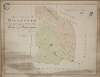
A map of the lands of Killaster situate in the barony of Castlereagh and County of Roscommon. S...
Loading...
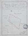
[A plan of holdings in the neighbourhood of Dolphins Barn] by John Battersby 1778
Loading...
A mapp of a lott of ground situate west side of Drogheda St. Monasterevin ... Surveyed by J Lon...
Loading...
A map of a lot of ground on the east side of St. Michaels Lane in the City of Dublin the estate...
Loading...
A survey of part of the Lands of Blanchardstown in the County of Dublin - Parish & Barony of Cas...
Loading...
A map of part of the Lands of Ashtown, near the 11th lock of the Royal Canal in the Co Dublin....
Loading...
A survey of a Lott of ground in Whites Avenue [Merrion] in the Parish of Donnybrook and Co of Du...
Loading...
A map of the precincts of Christ Church showing the part about to be purchased by the Commission...
Loading...
A survey of two fields on Rathmines Road part of the Estate of the Right Honble. the Earl of Mea...
Loading...
A map of part of the Glebe lands of Kilcullen in the County of Kildare, granted by the Rev. Thom...
Loading...
A survey of part of the farm of St. Sepulchre's in the County of Dublin let by His Grace Robert...
Loading...
A map of the lands of Galbertstown ... in the barony of Eliogarty and County of Tipperary. Surv...
Loading...
A map of part of the lands at Kelshamore in the barony of Talbotstown Upper and County of Wicklo...
Loading...
A map of a lot of ground between Boyne Street and Denzile Street the property of Thomas Hamilton...
Loading...
A map of part of the lands of Kelshamore in the barony of Talbotstown Upper and County of Wicklo...
Loading...
A map of part of the Lands of Finglass in the Co Dublin - Surveyed for John Bayly Esq. by J.L. 1...
Loading...
A map of part of Lloyd's Rope walk and sundry other premises lying on the north side of Lower Ab...
Loading...
A map of a Part of the Demense of Stillorgan in the Barony of Half Rathdown & County of Dublin t...
Loading...
A map of Killishee [Killashee] Soordlestown [Swordlestown] etc, in the barony of Naas and County...
Loading...
A map of the new Line of street called Hatch Street and also of the continuation of Harcourt Str...
1
2
3
4
5
6
7
8
9
10
11
Next
27
Get RSS Feed
Email this Search
History
Narrow Search
Digitised
Remove Filters
Clear Filter
Genre: Manuscript maps
Clear Filter
Subject: Land tenure
Format
526
Map
Online Availability
264
Digitised
262
Not Digitised
Published / Created
From:
To:
Subject
526
Boundaries (Estates)
Land tenure
526
Land use surveys
516
Administration of estates
126
History
19
Administration of Estates
Author
335
Longfield, John, ca. 1775-1833, surveyor
112
Brownrigg, John, ca. 1748-1838, surveyor
42
Brownrigg & Co., fl. 1801-1809, surveyors
7
Brownrigg, Longfield and Murray, fl. 1799-ca. 1805, surveyors
6
Longfield, William, fl. 1825-ca. 1870, surveyor
4
Scalé, Brownrigg & Sherrard, fl. 1774-1778, surveyors
more ...
3
Roe, John, fl. 1793-1824, surveyor
2
Brownrigg & Sherrard, fl. 1777-1778, surveyors
2
Byrne, John, fl. 1789-1828, surveyor
2
Moynahan, John, fl. 1736-1764, surveyor
1
Balfe, M., fl. 1821, surveyor
1
Battersby, John, fl. 1778, surveyor
1
Bell, John (I and II), fl. 1721-1820
1
Browne, John, fl. 1788-ca. 1807, surveyor
1
Connolly, John, fl. 1826, surveyor
1
Kelly, John, fl. 1820-1852, surveyor
1
Logan, John, fl. 1827-1846, surveyor
1
Molloy, John, fl. 1809-1839, surveyor
1
Netterville, John, fl. 1747-1768, surveyor
1
O'Brien, John, fl. 1784-1820, surveyor
1
Wright, John, fl. 1759-1775, surveyor
see all ...
less ...
Collections
526
Longfield Map Collection
Language
526
English
Genre
Manuscript maps
526
Maps, Manuscript
126
Early works to 1800
Era
126
18th century
Region
522
Ireland
321
Dublin (Ireland : County)
320
Dublin (County)
130
Dublin (Ireland)
127
Dublin
58
Meath
more ...
58
Meath (Ireland)
57
Rathdown (Barony)
49
Kildare (County)
49
Kildare (Ireland : County)
40
Coolock (Barony)
27
Uppercross (Barony)
21
Newcastle (Barony)
18
Offaly West (Barony)
17
Dublin (Barony)
16
Castleknock (Barony)
16
Dublin City (Barony)
16
Nethercross (Barony)
13
Wicklow (County)
13
Wicklow (Ireland : County)
12
Westmeath
12
Westmeath (Ireland)
11
Balrothery (Barony)
10
Roscommon (County)
10
Roscommon (Ireland : County)
9
Duleek Upper (Barony)
9
Laois
9
Laois (Ireland)
8
Tipperary (County)
8
Tipperary (Ireland : County)
see all ...
less ...
Loading...


![A map of Killishee [Killashee] Soordlestown [Swordlestown] etc, in the barony of Naas and County of Kildare belonging to Robert Graydon. By John Brownrigg 1777. Names of tenants shown on some holdings.](/IIIF/000310000/000302012/vtls000302012_001.jp2/full/100,/0/default.jpg)