Showing
201 - 220
results of
379
for search '
Will, John.
'
Skip to content
Toggle navigation
NLI Website
- Catalogue -
English
Gaeilge
Home
Help
Advanced Search
Browse
Orders
Ask a Librarian
Language
English
Gaeilge
All Fields
Title
Author
Subject
Call Number
ISBN/ISSN
Publisher
Coordinates
Search digitised content only
FIND
Author
Will, John.
Results
Showing
201 - 220
results of
379
for search '
Will, John.
'
, query time: 0.06s
List
Grid
Sort
Relevance
Newest First
Oldest First
Call Number
Author
Title
1
Previous
6
7
8
9
10
11
12
13
14
15
16
Next
19
Doctoris subtilis et Mariani Joannis Duns Scoti Ordinis Fratrum Minorum Opera omnia /
Book
Main Creator:
Duns Scotus,
John
, approximately 1266-1308
Language:
Latin
Format:
Book
Published / Created
1950-<1993>
Notes
Physical description: v. <19> ; 32 cm.
Call Number:
Loading...
Located:
Loading...
A survey of part of Old Connagh called Moat Field in the Barony of Rathdown & Co. of Dublin, the Estate of Mrs. Hutchinson, by J.B. May 2nd 1799. Scale 10 Perches to an Inch
Map
Main Creator:
Brownrigg,
John
, ca. 1748-1838, surveyor
Language:
English
Format:
Map
In collection:
Longfield Map Collection
Published / Created
[May 02 1799]
Notes
Physical description: 1 map Geographic Coverage: Bar...
Call Number:
Loading...
Located:
Loading...
The works of the Most Reverend Father in God, John Bramhall, D.D., sometime Lord Archbishop of Armagh, Primate and Metropolitan of all Ireland /
Book
Main Creator:
Bramhall,
John
, Apb. of Armagh, 1594-1663.
Language:
English
Format:
Book
Published / Created
1842-1845.
Notes
Prefaces signed by A.W.H. Includes bibliographical r...
Call Number:
Loading...
Located:
Loading...
A map of several lotts of ground on Channel Row in the County of the City of Dublin let by the Rt. Hon. Lord Visct. Palmerston to the Governors of the House of Industry. Surveyed by John Brownrigg 1787. Scale 80 feet to an Inch. Names of adjoining tenants shown
Map
Main Creator:
Brownrigg,
John
, ca. 1748-1838, surveyor
Language:
English
Format:
Map
In collection:
Longfield Map Collection
Published / Created
[1787]
Notes
Physical description: 1 map Geographic Coverage: Dub...
Call Number:
Loading...
Located:
Loading...
A map of three Parcels of ground near the Black Rock in the County of Dublin belonging to John Allen Esq. Survey'd by John Brownrigg 1796. Scale 10 Perches to an Inch
Map
Main Creator:
Brownrigg,
John
, ca. 1748-1838, surveyor
Language:
English
Format:
Map
In collection:
Longfield Map Collection
Published / Created
[1796]
Notes
Physical description: 1 map Geographic Coverage: Bar...
Call Number:
Loading...
Located:
Loading...
A survey of the Sea Fort etc, near the Blackrock in the County of Dublin done for Jus. Powell Esq by J.B. April 1798.
Map
Main Creator:
Brownrigg,
John
, ca. 1748-1838, surveyor
Language:
English
Format:
Map
In collection:
Longfield Map Collection
Published / Created
[April 1798]
Notes
Physical description: 1 map Geographic Coverage: Bar...
Call Number:
Loading...
Located:
Loading...
A map of part of the Lands of Lusk, in the County of Dublin the Estate of W. Parsons Esq. Surveyed by Laurence Magennis 1791. Copy.d. by J. Brownrigg 1792. Scale 20 Perches to an Inch.
Map
Main Creator:
Brownrigg,
John
, ca. 1748-1838, surveyor
Language:
English
Format:
Map
In collection:
Longfield Map Collection
Published / Created
[1792]
Notes
Physical description: 1 map Geographic Coverage: Bar...
Call Number:
Loading...
Located:
Loading...
A survey of Lisheenoona in the barony of Decies-without-Drum Co. Waterford estate of Mrs. Catherine Griffith. Surveyed by J.B. 23rd October 1792. Also shown lands at Knockgarraun, Churchquarter, Parkmore, Scart, Derry Upper, ... and Newtown.
Map
Main Creator:
Brownrigg,
John
, ca. 1748-1838, surveyor
Language:
English
Format:
Map
In collection:
Longfield Map Collection
Published / Created
[October 23 1792]
Notes
Physical description: 1 map Geographic Coverage: Bar...
Call Number:
Loading...
Located:
Loading...
A survey of part of Monkstown in the County of Dublin. The Estate of the Rt Honorable Lords De Verci & Longford. By J. Brownrigg 1784
Map
Main Creator:
Brownrigg,
John
, ca. 1748-1838, surveyor
Language:
English
Format:
Map
In collection:
Longfield Map Collection
Published / Created
[1784]
Notes
Physical description: 1 map Geographic Coverage: Bar...
Call Number:
Loading...
Located:
Loading...
A map of bog land in Roomead Clonmaskill Crownstown, with references to previous surveys of the Down Survey and Scalè's map; and a map of part of Mitchelstown in the barony of Fore and County of Westmeath done for Robert Tighe. By J.B. 1790. Scale 20 perches to an inch.
Map
Main Creator:
Brownrigg,
John
, ca. 1748-1838, surveyor
Language:
English
Format:
Map
In collection:
Longfield Map Collection
Published / Created
[1790]
Notes
Physical description: 1 map Geographic Coverage: Bar...
Call Number:
Loading...
Located:
Loading...
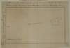
A survey of upper & lower Kinnea [Kineagh] in the barony of west Offaly parish of Kilcullen and County of Kildare the estate of Arthur Cope. By J. Brownrigg 1787. Scale 20 perches to an inch. Names of tenants & acreage of holdings shown.
Map
Main Creator:
Brownrigg,
John
, ca. 1748-1838, surveyor
Language:
English
Format:
Map
In collection:
Longfield Map Collection
Published / Created
[1787]
Notes
Physical description: 1 map Geographic Coverage: Par...
Call Number:
Loading...
Located:
Loading...
[A plan of holdings at] Johnmills in the Barony of Uppercross Co Dublin belonging to John Gilmore Esq. by J.B. 1774.
Map
Main Creator:
Brownrigg,
John
, ca. 1748-1838, surveyor
Language:
English
Format:
Map
In collection:
Longfield Map Collection
Published / Created
[1774]
Notes
Inset map: "A plan showing Temple Street and Stable L...
Call Number:
Loading...
Located:
Loading...
A map of a lot of ground lying on the west side of Christ Church Lane whereon are several houses and tenements belonging to the Dean & Chapter of Christ Church Dublin. Surveyed by J.B. 7 May 1796. John Finlay's name on holding
Map
Main Creator:
Brownrigg,
John
, ca. 1748-1838, surveyor
Language:
English
Format:
Map
In collection:
Longfield Map Collection
Published / Created
[May 07 1796]
Notes
Physical description: 1 map Geographic Coverage: Dub...
Call Number:
Loading...
Located:
Loading...
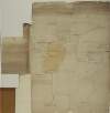
A survey of Clonmeen and Clonlack in the barony of Coolistown [Coolestown] and Kings County [Offaly] the estate of the most noble the Marqueesof Downshire. By J. Brownrigg. 1795. Scale of 20 perches to an inch. Table of reference & tenants names & acreage shown on holdings.
Map
Main Creator:
Brownrigg,
John
, ca. 1748-1838, surveyor
Language:
English
Format:
Map
In collection:
Longfield Map Collection
Published / Created
[1795]
Notes
Some staining around the edges and down the right-han...
Call Number:
Loading...
Located:
Loading...
A survey of part of Johnstown and part of Parcellstown in the barony of Moygoish and County of Westmeath the estate of Ralph Smyth. By John Brownrigg 1783. Scale 20 perches to an inch. Names of tenants and acreage of holdings shown on Parellstown holdings.
Map
Main Creator:
Brownrigg,
John
, ca. 1748-1838, surveyor
Language:
English
Format:
Map
In collection:
Longfield Map Collection
Published / Created
[1783]
Notes
Physical description: 1 map Geographic Coverage: Bar...
Call Number:
Loading...
Located:
Loading...
Survey of a piece of ground on which is erected a brewery farm yards and dwelling houses situate in the Earl of Meath's Liberty in the possession of various persons. By John Brownrigg, Sept 1793. Scale 20 feet to an inch. Mr Thwaites dwelling house shown
Map
Main Creator:
Brownrigg,
John
, ca. 1748-1838, surveyor
Language:
English
Format:
Map
In collection:
Longfield Map Collection
Published / Created
[September 1793]
Notes
Physical description: 1 map Geographic Coverage: Dub...
Call Number:
Loading...
Located:
Loading...
A survey of part of the lands of Woodtown in the barony of Deece Upper and County of Meath, the estate of the late J. Wilson. By J. Brownrigg 1793. Scale 20 perches to an inch. Names of tenants & acreage of holdings shown.
Map
Main Creator:
Brownrigg,
John
, ca. 1748-1838, surveyor
Language:
English
Format:
Map
In collection:
Longfield Map Collection
Published / Created
[1793]
Notes
Physical description: 1 map Geographic Coverage: Bar...
Call Number:
Loading...
Located:
Loading...
A survey of Brennanstown & Loughanstown in the County of Dublin part of the Estate of the Dean of Christ Church, let to Capt. Mercer done by J.B. 1798
Map
Main Creator:
Brownrigg,
John
, ca. 1748-1838, surveyor
Language:
English
Format:
Map
In collection:
Longfield Map Collection
Published / Created
[1798]
Notes
Physical description: 1 map Geographic Coverage: Bar...
Call Number:
Loading...
Located:
Loading...
A map of a holding in Blackrock in the County of Dublin the Estate of Mrs. Mary Alcock, widow, let to Richd. Le Favre Esq. by J. Brownrigg 1793. Scale 40 Feet to an Inch
Map
Main Creator:
Brownrigg,
John
, ca. 1748-1838, surveyor
Language:
English
Format:
Map
In collection:
Longfield Map Collection
Published / Created
[1793]
Notes
Physical description: 1 map Geographic Coverage: Bar...
Call Number:
Loading...
Located:
Loading...
A design for changing the course of the River Dodder and for forming a wet dock in the harbour of Ringsend. By John Brownrigg, 1787.
Map
Main Creator:
Brownrigg,
John
, ca. 1748-1838, surveyor
Language:
English
Format:
Map
In collection:
Longfield Map Collection
Published / Created
[1787]
Notes
Physical description: 1 map Geographic Coverage: Dub...
Call Number:
Loading...
Located:
Loading...
1
Previous
6
7
8
9
10
11
12
13
14
15
16
Next
19
Get RSS Feed
Email this Search
History
Narrow Search
Digitised
Remove Filters
Clear Filter
Genre: Early works to 1800
Clear Filter
Subject: History
Format
240
Book
127
Map
4
Manuscript
4
Newspaper
3
Journal / Serial
1
Microfilm
Online Availability
303
Not Digitised
76
Digitised
Published / Created
From:
To:
Subject
History
127
Land tenure
126
Administration of estates
126
Boundaries (Estates)
126
Land use surveys
35
Politics and government
more ...
16
Civil War, 1642-1649
16
Theology
11
Description and travel
10
Sources
7
Apologetics
6
Kings and rulers
5
Massacres
4
Antiquities
4
Commerce
4
Early works to 1800
4
Economic conditions
4
Social life and customs
4
Tariff
4
Trials (Treason)
3
Bishops
3
Broadsides
3
Catholics
3
Christian literature, Early
3
Church history
3
Civil rights
3
Clergy
3
Doctrines
3
Education
3
History and criticism
see all ...
less ...
Author
108
Brownrigg, John, ca. 1748-1838, surveyor
9
Temple, John, Sir, 1600-1677
5
England and Wales. Sovereign (1625-1649 : Charles I)
5
Lilburne, John, 1614?-1657
4
Curry, John, d. 1780
4
Scalé, Brownrigg & Sherrard, fl. 1774-1778, surveyors
more ...
3
Cook, John, d. 1660
3
Davies, John, Sir, 1569-1626
3
England and Wales. Parliament
3
Evelyn, John, 1620-1706
3
Glynne, John, Sir, 1603-1666
3
Ireland. Lord Lieutenant (1795-1798 : John Jefferies Pratt, Marquis Camden)
2
Andrews, John Harwood, 1927-
2
Becon, Thomas, 1512-1567
2
Brownrigg & Co., fl. 1801-1809, surveyors
2
Bury, John, Capt
2
Capgrave, John, 1393-1464
2
Dryden, John, 1631-1700
2
Foxe, John, 1516-1587
2
Fuller, John and Thomas, Wholesale New Drapery Manufactory
2
Gauden, John, 1605-1662
2
Graham, John, 1776-1844
2
Great Britain. Parliament
2
John, of Damascus, Saint
2
Mackenzie, John, 1648?-1696
2
Moynahan, John, fl. 1736-1764, surveyor
2
Nalson, John, 1638?-1686
2
Oriel, John Foster, Baron, 1740-1828
2
Pym, John, 1584-1643
2
Spottiswood, John, 1565-1639
see all ...
less ...
Collections
126
Longfield Map Collection
1
John Pitt Kennedy papers, 1800-1964.
Language
363
English
20
Latin
4
Ancient Greek
4
French
1
Dutch
1
Undetermined
more ...
1
Welsh
see all ...
less ...
Genre
Early works to 1800
126
Manuscript maps
126
Maps, Manuscript
15
Sources
8
Controversial literature
5
Maps
more ...
3
Biography
3
Poetry
2
Correspondence
2
Diaries
2
Pamphlets
2
Periodicals
2
Personal narratives
2
Receipts
1
15th century
1
Binders' instructions (Binding)
1
Chronology
1
Commentaries
1
Correspondence, reminiscences, etc
1
Early works to 1850
1
Humor
1
Ireland
1
Juvenile literature
1
Newspapers
1
Outlines, syllabi, etc
1
Pagination errors (Printing)
1
Pictorial works
1
Publisher's advertisements
1
Registers
1
Surveys
see all ...
less ...
Era
163
18th century
30
17th century
25
Rebellion of 1641
18
Commonwealth and Protectorate, 1649-1660
15
Charles I, 1625-1649
13
1600-1649
more ...
9
16th century
8
1625-1649
8
1649-1660
8
Civil War, 1642-1649
7
1642-1649
7
Charles II, 1660-1685
7
Early church, ca. 30-600
6
1593-1641
5
1649-1775
4
Middle Ages, 600-1500
4
Rebellion of 1798
4
Stuarts, 1603-1714
4
Union, 1801
4
William and Mary, 1689-1702
3
1614?-1657
3
1649-1685
3
1660-1688
3
1760-1820
3
Medieval period, 1066-1485
3
Puritan Revolution, 1642-1660
3
To 1603
3
War of 1689-1691
2
1066-1485
2
1066-1687
see all ...
less ...
Region
225
Ireland
98
Great Britain
90
Dublin (Ireland : County)
87
Dublin (County)
54
Dublin (Ireland)
43
Dublin
more ...
26
England
16
Rathdown (Barony)
11
Dublin City (Barony)
11
Uppercross (Barony)
9
Coolock (Barony)
9
Meath
9
Meath (Ireland)
8
Scotland
8
Westmeath
8
Westmeath (Ireland)
7
Dublin (Barony)
7
Kildare (County)
7
Kildare (Ireland : County)
5
Balrothery (Barony)
5
Fore (Barony)
5
Longford (County)
5
Longford (Ireland : County)
4
Granard (Barony)
4
Skreen (Barony)
3
Connell (Barony)
3
Europe
3
France
3
London
3
London (England)
see all ...
less ...
Loading...


![A survey of upper & lower Kinnea [Kineagh] in the barony of west Offaly parish of Kilcullen and County of Kildare the estate of Arthur Cope. By J. Brownrigg 1787. Scale 20 perches to an inch. Names of tenants & acreage of holdings shown.](/IIIF/000310000/000302064/vtls000302064_001.jp2/full/100,/0/default.jpg)
![A survey of Clonmeen and Clonlack in the barony of Coolistown [Coolestown] and Kings County [Offaly] the estate of the most noble the Marqueesof Downshire. By J. Brownrigg. 1795. Scale of 20 perches to an inch. Table of reference & tenants names & acreage shown on holdings.](/IIIF/000310000/000302155/vtls000302155_001.jp2/full/100,/0/default.jpg)


