Showing
101 - 120
results of
526
for search '
Will, John.
'
Skip to content
Toggle navigation
NLI Website
- Catalogue -
English
Gaeilge
Home
Help
Advanced Search
Browse
Orders
Ask a Librarian
Language
English
Gaeilge
All Fields
Title
Author
Subject
Call Number
ISBN/ISSN
Publisher
Coordinates
Search digitised content only
FIND
Author
Will, John.
Results
Showing
101 - 120
results of
526
for search '
Will, John.
'
, query time: 0.09s
List
Grid
Sort
Relevance
Newest First
Oldest First
Call Number
Author
Title
1
Previous
1
2
3
4
5
6
7
8
9
10
11
Next
27
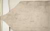
Section of the Canal Stream, commencing at the Bottom of the Foot Bridge [near the Barn of Castlekelly] and continuing same to the junction of the Streams near the ford of Thomastown. By J.L. 1815
Map
Main Creator:
Longfield,
John
, ca. 1775-1833, surveyor
Language:
English
Format:
Map
In collection:
Longfield Map Collection
Published / Created
[1815]
Notes
Physical description: 1 map Geographic Coverage: Bar...
Call Number:
Loading...
Located:
Loading...
A survey of a lot of ground on the west side of Bridge St in the parish of St. Audeon City of Dublin belonging to the Dean & Chapter of Christ Church. Surveyed by John Longfield. Scale 20 feet to an inch. Names of tenants shown on properties
Map
Main Creator:
Longfield,
John
, ca. 1775-1833, surveyor
Language:
English
Format:
Map
In collection:
Longfield Map Collection
Published / Created
[between 1795 and 1833]
Notes
Physical description: 1 map Geographic Coverage: Dub...
Call Number:
Loading...
Located:
Loading...
A map of a piece of ground on the west side of Fishamble Street in the City of Dublin belonging to Richd. Eaton. Surveyed by J.L. 1809. Names of tenants shown on holdings.
Map
Main Creator:
Longfield,
John
, ca. 1775-1833, surveyor
Language:
English
Format:
Map
In collection:
Longfield Map Collection
Published / Created
[1809]
Notes
Physical description: 1 map Geographic Coverage: Dub...
Call Number:
Loading...
Located:
Loading...
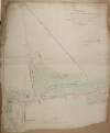
A survey of the lands of Moortown in the barony of Duleek [Upper] and County of Meath. Done for Francis Synge by J.L. 1805. Names of tenants and acreage of holdings shown. Scale 10 perches to an inch.
Map
Main Creator:
Longfield,
John
, ca. 1775-1833, surveyor
Language:
English
Format:
Map
In collection:
Longfield Map Collection
Published / Created
[1805]
Notes
Physical description: 1 map Geographic Coverage: Bar...
Call Number:
Loading...
Located:
Loading...
A map of Esker in the barony of Fassadinin and County of Kilkenny the estate of [illegible] George. Surveyed in 1824. By J.L. Scale 16 perches to an inch. Names of tenants & acreage of holdings shown.
Map
Main Creator:
Longfield,
John
, ca. 1775-1833, surveyor
Language:
English
Format:
Map
In collection:
Longfield Map Collection
Published / Created
[1824]
Notes
Some staining around the edges of the map. Physical d...
Call Number:
Loading...
Located:
Loading...
A map of Giblaghstown [Gibblockstown] in the barony of Upper Duleek and County of Meath the estate of the most noble the Marquis of Lansdowne let to Mr. Nicholas Baylor. Surveyed by J. Longfield May 1818. Scale 16 perches to an inch.
Map
Main Creator:
Longfield,
John
, ca. 1775-1833, surveyor
Language:
English
Format:
Map
In collection:
Longfield Map Collection
Published / Created
[May 1818]
Notes
Physical description: 1 map Geographic Coverage: Bar...
Call Number:
Loading...
Located:
Loading...
A survey of the Estate of Simon Davenport Esq. in the Barony of Tullygarvey and County of Cavan, by J. B[rownrigg] 1791.
Map
Main Creator:
Brownrigg,
John
, ca. 1748-1838, surveyor
Language:
English
Format:
Map
In collection:
Longfield Map Collection
Published / Created
[1791]
Notes
Physical description: 1 map Geographic Coverage: Par...
Call Number:
Loading...
Located:
Loading...
A map of a Lott of Building ground in the Lordship of Mary's Abbey and County of Dublin belonging to Mr. William Crosby. Survey'd by J. Brownrigg March 1789
Map
Main Creator:
Brownrigg,
John
, ca. 1748-1838, surveyor
Language:
English
Format:
Map
In collection:
Longfield Map Collection
Published / Created
[March 1789]
Notes
Physical description: 1 map Geographic Coverage: Dub...
Call Number:
Loading...
Located:
Loading...
A map of the lands of Fennor and Rowlestown in the barony of Duleek Upper and County of Meath the estate of Francis Synge. Surveyed by J.L. 1806. Table of reference to Rowleston showing tenants and acreage of holdings. Names of tenants shown on Fennor map.
Map
Main Creator:
Longfield,
John
, ca. 1775-1833, surveyor
Language:
English
Format:
Map
In collection:
Longfield Map Collection
Published / Created
[1806]
Notes
Physical description: 1 map Geographic Coverage: Bar...
Call Number:
Loading...
Located:
Loading...
A survey of part of the Lands of Puckstown in the County of Dublin, let by Thos. Twig Esq. to [illegible] Hammell Esq. Surveyed by J.B. 18th May 1793. Scale 10 Perches to an Inch
Map
Main Creator:
Brownrigg,
John
, ca. 1748-1838, surveyor
Language:
English
Format:
Map
In collection:
Longfield Map Collection
Published / Created
[May 18 1793]
Notes
Physical description: 1 map Geographic Coverage: Bar...
Call Number:
Loading...
Located:
Loading...
A map of a holding in Skippers Alley in the City of Dublin. The estate of [illegible] Ball, Esq Surveyed by J.L. 1814. Names of tenants shown on property.
Map
Main Creator:
Longfield,
John
, ca. 1775-1833, surveyor
Language:
English
Format:
Map
In collection:
Longfield Map Collection
Published / Created
[1814]
Notes
Physical description: 1 map Geographic Coverage: Dub...
Call Number:
Loading...
Located:
Loading...
A survey of a Lott of ground in Whites Avenue [Merrion] in the Parish of Donnybrook and Co of Dublin, done Frans. Lowe Esq by J.L. 1819. Scale 10 Perches to an Inch
Map
Main Creator:
Longfield,
John
, ca. 1775-1833, surveyor
Language:
English
Format:
Map
In collection:
Longfield Map Collection
Published / Created
[1819]
Notes
Physical description: 1 map Geographic Coverage: Bar...
Call Number:
Loading...
Located:
Loading...
A map of part of the Demense of Malahide, with parts of Streamstown Mayfield & Auburn, the whole formerly call'd Mabstown, in the B[arony] of Coolock & Co. Dublin - traced from the Down Survey. Order of the Rt. Revd. the Dean & Chapter of C.C. [Christ Church] Dublin. By J.L. 1816
Map
Main Creator:
Longfield,
John
, ca. 1775-1833, surveyor
Language:
English
Format:
Map
In collection:
Longfield Map Collection
Published / Created
[1816]
Notes
Physical description: 1 map Geographic Coverage: Bar...
Call Number:
Loading...
Located:
Loading...
A survey of the town of Monasterevin done with a view to shew the advantage & improvement of changing the bridge from its present site so as to range with the main entrance from Dublin. By John Longfield, 1807. Scale 100 feet to an inch. Names of some tenants shown on properties.
Map
Main Creator:
Longfield,
John
, ca. 1775-1833, surveyor
Language:
English
Format:
Map
In collection:
Longfield Map Collection
Published / Created
[1807]
Notes
Physical description: 1 map Geographic Coverage: Bar...
Call Number:
Loading...
Located:
Loading...
A survey of the Demense of Thorn Hill in the Parish of Clontarf & Co. of Dublin, belonging to Mrs. Bull, by J.L. 1816. Scale 10 Perches to an Inch
Map
Main Creator:
Longfield,
John
, ca. 1775-1833, surveyor
Language:
English
Format:
Map
In collection:
Longfield Map Collection
Published / Created
[1816]
Notes
Physical description: 1 map Geographic Coverage: Par...
Call Number:
Loading...
Located:
Loading...
A map of part of Peafield in the Barony of Coolock & County of Dublin, the Estate of [illegible] Bever Esq. Survey'd by John Brownrigg 1795. Scale 20 Perches to an Inch
Map
Main Creator:
Brownrigg,
John
, ca. 1748-1838, surveyor
Language:
English
Format:
Map
In collection:
Longfield Map Collection
Published / Created
[1795]
Notes
Physical description: 1 map Geographic Coverage: Bar...
Call Number:
Loading...
Located:
Loading...
A map of part of the Lands of Swords call'd the Bullock Parks - let by the Revd. Sir James B Hutchinson to Mr. Pat Cuffe. Survey'd by J.L. 1814
Map
Main Creator:
Longfield,
John
, ca. 1775-1833, surveyor
Language:
English
Format:
Map
In collection:
Longfield Map Collection
Published / Created
[1814]
Notes
Physical description: 1 map Geographic Coverage: Bar...
Call Number:
Loading...
Located:
Loading...
A survey of part of the lands of Ballynabarny in the barony of Newcastle and County of Wicklow. By J.L. 1831. Scale 20 perches to an inch.
Map
Main Creator:
Longfield,
John
, ca. 1775-1833, surveyor
Language:
English
Format:
Map
In collection:
Longfield Map Collection
Published / Created
[1831]
Notes
Physical description: 1 map Geographic Coverage: Bar...
Call Number:
Loading...
Located:
Loading...
A survey of part of the Lands of Blanchardstown in the County of Dublin - Parish & Barony of Castleknock, the Estate of Peter Locke Esq. by John Longfield 1830. Scale 10 Perches to an Inch
Map
Main Creator:
Longfield,
John
, ca. 1775-1833, surveyor
Language:
English
Format:
Map
In collection:
Longfield Map Collection
Published / Created
[1830]
Notes
Physical description: 1 map Geographic Coverage: Par...
Call Number:
Loading...
Located:
Loading...
A map of part of the Lands of Ashtown, near the 11th lock of the Royal Canal in the Co Dublin. Surveyed by J.L. Scale 100 Feet to an Inch
Map
Main Creator:
Longfield,
John
, ca. 1775-1833, surveyor
Language:
English
Format:
Map
In collection:
Longfield Map Collection
Published / Created
[between 1795 and 1833]
Notes
Physical description: 1 map Geographic Coverage: Bar...
Call Number:
Loading...
Located:
Loading...
1
Previous
1
2
3
4
5
6
7
8
9
10
11
Next
27
Get RSS Feed
Email this Search
History
Narrow Search
Digitised
Remove Filters
Clear Filter
Format: Map
Clear Filter
Subject: Administration of estates
Format
Map
Online Availability
271
Not Digitised
255
Digitised
Published / Created
From:
To:
Subject
Administration of estates
524
Land use surveys
520
Land tenure
516
Boundaries (Estates)
126
History
9
Administration of Estates
more ...
8
Estates
4
Cartography
4
Eviction
4
Farm rents
4
Landlord and tenant
4
Maps and Surveys
4
Surveyors
4
Tenant farmers
1
Maps, Manuscript
see all ...
less ...
Author
327
Longfield, John, ca. 1775-1833, surveyor
112
Brownrigg, John, ca. 1748-1838, surveyor
42
Brownrigg & Co., fl. 1801-1809, surveyors
7
Brownrigg, Longfield and Murray, fl. 1799-ca. 1805, surveyors
6
Longfield, William, fl. 1825-ca. 1870, surveyor
4
Scalé, Brownrigg & Sherrard, fl. 1774-1778, surveyors
more ...
3
Roe, John, fl. 1793-1824, surveyor
2
Altamont, Earls of
2
Brownrigg & Sherrard, fl. 1777-1778, surveyors
2
Byrne, John, fl. 1789-1828, surveyor
2
Logan, John, fl. 1827-1846, surveyor
2
Moynahan, John, fl. 1736-1764, surveyor
2
O'Brien, William, 1881-1968
1
Balfe, M., fl. 1821, surveyor
1
Battersby, John, fl. 1778, surveyor
1
Bell, John (I and II), fl. 1721-1820
1
Browne, John, fl. 1788-ca. 1807, surveyor
1
Connolly, John, fl. 1826, surveyor
1
Kelly, John, fl. 1820-1852, surveyor
1
Kennedy, Robert
1
Molloy, John, fl. 1809-1839, surveyor
1
Netterville, John, fl. 1747-1768, surveyor
1
O'Brien, John, fl. 1784-1820, surveyor
1
O'Rorke, John, Reverend
1
Wright, John, fl. 1759-1775, surveyor
see all ...
less ...
Collections
516
Longfield Map Collection
4
vtls000364409
2
Bellew of Mount Bellew Papers
2
Westport Estate papers, 1540-1993.
Language
526
English
Genre
520
Manuscript maps
516
Maps, Manuscript
126
Early works to 1800
2
Maps
Era
126
18th century
1
1791-1862
1
19th century
Region
522
Ireland
321
Dublin (Ireland : County)
320
Dublin (County)
130
Dublin (Ireland)
127
Dublin
57
Rathdown (Barony)
more ...
49
Kildare (County)
49
Kildare (Ireland : County)
48
Meath
48
Meath (Ireland)
40
Coolock (Barony)
27
Uppercross (Barony)
21
Newcastle (Barony)
18
Offaly West (Barony)
17
Dublin (Barony)
16
Castleknock (Barony)
16
Dublin City (Barony)
16
Nethercross (Barony)
13
Wicklow (County)
13
Wicklow (Ireland : County)
12
Westmeath
12
Westmeath (Ireland)
11
Balrothery (Barony)
10
Roscommon (County)
10
Roscommon (Ireland : County)
9
Duleek Upper (Barony)
9
Laois
9
Laois (Ireland)
8
Tipperary (County)
8
Tipperary (Ireland : County)
see all ...
less ...
Loading...
![A survey of the lands of Moortown in the barony of Duleek [Upper] and County of Meath. Done for Francis Synge by J.L. 1805. Names of tenants and acreage of holdings shown. Scale 10 perches to an inch.](/IIIF/000310000/000301796/vtls000301796_001.jp2/full/100,/0/default.jpg)
![A map of Esker in the barony of Fassadinin and County of Kilkenny the estate of [illegible] George. Surveyed in 1824. By J.L. Scale 16 perches to an inch. Names of tenants & acreage of holdings shown.](/IIIF/000310000/000302134/vtls000302134_001.jp2/full/100,/0/default.jpg)
![A map of Giblaghstown [Gibblockstown] in the barony of Upper Duleek and County of Meath the estate of the most noble the Marquis of Lansdowne let to Mr. Nicholas Baylor. Surveyed by J. Longfield May 1818. Scale 16 perches to an inch.](/IIIF/000310000/000301733/vtls000301733_001.jp2/full/100,/0/default.jpg)
![A survey of the Estate of Simon Davenport Esq. in the Barony of Tullygarvey and County of Cavan, by J. B[rownrigg] 1791.](/IIIF/000310000/000302209/vtls000302209_001.jp2/full/100,/0/default.jpg)
![A survey of part of the Lands of Puckstown in the County of Dublin, let by Thos. Twig Esq. to [illegible] Hammell Esq. Surveyed by J.B. 18th May 1793. Scale 10 Perches to an Inch](/IIIF/000310000/000301180/vtls000301180_001.jp2/full/100,/0/default.jpg)
![A map of part of the Demense of Malahide, with parts of Streamstown Mayfield & Auburn, the whole formerly call'd Mabstown, in the B[arony] of Coolock & Co. Dublin - traced from the Down Survey. Order of the Rt. Revd. the Dean & Chapter of C.C. [Christ Church] Dublin. By J.L. 1816](/IIIF/000310000/000301174/vtls000301174_001.jp2/full/100,/0/default.jpg)

![A map of part of Peafield in the Barony of Coolock & County of Dublin, the Estate of [illegible] Bever Esq. Survey'd by John Brownrigg 1795. Scale 20 Perches to an Inch](/IIIF/000310000/000301182/vtls000301182_001.jp2/full/100,/0/default.jpg)


