Showing
1 - 11
results of
11
for search '
Will, John.
'
Skip to content
Toggle navigation
NLI Website
- Catalogue -
English
Gaeilge
Home
Help
Advanced Search
Browse
Orders
Ask a Librarian
Language
English
Gaeilge
All Fields
Title
Author
Subject
Call Number
ISBN/ISSN
Publisher
Coordinates
Search digitised content only
FIND
Author
Will, John.
Results
Showing
1 - 11
results of
11
for search '
Will, John.
'
, query time: 0.06s
List
Grid
Sort
Relevance
Newest First
Oldest First
Call Number
Author
Title
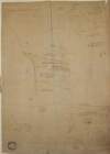
A map of Ballinealoe and Williamstown in the barony of Fore and County of Westmeath, the estate of Thomas Smyth. By J.B. March 1781.
Map
Main Creator:
Brownrigg,
John
, ca. 1748-1838, surveyor
Language:
English
Format:
Map
In collection:
Longfield Map Collection
Published / Created
[1781]
Notes
Inset map: "A map of several lots of ground lying bet...
Call Number:
Loading...
Located:
Loading...
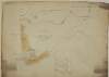
A survey of Cloncrave in the barony of Farbill and County of Westmeath the estate of Thomas Darlington. By J.B. 1795. Scale 20 perches to an inch. Table of reference showing acreage and nature of land.
Map
Main Creator:
Brownrigg,
John
, ca. 1748-1838, surveyor
Language:
English
Format:
Map
In collection:
Longfield Map Collection
Published / Created
[1795]
Notes
Physical description: 1 map Geographic Coverage: Bar...
Call Number:
Loading...
Located:
Loading...
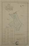
Map of the Demense of Kinturk in the barony of Fore and County of Westmeath the seat of William Pollard. Surveyed in 1786 by J.B. Scale 10 perches to an inch.
Map
Main Creator:
Brownrigg,
John
, ca. 1748-1838, surveyor
Language:
English
Format:
Map
In collection:
Longfield Map Collection
Published / Created
[1786]
Notes
Physical description: 1 map Geographic Coverage: Bar...
Call Number:
Loading...
Located:
Loading...
A survey of Carn in the barony of Fore and County of Westmeath part of the estate of the Rt. Hon. the Earl of Longford. By J.B. December 1798. Scale 20 perches to an inch.
Map
Main Creator:
Brownrigg,
John
, ca. 1748-1838, surveyor
Language:
English
Format:
Map
In collection:
Longfield Map Collection
Published / Created
[December 1798]
Notes
Physical description: 1 map Geographic Coverage: Bar...
Call Number:
Loading...
Located:
Loading...
A map of a proposed line to be laid out as an equal give and take straight boundary between Hodgestown the estate of the Rt. Hon. the Earl of Longford, and Higginstown the estate of George Nugent. Surveyed by John Brownrigg. 1796. Scale 20 perches to an inch.
Map
Main Creator:
Brownrigg,
John
, ca. 1748-1838, surveyor
Language:
English
Format:
Map
In collection:
Longfield Map Collection
Published / Created
[1796]
Notes
Physical description: 1 map Geographic Coverage: Bar...
Call Number:
Loading...
Located:
Loading...
A map of Rathcastle and Rowlandstown in the barony of Rathconrath and County Westmeath the estate of Thomas Bannon. Surveyed by J.L. 1809. Table of reference showing tenants and acreage of holdings. Scale 10 perches to an inch.
Map
Main Creator:
Longfield,
John
, ca. 1775-1833, surveyor
Language:
English
Format:
Map
In collection:
Longfield Map Collection
Published / Created
[1809]
Notes
Physical description: 1 map Geographic Coverage: Bar...
Call Number:
Loading...
Located:
Loading...
A map of Ballymore in the barony of Rathconrath and County of Westmeath the estate of Lord Mountsandford. Surveyed by J. Longfield. 1828. Scale 16 plantation perches to an inch. Table of reference showing tenants and area of holdings.
Map
Main Creator:
Longfield,
John
, ca. 1775-1833, surveyor
Language:
English
Format:
Map
In collection:
Longfield Map Collection
Published / Created
[1828]
Notes
Physical description: 1 map Geographic Coverage: Bar...
Call Number:
Loading...
Located:
Loading...
A survey of part of Johnstown and part of Parcellstown in the barony of Moygoish and County of Westmeath the estate of Ralph Smyth. By John Brownrigg 1783. Scale 20 perches to an inch. Names of tenants and acreage of holdings shown on Parellstown holdings.
Map
Main Creator:
Brownrigg,
John
, ca. 1748-1838, surveyor
Language:
English
Format:
Map
In collection:
Longfield Map Collection
Published / Created
[1783]
Notes
Physical description: 1 map Geographic Coverage: Bar...
Call Number:
Loading...
Located:
Loading...
A survey of Carn in the barony of Fore and County of Westmeath part of the estate of the Rt. Hon. the Earl of Longford. By John Brownrigg 1799. Scale of 20 perches to an inch. Table of reference showing acreage and nature of land.
Map
Main Creator:
Brownrigg,
John
, ca. 1748-1838, surveyor
Language:
English
Format:
Map
In collection:
Longfield Map Collection
Published / Created
[1799]
Notes
Physical description: 1 map Geographic Coverage: Bar...
Call Number:
Loading...
Located:
Loading...
A map of the lands of Ballyhug in the barony of Moygoish and County of Westmeath part of the estate of Hugh Tuite. Surveyed by J.L. November 1812. Names of tenants and acreage of holdings shown.
Map
Main Creator:
Longfield,
John
, ca. 1775-1833, surveyor
Language:
English
Format:
Map
In collection:
Longfield Map Collection
Published / Created
[November 1812]
Notes
Physical description: 1 map Geographic Coverage: Bar...
Call Number:
Loading...
Located:
Loading...
A map of bog land in Roomead Clonmaskill Crownstown, with references to previous surveys of the Down Survey and Scalè's map; and a map of part of Mitchelstown in the barony of Fore and County of Westmeath done for Robert Tighe. By J.B. 1790. Scale 20 perches to an inch.
Map
Main Creator:
Brownrigg,
John
, ca. 1748-1838, surveyor
Language:
English
Format:
Map
In collection:
Longfield Map Collection
Published / Created
[1790]
Notes
Physical description: 1 map Geographic Coverage: Bar...
Call Number:
Loading...
Located:
Loading...
Get RSS Feed
Email this Search
History
Narrow Search
Clear Filter
Digitised
Remove Filters
Clear Filter
Region: Westmeath (Ireland)
Clear Filter
Subject: Administration of estates
Format
11
Map
Online Availability
Digitised
Published / Created
From:
To:
Subject
Administration of estates
11
Boundaries (Estates)
11
Land tenure
11
Land use surveys
8
History
Author
8
Brownrigg, John, ca. 1748-1838, surveyor
3
Longfield, John, ca. 1775-1833, surveyor
Collections
11
Longfield Map Collection
Language
11
English
Genre
11
Manuscript maps
11
Maps, Manuscript
8
Early works to 1800
Era
8
18th century
Region
11
Ireland
11
Westmeath
Westmeath (Ireland)
5
Fore (Barony)
2
Farbill (Barony)
2
Moygoish (Barony)
more ...
2
Rathconrath (Barony)
1
Dublin
1
Dublin (Ireland : County)
1
Dublin (Ireland)
1
Dublin City (Barony)
see all ...
less ...
Loading...