Showing
1 - 20
results of
335
for search '
Will, John.
'
Skip to content
Toggle navigation
NLI Website
- Catalogue -
English
Gaeilge
Home
Help
Advanced Search
Browse
Orders
Ask a Librarian
Language
English
Gaeilge
All Fields
Title
Author
Subject
Call Number
ISBN/ISSN
Publisher
Coordinates
Search digitised content only
FIND
Author
Will, John.
Results
Showing
1 - 20
results of
335
for search '
Will, John.
'
, query time: 0.04s
List
Grid
Sort
Relevance
Newest First
Oldest First
Call Number
Author
Title
1
2
3
4
5
6
7
8
9
10
11
Next
17
A map of part of the Lands of Crumlin in the County of Dublin, the Estate of the Dean & Chapter of Christ Church let to [illegible]. Survey'd by Jn.. Longfield 1805. Scale 20 Perches to an Inch
Map
Main Creator:
Longfield,
John
, ca. 1775-1833, surveyor
Language:
English
Format:
Map
In collection:
Longfield Map Collection
Published / Created
[1805]
Notes
Physical description: 1 map Geographic Coverage: Bar...
Call Number:
Loading...
Located:
Loading...
A map of a piece of ground on the west side of Church St in the City of Dublin being part of the foundry concern formerly belonging to Mr. Henry Jackson. The estate of the Dean and Chapter of Christ Church. Surveyed by J.L. 1812. Scale 15 feet to an inch
Map
Main Creator:
Longfield,
John
, ca. 1775-1833, surveyor
Language:
English
Format:
Map
In collection:
Longfield Map Collection
Published / Created
[1812]
Notes
Physical description: 1 map Geographic Coverage: Dub...
Call Number:
Loading...
Located:
Loading...
A map of Part of Castleknock. Surveyed by J. Longfield
Map
Main Creator:
Longfield,
John
, ca. 1775-1833, surveyor
Language:
English
Format:
Map
In collection:
Longfield Map Collection
Published / Created
[between 1795 and 1833]
Notes
Physical description: 1 map Geographic Coverage: Bar...
Call Number:
Loading...
Located:
Loading...
A map of the glebe lands of Killenaule in the barony of Slievardagh and County of Tipperary belonging to the Chancellor of Christ Church. Surveyed and traced by J.L. 1817. Names of tenants shown & table of reference with tenants names & area of holdings. With additional list 4 January 1833 laid out and possession taken by Sheriff.
Map
Main Creator:
Longfield,
John
, ca. 1775-1833, surveyor
Language:
English
Format:
Map
In collection:
Longfield Map Collection
Published / Created
[1817]
Notes
Physical description: 1 map Geographic Coverage: Bar...
Call Number:
Loading...
Located:
Loading...
A map of part of the lands at Kelshamore in the barony of Talbotstown Upper and County of Wicklow the estate of the Rev Sir S.S. Hutchinson, Bart let to Edward Flynn, Senior. Surveyed by John Longfield 1813. Scale 20 perches to an inch.
Map
Main Creator:
Longfield,
John
, ca. 1775-1833, surveyor
Language:
English
Format:
Map
In collection:
Longfield Map Collection
Published / Created
[1813]
Notes
Physical description: 1 map Geographic Coverage: Bar...
Call Number:
Loading...
Located:
Loading...
A map of part of the Lands of Rathcoole in the County of Dublin belonging to Laurence Clynch Esq. Surveyed and traced by John Longfield 1827. Scale 10 Perches to an Inch.
Map
Main Creator:
Longfield,
John
, ca. 1775-1833, surveyor
Language:
English
Format:
Map
In collection:
Longfield Map Collection
Published / Created
[1827]
Notes
Physical description: 1 map Geographic Coverage: Bar...
Call Number:
Loading...
Located:
Loading...
A survey of Redesdale [Part of the Lands of Kilmacud] in the Parish of Stillorgan, Barony of Rathdown & County of Dublin for Walter Bourne Esq. June 1833 by Jn. Longfield. Scale 10 statute Perches to an Inch
Map
Main Creator:
Longfield,
John
, ca. 1775-1833, surveyor
Language:
English
Format:
Map
In collection:
Longfield Map Collection
Published / Created
[June 1833]
Notes
Physical description: 1 map Geographic Coverage: Par...
Call Number:
Loading...
Located:
Loading...
A map of a holding in Blessington St in the City of Dublin let to Charles Hunt. Surveyed by J. Longfield 1824. Scale 20 feet to an Inch
Map
Main Creator:
Longfield,
John
, ca. 1775-1833, surveyor
Language:
English
Format:
Map
In collection:
Longfield Map Collection
Published / Created
[1824]
Notes
Physical description: 1 map Geographic Coverage: Dub...
Call Number:
Loading...
Located:
Loading...
A map of part of the Lands of Dunleary in the Barony of Rathdown and County of Dublin let by Edwd. Bonham Esq. to Mrs. Maria Burbury Isaac. Survey'd by J.L. 1809. Scale 10 Perches to an Inch
Map
Main Creator:
Longfield,
John
, ca. 1775-1833, surveyor
Language:
English
Format:
Map
In collection:
Longfield Map Collection
Published / Created
[1809]
Notes
Physical description: 1 map Geographic Coverage: Bar...
Call Number:
Loading...
Located:
Loading...
A map of part of Lloyd's Rope walk and sundry other premises lying on the north side of Lower Abbey St. Taken from Saml. Byron's survey made in 1791 on which is described the ground purchased by the Commissrs. of Wide Streets as by Deed dated 2nd & 4th of Dec 1797 may appear; & also the ground which they now claim in addition to said Purchase done by John Longfield 1807. Scale 30 Feet to an Inch
Map
Main Creator:
Longfield,
John
, ca. 1775-1833, surveyor
Language:
English
Format:
Map
In collection:
Longfield Map Collection
Published / Created
[1807]
Notes
Physical description: 1 map Geographic Coverage: Dub...
Call Number:
Loading...
Located:
Loading...
A map of three lots of ground situate in the town of Carlingford and County of Louth part of the estate of the Chancellor of Christ Church Dublin. Surveyed by J. Longfield 1805. Scale 50 feet to an inch. Table of reference. Some tenants names shown.
Map
Main Creator:
Longfield,
John
, ca. 1775-1833, surveyor
Language:
English
Format:
Map
In collection:
Longfield Map Collection
Published / Created
[1805]
Notes
A large strip of tape runns through the centre of the...
Call Number:
Loading...
Located:
Loading...
Longitudinal and transverse sections of that part of the river Blackwater adjoining the lands of Mullaghard Rathaldron and Liscartan in the County of Meath. Surveyed by John Long under the direction of William F. Mulvany C.E.
Map
Main Creator:
Longfield,
John
, ca. 1775-1833, surveyor
Language:
English
Format:
Map
In collection:
Longfield Map Collection
Published / Created
[between 1795 and 1833]
Notes
For other sections of the river Blackwater see: MS 21...
Call Number:
Loading...
Located:
Loading...
A map of several pieces of Land lying in and about the Town of Finglas, in the Parish of Finglas, Barony of Nethercross and County of Dublin belonging to the Dean & Chapter of Christ Church Dublin, let to John Bayly Esq. Surveyed by John Longfield 1812. Scale 20 Perches to an Inch.
Map
Main Creator:
Longfield,
John
, ca. 1775-1833, surveyor
Language:
English
Format:
Map
In collection:
Longfield Map Collection
Published / Created
[1812]
Notes
Physical description: 1 map Geographic Coverage: Par...
Call Number:
Loading...
Located:
Loading...
A map of part of the lands of Ballyboggan in the barony of Moyfenrath and County of Meath part of the estate of the Marquis of Lansdowne. By J. L. 1824. Names of tenants and acreage of holdings shown.
Map
Main Creator:
Longfield,
John
, ca. 1775-1833, surveyor
Language:
English
Format:
Map
In collection:
Longfield Map Collection
Published / Created
[1824]
Notes
Physical description: 1 map Geographic Coverage: Bar...
Call Number:
Loading...
Located:
Loading...
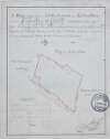
A survey of part of the Rath of Creekstown [Crickstown] in the barony of Ratoath and County Meath part of the estate of the most noble the Marquis of Lansdowne. Surveyed by J.L. March 1823. Scale 16 perches to an inch.
Map
Main Creator:
Longfield,
John
, ca. 1775-1833, surveyor
Language:
English
Format:
Map
In collection:
Longfield Map Collection
Published / Created
[March 1823]
Notes
Inset map: "Dispensary ground at Ballyboggan in Count...
Call Number:
Loading...
Located:
Loading...
A map of several holdings on Mercer St & Glover's Alley in the City of Dublin part of the estate of the Dean of Christ Church. Surveyed by John Longfield, 1800. Names of some tenants shown on properties
Map
Main Creator:
Longfield,
John
, ca. 1775-1833, surveyor
Language:
English
Format:
Map
In collection:
Longfield Map Collection
Published / Created
[1800]
Notes
Physical description: 1 map Geographic Coverage: Dub...
Call Number:
Loading...
Located:
Loading...
Section of the line of Hatch Street from Harcourt Street to Leeson Street By John Longfield 1828.
Map
Main Creator:
Longfield,
John
, ca. 1775-1833, surveyor
Language:
English
Format:
Map
In collection:
Longfield Map Collection
Published / Created
[1828]
Notes
Physical description: 1 map Geographic Coverage: Dub...
Call Number:
Loading...
Located:
Loading...
A map of lands at Lyonstown part of Lord Derby's estate ... in the barony of Middlethird and County of Tipperary. By John Longfield, July 1824. Names of tenants and acreage of lands shown.
Map
Main Creator:
Longfield,
John
, ca. 1775-1833, surveyor
Language:
English
Format:
Map
In collection:
Longfield Map Collection
Published / Created
[July 1824]
Notes
Physical description: 1 map Geographic Coverage: Bar...
Call Number:
Loading...
Located:
Loading...
A map of part of the Glebe lands of Kilcullen in the County of Kildare, granted by the Rev. Thomas Brownrigg Chancellor of the cathedral church of the Holy and Undivided Trinity Dublin to the Rev. J. Hardy and his successors as an additional Glebe to the parish of Killcullen. Surveyed by John Longfield 1822. Scale 20 perches to an inch. Table of reference showing tenants names & area of holdings.
Map
Main Creator:
Longfield,
John
, ca. 1775-1833, surveyor
Language:
English
Format:
Map
In collection:
Longfield Map Collection
Published / Created
[1822]
Notes
Physical description: 1 map Geographic Coverage: Par...
Call Number:
Loading...
Located:
Loading...
A mapp of a lott of ground situate west side of Drogheda St. Monasterevin ... Surveyed by J Longfield. 1809. Scale 4 perches to an inch.
Map
Main Creator:
Longfield,
John
, ca. 1775-1833, surveyor
Language:
English
Format:
Map
In collection:
Longfield Map Collection
Published / Created
[1809]
Notes
In mylar covering. Physical description: 1 map Geogr...
Call Number:
Loading...
Located:
Loading...
1
2
3
4
5
6
7
8
9
10
11
Next
17
Get RSS Feed
Email this Search
History
Narrow Search
Digitised
Remove Filters
Clear Filter
Author: Longfield, John, ca. 1775-1833, surveyor
Clear Filter
Language: English
Clear Filter
Subject: Land tenure
Format
335
Map
Online Availability
186
Digitised
149
Not Digitised
Published / Created
From:
To:
Subject
335
Boundaries (Estates)
Land tenure
335
Land use surveys
325
Administration of estates
19
Administration of Estates
1
History
Author
Longfield, John, ca. 1775-1833, surveyor
Collections
335
Longfield Map Collection
Language
English
Genre
335
Manuscript maps
335
Maps, Manuscript
1
Early works to 1800
Era
1
18th century
Region
332
Ireland
186
Dublin (County)
186
Dublin (Ireland : County)
70
Dublin
70
Dublin (Ireland)
43
Meath
more ...
43
Meath (Ireland)
39
Kildare (County)
39
Kildare (Ireland : County)
32
Rathdown (Barony)
26
Coolock (Barony)
16
Offaly West (Barony)
14
Castleknock (Barony)
14
Uppercross (Barony)
13
Newcastle (Barony)
12
Nethercross (Barony)
11
Wicklow (County)
11
Wicklow (Ireland : County)
8
Duleek Upper (Barony)
7
Laois
7
Laois (Ireland)
7
Moyfenrath Upper (Barony)
7
Ratoath (Barony)
7
Roscommon (County)
7
Roscommon (Ireland : County)
6
Balrothery (Barony)
5
Kilcullen (Barony)
5
Kilkenny (County)
5
Kilkenny (Ireland : County)
5
Mayo (County)
see all ...
less ...
Loading...


![A survey of part of the Rath of Creekstown [Crickstown] in the barony of Ratoath and County Meath part of the estate of the most noble the Marquis of Lansdowne. Surveyed by J.L. March 1823. Scale 16 perches to an inch.](/IIIF/000310000/000301848/vtls000301848_001.jp2/full/100,/0/default.jpg)