Showing
1 - 20
results of
42
for search '
Will, John.
'
Skip to content
Toggle navigation
NLI Website
- Catalogue -
English
Gaeilge
Home
Help
Advanced Search
Browse
Orders
Ask a Librarian
Language
English
Gaeilge
All Fields
Title
Author
Subject
Call Number
ISBN/ISSN
Publisher
Coordinates
Search digitised content only
FIND
Author
Will, John.
Results
Showing
1 - 20
results of
42
for search '
Will, John.
'
, query time: 0.11s
List
Grid
Sort
Relevance
Newest First
Oldest First
Call Number
Author
Title
1
2
3
Next
3
Loading...
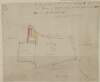
A map of a piece of ground called the east half of the Deans Orchard and also a piece of ground...
Loading...
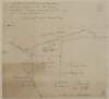
A map of pt. of the Lands of Santry & Artane in the County of Dublin the state of the Honble. W....
Loading...
A map of a holding on the south east side of Fishamble Street in the City of Dublin belonging to...
Loading...
A map of a holding on the west side of Capel Street in the Lordship of St Marys Abbey and City o...
Loading...
A map of Belgard Estate in the Barony of Uppercross and County of Dublin the Property of John He...
Loading...
A map of part of the Lands of Clontarf in the Barony of Coolock & Co. Dublin. Let by W. Punbert...
Loading...
A map of the present course of that part of the River Dodder running between the demenses of A....
Loading...
A map of a holding on the south east side of Fishamble Street in the City of Dublin belonging to...
Loading...
A map of part of the Lands of Windy Harbour in the Parish Blanchards Town. Bary. of Castleknock...
Loading...
A map of a piece of ground on Sir John Rogerson's Quay or South Wall. Also a piece of ground be...
Loading...
A map of part of the Lands of Finglas in the Barony of Nethercross & County of Dublin let by Mr....
Loading...
A map of part of Lanesborough Lands in the Parish of Swords & County of Dublin let by the Coheir...
Loading...
A map of a holding on the east side of Grafton Street in the City of Dublin belonging to Mr. Wil...
Loading...
A map of a piece of ground called the Dean's Orchard, situate near Grange Gorman partly in the C...
Loading...
A survey of part of the Lands of Grange, situate between the 11th & 12th Locks in the Grand Cana...
Loading...
A map of a parcel of ground lying between Smock Alley and Copper Alley on which is standing the...
Loading...
A map of lands at Aghaderan, Abbeycartron & the Demense at Longford. [Pencilled title - A map o...
Loading...
A map of part of the lands of Milestown, part of the lands of Rathleek and Walterstown in the ba...
Loading...
A map of the Great Commons [Derrymore & Cooltedery] adjoining the town of Portarlington in the Q...
Loading...
A map of a holding on the west side of Capel Street in the Lordship of St Marys Abbey and City o...
1
2
3
Next
3
Get RSS Feed
Email this Search
History
Narrow Search
Digitised
Remove Filters
Clear Filter
Author: Brownrigg & Co., fl. 1801-1809, surveyors
Clear Filter
Subject: Boundaries (Estates)
Format
42
Map
Online Availability
28
Not Digitised
14
Digitised
Published / Created
From:
To:
Subject
42
Administration of estates
Boundaries (Estates)
42
Land tenure
42
Land use surveys
2
History
Author
Brownrigg & Co., fl. 1801-1809, surveyors
Collections
42
Longfield Map Collection
Language
42
English
Genre
42
Manuscript maps
42
Maps, Manuscript
2
Early works to 1800
Era
2
18th century
Region
42
Ireland
33
Dublin (County)
33
Dublin (Ireland : County)
17
Dublin (Ireland)
16
Dublin
4
Coolock (Barony)
more ...
4
Meath
4
Meath (Ireland)
4
Rathdown (Barony)
3
Dublin (Barony)
3
Nethercross (Barony)
3
Newcastle (Barony)
2
Kells Upper (Barony)
2
Uppercross (Barony)
2
Wicklow (County)
2
Wicklow (Ireland : County)
1
Ballymadun Parish
1
Ballymadun Parish (Ireland)
1
Balrothery (Barony)
1
Blanchards Town Parish
1
Blanchards Town Parish (Ireland)
1
Castleknock (Barony)
1
Dublin City
1
Dublin City (Barony)
1
Duleek (Barony)
1
Dunboyne (Barony)
1
Kildare (County)
1
Kildare (Ireland : County)
1
Laois
1
Laois (Ireland)
see all ...
less ...
Loading...

![A map of lands at Aghaderan, Abbeycartron & the Demense at Longford. [Pencilled title - A map of part of the lands of Longford the estate of the Rt. Honable. Thomas Earl of Longford. Surveyed by John Brownrigg 1796 and copied by Brownrigg & Co. 1804] Tenants & acreage shown.](/IIIF/000310000/000302312/vtls000302312_001.jp2/full/100,/0/default.jpg)
![A map of the Great Commons [Derrymore & Cooltedery] adjoining the town of Portarlington in the Queens [Leix] County. Surveyed for Henry Parnell by Brownrigg & Co 1803. Scale 250 feet to an inch. Names of tenants & acreage of holdings shown.](/IIIF/000310000/000302382/vtls000302382_001.jp2/full/100,/0/default.jpg)