Showing
1 - 9
results of
9
for search '
Reading, Thomas, ca. 1704-1779, surveyor
'
Skip to content
Toggle navigation
NLI Website
- Catalogue -
English
Gaeilge
Home
Help
Advanced Search
Browse
Orders
Ask a Librarian
Language
English
Gaeilge
All Fields
Title
Author
Subject
Call Number
ISBN/ISSN
Publisher
Coordinates
Search digitised content only
FIND
Author
Reading, Thomas, ca. 1704-1779, surveyor
Results
Showing
1 - 9
results of
9
for search '
Reading, Thomas, ca. 1704-1779, surveyor
'
, query time: 0.05s
List
Grid
Sort
Relevance
Newest First
Oldest First
Call Number
Author
Title
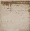
Map of Part of the Lands of [Fausagh] Fausogh in the Parish of Glasnevin. Partly traced from a Survey made by Richd. Francis A.D. 1640 & partly from a survey by Thos. Reading A.D. 1768.
Map
Main Creator:
Reading
,
Thomas
,
ca
.
1704
-
1779
,
surveyor
Language:
English
Format:
Map
In collection:
Longfield Map Collection
Published / Created
[1768]
Notes
Physical description: 1 map Geographic Coverage: Par...
Call Number:
Loading...
Located:
Loading...
A map of twenty acres part of the Glebe of Knockalin [Knockaulin] laid out for the Rev. Marmaduke Cramer. Surveyed December 30th 1773 by Charles Vaughan copied by Thomas Reading. Scale of 20 perches to an inch. Names of adjoining tenants shown.
Map
Main Creator:
Reading
,
Thomas
,
ca
.
1704
-
1779
,
surveyor
Language:
English
Format:
Map
In collection:
Longfield Map Collection
Published / Created
[between 1724 and 1779]
Notes
Map is in two pieces and joined with old tape. Physic...
Call Number:
Loading...
Located:
Loading...
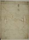
Copy of a map of several parcell's of Land - part of the Lands of Cottrellstown and Weystown. Barony of Balrothery in the County of Dublin, belonging to the Vicars and Prebends of Christ Church Dublin. Surveyed in June 1751. By Thos. Reading. [with copy of Indenture]
Map
Main Creator:
Reading
,
Thomas
,
ca
.
1704
-
1779
,
surveyor
Language:
English
Format:
Map
In collection:
Longfield Map Collection
Published / Created
[June 1751]
Notes
Physical description: 1 map Geographic Coverage: Bar...
Call Number:
Loading...
Located:
Loading...
A map of part of the townland of Milltown in the Parish of Swords Barony of Nethercross and County of Dublin part of the Estate belonging to the Rt. Honble. the Lord Vist. Molesworth. Surveyed June 1736. By Thos. Reading. Scale 20 Perches to an Inch.
Map
Main Creator:
Reading
,
Thomas
,
ca
.
1704
-
1779
,
surveyor
Language:
English
Format:
Map
In collection:
Longfield Map Collection
Published / Created
[June 1736]
Notes
Physical description: 1 map Geographic Coverage: Par...
Call Number:
Loading...
Located:
Loading...
A map of several parcels of the townland of Glasnevin in the County of Dublin, called Fosters Farm, belonging to the Dean of Christ Church Dublin. Surveyed in May 1768 by Tho Reading.
Map
Main Creator:
Reading
,
Thomas
,
ca
.
1704
-
1779
,
surveyor
Language:
English
Format:
Map
In collection:
Longfield Map Collection
Published / Created
[May 1768]
Notes
Physical description: 1 map Geographic Coverage: Bar...
Call Number:
Loading...
Located:
Loading...
A map of part of the town land of Ballcurris in the parish of Santry barony of Coolock and county of Dublin belonging to Rt. Hon. Luke Gardiner Esqr. as set to the Incorporate Society in Dublin,
1739 Mar.
Map
Main Creator:
Reading
,
Thomas
,
ca
.
1704
-
1779
,
surveyor
Language:
English
Format:
Map
In collection:
Gardiner Papers, ca. 1667-1898.
Published / Created
1739 Mar.
Notes
Map content: land plot, river and placenames. Inscri...
Call Number:
Loading...
Located:
Loading...
View Context
A map of a lot of ground lying in the East side of Milltown Road, joining the new Road belonging to John Hatch Esq. Surveyed in October 1770 by Thos. Reading. Scale forty feet to an Inch
Map
Main Creator:
Reading
,
Thomas
,
ca
.
1704
-
1779
,
surveyor
Language:
English
Format:
Map
In collection:
Longfield Map Collection
Published / Created
[October 1770]
Notes
Physical description: 1 map Geographic Coverage: Bar...
Call Number:
Loading...
Located:
Loading...
A map of three parts of Rogenstown in the Parish of Swords Barony of Nethercross and County of Dublin belonging to the Chanallor of Christ Church. Surveyed in October 1771 by Thos. Reading. Scale 20 Perches to an Inch
Map
Main Creator:
Reading
,
Thomas
,
ca
.
1704
-
1779
,
surveyor
Language:
English
Format:
Map
In collection:
Longfield Map Collection
Published / Created
[October 1771]
Notes
Physical description: 1 map Geographic Coverage: Par...
Call Number:
Loading...
Located:
Loading...
A map of part of the Lands of Turvey in the Parish of Donabate Barony of Balrothery and County of Dublin, part of the Estate belonging to the Rt. Honble. the Ld. Kingsland. Surveyed in October 1768 by Thos. Reading.
Map
Main Creator:
Reading
,
Thomas
,
ca
.
1704
-
1779
,
surveyor
Language:
English
Format:
Map
In collection:
Longfield Map Collection
Published / Created
[October 1768]
Notes
Physical description: 1 map Geographic Coverage: Par...
Call Number:
Loading...
Located:
Loading...
Get RSS Feed
Email this Search
History
Narrow Search
Digitised
Remove Filters
Clear Filter
Author: Reading, Thomas, ca. 1704-1779, surveyor
Format
9
Map
Online Availability
5
Digitised
4
Not Digitised
Published / Created
From:
To:
Subject
9
Land use surveys
8
Administration of estates
8
Boundaries (Estates)
8
Land tenure
7
History
1
Administration of Estates
more ...
1
Cartography
1
Estates
1
Maps
1
Maps and Surveys
1
Surveyors
see all ...
less ...
Author
Reading, Thomas, ca. 1704-1779, surveyor
Collections
8
Longfield Map Collection
1
Gardiner Papers, ca. 1667-1898.
Language
9
English
Genre
9
Manuscript maps
8
Maps, Manuscript
7
Early works to 1800
Era
7
18th century
Region
9
Ireland
7
Dublin (County)
7
Dublin (Ireland : County)
2
Balrothery (Barony)
2
Coolock (Barony)
2
Nethercross (Barony)
more ...
2
Swords Parish
2
Swords Parish (Ireland)
1
Donabate Parish
1
Donabate Parish (Ireland)
1
Glasnevin Parish
1
Glasnevin Parish (Ireland)
1
Kilcullen (Barony)
1
Kildare (County)
1
Kildare (Ireland : County)
1
Uppercross (Barony)
see all ...
less ...
Loading...
![Map of Part of the Lands of [Fausagh] Fausogh in the Parish of Glasnevin. Partly traced from a Survey made by Richd. Francis A.D. 1640 & partly from a survey by Thos. Reading A.D. 1768.](/IIIF/000310000/000301146/vtls000301146_001.jp2/full/100,/0/default.jpg)
![A map of twenty acres part of the Glebe of Knockalin [Knockaulin] laid out for the Rev. Marmaduke Cramer. Surveyed December 30th 1773 by Charles Vaughan copied by Thomas Reading. Scale of 20 perches to an inch. Names of adjoining tenants shown.](/IIIF/000310000/000302008/vtls000302008_001.jp2/full/100,/0/default.jpg)
![Copy of a map of several parcell's of Land - part of the Lands of Cottrellstown and Weystown. Barony of Balrothery in the County of Dublin, belonging to the Vicars and Prebends of Christ Church Dublin. Surveyed in June 1751. By Thos. Reading. [with copy of Indenture]](/IIIF/000310000/000302265/vtls000302265_001.jp2/full/100,/0/default.jpg)